Directions to Idolize.Lashlounge (Norwood) with public transportation
The following transit lines have routes that pass near Idolize.Lashlounge
How to get to Idolize.Lashlounge by bus?
Click on the bus route to see step by step directions with maps, line arrival times and updated time schedules.
How to get to Idolize.Lashlounge by train?
Click on the train route to see step by step directions with maps, line arrival times and updated time schedules.
Bus stops near Idolize.Lashlounge in Norwood
Train station near Idolize.Lashlounge in Norwood
- Norwood Central, 15 min walk,VIEW
Bus lines to Idolize.Lashlounge in Norwood
What are the closest stations to Idolize.Lashlounge?
The closest stations to Idolize.Lashlounge are:
- Washington St Opp Dean St is 70 yards away, 2 min walk.
- Norwood Central is 699 yards away, 10 min walk.
Which bus line stops near Idolize.Lashlounge?
34E (Walpole Center Via Washington St)
Which train line stops near Idolize.Lashlounge?
FRANKLIN/FOXBORO (#1709 | Foxboro)
What’s the nearest train station to Idolize.Lashlounge in Norwood?
The nearest train station to Idolize.Lashlounge in Norwood is Norwood Central. It’s a 15 min walk away.
What’s the nearest bus station to Idolize.Lashlounge in Norwood?
The nearest bus station to Idolize.Lashlounge in Norwood is Washington St Opp Dean St. It’s a 2 min walk away.
What time is the first bus to Idolize.Lashlounge in Norwood?
The 34E is the first bus that goes to Idolize.Lashlounge in Norwood. It stops nearby at 5:11 AM.
What time is the last bus to Idolize.Lashlounge in Norwood?
The 34E is the last bus that goes to Idolize.Lashlounge in Norwood. It stops nearby at 1:07 AM.
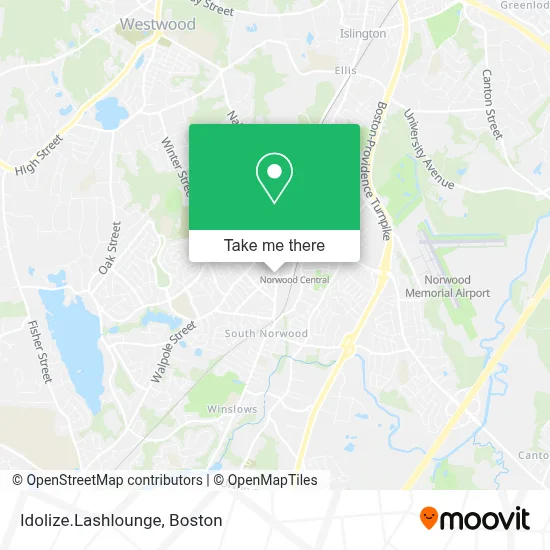
See Idolize.Lashlounge, Norwood, on the map
Public Transit to Idolize.Lashlounge in Norwood
Wondering how to get to Idolize.Lashlounge in Norwood? Moovit helps you find the best way to get to Idolize.Lashlounge with step-by-step directions from the nearest public transit station.
Moovit provides free maps and live directions to help you navigate through your city. View schedules, routes, timetables, and find out how long does it take to get to Idolize.Lashlounge in real time.
Looking for the nearest stop or station to Idolize.Lashlounge? Check out this list of stops closest to your destination: Washington St Opp Dean St; Norwood Central.
Bus: 34E, FRANKLIN LINE SHUTTLE, FRANKLIN LINE SHUTTLE, FRANKLIN LINE SHUTTLE.Train: FRANKLIN/FOXBORO.
Want to see if there’s another route that gets you there at an earlier time? Moovit helps you find alternative routes or times. Get directions from and directions to Idolize.Lashlounge easily from the Moovit App or Website.
We make riding to Idolize.Lashlounge easy, which is why over 1.7 million users, including users in Norwood, trust Moovit as the best app for public transit. You don’t need to download an individual bus app or train app, Moovit is your all-in-one transit app that helps you find the best bus time or train time available.
For information on prices of bus and train, costs and ride fares to Idolize.Lashlounge, please check the Moovit app.
Use the app to navigate to popular places including to the airport, hospital, stadium, grocery store, mall, coffee shop, school, college, and university.
Idolize.Lashlounge Address: 839 Washington St street in Norwood
- Schoolhouse Counseling,
- Richard F Fruci Attorney,
- Norwood, Massachusetts,
- Lisathuy Nguyen,
- Roger & Beth Salon,
- Colleen Ammidown NP,
- Alice M Freeman MD,
- Repair Lennox Hvac Systems,
- Suburban Eye Specialists,
- Nidhi Kapoor MD - Steward Medical Group,
- Vera Bradley,
- Caritas Southwood Hospital,
- FedEx,
- Norman R Tabroff,
- Robert Dalton Garage Doors,
- Trust Roofing,
- Eastwest Painting & Restoration,
- 7 Hens,
- Skincare Therapy,
- US National Board Certified
Places Near Idolize.Lashlounge (Norwood)
- Quincy Market, Boston,
- Leader Bank Pavilion (Leader Bank Pavillion), Boston,
- Seaport District, Boston,
- Museum Of Science, Boston,
- Wilbur Theatre, Boston,
- Massachusetts General Hospital, Boston,
- Boston Convention & Exhibition Center, Boston,
- Mgm Music Hall, Boston,
- North End, Boston,
- Boston Children's Hospital, Boston,
- Boston Common, Boston,
- Boston Medical Center, Boston,
- House Of Blues, Boston,
- Prudential Center, Boston,
- Isabella Stewart Gardner Museum, Boston,
- Wang Theater, Boston,
- Td Garden, Boston,
- Faneuil Hall, Boston,
- Castle Island, Boston,
- Cheers, Boston
How to get to popular places in Boston with public transit
Get around Norwood by public transit!
Traveling around Norwood has never been so easy. See step by step directions as you travel to any attraction, street or major public transit station. View bus and train schedules, arrival times, service alerts and detailed routes on a map, so you know exactly how to get to anywhere in Norwood.
When traveling to any destination around Norwood use Moovit's Live Directions with Get Off Notifications to know exactly where and how far to walk, how long to wait for your line, and how many stops are left. Moovit will alert you when it's time to get off — no need to constantly re-check whether yours is the next stop.
Wondering how to use public transit in Norwood or how to pay for public transit in Norwood? Moovit public transit app can help you navigate your way with public transit easily, and at minimum cost. It includes public transit fees, ticket prices, and costs. Looking for a map of Norwood public transit lines? Moovit public transit app shows all public transit maps in Norwood with all Bus, Train, Subway and Ferry routes and stops on an interactive map.
Boston has 4 transit type(s), including: Bus, Train, Subway and Ferry, operated by several transit agencies, including MBTA, Southeastern Regional Transit Authority, MetroWest Regional Transit Authority, Rhode Island Public Transit Authority, WRTA, Lowell Regional Transit Authority, Merrimack Valley Transit, Montachusett Regional Transit Authority, Cape Cod Regional Transit Authority, Brockton Area Transit Authority, Martha's Vineyard Transit Authority, the WAVE - Nantucket Regional Transit Authority, GATRA, Cape Ann Transportation Authority and Massport