Directions to Ignitepost (Cambridge) with public transportation
The following transit lines have routes that pass near Ignitepost
 Bus: 77, 83, 89, 87, 88.
- Train: FITCHBURG.
- Subway: RED LINE, GREEN LINE B, GREEN LINE C, GREEN LINE E.
How to get to Ignitepost by bus?
Click on the bus route to see step by step directions with maps, line arrival times and updated time schedules.
From Mass Lottery, Boston
44 minFrom Eataly, Boston
44 minFrom The Strand Theater, Boston
81 minFrom MBTA-Museum of Fine Arts, Boston
61 minFrom Fairmont Copley Plaza Boston, Boston
45 minFrom Market Basket, Revere
78 minFrom The Banshee Bar, Boston
73 minFrom Lexington, MA, Lexington
43 minFrom Uphams Corner, Boston
74 minFrom Whole Foods, Boston
57 min
How to get to Ignitepost by subway?
Click on the subway route to see step by step directions with maps, line arrival times and updated time schedules.
Bus stops near Ignitepost in Cambridge
Subway stations near Ignitepost in Cambridge
Train station near Ignitepost in Cambridge
- Porter, 18 min walk,VIEW
Bus lines to Ignitepost in Cambridge
- 83, Central Square,VIEW
- 87, Lechmere - Arlington Center,VIEW
- 88, Lechmere - Clarendon Hill,VIEW
- RED LINE SHUTTLE, Alewife - Park Street,VIEW
- RED LINE SHUTTLE, Alewife - Harvard via Brattle Street,VIEW
- RED LINE SHUTTLE, Alewife - Davis,VIEW
- RED LINE SHUTTLE, Alewife - Harvard via Holyoke Street,VIEW
- RED LINE SHUTTLE, Alewife - Kendall/MIT,VIEW
- 77, Harvard,VIEW
- 89, Sullivan - Davis,VIEW
- 90, Assembly - Davis,VIEW
- 94, Davis - Medford Square,VIEW
- 96, Harvard - Medford Square,VIEW
What are the closest stations to Ignitepost?
The closest stations to Ignitepost are:
- Rindge Ave @ Middlesex St is 143 yards away, 2 min walk.
- Holland St @ Dover St is 416 yards away, 5 min walk.
- Davis Sq. is 417 yards away, 5 min walk.
- Massachusetts Ave @ Shea Rd is 459 yards away, 6 min walk.
- Elm St @ Chester St is 472 yards away, 6 min walk.
- Ball Square Station is 1481 yards away, 18 min walk.
- Porter is 1484 yards away, 18 min walk.
Which bus lines stop near Ignitepost?
These bus lines stop near Ignitepost: 77, 83, 89.
Which subway line stops near Ignitepost?
RED LINE (Alewife)
What’s the nearest subway station to Ignitepost in Cambridge?
The nearest subway station to Ignitepost in Cambridge is Davis Sq.. It’s a 5 min walk away.
What’s the nearest train station to Ignitepost in Cambridge?
The nearest train station to Ignitepost in Cambridge is Porter. It’s a 18 min walk away.
What’s the nearest bus station to Ignitepost in Cambridge?
The nearest bus station to Ignitepost in Cambridge is Rindge Ave @ Middlesex St. It’s a 2 min walk away.
What time is the first subway to Ignitepost in Cambridge?
The GREEN LINE E is the first subway that goes to Ignitepost in Cambridge. It stops nearby at 4:53 AM.
What time is the last subway to Ignitepost in Cambridge?
The GREEN LINE E is the last subway that goes to Ignitepost in Cambridge. It stops nearby at 2:39 AM.
What time is the first train to Ignitepost in Cambridge?
The FITCHBURG is the first train that goes to Ignitepost in Cambridge. It stops nearby at 5:47 AM.
What time is the last train to Ignitepost in Cambridge?
The FITCHBURG is the last train that goes to Ignitepost in Cambridge. It stops nearby at 12:17 AM.
What time is the first bus to Ignitepost in Cambridge?
The 77 is the first bus that goes to Ignitepost in Cambridge. It stops nearby at 5:01 AM.
What time is the last bus to Ignitepost in Cambridge?
The 83 is the last bus that goes to Ignitepost in Cambridge. It stops nearby at 1:25 AM.
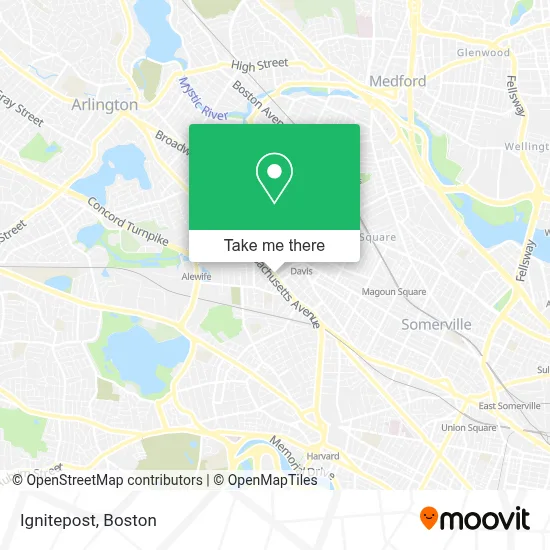
See Ignitepost, Cambridge, on the map
Public Transit to Ignitepost in Cambridge
Wondering how to get to Ignitepost in Cambridge? Moovit helps you find the best way to get to Ignitepost with step-by-step directions from the nearest public transit station.
Moovit provides free maps and live directions to help you navigate through your city. View schedules, routes, timetables, and find out how long does it take to get to Ignitepost in real time.
Looking for the nearest stop or station to Ignitepost? Check out this list of stops closest to your destination: Rindge Ave @ Middlesex St; Holland St @ Dover St; Davis Sq.; Massachusetts Ave @ Shea Rd; Elm St @ Chester St; Ball Square Station; Porter.
Bus: 77, 83, 89, 87, 88, RED LINE SHUTTLE, RED LINE SHUTTLE, RED LINE SHUTTLE.Train: FITCHBURG.Subway: RED LINE, GREEN LINE B, GREEN LINE C, GREEN LINE E.
Want to see if there’s another route that gets you there at an earlier time? Moovit helps you find alternative routes or times. Get directions from and directions to Ignitepost easily from the Moovit App or Website.
We make riding to Ignitepost easy, which is why over 1.7 million users, including users in Cambridge, trust Moovit as the best app for public transit. You don’t need to download an individual bus app or train app, Moovit is your all-in-one transit app that helps you find the best bus time or train time available.
For information on prices of subway and bus, costs and ride fares to Ignitepost, please check the Moovit app.
Use the app to navigate to popular places including to the airport, hospital, stadium, grocery store, mall, coffee shop, school, college, and university.
Ignitepost Address: 2285 Massachusetts Ave street in Cambridge
- Lecture & Tour International Travel,
- Johanna Schulman - Ameriprise Financial Services,
- WRMS,
- Gotobus.com,
- Madeleine,
- Momma's Grocery + Wine,
- Raspberry Beret,
- Chicken & Co,
- Metro by T-Mobile,
- Frank's Steak House,
- Frank's Steak House (Franks Steak House),
- Amazon Locker-Patrick,
- Navy Federal Credit Union,
- Day St & Mass Ave,
- Big Dig Records,
- FOODLAND,
- Ramsey Gilbert Chiropractor,
- 4 Buyers Real Estate,
- galaxyadvisors,
- Pemberton Farms & Garden Center
Places Near Ignitepost (Cambridge)
- House Of Blues, Boston,
- Boston Common, Boston,
- Museum Of Science, Boston,
- Wang Theater, Boston,
- Wilbur Theatre, Boston,
- Castle Island, Boston,
- Isabella Stewart Gardner Museum, Boston,
- Faneuil Hall, Boston,
- Mgm Music Hall, Boston,
- Seaport District, Boston,
- Boston Medical Center, Boston,
- Td Garden, Boston,
- Boston Convention & Exhibition Center, Boston,
- North End, Boston,
- Leader Bank Pavilion (Leader Bank Pavillion), Boston,
- Massachusetts General Hospital, Boston,
- Quincy Market, Boston,
- Prudential Center, Boston,
- Boston Children's Hospital, Boston,
- Cheers, Boston
How to get to popular places in Boston with public transit
Get around Cambridge by public transit!
Traveling around Cambridge has never been so easy. See step by step directions as you travel to any attraction, street or major public transit station. View bus and train schedules, arrival times, service alerts and detailed routes on a map, so you know exactly how to get to anywhere in Cambridge.
When traveling to any destination around Cambridge use Moovit's Live Directions with Get Off Notifications to know exactly where and how far to walk, how long to wait for your line, and how many stops are left. Moovit will alert you when it's time to get off — no need to constantly re-check whether yours is the next stop.
Wondering how to use public transit in Cambridge or how to pay for public transit in Cambridge? Moovit public transit app can help you navigate your way with public transit easily, and at minimum cost. It includes public transit fees, ticket prices, and costs. Looking for a map of Cambridge public transit lines? Moovit public transit app shows all public transit maps in Cambridge with all Bus, Train, Subway and Ferry routes and stops on an interactive map.
Boston has 4 transit type(s), including: Bus, Train, Subway and Ferry, operated by several transit agencies, including MBTA, Southeastern Regional Transit Authority, MetroWest Regional Transit Authority, Rhode Island Public Transit Authority, WRTA, Lowell Regional Transit Authority, Merrimack Valley Transit, Montachusett Regional Transit Authority, Cape Cod Regional Transit Authority, Brockton Area Transit Authority, Martha's Vineyard Transit Authority, the WAVE - Nantucket Regional Transit Authority, GATRA, Cape Ann Transportation Authority and Massport