Directions to Ilha Da Pombeba (Caju) with public transportation
The following transit lines have routes that pass near Ilha Da Pombeba
 Bus: 1910D (EXECUTIVO), 2740D (EXECUTIVO), 343, 388, 397.
- Metro: L2.
- Train: RAMAL SARACURUNA.
How to get to Ilha Da Pombeba by bus?
Click on the bus route to see step by step directions with maps, line arrival times and updated time schedules.
From Pavão-Pavãozinho, Copacabana
52 minFrom Hospital Mário Kroeff, Penha Circular
44 minFrom Rua Alberto de Campos, Ipanema
40 minFrom Instituto Fernandes Figueira (IFF/Fiocruz), Flamengo
33 minFrom Praça Serzedelo Corrêa, 15, Copacabana
38 minFrom MetrôRio-Siqueira Campos (Estação de Metrô Siqueira Campos), Copacabana
38 minFrom BRT - Fundão (Terminal Aroldo Melodia), Cidade Universitária (Fundão)
32 minFrom Shopping RioSul, Botafogo
33 minFrom Rua Doutor Tavares de Macedo, Niterói
44 minFrom Bairro de Fátima, Niterói
37 min
How to get to Ilha Da Pombeba by train?
Click on the train route to see step by step directions with maps, line arrival times and updated time schedules.
How to get to Ilha Da Pombeba by metro?
Click on the metro route to see step by step directions with maps, line arrival times and updated time schedules.
From Pavão-Pavãozinho, Copacabana
89 minFrom Rua Alberto de Campos, Ipanema
86 minFrom Instituto Fernandes Figueira (IFF/Fiocruz), Flamengo
80 minFrom Praça Serzedelo Corrêa, 15, Copacabana
81 minFrom MetrôRio-Siqueira Campos (Estação de Metrô Siqueira Campos), Copacabana
75 minFrom Shopping RioSul, Botafogo
86 min
Bus stops near Ilha Da Pombeba in Caju
- Avenida Rio De Janeiro | Triunfo Logística - Portão 24 / Linhas Municipais, 10 min walk,VIEW
- Avenida Rio De Janeiro | Triunfo Logística - Portão 24 / Linhas Intermunicipais, 10 min walk,VIEW
- Into | Linhas Intermunicipais, 14 min walk,VIEW
- Into, 16 min walk,VIEW
- Av. Brasil 138 - Caju Rio De Janeiro - Rj Brasil, 16 min walk,VIEW
- Av. Brasil 138 - Caju Rio De Janeiro, 17 min walk,VIEW
- Into (Pista Lateral Interna), 18 min walk,VIEW
- Rua Santos Lima | Into, 19 min walk,VIEW
- Avenida Brasil Próximo Ao 25 - Caju Rio De Janeiro - Rj Brasil, 19 min walk,VIEW
- Into (Pista Lateral Externa), 19 min walk,VIEW
- Avenida Rodrigues Alves | Rodoviária Do Rio, 26 min walk,VIEW
- Via Trilhos Santo Cristo Rio De Janeiro - Rio De Janeiro 20220 Brasil, 29 min walk,VIEW
Light Rail stations near Ilha Da Pombeba in Caju
- Rodoviária, 43 min walk,VIEW
Bus lines to Ilha Da Pombeba in Caju
- 210, Caju - Candelária (Brs 1 - Direto / Circular),VIEW
- 292, Engenho da Rainha - Castelo (Brs 4 - Via Bonsucesso / Av. Brasil),VIEW
- 300, Sulacap - Candelária (Brs 5 - via BRT Deodoro),VIEW
- SR 300, Sulacap - Candelária (Rápido),VIEW
- 315, Recreio - Central (BRS 5 - via Linha Amarela),VIEW
- 328, Bananal - Candelária (Brs 4 - via Av. Brasil),VIEW
- SN 328, Bananal - Candelária (Brs 4 - via Aeroporto / Av. Brasil),VIEW
- 329, Bancários - Candelária (Brs 4 - Via Praia da Rosa / Av. Brasil),VIEW
- 335, Cordovil - Praça Tiradentes (Brs 4 - Via Brás de Pina - Circular),VIEW
- SV 335, Cordovil - Praça Tiradentes (Brs 4 - Via Porcão - Rápido),VIEW
- 338, Taquara - Candelária (Brs 5 - Via Linha Amarela),VIEW
- 343, Jardim Oceânico - Candelária (Brs 5 - via Linha Amarela),VIEW
- 348, Riocentro - Candelária (Brs 5 - Via Linha Amarela),VIEW
- 350, Irajá - Castelo (Brs 4 - Via Praça das Nações),VIEW
- 352, Riocentro - Candelária (Brs 5 - Via Linha Amarela),VIEW
- 355, Madureira - Tiradentes (Brs 4 - Via Mercadão - Parador),VIEW
- SN 355, Madureira - Tiradentes (BRS 4 - Via Mercadão - Parador),VIEW
- 361, Recreio - Castelo (Brs 5 - Via Linha Amarela),VIEW
- 369, Bangu - Candelária (Brs 5 - Expresso),VIEW
- 380, Curicica - Candelária (Brs 5 - Via Linha Amarela),VIEW
What are the closest stations to Ilha Da Pombeba?
The closest stations to Ilha Da Pombeba are:
- Avenida Rio De Janeiro | Triunfo Logística - Portão 24 / Linhas Municipais is 218 meters away, 10 min walk.
- Avenida Rio De Janeiro | Triunfo Logística - Portão 24 / Linhas Intermunicipais is 218 meters away, 10 min walk.
- Into | Linhas Intermunicipais is 518 meters away, 14 min walk.
- Into is 668 meters away, 16 min walk.
- Av. Brasil 138 - Caju Rio De Janeiro - Rj Brasil is 712 meters away, 16 min walk.
- Av. Brasil 138 - Caju Rio De Janeiro is 743 meters away, 17 min walk.
- Rua Santos Lima | Into is 803 meters away, 19 min walk.
- Avenida Brasil Próximo Ao 25 - Caju Rio De Janeiro - Rj Brasil is 809 meters away, 19 min walk.
- Into (Pista Lateral Externa) is 809 meters away, 19 min walk.
- Into (Pista Lateral Interna) is 819 meters away, 18 min walk.
- Avenida Rodrigues Alves | Rodoviária Do Rio is 1453 meters away, 26 min walk.
- Via Trilhos Santo Cristo Rio De Janeiro - Rio De Janeiro 20220 Brasil is 1704 meters away, 29 min walk.
- Rodoviária is 3352 meters away, 43 min walk.
Which bus lines stop near Ilha Da Pombeba?
These bus lines stop near Ilha Da Pombeba: 1910D (EXECUTIVO), 2740D (EXECUTIVO), 343, 388, 397, 492, 740D, 760D, SR 355.
Which metro line stops near Ilha Da Pombeba?
L2 (Pavuna)
Which train line stops near Ilha Da Pombeba?
RAMAL SARACURUNA (Central Do Brasil)
What’s the nearest bus station to Ilha Da Pombeba in Caju?
The nearest bus stations to Ilha Da Pombeba in Caju are Avenida Rio De Janeiro | Triunfo Logística - Portão 24 / Linhas Municipais and Avenida Rio De Janeiro | Triunfo Logística - Portão 24 / Linhas Intermunicipais. The closest one is a 10 min walk away.
What time is the first light rail to Ilha Da Pombeba in Caju?
The L4 is the first light rail that goes to Ilha Da Pombeba in Caju. It stops nearby at 5:01 AM.
What time is the last light rail to Ilha Da Pombeba in Caju?
The L1 is the last light rail that goes to Ilha Da Pombeba in Caju. It stops nearby at 11:18 PM.
What time is the first bus to Ilha Da Pombeba in Caju?
The 397 is the first bus that goes to Ilha Da Pombeba in Caju. It stops nearby at 3:00 AM.
What time is the last bus to Ilha Da Pombeba in Caju?
The 388 is the last bus that goes to Ilha Da Pombeba in Caju. It stops nearby at 4:48 AM.
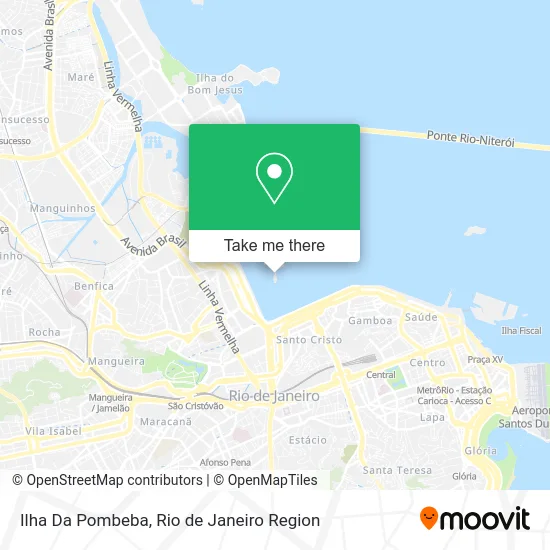
See Ilha Da Pombeba, Caju, on the map
Public Transit to Ilha Da Pombeba in Caju
Wondering how to get to Ilha Da Pombeba in Caju? Moovit helps you find the best way to get to Ilha Da Pombeba with step-by-step directions from the nearest public transit station.
Moovit provides free maps and live directions to help you navigate through your city. View schedules, routes, timetables, and find out how long does it take to get to Ilha Da Pombeba in real time.
Looking for the nearest stop or station to Ilha Da Pombeba? Check out this list of stops closest to your destination: Avenida Rio De Janeiro | Triunfo Logística - Portão 24 / Linhas Municipais; Avenida Rio De Janeiro | Triunfo Logística - Portão 24 / Linhas Intermunicipais; Into | Linhas Intermunicipais; Into; Av. Brasil 138 - Caju Rio De Janeiro - Rj Brasil; Av. Brasil 138 - Caju Rio De Janeiro; Rua Santos Lima | Into; Avenida Brasil Próximo Ao 25 - Caju Rio De Janeiro - Rj Brasil; Into (Pista Lateral Externa); Into (Pista Lateral Interna); Avenida Rodrigues Alves | Rodoviária Do Rio; Via Trilhos Santo Cristo Rio De Janeiro - Rio De Janeiro 20220 Brasil; Rodoviária.
Bus: 1910D (EXECUTIVO), 2740D (EXECUTIVO), 343, 388, 397, 492, 740D, 760D, SR 355, 101C, 102C, 104C, 108C, 111C, 210, 292, 300, SR 300, 315, 545, 2110, 2545, 4110, 4545, 60, 70, 80, 90, 110, 428, 535, 566D, 521D, 726D, 727D, 728D, 1721D.Metro: L2.Train: RAMAL SARACURUNA.
Want to see if there’s another route that gets you there at an earlier time? Moovit helps you find alternative routes or times. Get directions from and directions to Ilha Da Pombeba easily from the Moovit App or Website.
We make riding to Ilha Da Pombeba easy, which is why over 1.5 million users, including users in Caju, trust Moovit as the best app for public transit. You don’t need to download an individual bus app or train app, Moovit is your all-in-one transit app that helps you find the best bus time or train time available.
For information on prices of bus, metro and train, costs and ride fares to Ilha Da Pombeba, please check the Moovit app.
Use the app to navigate to popular places including to the airport, hospital, stadium, grocery store, mall, coffee shop, school, college, and university.
Location: Caju, Rio de Janeiro Region
- Cais do Porto,
- Espaço Cultural Taquara,
- Terminal da Triunfo Portuária Ltda.,
- Porto do Rio de Janeiro-Triunfo Logística,
- Porto Do Rio De Janeiro - Portão 24,
- Compania de Docas do Rio de Janeiro,
- Via Elevado da Perimetral,
- Porto do Rio,
- Niteroi,
- Praça da Apoteose - RJ,
- Instituto Nacional de Traumatologia e Ortopedia (Inst. de Traumatologia e Ortopedia),
- Porto Do Caju,
- Avenida Brasil 500,
- Avenida Rio de Janeiro Próximo ao 1383-1497,
- Avenida Rio de Janeiro 555,
- INTO - Instituto Nacional de Traumatologia e Ortopedia Jamil Hadadd,
- Viaduto do Gasômetro,
- Rua Eduardo Luís Lopes,
- Passarela do INTO,
- Zona Portuária do Rio de Janeiro
Places Near Ilha Da Pombeba (Caju)
- Shopping RioSul, Botafogo,
- Hospital Federal Do Andaraí, Andaraí,
- Shopping Downtown, Barra Da Tijuca,
- Hospital Pedro Ernesto, Vila Isabel,
- Shopping Nova América, Del Castilho,
- Hospital Federal Cardoso Fontes, Jacarepaguá,
- Avenida Venezuela 134, Saúde,
- Rua Licínio Cardoso, São Francisco Xavier,
- Rodoviária Novo Rio (Rodoviária do Rio de Janeiro), Santo Cristo,
- Feira Livre da Gloria, Glória,
- Avenida Rio Branco, Centro,
- Praia do Arpoador, Ipanema,
- Rio De Janeiro,
- Museu Do Amanhã, Centro,
- Hospital Municipal Ronaldo Gazolla, Acari,
- Norte Shopping, Cachambi,
- Niterói, Niterói,
- Shopping Rio Sul, Botafogo,
- Rua Ulysses Guimarães 16, Cidade Nova,
- Feirão De Malhas, Duque De Caxias
How to get to popular places in Rio de Janeiro Region with public transit
Get around Caju by public transit!
Traveling around Caju has never been so easy. See step by step directions as you travel to any attraction, street or major public transit station. View bus and train schedules, arrival times, service alerts and detailed routes on a map, so you know exactly how to get to anywhere in Caju.
When traveling to any destination around Caju use Moovit's Live Directions with Get Off Notifications to know exactly where and how far to walk, how long to wait for your line, and how many stops are left. Moovit will alert you when it's time to get off — no need to constantly re-check whether yours is the next stop.
Wondering how to use public transit in Caju or how to pay for public transit in Caju? Moovit public transit app can help you navigate your way with public transit easily, and at minimum cost. It includes public transit fees, ticket prices, and costs. Looking for a map of Caju public transit lines? Moovit public transit app shows all public transit maps in Caju with all Bus, Train, Metro, Light Rail, Ferry, Cable Car, Gondola and Funicular routes and stops on an interactive map.
Rio de Janeiro Region has 8 transit type(s), including: Bus, Train, Metro, Light Rail, Ferry, Cable Car, Gondola and Funicular, operated by several transit agencies, including TrensRJ, Metrô Rio, VLT Carioca, Barcas Rio, BRT MOBI-Rio, Auto Viação Alpha, Auto Viação Tijuca, Gire Transportes, Transurb, Viação Nossa Senhora das Graças, Consórcio INTERSUL, Braso Lisboa (Municipal), Caprichosa Auto Ônibus, Auto Viação Três Amigos and Rodoviária Âncora Matias