Directions to Imam Sadeq Islamic Foundation-Boston with public transportation
The following transit lines have routes that pass near Imam Sadeq Islamic Foundation-Boston
 Bus: 14, 30, 34, 34E, 35.
- Train: NEEDHAM, FRANKLIN/FOXBORO, ORANGE LINE, PROVIDENCE/STOUGHTON.
- Subway: ORANGE LINE.
How to get to Imam Sadeq Islamic Foundation-Boston by bus?
Click on the bus route to see step by step directions with maps, line arrival times and updated time schedules.
From Hynes Convention Center MBTA Station
62 minFrom Hotel Aka Back Bay (Hotel Back Bay)
46 minFrom Park Plaza Castle
48 minFrom Inman Sq
84 minFrom PwC
81 minFrom The Barking Crab
81 minFrom Courtyard South Boston (COURTYARD by Marriott)
40 minFrom MGH
62 minFrom Federal Courthouse
61 minFrom Courtyard Marriott Lobby
43 min
How to get to Imam Sadeq Islamic Foundation-Boston by train?
Click on the train route to see step by step directions with maps, line arrival times and updated time schedules.
How to get to Imam Sadeq Islamic Foundation-Boston by subway?
Click on the subway route to see step by step directions with maps, line arrival times and updated time schedules.
From Hynes Convention Center MBTA Station
49 minFrom Hotel Aka Back Bay (Hotel Back Bay)
47 minFrom Park Plaza Castle
49 minFrom Inman Sq
71 minFrom PwC
65 minFrom The Barking Crab
62 minFrom Courtyard South Boston (COURTYARD by Marriott)
64 minFrom MGH
60 minFrom Federal Courthouse
55 minFrom Courtyard Marriott Lobby
47 min
Bus stops near Imam Sadeq Islamic Foundation-Boston
Train station near Imam Sadeq Islamic Foundation-Boston
- Forest Hills, 13 min walk,VIEW
Bus lines to Imam Sadeq Islamic Foundation-Boston
- 14, Heath St,VIEW
- 30, Forest Hills,VIEW
- 34, Forest Hills - Dedham Mall,VIEW
- 35, Forest Hills - Dedham Mall,VIEW
- 36, Forest Hills - VA Hospital,VIEW
- 37, Forest Hills - Baker & Vermont St,VIEW
- 39, Back Bay - Forest Hills,VIEW
- 40, Forest Hills - Georgetowne,VIEW
- 50, Forest Hills - Cleary Square,VIEW
- 51, Forest Hills - Reservoir,VIEW
- 34E, Forest Hills - Walpole Center via Washington St,VIEW
- NEEDHAM LINE SHUTTLE, Newton Highlands (Shuttle),VIEW
- NEEDHAM LINE SHUTTLE, Forest Hills (Shuttle),VIEW
What are the closest stations to Imam Sadeq Islamic Foundation-Boston?
The closest stations to Imam Sadeq Islamic Foundation-Boston are:
- Cummins Hwy @ Washington St is 44 yards away, 1 min walk.
- Washington St @ Cummins Hwy is 78 yards away, 2 min walk.
- Roslindale Village/Belgrade Avenue 25 is 325 yards away, 4 min walk.
- Forest Hills is 1088 yards away, 13 min walk.
Which bus lines stop near Imam Sadeq Islamic Foundation-Boston?
These bus lines stop near Imam Sadeq Islamic Foundation-Boston: 14, 30, 34, 34E, 35, 37, 50.
Which train line stops near Imam Sadeq Islamic Foundation-Boston?
NEEDHAM (#625 | Needham Heights)
Which subway line stops near Imam Sadeq Islamic Foundation-Boston?
ORANGE LINE (Forest Hills)
What’s the nearest train station to Imam Sadeq Islamic Foundation-Boston?
The nearest train station to Imam Sadeq Islamic Foundation-Boston is Forest Hills. It’s a 13 min walk away.
What’s the nearest bus station to Imam Sadeq Islamic Foundation-Boston?
The nearest bus station to Imam Sadeq Islamic Foundation-Boston is Cummins Hwy @ Washington St. It’s a 1 min walk away.
What time is the first subway to Imam Sadeq Islamic Foundation-Boston?
The ORANGE LINE is the first subway that goes to Imam Sadeq Islamic Foundation-Boston. It stops nearby at 5:15 AM.
What time is the last subway to Imam Sadeq Islamic Foundation-Boston?
The ORANGE LINE is the last subway that goes to Imam Sadeq Islamic Foundation-Boston. It stops nearby at 1:58 AM.
What time is the first train to Imam Sadeq Islamic Foundation-Boston?
The NEEDHAM is the first train that goes to Imam Sadeq Islamic Foundation-Boston. It stops nearby at 7:22 AM.
What time is the last train to Imam Sadeq Islamic Foundation-Boston?
The PROVIDENCE/STOUGHTON is the last train that goes to Imam Sadeq Islamic Foundation-Boston. It stops nearby at 12:08 AM.
What time is the first bus to Imam Sadeq Islamic Foundation-Boston?
The 39 is the first bus that goes to Imam Sadeq Islamic Foundation-Boston. It stops nearby at 4:33 AM.
What time is the last bus to Imam Sadeq Islamic Foundation-Boston?
The 36 is the last bus that goes to Imam Sadeq Islamic Foundation-Boston. It stops nearby at 1:38 AM.
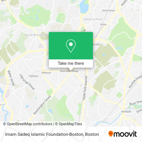
See Imam Sadeq Islamic Foundation-Boston on the map
Public Transportation to Imam Sadeq Islamic Foundation-Boston
Wondering how to get to Imam Sadeq Islamic Foundation-Boston? Moovit helps you find the best way to get to Imam Sadeq Islamic Foundation-Boston with step-by-step directions from the nearest public transit station.
Moovit provides free maps and live directions to help you navigate through your city. View schedules, routes, timetables, and find out how long does it take to get to Imam Sadeq Islamic Foundation-Boston in real time.
Looking for the nearest stop or station to Imam Sadeq Islamic Foundation-Boston? Check out this list of stops closest to your destination: Cummins Hwy @ Washington St; Washington St @ Cummins Hwy; Roslindale Village/Belgrade Avenue 25; Forest Hills.
Bus: 14, 30, 34, 34E, 35, 37, 50, 36, 39, NEEDHAM LINE SHUTTLE, NEEDHAM LINE SHUTTLE.Train: NEEDHAM, FRANKLIN/FOXBORO, ORANGE LINE, PROVIDENCE/STOUGHTON.Subway: ORANGE LINE.
Want to see if there’s another route that gets you there at an earlier time? Moovit helps you find alternative routes or times. Get directions from and directions to Imam Sadeq Islamic Foundation-Boston easily from the Moovit App or Website.
We make riding to Imam Sadeq Islamic Foundation-Boston easy, which is why over 1.7 million users, including users in Boston, trust Moovit as the best app for public transit. You don’t need to download an individual bus app or train app, Moovit is your all-in-one transit app that helps you find the best bus time or train time available.
For information on prices of bus, subway and train, costs and ride fares to Imam Sadeq Islamic Foundation-Boston, please check the Moovit app.
Use the app to navigate to popular places including to the airport, hospital, stadium, grocery store, mall, coffee shop, school, college, and university.
Imam Sadeq Islamic Foundation-Boston Address: 43 Poplar St street in Boston
- Roslindale Square,
- Social Security,
- Lost & Found Treasures,
- J B Edward Uniforms (JB Pride Uniforms - We),
- Registry of Motor Vehicles,
- Roslindale Pediatrics,
- Benjamin Eleonu, MD,
- Roslindale MBTA Commuter Station,
- Roslindale Village Commuter Rail Station,
- Grunber,
- Valentini Landscaping,
- Roslindale,
- Pay Attention To Detail,
- Boston for the Dogs,
- Anomia Press,
- Arnold Arboretum-Mendum Street Gate,
- Arbri Cafe,
- Dale,
- Delta Glass Service,
- Foreign & Domestic Auto Services
Places Near Imam Sadeq Islamic Foundation-Boston
- Wang Theater, Boston,
- Isabella Stewart Gardner Museum, Boston,
- Td Garden, Boston,
- Faneuil Hall, Boston,
- Seaport District, Boston,
- Boston Medical Center, Boston,
- North End, Boston,
- Wilbur Theatre, Boston,
- Mgm Music Hall, Boston,
- Castle Island, Boston,
- Quincy Market, Boston,
- Boston Children's Hospital, Boston,
- House Of Blues, Boston,
- Prudential Center, Boston,
- Boston Common, Boston,
- Boston Convention & Exhibition Center, Boston,
- Leader Bank Pavilion (Leader Bank Pavillion), Boston,
- Massachusetts General Hospital, Boston,
- Cheers, Boston,
- Museum Of Science, Boston
How to get to popular places in Boston with public transit
Get around Boston by public transit!
Traveling around Boston has never been so easy. See step by step directions as you travel to any attraction, street or major public transit station. View bus and train schedules, arrival times, service alerts and detailed routes on a map, so you know exactly how to get to anywhere in Boston.
When traveling to any destination around Boston use Moovit's Live Directions with Get Off Notifications to know exactly where and how far to walk, how long to wait for your line, and how many stops are left. Moovit will alert you when it's time to get off — no need to constantly re-check whether yours is the next stop.
Wondering how to use public transit in Boston or how to pay for public transit in Boston? Moovit public transit app can help you navigate your way with public transit easily, and at minimum cost. It includes public transit fees, ticket prices, and costs. Looking for a map of Boston public transit lines? Moovit public transit app shows all public transit maps in Boston with all Bus, Train, Subway and Ferry routes and stops on an interactive map.
Boston has 4 transit type(s), including: Bus, Train, Subway and Ferry, operated by several transit agencies, including MBTA, Southeastern Regional Transit Authority, MetroWest Regional Transit Authority, Rhode Island Public Transit Authority, WRTA, Lowell Regional Transit Authority, Merrimack Valley Transit, Montachusett Regional Transit Authority, Cape Cod Regional Transit Authority, Brockton Area Transit Authority, Martha's Vineyard Transit Authority, the WAVE - Nantucket Regional Transit Authority, GATRA, Cape Ann Transportation Authority and Massport