Directions to Immetrica, Inc. (Boston) with public transportation
The following transit lines have routes that pass near Immetrica, Inc.
 Bus: 501, 57, 65, 66, GREEN LINE B SHUTTLE.
- Train: FRAMINGHAM/WORCESTER.
- Subway: GREEN LINE B, GREEN LINE D.
How to get to Immetrica, Inc. by bus?
Click on the bus route to see step by step directions with maps, line arrival times and updated time schedules.
From new hampshire!, Boston
53 minFrom Chelsea, MA, Chelsea
84 minFrom Sudbury, Boston
53 minFrom Dartmouth, Boston
30 minFrom Boston Marriott Newton, Newton
87 minFrom Medford, MA, Medford
78 minFrom Wilbur Theatre, Boston
33 minFrom Castle Island, Boston
82 minFrom Boston Logan International Airport (Bos), Boston
39 min
How to get to Immetrica, Inc. by train?
Click on the train route to see step by step directions with maps, line arrival times and updated time schedules.
How to get to Immetrica, Inc. by subway?
Click on the subway route to see step by step directions with maps, line arrival times and updated time schedules.
Bus stops near Immetrica, Inc. in Boston
- Griggs Street - Commonwealth Ave @ Griggs St, 4 min walk,VIEW
- Griggs Street - Commonwealth Ave Opp Griggs St, 5 min walk,VIEW
- Washington St @ Euston St, 6 min walk,VIEW
- Warren Street - Commonwealth Ave @ Kelton St, 6 min walk,VIEW
- Washington Street - Commonwealth Ave @ Washington St, 7 min walk,VIEW
- Harvard St @ Verndale St, 8 min walk,VIEW
Subway station near Immetrica, Inc. in Boston
- Griggs Street, 5 min walk,VIEW
Bus lines to Immetrica, Inc. in Boston
- GREEN LINE B SHUTTLE, Washington Street - Kenmore,VIEW
- GREEN LINE B SHUTTLE, Washington Street - Blandford Street,VIEW
- GREEN LINE B SHUTTLE, Boston College - Packard's Corner,VIEW
- GREEN LINE B SHUTTLE, Boston College (Shuttle),VIEW
- 65, Kenmore,VIEW
- GREEN LINE B SHUTTLE, Back Bay (Shuttle),VIEW
- GREEN LINE B SHUTTLE, Babcock Street (Shuttle),VIEW
- SHUTTLE, Kenmore (Shuttle),VIEW
- GREEN LINE B SHUTTLE, Washington Street (Shuttle),VIEW
- 66, Nubian Via Allston,VIEW
What are the closest stations to Immetrica, Inc.?
The closest stations to Immetrica, Inc. are:
- Griggs Street - Commonwealth Ave @ Griggs St is 302 yards away, 4 min walk.
- Griggs Street - Commonwealth Ave Opp Griggs St is 324 yards away, 5 min walk.
- Griggs Street is 325 yards away, 5 min walk.
- Washington St @ Euston St is 416 yards away, 6 min walk.
- Warren Street - Commonwealth Ave @ Kelton St is 477 yards away, 6 min walk.
- Washington Street - Commonwealth Ave @ Washington St is 528 yards away, 7 min walk.
- Harvard St @ Verndale St is 619 yards away, 8 min walk.
Which bus lines stop near Immetrica, Inc.?
These bus lines stop near Immetrica, Inc.: 501, 57, 65, 66.
Which train line stops near Immetrica, Inc.?
FRAMINGHAM/WORCESTER (#525 | Worcester)
Which subway lines stop near Immetrica, Inc.?
These subway lines stop near Immetrica, Inc.: GREEN LINE B, GREEN LINE D.
What’s the nearest subway station to Immetrica, Inc. in Boston?
The nearest subway station to Immetrica, Inc. in Boston is Griggs Street. It’s a 5 min walk away.
What’s the nearest bus station to Immetrica, Inc. in Boston?
The nearest bus station to Immetrica, Inc. in Boston is Griggs Street - Commonwealth Ave @ Griggs St. It’s a 4 min walk away.
What time is the first subway to Immetrica, Inc. in Boston?
The GREEN LINE B is the first subway that goes to Immetrica, Inc. in Boston. It stops nearby at 5:10 AM.
What time is the last subway to Immetrica, Inc. in Boston?
The GREEN LINE B is the last subway that goes to Immetrica, Inc. in Boston. It stops nearby at 2:30 AM.
What time is the first bus to Immetrica, Inc. in Boston?
The 66 is the first bus that goes to Immetrica, Inc. in Boston. It stops nearby at 5:09 AM.
What time is the last bus to Immetrica, Inc. in Boston?
The 66 is the last bus that goes to Immetrica, Inc. in Boston. It stops nearby at 2:13 AM.
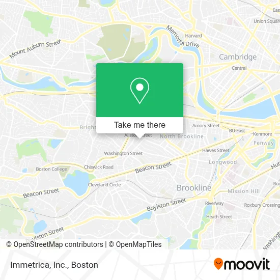
See Immetrica, Inc., Boston, on the map
Public Transit to Immetrica, Inc. in Boston
Wondering how to get to Immetrica, Inc. in Boston? Moovit helps you find the best way to get to Immetrica, Inc. with step-by-step directions from the nearest public transit station.
Moovit provides free maps and live directions to help you navigate through your city. View schedules, routes, timetables, and find out how long does it take to get to Immetrica, Inc. in real time.
Looking for the nearest stop or station to Immetrica, Inc.? Check out this list of stops closest to your destination: Griggs Street - Commonwealth Ave @ Griggs St; Griggs Street - Commonwealth Ave Opp Griggs St; Griggs Street; Washington St @ Euston St; Warren Street - Commonwealth Ave @ Kelton St; Washington Street - Commonwealth Ave @ Washington St; Harvard St @ Verndale St.
Bus: 501, 57, 65, 66, GREEN LINE B SHUTTLE, GREEN LINE B SHUTTLE, GREEN LINE B SHUTTLE, GREEN LINE B SHUTTLE, GREEN LINE B SHUTTLE, GREEN LINE B SHUTTLE, SHUTTLE, GREEN LINE B SHUTTLE.Train: FRAMINGHAM/WORCESTER.Subway: GREEN LINE B, GREEN LINE D.
Want to see if there’s another route that gets you there at an earlier time? Moovit helps you find alternative routes or times. Get directions from and directions to Immetrica, Inc. easily from the Moovit App or Website.
We make riding to Immetrica, Inc. easy, which is why over 1.7 million users, including users in Boston, trust Moovit as the best app for public transit. You don’t need to download an individual bus app or train app, Moovit is your all-in-one transit app that helps you find the best bus time or train time available.
For information on prices of bus, subway and train, costs and ride fares to Immetrica, Inc., please check the Moovit app.
Use the app to navigate to popular places including to the airport, hospital, stadium, grocery store, mall, coffee shop, school, college, and university.
Immetrica, Inc. Address: 36 Bellvista Rd street in Boston
- F & F Property Management,
- Commonwealth Square,
- Kelton St Laundry,
- North of the Wall,
- Elite Locksmith,
- Aurora Mountain,
- Boston Neuroscience,
- 228 Corey Rd Parking,
- Jay Liu - Real Estate Broker,
- Eliot Street,
- 287 Summit Ave Parking,
- Enzo Matcha Green Tea,
- Brecher,
- Adornment Appliance Repair,
- X Movers,
- Fast Heating & Cooling Repair,
- Laserhere,
- 164 Kelton St Parking,
- Carol Benintendi,
- Dana-Farber Marathon Challenge
Places Near Immetrica, Inc. (Boston)
- Seaport District, Boston,
- Boston Common, Boston,
- Castle Island, Boston,
- Leader Bank Pavilion (Leader Bank Pavillion), Boston,
- Wilbur Theatre, Boston,
- Cheers, Boston,
- Isabella Stewart Gardner Museum, Boston,
- Td Garden, Boston,
- Boston Medical Center, Boston,
- North End, Boston,
- Massachusetts General Hospital, Boston,
- Prudential Center, Boston,
- Quincy Market, Boston,
- Mgm Music Hall, Boston,
- Museum Of Science, Boston,
- Boston Convention & Exhibition Center, Boston,
- Faneuil Hall, Boston,
- Boston Children's Hospital, Boston,
- House Of Blues, Boston,
- Wang Theater, Boston
How to get to popular places in Boston with public transit
Get around Boston by public transit!
Traveling around Boston has never been so easy. See step by step directions as you travel to any attraction, street or major public transit station. View bus and train schedules, arrival times, service alerts and detailed routes on a map, so you know exactly how to get to anywhere in Boston.
When traveling to any destination around Boston use Moovit's Live Directions with Get Off Notifications to know exactly where and how far to walk, how long to wait for your line, and how many stops are left. Moovit will alert you when it's time to get off — no need to constantly re-check whether yours is the next stop.
Wondering how to use public transit in Boston or how to pay for public transit in Boston? Moovit public transit app can help you navigate your way with public transit easily, and at minimum cost. It includes public transit fees, ticket prices, and costs. Looking for a map of Boston public transit lines? Moovit public transit app shows all public transit maps in Boston with all Bus, Train, Subway and Ferry routes and stops on an interactive map.
Boston has 4 transit type(s), including: Bus, Train, Subway and Ferry, operated by several transit agencies, including MBTA, Southeastern Regional Transit Authority, MetroWest Regional Transit Authority, Rhode Island Public Transit Authority, WRTA, Lowell Regional Transit Authority, Merrimack Valley Transit, Montachusett Regional Transit Authority, Cape Cod Regional Transit Authority, Brockton Area Transit Authority, Martha's Vineyard Transit Authority, the WAVE - Nantucket Regional Transit Authority, GATRA, Cape Ann Transportation Authority and Massport