Directions to Impact Team Realty (Boston) with public transportation
The following transit lines have routes that pass near Impact Team Realty
 Train: KINGSTON.
How to get to Impact Team Realty by train?
Click on the train route to see step by step directions with maps, line arrival times and updated time schedules.
Train station near Impact Team Realty in Boston
- Hanson, 51 min walk,VIEW
What are the closest stations to Impact Team Realty?
The closest stations to Impact Team Realty are:
- Hanson is 4405 yards away, 51 min walk.
Which train line stops near Impact Team Realty?
KINGSTON (#1017 | Kingston)
What time is the first train to Impact Team Realty in Boston?
The KINGSTON is the first train that goes to Impact Team Realty in Boston. It stops nearby at 5:14 AM.
What time is the last train to Impact Team Realty in Boston?
The KINGSTON is the last train that goes to Impact Team Realty in Boston. It stops nearby at 12:45 AM.
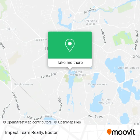
See Impact Team Realty, Boston, on the map
Public Transit to Impact Team Realty in Boston
Wondering how to get to Impact Team Realty in Boston? Moovit helps you find the best way to get to Impact Team Realty with step-by-step directions from the nearest public transit station.
Moovit provides free maps and live directions to help you navigate through your city. View schedules, routes, timetables, and find out how long does it take to get to Impact Team Realty in real time.
Looking for the nearest stop or station to Impact Team Realty? Check out this list of stops closest to your destination: Hanson.
Train: KINGSTON.
Want to see if there’s another route that gets you there at an earlier time? Moovit helps you find alternative routes or times. Get directions from and directions to Impact Team Realty easily from the Moovit App or Website.
We make riding to Impact Team Realty easy, which is why over 1.7 million users, including users in Boston, trust Moovit as the best app for public transit. You don’t need to download an individual bus app or train app, Moovit is your all-in-one transit app that helps you find the best bus time or train time available.
For information on prices of train and bus, costs and ride fares to Impact Team Realty, please check the Moovit app.
Use the app to navigate to popular places including to the airport, hospital, stadium, grocery store, mall, coffee shop, school, college, and university.
Impact Team Realty Address: 502 Liberty St street in Boston
- Old Cemetery Potter's Field,
- 5 Arrowhead Dr,
- Stonehill College,
- The Blueberry Farm,
- Bizi Bakes,
- Vineyard Sky Golden Retrievers,
- 129 Helen Dr,
- Sinners & Saints Collective,
- South Shore Industries,
- Wood Wizard Things,
- Speedway,
- Hope Christian School,
- 2 Waterford Dr,
- Laque Plumbing & Heating Harry,
- Harleys Portable Restrooms,
- 4 Phillips Rd,
- 3 Angels Tattoo,
- RPM Motor Sports,
- South Shore Install,
- Home
Places Near Impact Team Realty (Boston)
- Boston Convention & Exhibition Center, Boston,
- Seaport District, Boston,
- Boston Medical Center, Boston,
- Faneuil Hall, Boston,
- Cheers, Boston,
- Wilbur Theatre, Boston,
- Td Garden, Boston,
- Isabella Stewart Gardner Museum, Boston,
- Wang Theater, Boston,
- North End, Boston,
- Massachusetts General Hospital, Boston,
- Mgm Music Hall, Boston,
- Boston Children's Hospital, Boston,
- Castle Island, Boston,
- Boston Common, Boston,
- Prudential Center, Boston,
- Museum Of Science, Boston,
- Leader Bank Pavilion (Leader Bank Pavillion), Boston,
- House Of Blues, Boston,
- Quincy Market, Boston
How to get to popular places in Boston with public transit
Get around Boston by public transit!
Traveling around Boston has never been so easy. See step by step directions as you travel to any attraction, street or major public transit station. View bus and train schedules, arrival times, service alerts and detailed routes on a map, so you know exactly how to get to anywhere in Boston.
When traveling to any destination around Boston use Moovit's Live Directions with Get Off Notifications to know exactly where and how far to walk, how long to wait for your line, and how many stops are left. Moovit will alert you when it's time to get off — no need to constantly re-check whether yours is the next stop.
Wondering how to use public transit in Boston or how to pay for public transit in Boston? Moovit public transit app can help you navigate your way with public transit easily, and at minimum cost. It includes public transit fees, ticket prices, and costs. Looking for a map of Boston public transit lines? Moovit public transit app shows all public transit maps in Boston with all Bus, Train, Subway and Ferry routes and stops on an interactive map.
Boston has 4 transit type(s), including: Bus, Train, Subway and Ferry, operated by several transit agencies, including MBTA, Southeastern Regional Transit Authority, MetroWest Regional Transit Authority, Rhode Island Public Transit Authority, WRTA, Lowell Regional Transit Authority, Merrimack Valley Transit, Montachusett Regional Transit Authority, Cape Cod Regional Transit Authority, Brockton Area Transit Authority, Martha's Vineyard Transit Authority, the WAVE - Nantucket Regional Transit Authority, GATRA, Cape Ann Transportation Authority and Massport