Directions to In2motion Media (Minneapolis) with public transportation
The following transit lines have routes that pass near In2motion Media
 Bus: 14, 3, 7, 667, METRO C LINE.
- Light Rail: METRO BLUE LINE, METRO GREEN LINE.
How to get to In2motion Media by bus?
Click on the bus route to see step by step directions with maps, line arrival times and updated time schedules.
From New Hope, Minnesota, New Hope
56 minFrom Target, Crystal
55 minFrom Como Park Zoo and Conservatory, St. Paul
48 minFrom Minneapolis Veterans Home, Minneapolis
72 minFrom st anthony park, St. Paul
35 minFrom University Of St. Thomas, St. Paul
52 minFrom Dave's Deluxe Window Cleaning Service, Crystal
31 minFrom Carpenter Winnelle, Golden Valley
28 minFrom Knollwood Mall, St. Louis Park
58 minFrom Costco, St. Louis Park
37 min
Bus stops near In2motion Media in Minneapolis
Light Rail stations near In2motion Media in Minneapolis
- Target Field Platform 2, 45 min walk,VIEW
Bus lines to In2motion Media in Minneapolis
- 667, Express / Hwy 7 / Co 101,VIEW
- 3, Como / To Snelling / Energy Park,VIEW
- 7, Minnehaha / 46st Sta / Cedar Point,VIEW
- 14, Bloomington / 38st Sta / Via France,VIEW
- METRO C LINE, Penn / Brooklyn Ctr Tc,VIEW
- 755, Ltd Stop / Downtown / Gold Vall Rd,VIEW
- METRO D LINE, Chicago-Fremont / Brooklyn Ctr Tc,VIEW
- 5, Chicago - 56st,VIEW
- 22, Brklyn Ctr Tc / N Lyndale / Via Penn Av,VIEW
What are the closest stations to In2motion Media?
The closest stations to In2motion Media are:
- 2nd St N & 3rd Ave - Layover is 280 yards away, 4 min walk.
- Washington Ave & 3rd Ave N is 295 yards away, 4 min walk.
- Olson & 7th St Station is 865 yards away, 11 min walk.
- 7th St & Olson Station is 916 yards away, 11 min walk.
- Target Field Platform 2 is 3848 yards away, 45 min walk.
Which bus lines stop near In2motion Media?
These bus lines stop near In2motion Media: 14, 3, 7.
Which light rail lines stop near In2motion Media?
These light rail lines stop near In2motion Media: METRO BLUE LINE, METRO GREEN LINE.
What’s the nearest bus station to In2motion Media in Minneapolis?
The nearest bus stations to In2motion Media in Minneapolis are 2nd St N & 3rd Ave - Layover and Washington Ave & 3rd Ave N. The closest one is a 4 min walk away.
What time is the first light rail to In2motion Media in Minneapolis?
The METRO BLUE LINE is the first light rail that goes to In2motion Media in Minneapolis. It stops nearby at 4:28 AM.
What time is the last light rail to In2motion Media in Minneapolis?
The METRO BLUE LINE is the last light rail that goes to In2motion Media in Minneapolis. It stops nearby at 12:51 AM.
What time is the first bus to In2motion Media in Minneapolis?
The 3 is the first bus that goes to In2motion Media in Minneapolis. It stops nearby at 3:59 AM.
What time is the last bus to In2motion Media in Minneapolis?
The 3 is the last bus that goes to In2motion Media in Minneapolis. It stops nearby at 2:15 AM.
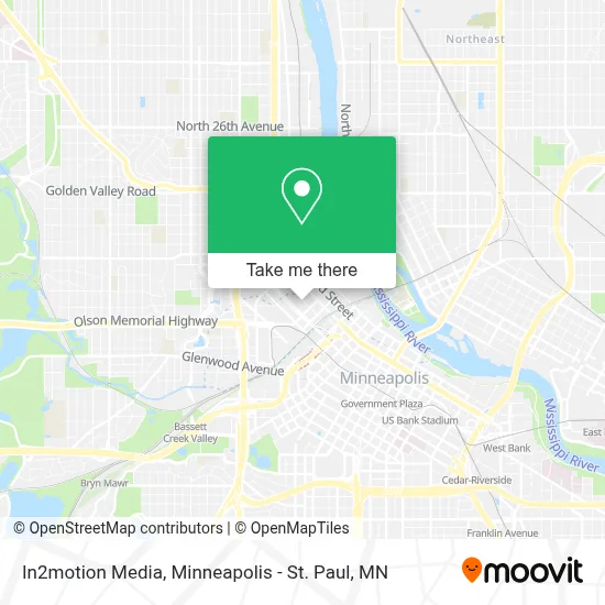
See In2motion Media, Minneapolis, on the map
Public Transit to In2motion Media in Minneapolis
Wondering how to get to In2motion Media in Minneapolis? Moovit helps you find the best way to get to In2motion Media with step-by-step directions from the nearest public transit station.
Moovit provides free maps and live directions to help you navigate through your city. View schedules, routes, timetables, and find out how long does it take to get to In2motion Media in real time.
Looking for the nearest stop or station to In2motion Media? Check out this list of stops closest to your destination: 2nd St N & 3rd Ave - Layover; Washington Ave & 3rd Ave N; Olson & 7th St Station; 7th St & Olson Station; Target Field Platform 2.
Bus: 14, 3, 7, 667, METRO C LINE, 755, METRO D LINE, 5, 22.Light Rail: METRO BLUE LINE, METRO GREEN LINE.
Want to see if there’s another route that gets you there at an earlier time? Moovit helps you find alternative routes or times. Get directions from and directions to In2motion Media easily from the Moovit App or Website.
We make riding to In2motion Media easy, which is why over 1.7 million users, including users in Minneapolis, trust Moovit as the best app for public transit. You don’t need to download an individual bus app or train app, Moovit is your all-in-one transit app that helps you find the best bus time or train time available.
For information on prices of bus and light rail, costs and ride fares to In2motion Media, please check the Moovit app.
Use the app to navigate to popular places including to the airport, hospital, stadium, grocery store, mall, coffee shop, school, college, and university.
In2motion Media Address: 701 N 3rd St street in Minneapolis
- Sip Better,
- Equal Housing Opportunity,
- North Loop,
- Farrell's North Loop,
- Barks & Rec,
- Burnt Chicken,
- Freehouse,
- Epnetwork,
- Smack Shack (Smack Shack North Loop),
- The Nordic Minneapolis,
- FRGMNT Coffee,
- Thrivent Financial for Lutherans,
- R2 Global Supply,
- Ignite Models Inc.,
- The Beard Group Inc.,
- Confluence,
- 756 N 4th St Parking,
- Corner Church,
- 514 Studios Event Center,
- Lu's Tacos
Places Near In2motion Media (Minneapolis)
- St. Paul College, St. Paul,
- Minneapolis Institute of Art, Minneapolis,
- Abbott Northwestern Piper Building, Minneapolis,
- Target Center, Minneapolis,
- Minnehaha Falls, Minneapolis,
- Target Field, Minneapolis,
- Harriet Island Regional Park, St. Paul,
- Treasure Island Resort & Casino, St. Paul,
- Minneapolis Sculpture Garden, Minneapolis,
- 3m Arena at Mariucci, Minneapolis,
- Huntington Bank Stadium, Minneapolis,
- Northrop Auditorium, Minneapolis,
- Xcel Energy Center, St. Paul,
- Mystic lake casino bus, Minneapolis,
- Mpls. Convention Center, Minneapolis,
- Bishop Henry Whipple Federal Building,
- Minnesota State Capitol, St. Paul,
- Surly Brewing Co., Minneapolis,
- Orpheum Theatre (Minneapolis, Minnesota), Minneapolis,
- Grand Casino Hinckley,MN, Minneapolis
How to get to popular places in Minneapolis - St. Paul, MN with public transit
Get around Minneapolis by public transit!
Traveling around Minneapolis has never been so easy. See step by step directions as you travel to any attraction, street or major public transit station. View bus and train schedules, arrival times, service alerts and detailed routes on a map, so you know exactly how to get to anywhere in Minneapolis.
When traveling to any destination around Minneapolis use Moovit's Live Directions with Get Off Notifications to know exactly where and how far to walk, how long to wait for your line, and how many stops are left. Moovit will alert you when it's time to get off — no need to constantly re-check whether yours is the next stop.
Wondering how to use public transit in Minneapolis or how to pay for public transit in Minneapolis? Moovit public transit app can help you navigate your way with public transit easily, and at minimum cost. It includes public transit fees, ticket prices, and costs. Looking for a map of Minneapolis public transit lines? Moovit public transit app shows all public transit maps in Minneapolis with all Bus, Train and Light Rail routes and stops on an interactive map.
Minneapolis - St. Paul, MN has 3 transit type(s), including: Bus, Train and Light Rail, operated by several transit agencies, including Metro Transit , Metro Transit, MVTA, Plymouth Metrolink, SouthWest Transit, Maple Grove, University of Minnesota, Airport (MAC), Amtrak, Mankato Transit System, SMART, FlixBus-us and Greyhound-us