How to get to In2spanish by bus?
Click on the bus route to see step by step directions with maps, line arrival times and updated time schedules.
From C.C. Parquesur, Leganés
86 minFrom Plaza Don Antonio de Andrés 18, Madrid
57 minFrom Aelia Relay 4006, Madrid
57 minFrom Comisaría de Policía de Madrid-Carabanchel, Madrid
52 minFrom Calle de Martínez Villergas, Madrid
50 minFrom Mad Cool Festival, Madrid
89 minFrom Faunia, Área Metropolitana De Madrid Y Corredor Del Henares
70 minFrom Plaza José Maria Soler 7, Madrid
38 minFrom Calle Emilio Ferrari, Madrid
52 minFrom C.E.P. PEÑAGRANDE, Madrid
42 min
How to get to In2spanish by train?
Click on the train route to see step by step directions with maps, line arrival times and updated time schedules.
How to get to In2spanish by metro?
Click on the metro route to see step by step directions with maps, line arrival times and updated time schedules.
From C.C. Parquesur, Leganés
60 minFrom Plaza Don Antonio de Andrés 18, Madrid
53 minFrom Aelia Relay 4006, Madrid
44 minFrom Comisaría de Policía de Madrid-Carabanchel, Madrid
41 minFrom Calle de Martínez Villergas, Madrid
38 minFrom Faunia, Área Metropolitana De Madrid Y Corredor Del Henares
68 minFrom Plaza José Maria Soler 7, Madrid
38 minFrom Calle Emilio Ferrari, Madrid
34 minFrom C.E.P. PEÑAGRANDE, Madrid
40 min
Metro stations near In2spanish in Madrid
Bus stops near In2spanish in Madrid
Train station near In2spanish in Madrid
- Príncipe Pío, 16 min walk,VIEW
Bus lines to In2spanish in Madrid
- 21, El Salvador,VIEW
- 62, Los Puertos,VIEW
- 74, Parque Avenidas,VIEW
- 1, Plaza de Cristo Rey - Prosperidad,VIEW
- 001, Estacion de Atocha - Moncloa,VIEW
- 44, Plaza del Callao - Marques de Viana,VIEW
- 133, Plaza del Callao - Mirasierra,VIEW
- 138, Plaza de Cristo Rey - Colonia San Ignacio de Loyola,VIEW
- C2, Circular 2 -,VIEW
- N21, Plaza de Cibeles - Arroyo del Fresno,VIEW
- NC2, Cuatro Caminos - Estacion de Atocha,VIEW
- SC1, Cuatro Caminos - Legazpi,VIEW
- C1, Circular 1 -,VIEW
- NC1, Cuatro Caminos - Estacion de Atocha,VIEW
- SC2, Cuatro Caminos - Legazpi,VIEW
What are the closest stations to In2spanish?
The closest stations to In2spanish are:
- Ventura Rodríguez is 121 meters away, 2 min walk.
- Marqués De Urquijo - Teleférico is 122 meters away, 3 min walk.
- Pintor Rosales is 178 meters away, 3 min walk.
- Argüelles is 270 meters away, 4 min walk.
- Príncipe Pío is 1071 meters away, 14 min walk.
Which bus lines stop near In2spanish?
These bus lines stop near In2spanish: 132, 21, 62, 74.
Which train line stops near In2spanish?
C10 (Villalba De Guadarrama)
Which metro lines stop near In2spanish?
These metro lines stop near In2spanish: M-3, M-4, M-6.
What’s the nearest metro station to In2spanish in Madrid?
The nearest metro station to In2spanish in Madrid is Ventura Rodríguez. It’s a 2 min walk away.
What’s the nearest train station to In2spanish in Madrid?
The nearest train station to In2spanish in Madrid is Príncipe Pío. It’s a 16 min walk away.
What’s the nearest bus station to In2spanish in Madrid?
The nearest bus stations to In2spanish in Madrid are Marqués De Urquijo - Teleférico and Pintor Rosales. The closest one is a 3 min walk away.
What time is the first metro to In2spanish in Madrid?
The M-4 is the first metro that goes to In2spanish in Madrid. It stops nearby at 6:05 AM.
What time is the last metro to In2spanish in Madrid?
The M-4 is the last metro that goes to In2spanish in Madrid. It stops nearby at 2:06 AM.
What time is the first train to In2spanish in Madrid?
The C7 is the first train that goes to In2spanish in Madrid. It stops nearby at 6:09 AM.
What time is the last train to In2spanish in Madrid?
The C7 is the last train that goes to In2spanish in Madrid. It stops nearby at 12:12 AM.
What time is the first bus to In2spanish in Madrid?
The 74 is the first bus that goes to In2spanish in Madrid. It stops nearby at 7:00 AM.
What time is the last bus to In2spanish in Madrid?
The NC1 is the last bus that goes to In2spanish in Madrid. It stops nearby at 3:18 AM.
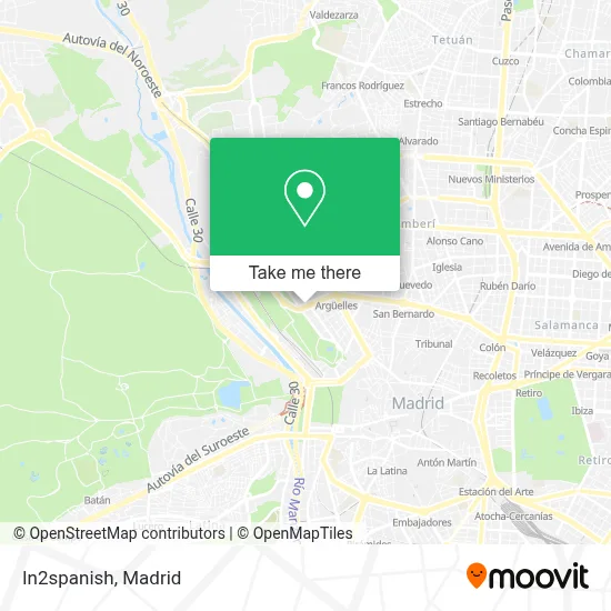
See In2spanish, Madrid, on the map
Public Transit to In2spanish in Madrid
Wondering how to get to In2spanish in Madrid? Moovit helps you find the best way to get to In2spanish with step-by-step directions from the nearest public transit station.
Moovit provides free maps and live directions to help you navigate through your city. View schedules, routes, timetables, and find out how long does it take to get to In2spanish in real time.
Looking for the nearest stop or station to In2spanish? Check out this list of stops closest to your destination: Ventura Rodríguez; Marqués De Urquijo - Teleférico; Pintor Rosales; Argüelles; Príncipe Pío.
Bus: 132, 21, 62, 74.Train: C10, C7, MD, REG.Metro: M-3, M-4, M-6, M-R, M-10.
Want to see if there’s another route that gets you there at an earlier time? Moovit helps you find alternative routes or times. Get directions from and directions to In2spanish easily from the Moovit App or Website.
We make riding to In2spanish easy, which is why over 1.5 million users, including users in Madrid, trust Moovit as the best app for public transit. You don’t need to download an individual bus app or train app, Moovit is your all-in-one transit app that helps you find the best bus time or train time available.
For information on prices of bus, metro and train, costs and ride fares to In2spanish, please check the Moovit app.
Use the app to navigate to popular places including to the airport, hospital, stadium, grocery store, mall, coffee shop, school, college, and university.
In2spanish Address: Calle Marqués de Urquijo, 40 28008 Argüelles Madrid street in Madrid
- Loraicami,
- Gila de la Puerta Abogados,
- Puertos y Construcciones,
- C/ Marqués de Urquijo 44,
- Oro Inverso,
- Hobbyceram,
- Motoshock Motor,
- Aldovea sa,
- Nivel Z Comunicación,
- Amagna Legal,
- Business Center Ferraz,
- África Solar Eolica,
- Rafael Alberti,
- Manuel Rodriguez Saura,
- Aethetic Madrid,
- Zerco Dental,
- Asociación de Usuarios de Servicios Bancarios Ausbanc,
- Palisis Ag Store,
- Best Hotel Princesa,
- Restaurante Cratera
Places Near In2spanish (Madrid)
- Mendez Alvaro, Madrid,
- Centro Comercial Islazul, Área Metropolitana De Madrid Y Corredor Del Henares,
- Nassica, Área Metropolitana De Madrid Y Corredor Del Henares,
- Plenilunio, Área Metropolitana De Madrid Y Corredor Del Henares,
- Palacio De Vistalegre, Área Metropolitana De Madrid Y Corredor Del Henares,
- Centro Comercial La Gavia, Área Metropolitana De Madrid Y Corredor Del Henares,
- Estadio Wanda Metropolitano, Área Metropolitana De Madrid Y Corredor Del Henares,
- Hospital Universitario Ramón y Cajal, Madrid,
- Hospital Clínico Universitario San Carlos, Madrid,
- Centro Comercial La Vaguada, Área Metropolitana De Madrid Y Corredor Del Henares,
- Wizink Center, Madrid,
- Hospital Universitario La Paz, Madrid,
- Estacion de Chamartin, Madrid,
- Calle de López de Hoyos 169, Madrid,
- Plaza Mayor, Madrid,
- Tres Aguas, Alcorcón,
- Sala La Riviera, Madrid,
- Rastro De Madrid, Área Metropolitana De Madrid Y Corredor Del Henares,
- Mercadillo de Majadahonda, Majadahonda,
- Centro Comercial Oasiz Madrid, Área Metropolitana De Madrid Y Corredor Del Henares
How to get to popular places in Madrid with public transit
Get around Madrid by public transit!
Traveling around Madrid has never been so easy. See step by step directions as you travel to any attraction, street or major public transit station. View bus and train schedules, arrival times, service alerts and detailed routes on a map, so you know exactly how to get to anywhere in Madrid.
When traveling to any destination around Madrid use Moovit's Live Directions with Get Off Notifications to know exactly where and how far to walk, how long to wait for your line, and how many stops are left. Moovit will alert you when it's time to get off — no need to constantly re-check whether yours is the next stop.
Wondering how to use public transit in Madrid or how to pay for public transit in Madrid? Moovit public transit app can help you navigate your way with public transit easily, and at minimum cost. It includes public transit fees, ticket prices, and costs. Looking for a map of Madrid public transit lines? Moovit public transit app shows all public transit maps in Madrid with all Bus, Train, Metro and Light Rail routes and stops on an interactive map.
Madrid has 4 transit type(s), including: Bus, Train, Metro and Light Rail, operated by several transit agencies, including Metro de Madrid, Metro Ligero, Tranvía de Parla, Renfe Cercanías - Servicios de Autobús especiales, Renfe Cercanias, Renfe Cercanías, EMT, Interurbanos, Urbanos de Alcalá de Henares, Urbanos de Alcobendas, Urbanos de Alcorcón, Urbanos de Algete, Urbanos de Aranjuez, Urbanos de Arganda del Rey and Urbanos de Arroyomolinos