Directions to In And Out Cellphone Repair (Minneapolis) with public transportation
The following transit lines have routes that pass near In And Out Cellphone Repair
 Bus: 38, METRO B LINE, METRO D LINE, 5, 11.
How to get to In And Out Cellphone Repair by bus?
Click on the bus route to see step by step directions with maps, line arrival times and updated time schedules.
From Normandale Community College, Edina
67 minFrom Jordan de Jong at Guaranteed Rate Affinity (NMLS, St. Paul
54 minFrom MOA Transit Station & Terminal Gate A, Bloomington
29 minFrom Southdale Center, Edina
39 minFrom 612brew, Minneapolis
48 minFrom St. Nygaard's House Of Legal Prostitution, St. Paul
42 minFrom Mall of America Bloomington MN, Bloomington
29 minFrom Hy-Vee, Robbinsdale
56 minFrom Mall of America LRT Station, Bloomington
29 min
Bus stops near In And Out Cellphone Repair in Minneapolis
Light Rail stations near In And Out Cellphone Repair in Minneapolis
Bus lines to In And Out Cellphone Repair in Minneapolis
What are the closest stations to In And Out Cellphone Repair?
The closest stations to In And Out Cellphone Repair are:
- Chicago Ave S & 33rd St E is 30 yards away, 1 min walk.
- 35th St E & Chicago Ave is 343 yards away, 5 min walk.
- Chicago & 34th St Station is 533 yards away, 7 min walk.
- Lake & Chicago Station is 640 yards away, 8 min walk.
- 4th Ave S & 33rd St E is 645 yards away, 8 min walk.
- Lake Street Midtown Station is 1514 yards away, 19 min walk.
- West Bank Station is 3830 yards away, 46 min walk.
Which bus lines stop near In And Out Cellphone Repair?
These bus lines stop near In And Out Cellphone Repair: 38, METRO B LINE, METRO D LINE.
What’s the nearest light rail station to In And Out Cellphone Repair in Minneapolis?
The nearest light rail station to In And Out Cellphone Repair in Minneapolis is Lake Street Midtown Station. It’s a 19 min walk away.
What’s the nearest bus station to In And Out Cellphone Repair in Minneapolis?
The nearest bus station to In And Out Cellphone Repair in Minneapolis is Chicago Ave S & 33rd St E. It’s a 1 min walk away.
What time is the first light rail to In And Out Cellphone Repair in Minneapolis?
The METRO BLUE LINE is the first light rail that goes to In And Out Cellphone Repair in Minneapolis. It stops nearby at 3:19 AM.
What time is the last light rail to In And Out Cellphone Repair in Minneapolis?
The METRO BLUE LINE is the last light rail that goes to In And Out Cellphone Repair in Minneapolis. It stops nearby at 12:40 AM.
What time is the first bus to In And Out Cellphone Repair in Minneapolis?
The METRO B LINE is the first bus that goes to In And Out Cellphone Repair in Minneapolis. It stops nearby at 4:10 AM.
What time is the last bus to In And Out Cellphone Repair in Minneapolis?
The 11 is the last bus that goes to In And Out Cellphone Repair in Minneapolis. It stops nearby at 1:25 AM.
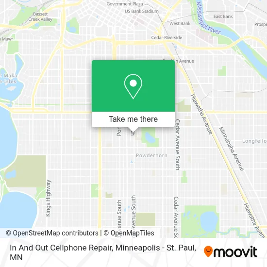
See In And Out Cellphone Repair, Minneapolis, on the map
Public Transit to In And Out Cellphone Repair in Minneapolis
Wondering how to get to In And Out Cellphone Repair in Minneapolis? Moovit helps you find the best way to get to In And Out Cellphone Repair with step-by-step directions from the nearest public transit station.
Moovit provides free maps and live directions to help you navigate through your city. View schedules, routes, timetables, and find out how long does it take to get to In And Out Cellphone Repair in real time.
Looking for the nearest stop or station to In And Out Cellphone Repair? Check out this list of stops closest to your destination: Chicago Ave S & 33rd St E; 35th St E & Chicago Ave; Chicago & 34th St Station; Lake & Chicago Station; 4th Ave S & 33rd St E; Lake Street Midtown Station; West Bank Station.
Bus: 38, METRO B LINE, METRO D LINE, 5, 11.
Want to see if there’s another route that gets you there at an earlier time? Moovit helps you find alternative routes or times. Get directions from and directions to In And Out Cellphone Repair easily from the Moovit App or Website.
We make riding to In And Out Cellphone Repair easy, which is why over 1.7 million users, including users in Minneapolis, trust Moovit as the best app for public transit. You don’t need to download an individual bus app or train app, Moovit is your all-in-one transit app that helps you find the best bus time or train time available.
For information on prices of bus and light rail, costs and ride fares to In And Out Cellphone Repair, please check the Moovit app.
Use the app to navigate to popular places including to the airport, hospital, stadium, grocery store, mall, coffee shop, school, college, and university.
In And Out Cellphone Repair Address: 3300 Chicago Ave S Ste B street in Minneapolis
- Transitions Plus High School,
- Wellstone International High School,
- Columbus Community Gardens,
- Early Childhood Special Education,
- Children's TRST of the United STTS of,
- CDJ Construction,
- Wildflyer Coffee,
- Chicago Ave S / E 34th St,
- Laura Ingalls Wilder School,
- Heritage Academy,
- Amigos One Stop,
- Rhu's Salon,
- The Porch Gallery,
- Fortress Of the Arts,
- Porch Gallery,
- True America,
- Adorable Yorkie Puppies For Adoption In Minnesota,
- The Exchange Minneapolis,
- Egon Zablonsky's Cleaning Service,
- MPS Metro DT
Places Near In And Out Cellphone Repair (Minneapolis)
- Treasure Island Resort & Casino, St. Paul,
- Abbott Northwestern Piper Building, Minneapolis,
- Target Center, Minneapolis,
- Minnehaha Falls, Minneapolis,
- Huntington Bank Stadium, Minneapolis,
- Northrop Auditorium, Minneapolis,
- Xcel Energy Center, St. Paul,
- Target Field, Minneapolis,
- Minnesota State Capitol, St. Paul,
- 3m Arena at Mariucci, Minneapolis,
- Bishop Henry Whipple Federal Building,
- Harriet Island Regional Park, St. Paul,
- Surly Brewing Co., Minneapolis,
- Grand Casino Hinckley,MN, Minneapolis,
- St. Paul College, St. Paul,
- Orpheum Theatre (Minneapolis, Minnesota), Minneapolis,
- Mpls. Convention Center, Minneapolis,
- Minneapolis Institute of Art, Minneapolis,
- Minneapolis Sculpture Garden, Minneapolis,
- Mystic lake casino bus, Minneapolis
How to get to popular places in Minneapolis - St. Paul, MN with public transit
Get around Minneapolis by public transit!
Traveling around Minneapolis has never been so easy. See step by step directions as you travel to any attraction, street or major public transit station. View bus and train schedules, arrival times, service alerts and detailed routes on a map, so you know exactly how to get to anywhere in Minneapolis.
When traveling to any destination around Minneapolis use Moovit's Live Directions with Get Off Notifications to know exactly where and how far to walk, how long to wait for your line, and how many stops are left. Moovit will alert you when it's time to get off — no need to constantly re-check whether yours is the next stop.
Wondering how to use public transit in Minneapolis or how to pay for public transit in Minneapolis? Moovit public transit app can help you navigate your way with public transit easily, and at minimum cost. It includes public transit fees, ticket prices, and costs. Looking for a map of Minneapolis public transit lines? Moovit public transit app shows all public transit maps in Minneapolis with all Bus, Train and Light Rail routes and stops on an interactive map.
Minneapolis - St. Paul, MN has 3 transit type(s), including: Bus, Train and Light Rail, operated by several transit agencies, including Metro Transit , Metro Transit, MVTA, Plymouth Metrolink, SouthWest Transit, Maple Grove, University of Minnesota, Airport (MAC), Amtrak, Mankato Transit System, SMART, FlixBus-us and Greyhound-us