Directions to In Camera Legal Video Services (St. Paul) with public transportation
The following transit lines have routes that pass near In Camera Legal Video Services
 Bus: 63, 67, 87, 30.
- Light Rail: METRO GREEN LINE.
How to get to In Camera Legal Video Services by bus?
Click on the bus route to see step by step directions with maps, line arrival times and updated time schedules.
From Richfield, MN, Richfield
61 minFrom Regions Hospital, St. Paul
34 minFrom Marathon, Minneapolis
56 minFrom Loring Park, Minneapolis
46 minFrom Plato Blvd & Hwy 52, St. Paul
60 minFrom Theodore Wirth Park, Golden Valley
73 minFrom 7th St W / 7th St E, St. Paul
34 minFrom Portland Ave S & #6244, Richfield
59 minFrom El Burrito Mercado, St. Paul
43 minFrom Science Museum Of Minnesota, St. Paul
36 min
Light Rail stations near In Camera Legal Video Services in St. Paul
- Westgate, 2 min walk,VIEW
Bus stops near In Camera Legal Video Services in St. Paul
Bus lines to In Camera Legal Video Services in St. Paul
What are the closest stations to In Camera Legal Video Services?
The closest stations to In Camera Legal Video Services are:
- Westgate is 89 yards away, 2 min walk.
- Raymond Ave & Territorial Rd is 235 yards away, 3 min walk.
- University Ave & Eustis St is 241 yards away, 3 min walk.
- Franklin Ave & Eustis St is 519 yards away, 7 min walk.
Which bus lines stop near In Camera Legal Video Services?
These bus lines stop near In Camera Legal Video Services: 63, 67.
Which light rail line stops near In Camera Legal Video Services?
METRO GREEN LINE (Mpls-Target Field)
What’s the nearest light rail station to In Camera Legal Video Services in St. Paul?
The nearest light rail station to In Camera Legal Video Services in St. Paul is Westgate. It’s a 2 min walk away.
What’s the nearest bus station to In Camera Legal Video Services in St. Paul?
The nearest bus stations to In Camera Legal Video Services in St. Paul are Raymond Ave & Territorial Rd and University Ave & Eustis St. The closest one is a 3 min walk away.
What time is the first light rail to In Camera Legal Video Services in St. Paul?
The METRO GREEN LINE is the first light rail that goes to In Camera Legal Video Services in St. Paul. It stops nearby at 4:48 AM.
What time is the last light rail to In Camera Legal Video Services in St. Paul?
The METRO GREEN LINE is the last light rail that goes to In Camera Legal Video Services in St. Paul. It stops nearby at 11:46 PM.
What time is the first bus to In Camera Legal Video Services in St. Paul?
The 63 is the first bus that goes to In Camera Legal Video Services in St. Paul. It stops nearby at 4:29 AM.
What time is the last bus to In Camera Legal Video Services in St. Paul?
The 63 is the last bus that goes to In Camera Legal Video Services in St. Paul. It stops nearby at 1:40 AM.
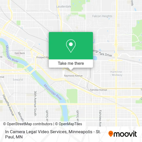
See In Camera Legal Video Services, St. Paul, on the map
Public Transit to In Camera Legal Video Services in St. Paul
Wondering how to get to In Camera Legal Video Services in St. Paul? Moovit helps you find the best way to get to In Camera Legal Video Services with step-by-step directions from the nearest public transit station.
Moovit provides free maps and live directions to help you navigate through your city. View schedules, routes, timetables, and find out how long does it take to get to In Camera Legal Video Services in real time.
Looking for the nearest stop or station to In Camera Legal Video Services? Check out this list of stops closest to your destination: Westgate; Raymond Ave & Territorial Rd; University Ave & Eustis St; Franklin Ave & Eustis St.
Bus: 63, 67, 87, 30.Light Rail: METRO GREEN LINE.
Want to see if there’s another route that gets you there at an earlier time? Moovit helps you find alternative routes or times. Get directions from and directions to In Camera Legal Video Services easily from the Moovit App or Website.
We make riding to In Camera Legal Video Services easy, which is why over 1.7 million users, including users in St. Paul, trust Moovit as the best app for public transit. You don’t need to download an individual bus app or train app, Moovit is your all-in-one transit app that helps you find the best bus time or train time available.
For information on prices of bus and light rail, costs and ride fares to In Camera Legal Video Services, please check the Moovit app.
Use the app to navigate to popular places including to the airport, hospital, stadium, grocery store, mall, coffee shop, school, college, and university.
In Camera Legal Video Services Address: 2375 University Ave W St Paul, MN 55114 street in St. Paul
- Open Insight Therapy LLC,
- MFM MN ST.Paul HQ,
- Cocoon House, Llc.,
- Twin Cities Reptiles,
- Thinkself Minnesota Deaf Adult Education & Advocacy,
- Indigo Counseling Center,
- Victoria MSW Woolley Licsw,
- ATM,
- Epilepsy Foundation of Minnesota,
- Spicy Feta,
- Smallest Museum St. Paul,
- Wayside Wellness,
- Ansr,
- The Security Building,
- Minnesota Prevention Resource Center,
- Workhorse Coffee Bar,
- Pediatric Home Service,
- Mystic Eye Studio,
- Johnson Brothers Liquor,
- Herbst Eatery & Farm Stand
Places Near In Camera Legal Video Services (St. Paul)
- Minneapolis Sculpture Garden, Minneapolis,
- Huntington Bank Stadium, Minneapolis,
- Surly Brewing Co., Minneapolis,
- Minnesota State Capitol, St. Paul,
- St. Paul College, St. Paul,
- Northrop Auditorium, Minneapolis,
- Grand Casino Hinckley,MN, Minneapolis,
- Xcel Energy Center, St. Paul,
- Abbott Northwestern Piper Building, Minneapolis,
- Orpheum Theatre (Minneapolis, Minnesota), Minneapolis,
- Treasure Island Resort & Casino, St. Paul,
- Bishop Henry Whipple Federal Building,
- Mpls. Convention Center, Minneapolis,
- Minneapolis Institute of Art, Minneapolis,
- Mystic lake casino bus, Minneapolis,
- Minnehaha Falls, Minneapolis,
- 3m Arena at Mariucci, Minneapolis,
- Target Field, Minneapolis,
- Target Center, Minneapolis,
- Harriet Island Regional Park, St. Paul
How to get to popular places in Minneapolis - St. Paul, MN with public transit
Get around St. Paul by public transit!
Traveling around St. Paul has never been so easy. See step by step directions as you travel to any attraction, street or major public transit station. View bus and train schedules, arrival times, service alerts and detailed routes on a map, so you know exactly how to get to anywhere in St. Paul.
When traveling to any destination around St. Paul use Moovit's Live Directions with Get Off Notifications to know exactly where and how far to walk, how long to wait for your line, and how many stops are left. Moovit will alert you when it's time to get off — no need to constantly re-check whether yours is the next stop.
Wondering how to use public transit in St. Paul or how to pay for public transit in St. Paul? Moovit public transit app can help you navigate your way with public transit easily, and at minimum cost. It includes public transit fees, ticket prices, and costs. Looking for a map of St. Paul public transit lines? Moovit public transit app shows all public transit maps in St. Paul with all Bus, Train and Light Rail routes and stops on an interactive map.
Minneapolis - St. Paul, MN has 3 transit type(s), including: Bus, Train and Light Rail, operated by several transit agencies, including Metro Transit , Metro Transit, MVTA, Plymouth Metrolink, SouthWest Transit, Maple Grove, University of Minnesota, Airport (MAC), Amtrak, Mankato Transit System, SMART, FlixBus-us and Greyhound-us