Directions to In & Out Transport (St. Paul) with public transportation
The following transit lines have routes that pass near In & Out Transport
 Bus: 65, 67.
- Light Rail: METRO GREEN LINE.
How to get to In & Out Transport by bus?
Click on the bus route to see step by step directions with maps, line arrival times and updated time schedules.
From Canopy-Minneapolis Mill District, Minneapolis
59 minFrom 24 Somali Mall, Minneapolis
45 minFrom St. Anthony Mills Apartments, Minneapolis
58 minFrom Stadium Village Station Green Line, Minneapolis
39 minFrom Abbott Northwestern Hospital Emergency Department, Minneapolis
47 minFrom Piper Parking Lot, Minneapolis
46 minFrom Roseville Area High School, Roseville
42 minFrom Post office, Minneapolis
55 minFrom Huntington Bank Stadium, Minneapolis
49 minFrom Pollo Campero, West St. Paul
58 min
Bus stops near In & Out Transport in St. Paul
Light Rail stations near In & Out Transport in St. Paul
- Hamline Avenue, 22 min walk,VIEW
Bus lines to In & Out Transport in St. Paul
What are the closest stations to In & Out Transport?
The closest stations to In & Out Transport are:
- Minnehaha Ave & Grotto St is 276 yards away, 4 min walk.
- Dale St & Minnehaha Ave is 696 yards away, 9 min walk.
- Hamline Avenue is 1838 yards away, 22 min walk.
Which bus lines stop near In & Out Transport?
These bus lines stop near In & Out Transport: 65, 67.
Which light rail line stops near In & Out Transport?
METRO GREEN LINE (St. Paul-Union Depot)
What’s the nearest light rail station to In & Out Transport in St. Paul?
The nearest light rail station to In & Out Transport in St. Paul is Hamline Avenue. It’s a 22 min walk away.
What’s the nearest bus station to In & Out Transport in St. Paul?
The nearest bus station to In & Out Transport in St. Paul is Minnehaha Ave & Grotto St. It’s a 4 min walk away.
What time is the first light rail to In & Out Transport in St. Paul?
The METRO GREEN LINE is the first light rail that goes to In & Out Transport in St. Paul. It stops nearby at 4:36 AM.
What time is the last light rail to In & Out Transport in St. Paul?
The METRO GREEN LINE is the last light rail that goes to In & Out Transport in St. Paul. It stops nearby at 11:58 PM.
What time is the first bus to In & Out Transport in St. Paul?
The 65 is the first bus that goes to In & Out Transport in St. Paul. It stops nearby at 5:17 AM.
What time is the last bus to In & Out Transport in St. Paul?
The 65 is the last bus that goes to In & Out Transport in St. Paul. It stops nearby at 12:27 AM.
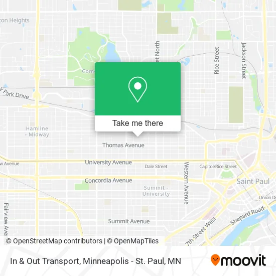
See In & Out Transport, St. Paul, on the map
Public Transit to In & Out Transport in St. Paul
Wondering how to get to In & Out Transport in St. Paul? Moovit helps you find the best way to get to In & Out Transport with step-by-step directions from the nearest public transit station.
Moovit provides free maps and live directions to help you navigate through your city. View schedules, routes, timetables, and find out how long does it take to get to In & Out Transport in real time.
Looking for the nearest stop or station to In & Out Transport? Check out this list of stops closest to your destination: Minnehaha Ave & Grotto St; Dale St & Minnehaha Ave; Hamline Avenue.
Bus: 65, 67.Light Rail: METRO GREEN LINE.
Want to see if there’s another route that gets you there at an earlier time? Moovit helps you find alternative routes or times. Get directions from and directions to In & Out Transport easily from the Moovit App or Website.
We make riding to In & Out Transport easy, which is why over 1.7 million users, including users in St. Paul, trust Moovit as the best app for public transit. You don’t need to download an individual bus app or train app, Moovit is your all-in-one transit app that helps you find the best bus time or train time available.
For information on prices of bus and light rail, costs and ride fares to In & Out Transport, please check the Moovit app.
Use the app to navigate to popular places including to the airport, hospital, stadium, grocery store, mall, coffee shop, school, college, and university.
In & Out Transport Address: 763 Blair Ave St Paul, MN 55104 street in St. Paul
- Minnehaha Ave W Building 831,
- District 7 Planning Council Office,
- Grandpa George's,
- Jegol Ethiopian Kitchen,
- Frogtown Farm And Park,
- Lilypad Community Garden - Frogtown,
- Everybodys Barbershop,
- Puppy Play Zone,
- Quick Set, Inc.,
- Tommey's Lock & Key,
- Frogtown,
- Scoopz Ice Cream,
- Tobasi Mini Tobacco,
- T-Cell Phone,
- Blendz Barbershop MN,
- Krispy Krunchy Chicken,
- Khue's Kitchen,
- Shwe Hintar Minnesota,
- MN Hands & Voices,
- Brownstone Lofts
Places Near In & Out Transport (St. Paul)
- Mystic lake casino bus, Minneapolis,
- Target Center, Minneapolis,
- Surly Brewing Co., Minneapolis,
- 3m Arena at Mariucci, Minneapolis,
- Abbott Northwestern Piper Building, Minneapolis,
- Huntington Bank Stadium, Minneapolis,
- Bishop Henry Whipple Federal Building,
- Minnehaha Falls, Minneapolis,
- Target Field, Minneapolis,
- Grand Casino Hinckley,MN, Minneapolis,
- St. Paul College, St. Paul,
- Treasure Island Resort & Casino, St. Paul,
- Orpheum Theatre (Minneapolis, Minnesota), Minneapolis,
- Mpls. Convention Center, Minneapolis,
- Minneapolis Sculpture Garden, Minneapolis,
- Xcel Energy Center, St. Paul,
- Harriet Island Regional Park, St. Paul,
- Minneapolis Institute of Art, Minneapolis,
- Northrop Auditorium, Minneapolis,
- Minnesota State Capitol, St. Paul
How to get to popular places in Minneapolis - St. Paul, MN with public transit
Get around St. Paul by public transit!
Traveling around St. Paul has never been so easy. See step by step directions as you travel to any attraction, street or major public transit station. View bus and train schedules, arrival times, service alerts and detailed routes on a map, so you know exactly how to get to anywhere in St. Paul.
When traveling to any destination around St. Paul use Moovit's Live Directions with Get Off Notifications to know exactly where and how far to walk, how long to wait for your line, and how many stops are left. Moovit will alert you when it's time to get off — no need to constantly re-check whether yours is the next stop.
Wondering how to use public transit in St. Paul or how to pay for public transit in St. Paul? Moovit public transit app can help you navigate your way with public transit easily, and at minimum cost. It includes public transit fees, ticket prices, and costs. Looking for a map of St. Paul public transit lines? Moovit public transit app shows all public transit maps in St. Paul with all Bus, Train and Light Rail routes and stops on an interactive map.
Minneapolis - St. Paul, MN has 3 transit type(s), including: Bus, Train and Light Rail, operated by several transit agencies, including Metro Transit , Metro Transit, MVTA, Plymouth Metrolink, SouthWest Transit, Maple Grove, University of Minnesota, Airport (MAC), Amtrak, Mankato Transit System, SMART, FlixBus-us and Greyhound-us