Directions to Inbound Health (Minneapolis) with public transportation
The following transit lines have routes that pass near Inbound Health
 Bus: METRO B LINE, METRO D LINE, 5, 27, 2.
How to get to Inbound Health by bus?
Click on the bus route to see step by step directions with maps, line arrival times and updated time schedules.
From Trader Joe's, St. Paul
48 minFrom Walmart Supercenter, Roseville
61 minFrom Jordan de Jong at Guaranteed Rate Affinity (NMLS, St. Paul
49 minFrom Rosedale Shopping Center-Entrance 4, Roseville
48 minFrom American Blvd & IKEA Entrance, Bloomington
29 minFrom 1 2 3 Tow Service, Minneapolis
43 minFrom Aquila Park, St. Louis Park
46 minFrom Kohl's, St. Louis Park
49 min
Bus stops near Inbound Health in Minneapolis
Light Rail stations near Inbound Health in Minneapolis
Bus lines to Inbound Health in Minneapolis
What are the closest stations to Inbound Health?
The closest stations to Inbound Health are:
- Chicago Lake Transit Center is 203 yards away, 3 min walk.
- Lake & Chicago Station is 219 yards away, 3 min walk.
- 28th St E & 10th Ave S is 449 yards away, 6 min walk.
- Chicago Ave S & 27th St E is 747 yards away, 9 min walk.
- West Bank Station is 996 yards away, 13 min walk.
- Cedar-Riverside is 1689 yards away, 21 min walk.
Which bus lines stop near Inbound Health?
These bus lines stop near Inbound Health: METRO B LINE, METRO D LINE.
What’s the nearest light rail station to Inbound Health in Minneapolis?
The nearest light rail station to Inbound Health in Minneapolis is West Bank Station. It’s a 13 min walk away.
What’s the nearest bus station to Inbound Health in Minneapolis?
The nearest bus stations to Inbound Health in Minneapolis are Chicago Lake Transit Center and Lake & Chicago Station. The closest one is a 3 min walk away.
What time is the first light rail to Inbound Health in Minneapolis?
The METRO BLUE LINE is the first light rail that goes to Inbound Health in Minneapolis. It stops nearby at 3:19 AM.
What time is the last light rail to Inbound Health in Minneapolis?
The METRO BLUE LINE is the last light rail that goes to Inbound Health in Minneapolis. It stops nearby at 12:42 AM.
What time is the first bus to Inbound Health in Minneapolis?
The METRO B LINE is the first bus that goes to Inbound Health in Minneapolis. It stops nearby at 4:10 AM.
What time is the last bus to Inbound Health in Minneapolis?
The METRO B LINE is the last bus that goes to Inbound Health in Minneapolis. It stops nearby at 1:48 AM.
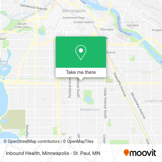
See Inbound Health, Minneapolis, on the map
Public Transit to Inbound Health in Minneapolis
Wondering how to get to Inbound Health in Minneapolis? Moovit helps you find the best way to get to Inbound Health with step-by-step directions from the nearest public transit station.
Moovit provides free maps and live directions to help you navigate through your city. View schedules, routes, timetables, and find out how long does it take to get to Inbound Health in real time.
Looking for the nearest stop or station to Inbound Health? Check out this list of stops closest to your destination: Chicago Lake Transit Center; Lake & Chicago Station; 28th St E & 10th Ave S; Chicago Ave S & 27th St E; West Bank Station; Cedar-Riverside.
Bus: METRO B LINE, METRO D LINE, 5, 27, 2.
Want to see if there’s another route that gets you there at an earlier time? Moovit helps you find alternative routes or times. Get directions from and directions to Inbound Health easily from the Moovit App or Website.
We make riding to Inbound Health easy, which is why over 1.7 million users, including users in Minneapolis, trust Moovit as the best app for public transit. You don’t need to download an individual bus app or train app, Moovit is your all-in-one transit app that helps you find the best bus time or train time available.
For information on prices of bus and light rail, costs and ride fares to Inbound Health, please check the Moovit app.
Use the app to navigate to popular places including to the airport, hospital, stadium, grocery store, mall, coffee shop, school, college, and university.
Inbound Health Address: 2925 Chicago Ave street in Minneapolis
- Oasis Market and Deli,
- Allina Health,
- Minneapolis DVS (MN DVS Deputy Registrar Office),
- Midtown Global Market,
- Chicago-Lake Transit Station,
- Southside, Minneapolis,
- Venture Bikes,
- Uncle Hugo's Science Fiction Bookstore,
- Chinese Restaurant Minneapolis MN Online Order,
- Midtown Exchange,
- U Two Nail,
- 2837 Chicago Ave Parking,
- Abbott Northwestern Hospital - Purple Parking Ramp,
- O'Reilly Auto Parts,
- Del Primo,
- Hsre-MN Midtown LLC C / O Cushman & Wakefield Ap,
- Pamela L. Burgess, MD,
- Kelly ONeill,
- Pelvic Floor Center,
- Allina Health Orthopedics - Minneapolis
Places Near Inbound Health (Minneapolis)
- Target Field, Minneapolis,
- St. Paul College, St. Paul,
- Huntington Bank Stadium, Minneapolis,
- Treasure Island Resort & Casino, St. Paul,
- Grand Casino Hinckley,MN, Minneapolis,
- Minnehaha Falls, Minneapolis,
- Minneapolis Sculpture Garden, Minneapolis,
- Mystic lake casino bus, Minneapolis,
- Harriet Island Regional Park, St. Paul,
- Northrop Auditorium, Minneapolis,
- Orpheum Theatre (Minneapolis, Minnesota), Minneapolis,
- 3m Arena at Mariucci, Minneapolis,
- Minneapolis Institute of Art, Minneapolis,
- Surly Brewing Co., Minneapolis,
- Target Center, Minneapolis,
- Mpls. Convention Center, Minneapolis,
- Minnesota State Capitol, St. Paul,
- Bishop Henry Whipple Federal Building,
- Xcel Energy Center, St. Paul,
- Abbott Northwestern Piper Building, Minneapolis
How to get to popular places in Minneapolis - St. Paul, MN with public transit
Get around Minneapolis by public transit!
Traveling around Minneapolis has never been so easy. See step by step directions as you travel to any attraction, street or major public transit station. View bus and train schedules, arrival times, service alerts and detailed routes on a map, so you know exactly how to get to anywhere in Minneapolis.
When traveling to any destination around Minneapolis use Moovit's Live Directions with Get Off Notifications to know exactly where and how far to walk, how long to wait for your line, and how many stops are left. Moovit will alert you when it's time to get off — no need to constantly re-check whether yours is the next stop.
Wondering how to use public transit in Minneapolis or how to pay for public transit in Minneapolis? Moovit public transit app can help you navigate your way with public transit easily, and at minimum cost. It includes public transit fees, ticket prices, and costs. Looking for a map of Minneapolis public transit lines? Moovit public transit app shows all public transit maps in Minneapolis with all Bus, Train and Light Rail routes and stops on an interactive map.
Minneapolis - St. Paul, MN has 3 transit type(s), including: Bus, Train and Light Rail, operated by several transit agencies, including Metro Transit , Metro Transit, MVTA, Plymouth Metrolink, SouthWest Transit, Maple Grove, University of Minnesota, Airport (MAC), Amtrak, Mankato Transit System, SMART, FlixBus-us and Greyhound-us