Directions to Inderlok (West) with public transportation
The following transit lines have routes that pass near Inderlok
How to get to Inderlok by bus?
Click on the bus route to see step by step directions with maps, line arrival times and updated time schedules.
Bus stops near Inderlok in West
- Inder LOK, 8 min walk,
- Zakhira, 9 min walk,
Metro stations near Inderlok in West
- Kanhiya Nagar, 17 min walk,
- Satguru Ram Singh Marg, 22 min walk,
Bus lines to Inderlok in West
- 219, Old Delhi Railway Station,
- 219STL, Hiran Kudna Crossing,
- 232, D Block Mangolpuri (T),
- 233, Saiyyad Nangloi (T),
- 233STL, Kashmere Gate I.S.B.T. (T),
- 236, Kashmere Gate I.S.B.T (T),
- 236, Anand Vihar I.S.B.T.,
- 236EXT, Sawda Ghevra J.J Colony,
- 78, Krishi Kunj (Inderpuri) ⬌ Azadpur Metro Station,
- 108, Shaheed Pawan Sahni Chowk (Hari Nagar) - Nehru Vihar (T),
- 234, Tilak Nagar ⬌ Harsh Vihar,
- 234, Karampura (T) ⬌ Harsh Vihar,
- 234 (LS), Karampura (T) ⬌ Harsh Vihar [Ladies Special],
- 234A, Tilak Nagar ⬌ Harsh Vihar,
- 778, Madhu Vihar (Dwarka Sector 3) ⬌ Inderlok Metro Station,
- 813, Manglapuri (T) ⬌ Kashmere Gate I.S.B.T (T),
- 817N, Najafgarh (T) ⬌ Kashmere Gate I.S.B.T (T),
- 832, Jai Mata Market Tri Nagar (T) ⬌ Janakpuri D Block,
- 832, Inderlok Metro Station ⬌ Janakpuri D Block,
- 953, Q Block Mangolpuri (T) ⬌ Ajmeri Gate / Kamla Market,
What are the closest stations to Inderlok?
The closest stations to Inderlok are:
- Inder LOK is 563 meters away, 8 min walk.
- Zakhira is 664 meters away, 9 min walk.
- Kanhiya Nagar is 1264 meters away, 17 min walk.
- Satguru Ram Singh Marg is 1683 meters away, 22 min walk.
Which bus lines stop near Inderlok?
These bus lines stop near Inderlok: 610, 816DOWN, 817ADOWN, 91UP, ML-09.
What’s the nearest metro station to Inderlok in West?
The nearest metro station to Inderlok in West is Kanhiya Nagar. It’s a 17 min walk away.
What’s the nearest bus stop to Inderlok in West?
The nearest bus stop to Inderlok in West is Inder LOK. It’s a 8 min walk away.
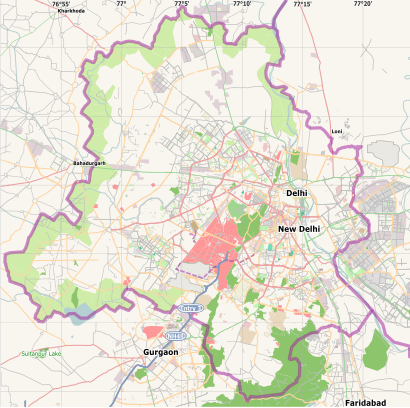
See Inderlok, West, on the map
Public Transit to Inderlok in West
Wondering how to get to Inderlok in West, India? Moovit helps you find the best way to get to Inderlok with step-by-step directions from the nearest public transit station.
Moovit provides free maps and live directions to help you navigate through your city. View schedules, routes, timetables, and find out how long does it take to get to Inderlok in real time.
Looking for the nearest stop or station to Inderlok? Check out this list of stops closest to your destination: Inder LOK; Zakhira; Kanhiya Nagar; Satguru Ram Singh Marg.
Bus: 610, 816DOWN, 817ADOWN, 91UP, ML-09, 219, 219STL, 232, 233, 233STL, 78, 108, 234, 234, 234 (LS).Metro: RED, RED, GREEN.
Want to see if there’s another route that gets you there at an earlier time? Moovit helps you find alternative routes or times. Get directions from and directions to Inderlok easily from the Moovit App or Website.
We make riding to Inderlok easy, which is why over 1.5 million users, including users in West, trust Moovit as the best app for public transit. You don’t need to download an individual bus app or train app, Moovit is your all-in-one transit app that helps you find the best bus time or train time available.
For information on prices of bus, costs and ride fares to Inderlok, please check the Moovit app.
Use the app to navigate to popular places including to the airport, hospital, stadium, grocery store, mall, coffee shop, school, college, and university.
Location: West, New Delhi
Attractions near Inderlok
How to get to popular places in New Delhi with public transit
Get around West by public transit!
Traveling around West has never been so easy. See step by step directions as you travel to any attraction, street or major public transit station. View bus and train schedules, arrival times, service alerts and detailed routes on a map, so you know exactly how to get to anywhere in West.
When traveling to any destination around West use Moovit's Live Directions with Get Off Notifications to know exactly where and how far to walk, how long to wait for your line, and how many stops are left. Moovit will alert you when it's time to get off — no need to constantly re-check whether yours is the next stop.
Wondering how to use public transit in West or how to pay for public transit in West? Moovit public transit app can help you navigate your way with public transit easily, and at minimum cost. It includes public transit fees, ticket prices, and costs. Looking for a map of West public transit lines? Moovit public transit app shows all public transit maps in West with all bus routes and stops on an interactive map.
West has 1 transit type(s), including: bus, operated by several transit agencies, including Delhi Metro Rail Corporation (DMRC), Delhi Metro Rail Corporation, Noida Metro Rail corporation, Delhi Transport Corporation (DTC), DMRC Feeder AC E-Buses, DTC AC Services, DTC Express Buses, DTC Night Bus, Delhi Integrated Multi-Modal Transit System Ltd., DIMTS (Delhi Integrated Multi-Modal Transit System Ltd.), AC bus lines, Airport AC bus lines, GMCBL (Gurugram Metropolitan City Bus Limited), Northern Railways and DTC Electric AC Buses