See Indian Boundary Park, Chicago, on the map
Directions to Indian Boundary Park (Chicago) with public transportation
The following transit lines have routes that pass near Indian Boundary Park
 Bus:
Bus: - Train:
- Chicago 'L':
How to get to Indian Boundary Park by bus?
Click on the bus route to see step by step directions with maps, line arrival times and updated time schedules.
How to get to Indian Boundary Park by train?
Click on the train route to see step by step directions with maps, line arrival times and updated time schedules.
How to get to Indian Boundary Park by Chicago 'L'?
Click on the Chicago 'L' route to see step by step directions with maps, line arrival times and updated time schedules.
Bus stations near Indian Boundary Park in Chicago
- Lunt & Campbell (West),2 min walk,
- 2477 W Touhy Ave,10 min walk,
Bus lines to Indian Boundary Park in Chicago
- 96,Morse & Glenwood (Red Line) (East),
- 290,Howard Cta Station,
What are the closest stations to Indian Boundary Park?
The closest stations to Indian Boundary Park are:
- Lunt & Campbell (West) is 118 yards away, 2 min walk.
- 2477 W Touhy Ave is 745 yards away, 10 min walk.
Which bus lines stop near Indian Boundary Park?
These bus lines stop near Indian Boundary Park: 49B, 96.
Which train line stops near Indian Boundary Park?
UP-N
Which Chicago 'L' lines stop near Indian Boundary Park?
These Chicago 'L' lines stop near Indian Boundary Park: PURPLE LINE, RED LINE.
What’s the nearest bus stop to Indian Boundary Park in Chicago?
The nearest bus stop to Indian Boundary Park in Chicago is Lunt & Campbell (West). It’s a 2 min walk away.
See Indian Boundary Park, Chicago, on the map
Public Transit to Indian Boundary Park in Chicago
Wondering how to get to Indian Boundary Park in Chicago, United States? Moovit helps you find the best way to get to Indian Boundary Park with step-by-step directions from the nearest public transit station.
Moovit provides free maps and live directions to help you navigate through your city. View schedules, routes, timetables, and find out how long does it take to get to Indian Boundary Park in real time.
Looking for the nearest stop or station to Indian Boundary Park? Check out this list of stops closest to your destination: Lunt & Campbell (West); 2477 W Touhy Ave.
Bus:Train:Chicago 'L':
Want to see if there’s another route that gets you there at an earlier time? Moovit helps you find alternative routes or times. Get directions from and directions to Indian Boundary Park easily from the Moovit App or Website.
We make riding to Indian Boundary Park easy, which is why over 1.5 million users, including users in Chicago, trust Moovit as the best app for public transit. You don’t need to download an individual bus app or train app, Moovit is your all-in-one transit app that helps you find the best bus time or train time available.
For information on prices of bus, Chicago 'L' and train, costs and ride fares to Indian Boundary Park, please check the Moovit app.
Use the app to navigate to popular places including to the airport, hospital, stadium, grocery store, mall, coffee shop, school, college, and university.
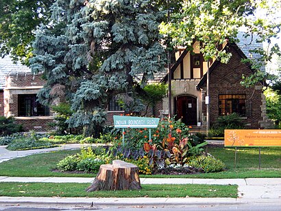
Indian Boundary Park Address: West Lunt Avenue street in Chicago
Indian Boundary Park is a 13-acre (5.3 ha) urban park in the West Ridge neighborhood of North Side, Chicago, Illinois.Wiki
Attractions near Indian Boundary Park
Spray Pool,Indian Boundary Park Fieldhouse,Indian Boundary Park Zoo,Stouffer's Party Room,Indian Boundary Park & Cultural Center,Lunt & Campbell,Indian Boundary Nature Play Center,W Lunt Ave (lunt and campbell),City Hall Keystone,Wind Harp,Park Gables Apartments,Devon Avenue Weekly Market,Billy Bedbugs Preparation Service,60645,Crystal Limousine Group,A Bark And A Meow,Asian Massage Parlor,6972 N Campbell Ave,Stormwind, Azeroth,Sonar Electrical CoHow to get to popular attractions in Chicago with public transit
Metra - Itasca, Itasca,Metra - Vernon Hills, Vernon Hills,Boeing Building, Chicago,Rt 83 & Thorndale, Bensenville,Metra - Forest Glen, Chicago,Metra - 55th / 56th / 57th St, Chicago,Metra - Prairie Crossing / Libertyville (MD-N), Libertyville,Hamburger Mary's / Andersonville Brewing, Chicago,Hala Kahiki Tiki Bar & Lounge, River Grove,Hotel Arista, Naperville,Ballydoyle Irish Pub, Downers Grove,Metra - Blue Island Vermont Street, Blue Island,Metra - Wheaton, Wheaton,Jamba Juice ORD - Chicago O'Hare Airport - Terminal 1, Chicago,127th St, Cicero Ave & I-294, Alsip,Sabri Nihari, Chicago,Palos Heights, IL,Metra - Glenview, Glenview,200 W Adams, Chicago,Ricobene's, ChicagoGet around Chicago by public transit!
Traveling around Chicago has never been so easy. See step by step directions as you travel to any attraction, street or major public transit station. View bus and train schedules, arrival times, service alerts and detailed routes on a map, so you know exactly how to get to anywhere in Chicago.
When traveling to any destination around Chicago use Moovit's Live Directions with Get Off Notifications to know exactly where and how far to walk, how long to wait for your line, and how many stops are left. Moovit will alert you when it's time to get off — no need to constantly re-check whether yours is the next stop.
Wondering how to use public transit in Chicago or how to pay for public transit in Chicago? Moovit public transit app can help you navigate your way with public transit easily, and at minimum cost. It includes public transit fees, ticket prices, and costs. Looking for a map of Chicago public transit lines? Moovit public transit app shows all public transit maps in Chicago with all bus, Chicago 'L' or train routes and stops on an interactive map.
Chicago has 3 transit type(s), including: bus, Chicago 'L' or train, operated by several transit agencies, including CTA 'L', Metra, Northern Indiana Commuter Transportation District, CTA, PACE, O'Hare International Airport Shuttle Bus, Gary Public Transit, Amtrak, River Valley Metro, Valpo Transit, DeKalb Public Transit, FlixBus-us, Greyhound-us, Van Galder (Coach USA) and Wisconsin Coach Lines