Directions to Indian Pavilion (Barnstable Town) with public transportation
The following transit lines have routes that pass near Indian Pavilion
How to get to Indian Pavilion by bus?
Click on the bus route to see step by step directions with maps, line arrival times and updated time schedules.
Bus stops near Indian Pavilion in Barnstable Town
Train station near Indian Pavilion in Barnstable Town
- Hyannis, 32 min walk,VIEW
Bus lines to Indian Pavilion in Barnstable Town
- HYANNIS AREA TROLLEY, Hyannis Transportation Center (Htc),VIEW
- HYANNIS CROSSTOWN, Hyannis Transportation Center (Htc),VIEW
- PETER PAN, CAPE COD - PROVIDENCE - NEW YORK,VIEW
- PETER PAN, BOSTON LOGAN AIRPORT - BOSTON - HYANNIS,VIEW
- PETER PAN, PROVINCETOWN - HYANNIS,VIEW
- PETER PAN, NEW YORK - PROVIDENCE - CAPE COD,VIEW
- PETER PAN, HYANNIS - PROVINCETOWN,VIEW
- PETER PAN, HYANNIS - BOSTON - BOSTON LOGAN AIRPORT,VIEW
- HYANNIS - SOUTH SHORE TO LOGAN AIRPORT, Hyannis Transportation Center,VIEW
- BARNSTABLE VILLAGER, Cape Cod Community College, West Barnstable,VIEW
- H2O HYANNIS-ORLEANS, Stop & Shop, Orleans,VIEW
- PATRIOT LTD, Patriot Square, South Dennis,VIEW
- SANDWICH LINE, Hyannis Transportation Center (Htc),VIEW
- SEALINE HYANNIS-FALMOUTH/WOODS HOLE, Mashpee Commons (Stop & Shop),VIEW
What are the closest stations to Indian Pavilion?
The closest stations to Indian Pavilion are:
- Bismore Park is 424 yards away, 6 min walk.
- Career Opportunities is 487 yards away, 6 min walk.
- Transportation Center Hyannis is 527 yards away, 7 min walk.
- Hyannis Transportation Center is 604 yards away, 8 min walk.
- Hyannis Transportation Center (Htc) is 630 yards away, 8 min walk.
- Hyannis is 2627 yards away, 32 min walk.
Which bus lines stop near Indian Pavilion?
These bus lines stop near Indian Pavilion: HYANNIS CROSSTOWN, PETER PAN, SANDWICH LINE.
What’s the nearest bus station to Indian Pavilion in Barnstable Town?
The nearest bus stations to Indian Pavilion in Barnstable Town are Bismore Park and Career Opportunities. The closest one is a 6 min walk away.
What time is the first bus to Indian Pavilion in Barnstable Town?
The HYANNIS - SOUTH SHORE TO LOGAN AIRPORT is the first bus that goes to Indian Pavilion in Barnstable Town. It stops nearby at 3:00 AM.
What time is the last bus to Indian Pavilion in Barnstable Town?
The HYANNIS - SOUTH SHORE TO LOGAN AIRPORT is the last bus that goes to Indian Pavilion in Barnstable Town. It stops nearby at 1:35 AM.
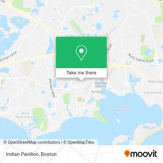
See Indian Pavilion, Barnstable Town, on the map
Public Transit to Indian Pavilion in Barnstable Town
Wondering how to get to Indian Pavilion in Barnstable Town? Moovit helps you find the best way to get to Indian Pavilion with step-by-step directions from the nearest public transit station.
Moovit provides free maps and live directions to help you navigate through your city. View schedules, routes, timetables, and find out how long does it take to get to Indian Pavilion in real time.
Looking for the nearest stop or station to Indian Pavilion? Check out this list of stops closest to your destination: Bismore Park; Career Opportunities; Transportation Center Hyannis; Hyannis Transportation Center; Hyannis Transportation Center (Htc); Hyannis.
Bus: HYANNIS CROSSTOWN, PETER PAN, SANDWICH LINE, HYANNIS AREA TROLLEY, HYANNIS - SOUTH SHORE TO LOGAN AIRPORT, BARNSTABLE VILLAGER, H2O HYANNIS-ORLEANS, PATRIOT LTD, SEALINE HYANNIS-FALMOUTH/WOODS HOLE.Train: CAPEFLYER.
Want to see if there’s another route that gets you there at an earlier time? Moovit helps you find alternative routes or times. Get directions from and directions to Indian Pavilion easily from the Moovit App or Website.
We make riding to Indian Pavilion easy, which is why over 1.7 million users, including users in Barnstable Town, trust Moovit as the best app for public transit. You don’t need to download an individual bus app or train app, Moovit is your all-in-one transit app that helps you find the best bus time or train time available.
For information on prices of bus and ferry, costs and ride fares to Indian Pavilion, please check the Moovit app.
Use the app to navigate to popular places including to the airport, hospital, stadium, grocery store, mall, coffee shop, school, college, and university.
Indian Pavilion Address: 511 Main St street in Barnstable Town
- The Monomoy White,
- Premier Image Barber Shop,
- Mini Market Convenience Stor,
- Black Pearl Tattoo Studio & Gallery,
- Barnstable Democrats,
- Vanilla & Chocolate,
- Black Whale Gallery,
- Rho Painting,
- Cape Cod Miniature Golf,
- Wings Beachwear,
- Harvard Realty Associates of Cape Cod,
- The Acoustical Society,
- Knight Home Helpers,
- Barnstable Police Department,
- Department of Children & Families,
- Colombo's Cafe & Pastries,
- Venture,
- Northwood Insurance Agency,
- Vertical Growth,
- Swift Financial Services, Inc.
Places Near Indian Pavilion (Barnstable Town)
- Castle Island, Boston,
- House Of Blues, Boston,
- Massachusetts General Hospital, Boston,
- Museum Of Science, Boston,
- Faneuil Hall, Boston,
- Boston Convention & Exhibition Center, Boston,
- Quincy Market, Boston,
- Cheers, Boston,
- Leader Bank Pavilion (Leader Bank Pavillion), Boston,
- Seaport District, Boston,
- Wang Theater, Boston,
- Prudential Center, Boston,
- Boston Medical Center, Boston,
- Mgm Music Hall, Boston,
- Isabella Stewart Gardner Museum, Boston,
- Wilbur Theatre, Boston,
- Td Garden, Boston,
- Boston Common, Boston,
- North End, Boston,
- Boston Children's Hospital, Boston
How to get to popular places in Boston with public transit
Get around Barnstable Town by public transit!
Traveling around Barnstable Town has never been so easy. See step by step directions as you travel to any attraction, street or major public transit station. View bus and train schedules, arrival times, service alerts and detailed routes on a map, so you know exactly how to get to anywhere in Barnstable Town.
When traveling to any destination around Barnstable Town use Moovit's Live Directions with Get Off Notifications to know exactly where and how far to walk, how long to wait for your line, and how many stops are left. Moovit will alert you when it's time to get off — no need to constantly re-check whether yours is the next stop.
Wondering how to use public transit in Barnstable Town or how to pay for public transit in Barnstable Town? Moovit public transit app can help you navigate your way with public transit easily, and at minimum cost. It includes public transit fees, ticket prices, and costs. Looking for a map of Barnstable Town public transit lines? Moovit public transit app shows all public transit maps in Barnstable Town with all Bus, Train, Subway and Ferry routes and stops on an interactive map.
Boston has 4 transit type(s), including: Bus, Train, Subway and Ferry, operated by several transit agencies, including MBTA, Southeastern Regional Transit Authority, MetroWest Regional Transit Authority, Rhode Island Public Transit Authority, WRTA, Lowell Regional Transit Authority, Merrimack Valley Transit, Montachusett Regional Transit Authority, Cape Cod Regional Transit Authority, Brockton Area Transit Authority, Martha's Vineyard Transit Authority, the WAVE - Nantucket Regional Transit Authority, GATRA, Cape Ann Transportation Authority and Massport