See Indiana State Library, Indianapolis City (Balance), on the map
Directions to Indiana State Library (Indianapolis City (Balance)) with public transportation
The following transit lines have routes that pass near Indiana State Library
 Bus:
Bus:
How to get to Indiana State Library by bus?
Click on the bus route to see step by step directions with maps, line arrival times and updated time schedules.
Bus stations near Indiana State Library in Indianapolis City (Balance)
- Statehouse Station Nb,3 min walk,
- Capitol Ave & Ohio St,3 min walk,
- Washington St & Illinois St,5 min walk,
- Vermont St & Capitol Ave,6 min walk,
Bus lines to Indiana State Library in Indianapolis City (Balance)
- 90,66th,
- 18,Transit Center,
- 28,Women's Hosp,
- 8,Out Of Service,
- 24,Ameriplex,
- 3,Michigan Street,
- 6,Harding,
- 10,10th Street,
- 15,West 34th St,
- 34,ML King/Michigan Rd,
- 37,Park 100,
What are the closest stations to Indiana State Library?
The closest stations to Indiana State Library are:
- Statehouse Station Nb is 154 yards away, 3 min walk.
- Capitol Ave & Ohio St is 163 yards away, 3 min walk.
- Washington St & Illinois St is 338 yards away, 5 min walk.
- Vermont St & Capitol Ave is 466 yards away, 6 min walk.
Which bus lines stop near Indiana State Library?
These bus lines stop near Indiana State Library: 10, 37, 39, 8, 90.
What’s the nearest bus stop to Indiana State Library in Indianapolis City (Balance)?
The nearest bus stops to Indiana State Library in Indianapolis City (Balance) are Statehouse Station Nb and Capitol Ave & Ohio St. The closest one is a 3 min walk away.
What time is the first bus to Indiana State Library in Indianapolis City (Balance)?
The 37 is the first bus that goes to Indiana State Library in Indianapolis City (Balance). It stops nearby at 4:50 AM.
What time is the last bus to Indiana State Library in Indianapolis City (Balance)?
The 90 is the last bus that goes to Indiana State Library in Indianapolis City (Balance). It stops nearby at 12:57 AM.
See Indiana State Library, Indianapolis City (Balance), on the map
Public Transit to Indiana State Library in Indianapolis City (Balance)
Wondering how to get to Indiana State Library in Indianapolis City (Balance), United States? Moovit helps you find the best way to get to Indiana State Library with step-by-step directions from the nearest public transit station.
Moovit provides free maps and live directions to help you navigate through your city. View schedules, routes, timetables, and find out how long does it take to get to Indiana State Library in real time.
Looking for the nearest stop or station to Indiana State Library? Check out this list of stops closest to your destination: Statehouse Station Nb; Capitol Ave & Ohio St; Washington St & Illinois St; Vermont St & Capitol Ave.
Bus:
Want to see if there’s another route that gets you there at an earlier time? Moovit helps you find alternative routes or times. Get directions from and directions to Indiana State Library easily from the Moovit App or Website.
We make riding to Indiana State Library easy, which is why over 1.5 million users, including users in Indianapolis City (Balance), trust Moovit as the best app for public transit. You don’t need to download an individual bus app or train app, Moovit is your all-in-one transit app that helps you find the best bus time or train time available.
For information on prices of bus, costs and ride fares to Indiana State Library, please check the Moovit app.
Use the app to navigate to popular places including to the airport, hospital, stadium, grocery store, mall, coffee shop, school, college, and university.
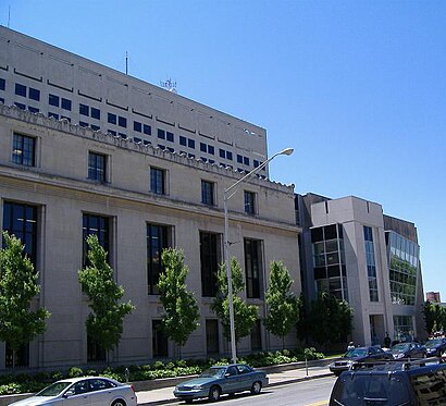
Indiana State Library Address: West Ohio Street street in Indianapolis City (Balance)
Attractions near Indiana State Library
Office of the Director/Admin,Bicentennial Plaza,Driver Services Division,Environmental Programs,Indiana Statehouse,Indiana Arts Commission,Indiana Commission for Women,State of Indiana All State Offices Not Listed Below,Driver Services Division (Traffic Safety Division),Local Government Finance Dept,Multi Modal Transportation,Indiana Commission on the Social Status of Black Males,Bike Safe Indiana,Day Early Learning,Test Centers,Titles,Motor Vehicles Bureau,IGCN Senate Avenue Garage,Indiana Government Center North,Integrated Public Safety Commission - Indiana (Traffic Safety)How to get to popular attractions in Indianapolis City (Balance) with public transit
IndyGo Route #31 Greenwood to Indianapolis, Indianapolis City (Balance),Tienda Guatemalteca, Indianapolis City (Balance),Central Library, Indianapolis City (Balance),All american threaded products, Indianapolis City (Balance),Tienda Esoterica - Ta' Jose, Indianapolis,Rural Street And Brookside Parkway, Indianapolis City (Balance),Indianapolis Crash Pad, Indianapolis City (Balance),Holt Rd & 10th St, Indianapolis City (Balance),Ross Dress for Less, Indianapolis City (Balance),St. Vincent Indianapolis Hospital, Indianapolis City (Balance),Eskenazi Health, Indianapolis City (Balance),City Of Avon, Indianapolis City (Balance),56th Street and Harrison Park Drive, Lawrence,Indiana Bmv - Madison Ave License Branch, Indianapolis,3850 Shore Dr, Indianapolis City (Balance),Eli Lilly Corporate Center 31 / 5 Queen Mary, Indianapolis City (Balance),Mother Nature's Mercantile, Indianapolis City (Balance),71st Street and Michigan Road, Indianapolis City (Balance),Dr. Ferguson, Chiropractor, Indianapolis City (Balance),IndyGo Bus Stop Madison And Stop 11, Indianapolis City (Balance)Get around Indianapolis City (Balance) by public transit!
Traveling around Indianapolis City (Balance) has never been so easy. See step by step directions as you travel to any attraction, street or major public transit station. View bus and train schedules, arrival times, service alerts and detailed routes on a map, so you know exactly how to get to anywhere in Indianapolis City (Balance).
When traveling to any destination around Indianapolis City (Balance) use Moovit's Live Directions with Get Off Notifications to know exactly where and how far to walk, how long to wait for your line, and how many stops are left. Moovit will alert you when it's time to get off — no need to constantly re-check whether yours is the next stop.
Wondering how to use public transit in Indianapolis City (Balance) or how to pay for public transit in Indianapolis City (Balance)? Moovit public transit app can help you navigate your way with public transit easily, and at minimum cost. It includes public transit fees, ticket prices, and costs. Looking for a map of Indianapolis City (Balance) public transit lines? Moovit public transit app shows all public transit maps in Indianapolis City (Balance) with all bus routes and stops on an interactive map.
Indianapolis City (Balance) has 1 transit type(s), including: bus, operated by several transit agencies, including IndyGo, FlixBus-us and Greyhound-us