Directions to Indianapolis Union Station (Indianapolis City (Balance)) with public transportation
The following transit lines have routes that pass near Indianapolis Union Station
How to get to Indianapolis Union Station by bus?
Click on the bus route to see step by step directions with maps, line arrival times and updated time schedules.
Bus stations near Indianapolis Union Station in Indianapolis City (Balance)
- Statehouse Station Sb, 2 min walk,
- Washington St & Senate Ave, 2 min walk,
- Pennsylvania St & Merrill St, 5 min walk,
- Indianapolis Bus Station, 6 min walk,
- Ctc-T, 9 min walk,
- Ctc-S, 10 min walk,
Bus lines to Indianapolis Union Station in Indianapolis City (Balance)
- 90, 66th,
- 8, Out Of Service,
- 24, Ameriplex,
- 16, Beech Grove,
- 31, US 31,
- GREYHOUND US0100, Atlanta - Chicago,
- GREYHOUND US0101, Atlanta - Chicago - Minneapolis,
- GREYHOUND US0120, Chicago - Cincinnati,
- GREYHOUND US0120S, Chicago - Indianapolis,
- GREYHOUND US0421, New York - Pittsburgh - St. Louis,
- 2, 33rd & Post - Crossroads,
- 4, Transit Center,
- 5, East 25th St,
- 6, Harding,
- 25, West 16th St,
What are the closest stations to Indianapolis Union Station?
The closest stations to Indianapolis Union Station are:
- Statehouse Station Sb is 109 yards away, 2 min walk.
- Washington St & Senate Ave is 136 yards away, 2 min walk.
- Pennsylvania St & Merrill St is 374 yards away, 5 min walk.
- Indianapolis Bus Station is 431 yards away, 6 min walk.
- Ctc-T is 750 yards away, 9 min walk.
- Ctc-S is 776 yards away, 10 min walk.
Which bus lines stop near Indianapolis Union Station?
These bus lines stop near Indianapolis Union Station: 10, 16, 2, 37, 56, 90.
What’s the nearest bus stop to Indianapolis Union Station in Indianapolis City (Balance)?
The nearest bus stops to Indianapolis Union Station in Indianapolis City (Balance) are Statehouse Station Sb and Washington St & Senate Ave. The closest one is a 2 min walk away.
What time is the first bus to Indianapolis Union Station in Indianapolis City (Balance)?
The GREYHOUND US0421 is the first bus that goes to Indianapolis Union Station in Indianapolis City (Balance). It stops nearby at 3:35 AM.
What time is the last bus to Indianapolis Union Station in Indianapolis City (Balance)?
The GREYHOUND US0421 is the last bus that goes to Indianapolis Union Station in Indianapolis City (Balance). It stops nearby at 11:15 AM.
See Indianapolis Union Station, Indianapolis City (Balance), on the map
Public Transit to Indianapolis Union Station in Indianapolis City (Balance)
Wondering how to get to Indianapolis Union Station in Indianapolis City (Balance), United States? Moovit helps you find the best way to get to Indianapolis Union Station with step-by-step directions from the nearest public transit station.
Moovit provides free maps and live directions to help you navigate through your city. View schedules, routes, timetables, and find out how long does it take to get to Indianapolis Union Station in real time.
Looking for the nearest stop or station to Indianapolis Union Station? Check out this list of stops closest to your destination: Statehouse Station Sb; Washington St & Senate Ave; Pennsylvania St & Merrill St; Indianapolis Bus Station; Ctc-T; Ctc-S.
Bus: 10, 16, 2, 37, 56, 90, 8, 24, 31, GREYHOUND US0100, GREYHOUND US0101, GREYHOUND US0120, GREYHOUND US0120S, GREYHOUND US0421, 4, 5, 6, 25.
Want to see if there’s another route that gets you there at an earlier time? Moovit helps you find alternative routes or times. Get directions from and directions to Indianapolis Union Station easily from the Moovit App or Website.
We make riding to Indianapolis Union Station easy, which is why over 1.5 million users, including users in Indianapolis City (Balance), trust Moovit as the best app for public transit. You don’t need to download an individual bus app or train app, Moovit is your all-in-one transit app that helps you find the best bus time or train time available.
For information on prices of bus, costs and ride fares to Indianapolis Union Station, please check the Moovit app.
Use the app to navigate to popular places including to the airport, hospital, stadium, grocery store, mall, coffee shop, school, college, and university.
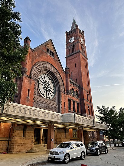
Indianapolis Union Station Address: South Illinois Street street in Indianapolis City (Balance)
Attractions near Indianapolis Union Station
Personal Injury Lawyer Indianapolis,Indianapolis Bus Station (Greyhound-Indianapolis),Casino Party Planners Indiana,350 South Illinois Street,Atterbury Job Corp Center,Indianapolis Amtrak Station,The Pourhouse,Same Day Auto Glass Repair,CROWNE PLAZA HOTEL,Perfect Wedding Guide,McFadden Group,Second Reign,350 S Illinois St,Indianapolis Police Department,Crowne Plaza Indianapolis-Dwtn-Union Stn,Siding Repair Pros Indiana,Hashtag Tequilas,W&J Financial Group,Brothers Bar & Grill (Brothers Downtown Indy),Omni Severin HotelHow to get to popular attractions in Indianapolis City (Balance) with public transit
Perry Meridian High School, Indianapolis City (Balance),21st & Arlington Ave., Indianapolis City (Balance),Bud Light Party Zone, Indianapolis City (Balance),Marian University, Indianapolis City (Balance),S Emerson Ave / E Washington St, Indianapolis City (Balance),Lawrence North High School, Indianapolis City (Balance),Peyton Manning Children's Hospital at St.Vincent, Indianapolis City (Balance),Marion County Health Department, Indianapolis City (Balance),Warren Central High School, Door 36, Indianapolis City (Balance),46th Street and Arlington Ave., Indianapolis City (Balance),Downtown Indianapolis, Indianapolis City (Balance),Casino Party Experts, Indiana, Indianapolis City (Balance),Target (Target Store Nora-Plaza), Indianapolis City (Balance),Shoe Shine @ Gate B5, Indianapolis City (Balance),W Morris St / S Girls School Rd, Indianapolis City (Balance),E Southport Rd / S Emerson Ave, Indianapolis City (Balance),Los Dos Hermanos, Indianapolis City (Balance),IU Health Indiana University Hospital (IU Hospital) Parking Garage, Indianapolis City (Balance),Meridian Street & 34th Street, Indianapolis City (Balance),Ben Davis High School, Indianapolis City (Balance)Get around Indianapolis by public transit!
Traveling around Indianapolis has never been so easy. See step by step directions as you travel to any attraction, street or major public transit station. View bus and train schedules, arrival times, service alerts and detailed routes on a map, so you know exactly how to get to anywhere in Indianapolis.
When traveling to any destination around Indianapolis use Moovit's Live Directions with Get Off Notifications to know exactly where and how far to walk, how long to wait for your line, and how many stops are left. Moovit will alert you when it's time to get off — no need to constantly re-check whether yours is the next stop.
Wondering how to use public transit in Indianapolis or how to pay for public transit in Indianapolis? Moovit public transit app can help you navigate your way with public transit easily, and at minimum cost. It includes public transit fees, ticket prices, and costs. Looking for a map of Indianapolis public transit lines? Moovit public transit app shows all public transit maps in Indianapolis with all bus routes and stops on an interactive map.
Indianapolis has 1 transit type(s), including: bus, operated by several transit agencies, including IndyGo, FlixBus-us, Greyhound-us