Directions to Infor Commons (St. Paul) with public transportation
The following transit lines have routes that pass near Infor Commons
 Bus: 54, 62, 63, 74, METRO GOLD LINE.
- Train: BOREALIS, EMPIRE BUILDER.
- Light Rail: METRO GREEN LINE.
How to get to Infor Commons by bus?
Click on the bus route to see step by step directions with maps, line arrival times and updated time schedules.
From Menards, St. Paul
41 minFrom Comprehensive Health and Wellness, Roseville
36 minFrom 46 street parking lot, Minneapolis
35 minFrom Rhi, Minneapolis
43 minFrom Holiday Stationstores, Minneapolis
35 minFrom West 7th Street!, St. Paul
16 minFrom Snelling Ave and County Rd C, Roseville
58 minFrom Sun Ray Shopping Center, St. Paul
24 minFrom Costco, Eagan
88 minFrom 3M Center - Building 222 Mall, Maplewood
30 min
Bus stops near Infor Commons in St. Paul
Light Rail stations near Infor Commons in St. Paul
- 10th Street, 12 min walk,VIEW
Train station near Infor Commons in St. Paul
- St. Paul-Minneapolis, 53 min walk,VIEW
Bus lines to Infor Commons in St. Paul
- 480, Apple Valley/Burnsville-St Paul,VIEW
- 489, St Paul-Eagan Rev Comm,VIEW
- 275, Express / Co Rd E P&R / Co Rd 14 P&R,VIEW
- 294, Express / St Crx P&R / Stillwater,VIEW
- 363, Express / St Paul / Minneapolis,VIEW
- 860, Express / Northtown / Dtwn St Paul,VIEW
- METRO B LINE, Selby-Lake / Downtown St Paul,VIEW
- METRO GOLD LINE, Gold Woodbury,VIEW
- 54, Ltd Stop / Mplwd Mall / Via Airport,VIEW
- 61, Henn-Larp / Dwtn Mpls / Via Arcade,VIEW
- 63, Grand-E 3st / Westgate Sta,VIEW
- 64, Payne Av / Hillcrest / Wh Bear Av,VIEW
- 72, Selby-Burns / University & Hamline,VIEW
- 74, E 7th St / Sunray,VIEW
- 94, Express / I-94 / Downtown St Paul,VIEW
- 484, Saint Paul,VIEW
- 3, St Paul / Union Depot / Via Maryland,VIEW
- 62, Smith Av / Signal Hills / Thompson,VIEW
- 67, Minnehaha / Downtown St Paul,VIEW
- 75, Stryker Av / Salem Green / Lake Cove,VIEW
What are the closest stations to Infor Commons?
The closest stations to Infor Commons are:
- 5 St at Washington S Corner (Drop Off by is 73 yards away, 2 min walk.
- 6th St & Wabasha St is 162 yards away, 2 min walk.
- Rice Park Station is 186 yards away, 3 min walk.
- 5 St at Wabasha St/Cedar St S Corner is 224 yards away, 3 min walk.
- Cedar St & 5th St is 316 yards away, 4 min walk.
- 10th Street is 954 yards away, 12 min walk.
- St. Paul-Minneapolis is 4494 yards away, 53 min walk.
Which bus lines stop near Infor Commons?
These bus lines stop near Infor Commons: 54, 62, 63, 74, METRO GOLD LINE.
Which light rail line stops near Infor Commons?
METRO GREEN LINE (St. Paul-Union Depot)
What’s the nearest light rail station to Infor Commons in St. Paul?
The nearest light rail station to Infor Commons in St. Paul is 10th Street. It’s a 12 min walk away.
What’s the nearest bus station to Infor Commons in St. Paul?
The nearest bus stations to Infor Commons in St. Paul are 5 St at Washington S Corner (Drop Off by and 6th St & Wabasha St. The closest one is a 2 min walk away.
What time is the first light rail to Infor Commons in St. Paul?
The METRO GREEN LINE is the first light rail that goes to Infor Commons in St. Paul. It stops nearby at 4:26 AM.
What time is the last light rail to Infor Commons in St. Paul?
The METRO GREEN LINE is the last light rail that goes to Infor Commons in St. Paul. It stops nearby at 12:10 AM.
What time is the first train to Infor Commons in St. Paul?
The BOREALIS is the first train that goes to Infor Commons in St. Paul. It stops nearby at 11:39 AM.
What time is the last train to Infor Commons in St. Paul?
The EMPIRE BUILDER is the last train that goes to Infor Commons in St. Paul. It stops nearby at 8:50 AM.
What time is the first bus to Infor Commons in St. Paul?
The 54 is the first bus that goes to Infor Commons in St. Paul. It stops nearby at 3:05 AM.
What time is the last bus to Infor Commons in St. Paul?
The 3 is the last bus that goes to Infor Commons in St. Paul. It stops nearby at 2:15 AM.
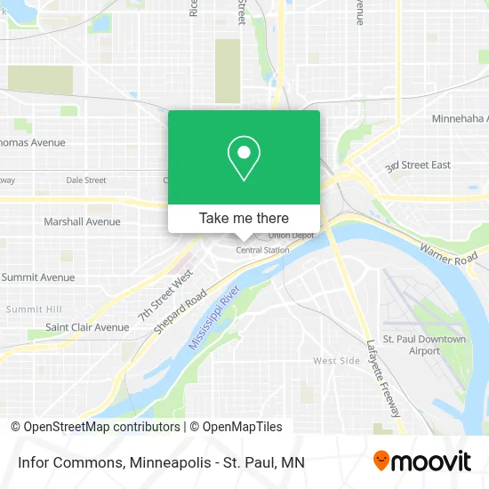
See Infor Commons, St. Paul, on the map
Public Transit to Infor Commons in St. Paul
Wondering how to get to Infor Commons in St. Paul? Moovit helps you find the best way to get to Infor Commons with step-by-step directions from the nearest public transit station.
Moovit provides free maps and live directions to help you navigate through your city. View schedules, routes, timetables, and find out how long does it take to get to Infor Commons in real time.
Looking for the nearest stop or station to Infor Commons? Check out this list of stops closest to your destination: 5 St at Washington S Corner (Drop Off by; 6th St & Wabasha St; Rice Park Station; 5 St at Wabasha St/Cedar St S Corner; Cedar St & 5th St; 10th Street; St. Paul-Minneapolis.
Bus: 54, 62, 63, 74, METRO GOLD LINE, 480, 489, 275, 294, 363, 860, METRO B LINE, 61, 484, 3, 67, 75.Train: BOREALIS, EMPIRE BUILDER.Light Rail: METRO GREEN LINE.
Want to see if there’s another route that gets you there at an earlier time? Moovit helps you find alternative routes or times. Get directions from and directions to Infor Commons easily from the Moovit App or Website.
We make riding to Infor Commons easy, which is why over 1.7 million users, including users in St. Paul, trust Moovit as the best app for public transit. You don’t need to download an individual bus app or train app, Moovit is your all-in-one transit app that helps you find the best bus time or train time available.
For information on prices of bus and light rail, costs and ride fares to Infor Commons, please check the Moovit app.
Use the app to navigate to popular places including to the airport, hospital, stadium, grocery store, mall, coffee shop, school, college, and university.
Infor Commons Address: 380 St Peter St street in St. Paul
- Karen Myers - Morgan Stanley,
- James Schmidt - Morgan Stanley,
- Our Partners Board of Directors,
- CSL Group - Morgan Stanley,
- Johnathan Evans - Morgan Stanley,
- Retail Rally,
- Thomas Gillund - Morgan Stanley,
- Macvb Toolkit,
- Minnesota Chamber of Commerce,
- Elvis Rivera - Morgan Stanley,
- Hallberg Law, P.A.,
- Healthvision Solutions,
- Laura Peterson Feintech - Morgan Stanley,
- Duluth Metals,
- Infor,
- Nice Ride - Landmark Plaza,
- Downtown Saint Paul,
- Leighton Robert J Attorney,
- Momento,
- Lawson Software
Places Near Infor Commons (St. Paul)
- St. Paul College, St. Paul,
- Northrop Auditorium, Minneapolis,
- Harriet Island Regional Park, St. Paul,
- Huntington Bank Stadium, Minneapolis,
- Bishop Henry Whipple Federal Building,
- Minnehaha Falls, Minneapolis,
- Mpls. Convention Center, Minneapolis,
- Abbott Northwestern Piper Building, Minneapolis,
- Target Field, Minneapolis,
- Minneapolis Institute of Art, Minneapolis,
- Target Center, Minneapolis,
- Mystic lake casino bus, Minneapolis,
- Grand Casino Hinckley,MN, Minneapolis,
- Orpheum Theatre (Minneapolis, Minnesota), Minneapolis,
- Minnesota State Capitol, St. Paul,
- 3m Arena at Mariucci, Minneapolis,
- Minneapolis Sculpture Garden, Minneapolis,
- Treasure Island Resort & Casino, St. Paul,
- Xcel Energy Center, St. Paul,
- Surly Brewing Co., Minneapolis
How to get to popular places in Minneapolis - St. Paul, MN with public transit
Get around St. Paul by public transit!
Traveling around St. Paul has never been so easy. See step by step directions as you travel to any attraction, street or major public transit station. View bus and train schedules, arrival times, service alerts and detailed routes on a map, so you know exactly how to get to anywhere in St. Paul.
When traveling to any destination around St. Paul use Moovit's Live Directions with Get Off Notifications to know exactly where and how far to walk, how long to wait for your line, and how many stops are left. Moovit will alert you when it's time to get off — no need to constantly re-check whether yours is the next stop.
Wondering how to use public transit in St. Paul or how to pay for public transit in St. Paul? Moovit public transit app can help you navigate your way with public transit easily, and at minimum cost. It includes public transit fees, ticket prices, and costs. Looking for a map of St. Paul public transit lines? Moovit public transit app shows all public transit maps in St. Paul with all Bus, Train and Light Rail routes and stops on an interactive map.
Minneapolis - St. Paul, MN has 3 transit type(s), including: Bus, Train and Light Rail, operated by several transit agencies, including Metro Transit , Metro Transit, MVTA, Plymouth Metrolink, SouthWest Transit, Maple Grove, University of Minnesota, Airport (MAC), Amtrak, Mankato Transit System, SMART, FlixBus-us and Greyhound-us