Directions to Information Architected, Inc. (Boston) with public transportation
The following transit lines have routes that pass near Information Architected, Inc.
 Bus: 354, 501, 504, 92, SL4.
- Train: FITCHBURG, FRAMINGHAM/WORCESTER, LOWELL, NEEDHAM.
- Subway: BLUE LINE, GREEN LINE B, GREEN LINE D, ORANGE LINE, RED LINE.
- Ferry: CHARLESTOWN FERRY.
How to get to Information Architected, Inc. by bus?
Click on the bus route to see step by step directions with maps, line arrival times and updated time schedules.
From FOUR POINTS BY SHERATON Boston Newton, Newton
36 minFrom Qea, Quincy
105 minFrom St. Elizabeth's Medical Center, Boston
54 minFrom Porter Square, Cambridge
50 minFrom Spaulding Rehabilitation Center, Boston
68 minFrom The Mall At Chestnut Hill, Newton
79 minFrom Regent Theatre, Arlington
66 minFrom Arlington, MA, Arlington
77 minFrom Conte Forum, Boston
71 minFrom Jamaica Plain, Boston
65 min
How to get to Information Architected, Inc. by train?
Click on the train route to see step by step directions with maps, line arrival times and updated time schedules.
How to get to Information Architected, Inc. by subway?
Click on the subway route to see step by step directions with maps, line arrival times and updated time schedules.
Bus stops near Information Architected, Inc. in Boston
- Pearl St @ High St, 2 min walk,VIEW
- Devonshire St @ Water St, 2 min walk,VIEW
- Federal St @ Matthews St, 3 min walk,VIEW
- State - Devonshire St @ State St, 3 min walk,VIEW
- Federal St @ Franklin St, 3 min walk,VIEW
- Pearl St @ Congress St, 3 min walk,VIEW
- State St @ Washington Mall - State St Sta, 3 min walk,VIEW
- State, 4 min walk,VIEW
Subway stations near Information Architected, Inc. in Boston
Ferry station near Information Architected, Inc. in Boston
- Long Wharf (South), 12 min walk,VIEW
Bus lines to Information Architected, Inc. in Boston
- 4, North Station,VIEW
- 92, Sullivan,VIEW
- 93, Sullivan Via Navy Yard,VIEW
- 7, City Point Via East First St,VIEW
- RED LINE SHUTTLE, Jfk/Umass (Shuttle),VIEW
- 501, Downtown via Copley (Express) - Brighton via Copley (Express),VIEW
- 504, Downtown via Copley (Express) - Watertown via Copley and Newton Corner (Express),VIEW
- 505, Downtown (Express) - Waltham (Express),VIEW
- RED LINE SHUTTLE, Harvard - JFK/UMass via Congress Street,VIEW
- RED LINE SHUTTLE, Kendall/MIT - JFK/UMass,VIEW
- RED LINE SHUTTLE, Harvard - Broadway,VIEW
- RED LINE SHUTTLE, Kendall/MIT - Broadway via Downtown Crossing,VIEW
- RED LINE SHUTTLE, JFK/UMass - Kendall/MIT (Shuttle),VIEW
- 15, Haymarket Via Fields Corner & Nubian,VIEW
- 39, Haymarket Via Forest Hills,VIEW
- 57, Haymarket Via Kenmore,VIEW
- 116, Maverick - Wonderland,VIEW
- 354, Boston (Express) via Woburn - Burlington (Express) via Woburn,VIEW
- BLUE LINE SHUTTLE, Airport - Government Center (Express),VIEW
- BLUE LINE SHUTTLE, Airport - Government Center via Maverick,VIEW
What are the closest stations to Information Architected, Inc.?
The closest stations to Information Architected, Inc. are:
- Pearl St @ High St is 118 yards away, 2 min walk.
- Devonshire St @ Water St is 130 yards away, 2 min walk.
- Federal St @ Matthews St is 187 yards away, 3 min walk.
- State - Devonshire St @ State St is 213 yards away, 3 min walk.
- Federal St @ Franklin St is 218 yards away, 3 min walk.
- Pearl St @ Congress St is 222 yards away, 3 min walk.
- State St @ Washington Mall - State St Sta is 222 yards away, 3 min walk.
- State is 318 yards away, 4 min walk.
- Government Center is 401 yards away, 5 min walk.
- State Street is 470 yards away, 6 min walk.
- Downtown Crossing is 512 yards away, 7 min walk.
- Long Wharf (South) is 942 yards away, 12 min walk.
Which bus lines stop near Information Architected, Inc.?
These bus lines stop near Information Architected, Inc.: 354, 501, 504, 92, SL4.
Which train lines stop near Information Architected, Inc.?
These train lines stop near Information Architected, Inc.: FITCHBURG, FRAMINGHAM/WORCESTER, LOWELL, NEEDHAM.
Which subway lines stop near Information Architected, Inc.?
These subway lines stop near Information Architected, Inc.: BLUE LINE, GREEN LINE B, GREEN LINE D, ORANGE LINE, RED LINE.
What’s the nearest subway station to Information Architected, Inc. in Boston?
The nearest subway station to Information Architected, Inc. in Boston is Government Center. It’s a 5 min walk away.
What’s the nearest bus station to Information Architected, Inc. in Boston?
The nearest bus stations to Information Architected, Inc. in Boston are Pearl St @ High St and Devonshire St @ Water St. The closest one is a 2 min walk away.
What’s the nearest ferry station to Information Architected, Inc. in Boston?
The nearest ferry station to Information Architected, Inc. in Boston is Long Wharf (South). It’s a 12 min walk away.
What time is the first subway to Information Architected, Inc. in Boston?
The GREEN LINE E is the first subway that goes to Information Architected, Inc. in Boston. It stops nearby at 5:05 AM.
What time is the last subway to Information Architected, Inc. in Boston?
The GREEN LINE E is the last subway that goes to Information Architected, Inc. in Boston. It stops nearby at 2:20 AM.
What time is the first bus to Information Architected, Inc. in Boston?
The 57 is the first bus that goes to Information Architected, Inc. in Boston. It stops nearby at 5:02 AM.
What time is the last bus to Information Architected, Inc. in Boston?
The 116 is the last bus that goes to Information Architected, Inc. in Boston. It stops nearby at 1:58 AM.
What time is the first ferry to Information Architected, Inc. in Boston?
The CHARLESTOWN FERRY is the first ferry that goes to Information Architected, Inc. in Boston. It stops nearby at 6:30 AM.
What time is the last ferry to Information Architected, Inc. in Boston?
The CHARLESTOWN FERRY is the last ferry that goes to Information Architected, Inc. in Boston. It stops nearby at 8:25 PM.
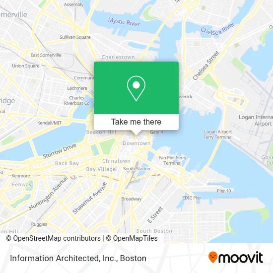
See Information Architected, Inc., Boston, on the map
Public Transit to Information Architected, Inc. in Boston
Wondering how to get to Information Architected, Inc. in Boston? Moovit helps you find the best way to get to Information Architected, Inc. with step-by-step directions from the nearest public transit station.
Moovit provides free maps and live directions to help you navigate through your city. View schedules, routes, timetables, and find out how long does it take to get to Information Architected, Inc. in real time.
Looking for the nearest stop or station to Information Architected, Inc.? Check out this list of stops closest to your destination: Pearl St @ High St; Devonshire St @ Water St; Federal St @ Matthews St; State - Devonshire St @ State St; Federal St @ Franklin St; Pearl St @ Congress St; State St @ Washington Mall - State St Sta; State; Government Center; State Street; Downtown Crossing; Long Wharf (South).
Bus: 354, 501, 504, 92, SL4, 4, 93.Train: FITCHBURG, FRAMINGHAM/WORCESTER, LOWELL, NEEDHAM.Subway: BLUE LINE, GREEN LINE B, GREEN LINE D, ORANGE LINE, RED LINE, GREEN LINE C, GREEN LINE E.Ferry: CHARLESTOWN FERRY.
Want to see if there’s another route that gets you there at an earlier time? Moovit helps you find alternative routes or times. Get directions from and directions to Information Architected, Inc. easily from the Moovit App or Website.
We make riding to Information Architected, Inc. easy, which is why over 1.7 million users, including users in Boston, trust Moovit as the best app for public transit. You don’t need to download an individual bus app or train app, Moovit is your all-in-one transit app that helps you find the best bus time or train time available.
For information on prices of bus, subway and train, costs and ride fares to Information Architected, Inc., please check the Moovit app.
Use the app to navigate to popular places including to the airport, hospital, stadium, grocery store, mall, coffee shop, school, college, and university.
Information Architected, Inc. Address: 10 Post Office Sq Fl 8 street in Boston
- Financial District,
- Garage at Post Office Square (Post Office Square Park),
- Edward Harris, CFP - Ubs Financial Services (Harris Wealth Management - Ubs Financial Services),
- Webster First Federal Credit Union,
- One Liberty Square,
- Dunkin',
- WESTERN UNION,
- Langham garage,
- Oliver Street Capital,
- One Post Office Square,
- Harvard Vanguard Medical Associates, Post Office Square,
- Church of Technological Freedom (BOS),
- Brown Brothers Harriman & Co,
- Atrius Health (Womens Health),
- Credit Union 1,
- The Mortgage Depot,
- The Langham Boston,
- 33 Broad St,
- Le Meridien,
- Broad St & Water St
Places Near Information Architected, Inc. (Boston)
- Boston Convention & Exhibition Center, Boston,
- Prudential Center, Boston,
- Wilbur Theatre, Boston,
- Cheers, Boston,
- Seaport District, Boston,
- Td Garden, Boston,
- North End, Boston,
- Mgm Music Hall, Boston,
- Boston Common, Boston,
- Boston Medical Center, Boston,
- Boston Children's Hospital, Boston,
- Isabella Stewart Gardner Museum, Boston,
- Quincy Market, Boston,
- Wang Theater, Boston,
- House Of Blues, Boston,
- Museum Of Science, Boston,
- Castle Island, Boston,
- Leader Bank Pavilion (Leader Bank Pavillion), Boston,
- Faneuil Hall, Boston,
- Massachusetts General Hospital, Boston
How to get to popular places in Boston with public transit
Get around Boston by public transit!
Traveling around Boston has never been so easy. See step by step directions as you travel to any attraction, street or major public transit station. View bus and train schedules, arrival times, service alerts and detailed routes on a map, so you know exactly how to get to anywhere in Boston.
When traveling to any destination around Boston use Moovit's Live Directions with Get Off Notifications to know exactly where and how far to walk, how long to wait for your line, and how many stops are left. Moovit will alert you when it's time to get off — no need to constantly re-check whether yours is the next stop.
Wondering how to use public transit in Boston or how to pay for public transit in Boston? Moovit public transit app can help you navigate your way with public transit easily, and at minimum cost. It includes public transit fees, ticket prices, and costs. Looking for a map of Boston public transit lines? Moovit public transit app shows all public transit maps in Boston with all Bus, Train, Subway and Ferry routes and stops on an interactive map.
Boston has 4 transit type(s), including: Bus, Train, Subway and Ferry, operated by several transit agencies, including MBTA, Southeastern Regional Transit Authority, MetroWest Regional Transit Authority, Rhode Island Public Transit Authority, WRTA, Lowell Regional Transit Authority, Merrimack Valley Transit, Montachusett Regional Transit Authority, Cape Cod Regional Transit Authority, Brockton Area Transit Authority, Martha's Vineyard Transit Authority, the WAVE - Nantucket Regional Transit Authority, GATRA, Cape Ann Transportation Authority and Massport