Directions to Infrared5 Inc. (Boston) with public transportation
The following transit lines have routes that pass near Infrared5 Inc.
 Bus: 39, 35, 38, 41, ORANGE LINE SHUTTLE.
- Train: NEEDHAM, FRANKLIN/FOXBORO, PROVIDENCE/STOUGHTON.
- Subway: ORANGE LINE, GREEN LINE E.
How to get to Infrared5 Inc. by bus?
Click on the bus route to see step by step directions with maps, line arrival times and updated time schedules.
From Galleria Mall, Cambridge
65 minFrom Registry of Motor Vehicles Haymarket (Boston), Boston
51 minFrom The W Hotel Boston, Boston
34 minFrom AC Hotel Boston Cambridge, Cambridge
105 minFrom Macy's, Boston
42 minFrom Apple Cinemas, Cambridge
83 minFrom Massport Security Badge Office, Boston
39 minFrom Boston Logan International Airport (Bos), Boston
40 minFrom Rino's Place, Boston
62 minFrom Terminal E- Logan International Airport, Boston
39 min
How to get to Infrared5 Inc. by train?
Click on the train route to see step by step directions with maps, line arrival times and updated time schedules.
How to get to Infrared5 Inc. by subway?
Click on the subway route to see step by step directions with maps, line arrival times and updated time schedules.
From Rino's Place, Boston
45 minFrom Terminal E- Logan International Airport, Boston
43 minFrom Galleria Mall, Cambridge
45 minFrom Registry of Motor Vehicles Haymarket (Boston), Boston
31 minFrom The W Hotel Boston, Boston
29 minFrom AC Hotel Boston Cambridge, Cambridge
63 minFrom Macy's, Boston
27 minFrom Apple Cinemas, Cambridge
58 minFrom Boston Logan International Airport (Bos), Boston
60 minFrom Massport Security Badge Office, Boston
43 min
Bus stops near Infrared5 Inc. in Boston
Subway stations near Infrared5 Inc. in Boston
Train station near Infrared5 Inc. in Boston
- Forest Hills, 36 min walk,VIEW
Bus lines to Infrared5 Inc. in Boston
- 35, Dedham Mall,VIEW
- 38, Forest Hills,VIEW
- 39, Wolcott Square Via Forest Hills,VIEW
- 41, Jfk/Umass,VIEW
- ORANGE LINE SHUTTLE, Forest Hills - Jackson Square,VIEW
- ORANGE LINE SHUTTLE, Forest Hills - Back Bay (Shuttle),VIEW
- ORANGE LINE SHUTTLE, Forest Hills - Jackson Square (Shuttle),VIEW
- ORANGE LINE SHUTTLE, Forest Hills - Back Bay via Ruggles Busway (Shuttle),VIEW
- ORANGE LINE SHUTTLE, Forest Hills - Ruggles,VIEW
- ORANGE LINE SHUTTLE, Forest Hills - Copley,VIEW
- ORANGE LINE SHUTTLE, Forest Hills - Back Bay via Copley (Shuttle),VIEW
What are the closest stations to Infrared5 Inc.?
The closest stations to Infrared5 Inc. are:
- Centre St @ Ballard St is 75 yards away, 1 min walk.
- Centre St @ Eliot St is 165 yards away, 2 min walk.
- Green Street - Amory St @ Green St is 732 yards away, 9 min walk.
- Green Street is 778 yards away, 10 min walk.
- Heath Street is 1428 yards away, 18 min walk.
- Forest Hills is 3065 yards away, 36 min walk.
Which bus line stops near Infrared5 Inc.?
39 (Back Bay)
Which train line stops near Infrared5 Inc.?
NEEDHAM (#625 | Needham Heights)
Which subway line stops near Infrared5 Inc.?
ORANGE LINE (Forest Hills)
What’s the nearest subway station to Infrared5 Inc. in Boston?
The nearest subway station to Infrared5 Inc. in Boston is Green Street. It’s a 10 min walk away.
What’s the nearest bus station to Infrared5 Inc. in Boston?
The nearest bus station to Infrared5 Inc. in Boston is Centre St @ Ballard St. It’s a 1 min walk away.
What time is the first subway to Infrared5 Inc. in Boston?
The ORANGE LINE is the first subway that goes to Infrared5 Inc. in Boston. It stops nearby at 5:15 AM.
What time is the last subway to Infrared5 Inc. in Boston?
The GREEN LINE E is the last subway that goes to Infrared5 Inc. in Boston. It stops nearby at 2:00 AM.
What time is the first train to Infrared5 Inc. in Boston?
The NEEDHAM is the first train that goes to Infrared5 Inc. in Boston. It stops nearby at 7:34 AM.
What time is the last train to Infrared5 Inc. in Boston?
The PROVIDENCE/STOUGHTON is the last train that goes to Infrared5 Inc. in Boston. It stops nearby at 12:08 AM.
What time is the first bus to Infrared5 Inc. in Boston?
The 39 is the first bus that goes to Infrared5 Inc. in Boston. It stops nearby at 4:40 AM.
What time is the last bus to Infrared5 Inc. in Boston?
The 39 is the last bus that goes to Infrared5 Inc. in Boston. It stops nearby at 1:31 AM.
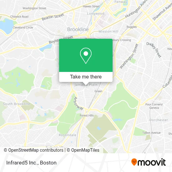
See Infrared5 Inc., Boston, on the map
Public Transit to Infrared5 Inc. in Boston
Wondering how to get to Infrared5 Inc. in Boston? Moovit helps you find the best way to get to Infrared5 Inc. with step-by-step directions from the nearest public transit station.
Moovit provides free maps and live directions to help you navigate through your city. View schedules, routes, timetables, and find out how long does it take to get to Infrared5 Inc. in real time.
Looking for the nearest stop or station to Infrared5 Inc.? Check out this list of stops closest to your destination: Centre St @ Ballard St; Centre St @ Eliot St; Green Street - Amory St @ Green St; Green Street; Heath Street; Forest Hills.
Bus: 39, 35, 38, 41, ORANGE LINE SHUTTLE, ORANGE LINE SHUTTLE, ORANGE LINE SHUTTLE, ORANGE LINE SHUTTLE, ORANGE LINE SHUTTLE.Train: NEEDHAM, FRANKLIN/FOXBORO, PROVIDENCE/STOUGHTON.Subway: ORANGE LINE, GREEN LINE E.
Want to see if there’s another route that gets you there at an earlier time? Moovit helps you find alternative routes or times. Get directions from and directions to Infrared5 Inc. easily from the Moovit App or Website.
We make riding to Infrared5 Inc. easy, which is why over 1.7 million users, including users in Boston, trust Moovit as the best app for public transit. You don’t need to download an individual bus app or train app, Moovit is your all-in-one transit app that helps you find the best bus time or train time available.
For information on prices of bus, subway and train, costs and ride fares to Infrared5 Inc., please check the Moovit app.
Use the app to navigate to popular places including to the airport, hospital, stadium, grocery store, mall, coffee shop, school, college, and university.
Infrared5 Inc. Address: 769 Centre St street in Boston
- Zircteeth - Boston,
- Costello's Tavern (Costello's Bistro),
- Jamaica Plain,
- Yumont True Value Hardware,
- J.P. Center,
- The Goodwill Store (Jamaica Plain),
- Brianna's Closet,
- Ryan Painting,
- JP Centre South Main Streets,
- Deep River Company Inc,
- Santia's Bakery,
- J.P. Licks Jamaica Plain,
- 100 Percent Delicias Express,
- Hub Hancrafted Wrap & Juice,
- Chiropractic Blurry Vision Treatment,
- Zipcar,
- The Monument,
- E-Dume Tax Consulting,
- David Levy Attorney,
- Barnette Plumbing & Heating
Places Near Infrared5 Inc. (Boston)
- Boston Medical Center, Boston,
- North End, Boston,
- Wang Theater, Boston,
- House Of Blues, Boston,
- Museum Of Science, Boston,
- Boston Common, Boston,
- Boston Convention & Exhibition Center, Boston,
- Isabella Stewart Gardner Museum, Boston,
- Cheers, Boston,
- Mgm Music Hall, Boston,
- Wilbur Theatre, Boston,
- Seaport District, Boston,
- Castle Island, Boston,
- Td Garden, Boston,
- Faneuil Hall, Boston,
- Massachusetts General Hospital, Boston,
- Prudential Center, Boston,
- Quincy Market, Boston,
- Leader Bank Pavilion (Leader Bank Pavillion), Boston,
- Boston Children's Hospital, Boston
How to get to popular places in Boston with public transit
Get around Boston by public transit!
Traveling around Boston has never been so easy. See step by step directions as you travel to any attraction, street or major public transit station. View bus and train schedules, arrival times, service alerts and detailed routes on a map, so you know exactly how to get to anywhere in Boston.
When traveling to any destination around Boston use Moovit's Live Directions with Get Off Notifications to know exactly where and how far to walk, how long to wait for your line, and how many stops are left. Moovit will alert you when it's time to get off — no need to constantly re-check whether yours is the next stop.
Wondering how to use public transit in Boston or how to pay for public transit in Boston? Moovit public transit app can help you navigate your way with public transit easily, and at minimum cost. It includes public transit fees, ticket prices, and costs. Looking for a map of Boston public transit lines? Moovit public transit app shows all public transit maps in Boston with all Bus, Train, Subway and Ferry routes and stops on an interactive map.
Boston has 4 transit type(s), including: Bus, Train, Subway and Ferry, operated by several transit agencies, including MBTA, Southeastern Regional Transit Authority, MetroWest Regional Transit Authority, Rhode Island Public Transit Authority, WRTA, Lowell Regional Transit Authority, Merrimack Valley Transit, Montachusett Regional Transit Authority, Cape Cod Regional Transit Authority, Brockton Area Transit Authority, Martha's Vineyard Transit Authority, the WAVE - Nantucket Regional Transit Authority, GATRA, Cape Ann Transportation Authority and Massport