Directions to Inhaúma with public transportation
The following transit lines have routes that pass near Inhaúma
 Bus: 292, 629, 711, 908, 311.
- Metro: L2.
- Train: RAMAL SARACURUNA, RAMAL BELFORD ROXO.
- Funicular: IGREJA DA PENHA.
How to get to Inhaúma by bus?
Click on the bus route to see step by step directions with maps, line arrival times and updated time schedules.
From Assim Medical Centro Médico Tijuca
50 minFrom Rua Sacadura Cabral 120
53 minFrom Rua Américo Brasiliense
47 minFrom Av. Nilo Peçanha - Duque de Caxias
45 minFrom Rua Camerino
53 minFrom Avenida Marechal Floriano 168
49 minFrom Hospital Estadual Carlos Chagas
64 minFrom Hospital Universitário Pedro Ernesto
41 minFrom Hospital São Vicente de Paulo (HSVP)
50 minFrom Pedra Do Sal
54 min
How to get to Inhaúma by train?
Click on the train route to see step by step directions with maps, line arrival times and updated time schedules.
From Assim Medical Centro Médico Tijuca
70 minFrom Rua Sacadura Cabral 120
66 minFrom Rua Américo Brasiliense
68 minFrom Av. Nilo Peçanha - Duque de Caxias
55 minFrom Rua Camerino
61 minFrom Avenida Marechal Floriano 168
59 minFrom Hospital Estadual Carlos Chagas
76 minFrom Hospital Universitário Pedro Ernesto
58 minFrom Hospital São Vicente de Paulo (HSVP)
61 minFrom Pedra Do Sal
67 min
How to get to Inhaúma by metro?
Click on the metro route to see step by step directions with maps, line arrival times and updated time schedules.
Bus stops near Inhaúma
Funicular station near Inhaúma
- Estação 3, 11 min walk,VIEW
Metro station near Inhaúma
- Inhaúma, 27 min walk,VIEW
Bus lines to Inhaúma
- 292, Engenho da Rainha - Castelo (Brs 4 - Via Bonsucesso / Av. Brasil),VIEW
- 311, Engenheiro Leal - Candelária (Brs 4 - Via Del Castilho / São Cristóvão),VIEW
- 492L, Caxias - Engenho da Rainha (Via Itaóca),VIEW
- 629, Irajá - Saens Peña,VIEW
- SN 629, Irajá - Saens Peña,VIEW
- 711, Rocha Miranda - Rio Comprido (Brs 6 - Via Inhaúma / Benfica),VIEW
- 908, Terminal Deodoro - Bonsucesso (Direto - Via Guadalupe / Metrô Inhaúma),VIEW
- SN 908, LECD107 - Terminal Deodoro - Bonsucesso (Direto - via Metrô Inhaúma),VIEW
- SV 908, Terminal Deodoro - Bonsucesso (Via Rua Álvaro de Miranda),VIEW
- 312, Olaria - Candelária (Brs 4 - Via São Cristóvão),VIEW
- SN 312, Penha - Candelária (Via Ibiapina / Itararé / Rodoviária),VIEW
- 485L, Caxias - Pilares (Via Itararé),VIEW
- 494L, Caxias - Pilares (Via Cidade Alta),VIEW
- 622, Penha - Saens Peña (Circular),VIEW
- 623, Penha - Saens Peña (Brs 6 - Via Túnel Noel Rosa),VIEW
- 628, Penha - Nova América (Via Paranhos),VIEW
- 621, Penha (Via Grajaú / Itararé),VIEW
- 946, Engenho Da Rainha,VIEW
What are the closest stations to Inhaúma?
The closest stations to Inhaúma are:
- Avenida Itaoca | Entrada Da Nova Brasília (Sentido Itararé) is 646 meters away, 9 min walk.
- Estação 3 is 793 meters away, 11 min walk.
- Estrada Do Itararé, 1042-1078 is 948 meters away, 13 min walk.
- Estrada Do Itararé, 1031 is 1012 meters away, 13 min walk.
- Ramos is 1207 meters away, 16 min walk.
- Estrada Adhemar Bebiano, 1374-1390 is 1944 meters away, 25 min walk.
- Inhaúma is 2066 meters away, 27 min walk.
- Del Castilho is 2844 meters away, 37 min walk.
Which bus lines stop near Inhaúma?
These bus lines stop near Inhaúma: 292, 629, 711, 908.
Which metro line stops near Inhaúma?
L2 (Pavuna)
Which train line stops near Inhaúma?
RAMAL SARACURUNA (Gramacho)
What’s the nearest metro station to Inhaúma?
The nearest metro station to Inhaúma is Inhaúma. It’s a 27 min walk away.
What’s the nearest train station to Inhaúma?
The nearest train station to Inhaúma is Ramos. It’s a 16 min walk away.
What’s the nearest bus station to Inhaúma?
The nearest bus station to Inhaúma is Avenida Itaoca | Entrada Da Nova Brasília (Sentido Itararé). It’s a 9 min walk away.
What’s the nearest funicular station to Inhaúma?
The nearest funicular station to Inhaúma is Estação 3. It’s a 11 min walk away.
What time is the first metro to Inhaúma?
The L2 is the first metro that goes to Inhaúma. It stops nearby at 5:18 AM.
What time is the last metro to Inhaúma?
The L2 is the last metro that goes to Inhaúma. It stops nearby at 12:32 AM.
What time is the first train to Inhaúma?
The RAMAL SARACURUNA is the first train that goes to Inhaúma. It stops nearby at 4:52 AM.
What time is the last train to Inhaúma?
The RAMAL SARACURUNA is the last train that goes to Inhaúma. It stops nearby at 10:54 PM.
What time is the first bus to Inhaúma?
The SN 908 is the first bus that goes to Inhaúma. It stops nearby at 3:00 AM.
What time is the last bus to Inhaúma?
The SN 312 is the last bus that goes to Inhaúma. It stops nearby at 3:21 AM.
What time is the first funicular to Inhaúma?
The IGREJA DA PENHA is the first funicular that goes to Inhaúma. It stops nearby at 7:00 AM.
What time is the last funicular to Inhaúma?
The IGREJA DA PENHA is the last funicular that goes to Inhaúma. It stops nearby at 6:00 PM.
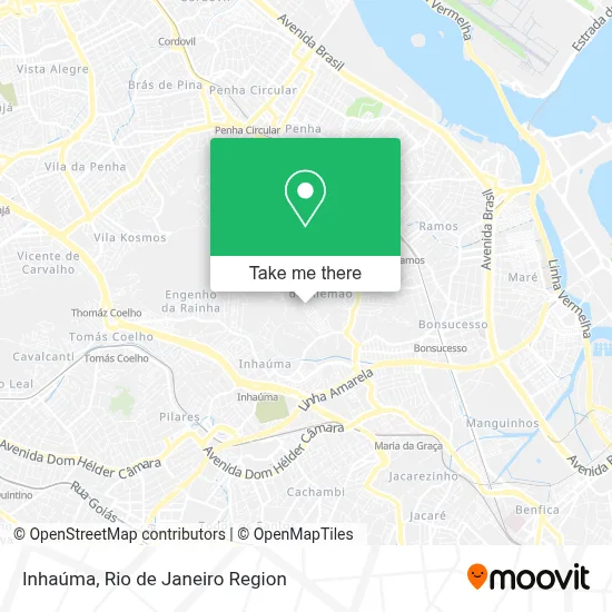
See Inhaúma on the map
Public Transportation to Inhaúma
Wondering how to get to Inhaúma? Moovit helps you find the best way to get to Inhaúma with step-by-step directions from the nearest public transit station.
Moovit provides free maps and live directions to help you navigate through your city. View schedules, routes, timetables, and find out how long does it take to get to Inhaúma in real time.
Looking for the nearest stop or station to Inhaúma? Check out this list of stops closest to your destination: Avenida Itaoca | Entrada Da Nova Brasília (Sentido Itararé); Estação 3; Estrada Do Itararé; Estrada Do Itararé; Ramos; Estrada Adhemar Bebiano; Inhaúma; Del Castilho.
Bus: 292, 629, 711, 908, 311, 492L, SN 629, 312, SN 312, 485L, 494L, 622.Metro: L2.Train: RAMAL SARACURUNA, RAMAL BELFORD ROXO.Funicular: IGREJA DA PENHA.
Want to see if there’s another route that gets you there at an earlier time? Moovit helps you find alternative routes or times. Get directions from and directions to Inhaúma easily from the Moovit App or Website.
We make riding to Inhaúma easy, which is why over 1.5 million users, including users in Inhaúma, trust Moovit as the best app for public transit. You don’t need to download an individual bus app or train app, Moovit is your all-in-one transit app that helps you find the best bus time or train time available.
For information on prices of bus, train and metro, costs and ride fares to Inhaúma, please check the Moovit app.
Use the app to navigate to popular places including to the airport, hospital, stadium, grocery store, mall, coffee shop, school, college, and university.
Inhaúma Address: Rio de Janeiro-RJ street in Inhaúma
- Travessa Guadalajara 349,
- Rua Sete de Setembro 707-789,
- Rua Sete de Setembro,
- Edi Professora Eliane Monte Chiari Dantas,
- Campo do Loteamento,
- Cala a Boca e Me Beija,
- Comunidade de São José - Complexo do Alemão,
- Rua Guadalajara 324,
- Rua Vista Alegre,
- Nova Brasília,
- Travessa Sonora 165,
- Rua Assembléia,
- Travessa Guanajuato, 26,
- Paróquia Nossa Senhora de Guadalupe - Inhaúma / RJ,
- Edi Prof Luiza Helena Maia Medeiros,
- Rua Santa Luzia,
- Academia Elas X Elas,
- Loteamento Da Castrol,
- Rua Yucatan,
- Rua Antônio Austregésilo / Rua Augusto Austragesilo
Places Near Inhaúma
- Shopping Rio Sul, Botafogo,
- Shopping RioSul, Botafogo,
- Avenida Rio Branco, Centro,
- Rua Ulysses Guimarães 16, Cidade Nova,
- Hospital Federal Cardoso Fontes, Jacarepaguá,
- Shopping Nova América, Del Castilho,
- Hospital Federal Do Andaraí, Andaraí,
- Niterói, Niterói,
- Rio De Janeiro,
- Feira Livre da Gloria, Glória,
- Hospital Municipal Ronaldo Gazolla, Acari,
- Feirão De Malhas, Duque De Caxias,
- Rua Licínio Cardoso, São Francisco Xavier,
- Hospital Pedro Ernesto, Vila Isabel,
- Praia do Arpoador, Ipanema,
- Shopping Downtown, Barra Da Tijuca,
- Museu Do Amanhã, Centro,
- Norte Shopping, Cachambi,
- Avenida Venezuela 134, Saúde,
- Rodoviária Novo Rio (Rodoviária do Rio de Janeiro), Santo Cristo
How to get to popular places in Rio de Janeiro Region with public transit
Get around Inhaúma by public transit!
Traveling around Inhaúma has never been so easy. See step by step directions as you travel to any attraction, street or major public transit station. View bus and train schedules, arrival times, service alerts and detailed routes on a map, so you know exactly how to get to anywhere in Inhaúma.
When traveling to any destination around Inhaúma use Moovit's Live Directions with Get Off Notifications to know exactly where and how far to walk, how long to wait for your line, and how many stops are left. Moovit will alert you when it's time to get off — no need to constantly re-check whether yours is the next stop.
Wondering how to use public transit in Inhaúma or how to pay for public transit in Inhaúma? Moovit public transit app can help you navigate your way with public transit easily, and at minimum cost. It includes public transit fees, ticket prices, and costs. Looking for a map of Inhaúma public transit lines? Moovit public transit app shows all public transit maps in Inhaúma with all Bus, Train, Metro, Light Rail, Ferry, Cable Car, Gondola and Funicular routes and stops on an interactive map.
Rio de Janeiro Region has 8 transit type(s), including: Bus, Train, Metro, Light Rail, Ferry, Cable Car, Gondola and Funicular, operated by several transit agencies, including TrensRJ, Metrô Rio, VLT Carioca, Barcas Rio, BRT MOBI-Rio, Auto Viação Alpha, Auto Viação Tijuca, Gire Transportes, Transurb, Viação Nossa Senhora das Graças, Consórcio INTERSUL, Braso Lisboa (Municipal), Caprichosa Auto Ônibus, Auto Viação Três Amigos and Rodoviária Âncora Matias