How to get to Injury Money by bus?
Click on the bus route to see step by step directions with maps, line arrival times and updated time schedules.
From Holiday Inn Express Boston Hotel Boston, Boston
64 minFrom Sam Adams Boston Brewery Tour, Boston
81 minFrom Warrior Ice Arena, Boston
94 minFrom MBTA / Alewife #6, Cambridge
98 minFrom Mount Auburn, Cambridge
77 minFrom 1 Brookline Place, Brookline
70 minFrom Beehive, Boston
55 minFrom Stone Zoo, Stoneham
63 minFrom MBTA Alewife Station, Cambridge
98 minFrom Samuel Adams Brewery, Boston
81 min
How to get to Injury Money by subway?
Click on the subway route to see step by step directions with maps, line arrival times and updated time schedules.
From Holiday Inn Express Boston Hotel Boston, Boston
57 minFrom Sam Adams Boston Brewery Tour, Boston
53 minFrom Warrior Ice Arena, Boston
88 minFrom MBTA / Alewife #6, Cambridge
60 minFrom 1 Brookline Place, Brookline
60 minFrom Beehive, Boston
46 minFrom MBTA Alewife Station, Cambridge
59 minFrom Samuel Adams Brewery, Boston
53 min
Bus stops near Injury Money in Chelsea
Train station near Injury Money in Chelsea
- Chelsea, 19 min walk,VIEW
Subway station near Injury Money in Chelsea
- Wood Island, 28 min walk,VIEW
Bus lines to Injury Money in Chelsea
What are the closest stations to Injury Money?
The closest stations to Injury Money are:
- Lexington St @ Shelby St is 160 yards away, 2 min walk.
- 467 Chelsea St - Eagle Square is 191 yards away, 3 min walk.
- Central Ave @ Lynn St is 394 yards away, 5 min walk.
- 270 Central Ave - Chelsea Garage is 542 yards away, 8 min walk.
- Eastern Avenue is 598 yards away, 8 min walk.
- Chelsea is 1622 yards away, 19 min walk.
- Wood Island is 2320 yards away, 28 min walk.
Which bus lines stop near Injury Money?
These bus lines stop near Injury Money: 104, SL3.
Which subway line stops near Injury Money?
BLUE LINE (Wonderland)
What’s the nearest subway station to Injury Money in Chelsea?
The nearest subway station to Injury Money in Chelsea is Wood Island. It’s a 28 min walk away.
What’s the nearest train station to Injury Money in Chelsea?
The nearest train station to Injury Money in Chelsea is Chelsea. It’s a 19 min walk away.
What’s the nearest bus station to Injury Money in Chelsea?
The nearest bus station to Injury Money in Chelsea is Lexington St @ Shelby St. It’s a 2 min walk away.
What time is the first subway to Injury Money in Chelsea?
The BLUE LINE is the first subway that goes to Injury Money in Chelsea. It stops nearby at 5:08 AM.
What time is the last subway to Injury Money in Chelsea?
The BLUE LINE is the last subway that goes to Injury Money in Chelsea. It stops nearby at 2:03 AM.
What time is the first train to Injury Money in Chelsea?
The NEWBURYPORT/ROCKPORT is the first train that goes to Injury Money in Chelsea. It stops nearby at 5:40 AM.
What time is the last train to Injury Money in Chelsea?
The NEWBURYPORT/ROCKPORT is the last train that goes to Injury Money in Chelsea. It stops nearby at 12:06 AM.
What time is the first bus to Injury Money in Chelsea?
The 771 is the first bus that goes to Injury Money in Chelsea. It stops nearby at 3:00 AM.
What time is the last bus to Injury Money in Chelsea?
The 771 is the last bus that goes to Injury Money in Chelsea. It stops nearby at 3:20 AM.
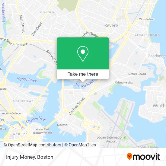
See Injury Money, Chelsea, on the map
Public Transit to Injury Money in Chelsea
Wondering how to get to Injury Money in Chelsea? Moovit helps you find the best way to get to Injury Money with step-by-step directions from the nearest public transit station.
Moovit provides free maps and live directions to help you navigate through your city. View schedules, routes, timetables, and find out how long does it take to get to Injury Money in real time.
Looking for the nearest stop or station to Injury Money? Check out this list of stops closest to your destination: Lexington St @ Shelby St; 467 Chelsea St - Eagle Square; Central Ave @ Lynn St; 270 Central Ave - Chelsea Garage; Eastern Avenue; Chelsea; Wood Island.
Bus: 104, SL3, 121, 112, 771, 772, 773.Train: NEWBURYPORT/ROCKPORT.Subway: BLUE LINE.
Want to see if there’s another route that gets you there at an earlier time? Moovit helps you find alternative routes or times. Get directions from and directions to Injury Money easily from the Moovit App or Website.
We make riding to Injury Money easy, which is why over 1.7 million users, including users in Chelsea, trust Moovit as the best app for public transit. You don’t need to download an individual bus app or train app, Moovit is your all-in-one transit app that helps you find the best bus time or train time available.
For information on prices of bus, subway and train, costs and ride fares to Injury Money, please check the Moovit app.
Use the app to navigate to popular places including to the airport, hospital, stadium, grocery store, mall, coffee shop, school, college, and university.
Injury Money Address: 235 Marginal St street in Chelsea
- Support Services,
- Enterprise Rent-A-Car,
- Adviniacare Baypointe Adviniacare Colony,
- TownePlace Suites Boston Logan Airport / Chelsea,
- Massport Bus 77 Chelsea Employee Parking,
- Logan Airport Employee Parking Garage,
- Marriott Town Place Suites,
- Boston Frenchiez,
- Joe Scoolabasta the Seagull Inn,
- Shelby St. hq,
- Westfarms Mall,
- Yazan Ice Cream,
- Eagle Hill,
- Superior Luggage (Luggage Repair),
- 111 Eastern Ave,
- PreFlight Airport Parking,
- Sukyo Mahikari,
- Rite Temp Cooling & Heating,
- Port Park,
- Jeveli's (Jeveli's Restaurant East Boston, MA)
Places Near Injury Money (Chelsea)
- Isabella Stewart Gardner Museum, Boston,
- Td Garden, Boston,
- Museum Of Science, Boston,
- North End, Boston,
- Boston Children's Hospital, Boston,
- Mgm Music Hall, Boston,
- Boston Medical Center, Boston,
- House Of Blues, Boston,
- Prudential Center, Boston,
- Quincy Market, Boston,
- Boston Convention & Exhibition Center, Boston,
- Cheers, Boston,
- Boston Common, Boston,
- Seaport District, Boston,
- Wang Theater, Boston,
- Wilbur Theatre, Boston,
- Faneuil Hall, Boston,
- Massachusetts General Hospital, Boston,
- Castle Island, Boston,
- Leader Bank Pavilion (Leader Bank Pavillion), Boston
How to get to popular places in Boston with public transit
Get around Chelsea by public transit!
Traveling around Chelsea has never been so easy. See step by step directions as you travel to any attraction, street or major public transit station. View bus and train schedules, arrival times, service alerts and detailed routes on a map, so you know exactly how to get to anywhere in Chelsea.
When traveling to any destination around Chelsea use Moovit's Live Directions with Get Off Notifications to know exactly where and how far to walk, how long to wait for your line, and how many stops are left. Moovit will alert you when it's time to get off — no need to constantly re-check whether yours is the next stop.
Wondering how to use public transit in Chelsea or how to pay for public transit in Chelsea? Moovit public transit app can help you navigate your way with public transit easily, and at minimum cost. It includes public transit fees, ticket prices, and costs. Looking for a map of Chelsea public transit lines? Moovit public transit app shows all public transit maps in Chelsea with all Bus, Train, Subway and Ferry routes and stops on an interactive map.
Boston has 4 transit type(s), including: Bus, Train, Subway and Ferry, operated by several transit agencies, including MBTA, Southeastern Regional Transit Authority, MetroWest Regional Transit Authority, Rhode Island Public Transit Authority, WRTA, Lowell Regional Transit Authority, Merrimack Valley Transit, Montachusett Regional Transit Authority, Cape Cod Regional Transit Authority, Brockton Area Transit Authority, Martha's Vineyard Transit Authority, the WAVE - Nantucket Regional Transit Authority, GATRA, Cape Ann Transportation Authority and Massport