How to get to Inkmaster by bus?
Click on the bus route to see step by step directions with maps, line arrival times and updated time schedules.
From Hospital Virgen De La Poveda, Villa Del Prado
80 minFrom Embalse de San Juan, San Martín De Valdeiglesias
170 minFrom Universidad Europea De Madrid, Área Metropolitana De Madrid Y Corredor Del Henares
131 minFrom Villaviciosa de Odón, Villaviciosa De Odón
116 minFrom Parque Coimbra, Área Metropolitana De Madrid Y Corredor Del Henares
75 minFrom Playa del Alberche, Aldea Del Fresno
22 minFrom Centro Comercial Xanadú, Arroyomolinos
71 minFrom Hospital Universitario De Móstoles., Área Metropolitana De Madrid Y Corredor Del Henares
78 min
Bus stops near Inkmaster in Méntrida
Bus lines to Inkmaster in Méntrida
What are the closest stations to Inkmaster?
The closest stations to Inkmaster are:
- Méntrida - Félix Arranz is 438 meters away, 6 min walk.
- Méntrida is 441 meters away, 6 min walk.
Which bus line stops near Inkmaster?
541 (La Torre De E. H. - Ctra. Méntrida)
What’s the nearest bus station to Inkmaster in Méntrida?
The nearest bus stations to Inkmaster in Méntrida are Méntrida - Félix Arranz and Méntrida. The closest one is a 6 min walk away.
What time is the first bus to Inkmaster in Méntrida?
The 541 is the first bus that goes to Inkmaster in Méntrida. It stops nearby at 8:07 AM.
What time is the last bus to Inkmaster in Méntrida?
The 541 is the last bus that goes to Inkmaster in Méntrida. It stops nearby at 9:23 PM.
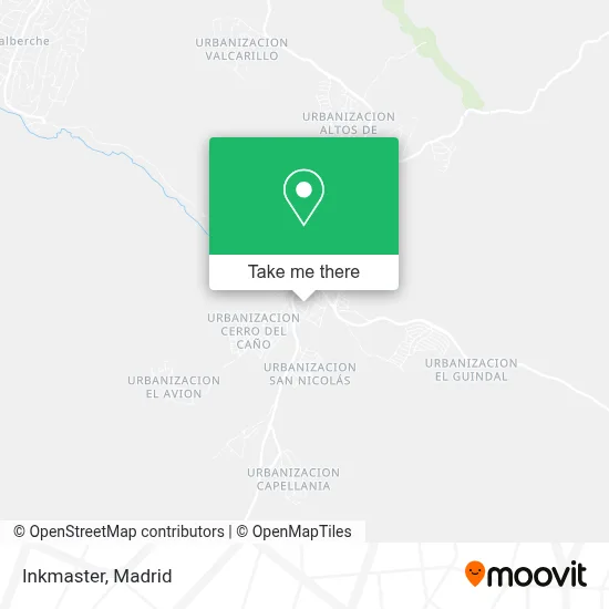
See Inkmaster, Méntrida, on the map
Public Transit to Inkmaster in Méntrida
Wondering how to get to Inkmaster in Méntrida? Moovit helps you find the best way to get to Inkmaster with step-by-step directions from the nearest public transit station.
Moovit provides free maps and live directions to help you navigate through your city. View schedules, routes, timetables, and find out how long does it take to get to Inkmaster in real time.
Looking for the nearest stop or station to Inkmaster? Check out this list of stops closest to your destination: Méntrida - Félix Arranz; Méntrida.
Bus: 541, VCM-044, VCM-039.
Want to see if there’s another route that gets you there at an earlier time? Moovit helps you find alternative routes or times. Get directions from and directions to Inkmaster easily from the Moovit App or Website.
We make riding to Inkmaster easy, which is why over 1.5 million users, including users in Méntrida, trust Moovit as the best app for public transit. You don’t need to download an individual bus app or train app, Moovit is your all-in-one transit app that helps you find the best bus time or train time available.
For information on prices of bus, costs and ride fares to Inkmaster, please check the Moovit app.
Use the app to navigate to popular places including to the airport, hospital, stadium, grocery store, mall, coffee shop, school, college, and university.
Inkmaster Address: Calle Río Tajo, 10 45930 Méntrida street in Méntrida
- Calle Castillejos 21,
- Urbanizacion Los Castillejos,
- Instituto Tm,
- Pan Chef,
- Schnauzer Miniatura Blanco Alimaxdog,
- Bueno Bueno,
- Avenida Solana 10,
- Peluquería Ms,
- El Fogón de Méntrida,
- José Javier Cabrera Sebastian,
- C.P. Luis Solana,
- Cafetería Restaurante Los Castillejos,
- La Casa de las Chuches Damivan,
- Alimentación y Productos Rumanos(Magazín Romanesc La Silvia),
- Lemon Shisha Burguer,
- Servicios Informáticos Orp,
- El Rincón Mentrida,
- Asador Don Pollo,
- Bercianitas,
- Unicaja
Places Near Inkmaster (Méntrida)
- Centro Comercial Oasiz Madrid, Área Metropolitana De Madrid Y Corredor Del Henares,
- Estacion de Chamartin, Madrid,
- Plenilunio, Área Metropolitana De Madrid Y Corredor Del Henares,
- Tres Aguas, Alcorcón,
- Sala La Riviera, Madrid,
- Palacio De Vistalegre, Área Metropolitana De Madrid Y Corredor Del Henares,
- Centro Comercial La Gavia, Área Metropolitana De Madrid Y Corredor Del Henares,
- Hospital Clínico Universitario San Carlos, Madrid,
- Centro Comercial La Vaguada, Área Metropolitana De Madrid Y Corredor Del Henares,
- Mercadillo de Majadahonda, Majadahonda,
- Centro Comercial Islazul, Área Metropolitana De Madrid Y Corredor Del Henares,
- Nassica, Área Metropolitana De Madrid Y Corredor Del Henares,
- Calle de López de Hoyos 169, Madrid,
- Plaza Mayor, Madrid,
- Rastro De Madrid, Área Metropolitana De Madrid Y Corredor Del Henares,
- Estadio Wanda Metropolitano, Área Metropolitana De Madrid Y Corredor Del Henares,
- Wizink Center, Madrid,
- Hospital Universitario Ramón y Cajal, Madrid,
- Mendez Alvaro, Madrid,
- Hospital Universitario La Paz, Madrid
How to get to popular places in Madrid with public transit
Get around Méntrida by public transit!
Traveling around Méntrida has never been so easy. See step by step directions as you travel to any attraction, street or major public transit station. View bus and train schedules, arrival times, service alerts and detailed routes on a map, so you know exactly how to get to anywhere in Méntrida.
When traveling to any destination around Méntrida use Moovit's Live Directions with Get Off Notifications to know exactly where and how far to walk, how long to wait for your line, and how many stops are left. Moovit will alert you when it's time to get off — no need to constantly re-check whether yours is the next stop.
Wondering how to use public transit in Méntrida or how to pay for public transit in Méntrida? Moovit public transit app can help you navigate your way with public transit easily, and at minimum cost. It includes public transit fees, ticket prices, and costs. Looking for a map of Méntrida public transit lines? Moovit public transit app shows all public transit maps in Méntrida with all Bus, Train, Metro and Light Rail routes and stops on an interactive map.
Madrid has 4 transit type(s), including: Bus, Train, Metro and Light Rail, operated by several transit agencies, including Metro de Madrid, Metro Ligero, Tranvía de Parla, Renfe Cercanías - Servicios de Autobús especiales, Renfe Cercanias, Renfe Cercanías, EMT, Interurbanos, Urbanos de Alcalá de Henares, Urbanos de Alcobendas, Urbanos de Alcorcón, Urbanos de Algete, Urbanos de Aranjuez, Urbanos de Arganda del Rey and Urbanos de Arroyomolinos