Directions to Inkwell Clothing Co. (Boston) with public transportation
The following transit lines have routes that pass near Inkwell Clothing Co.
 Bus: 7, 9, 13.
- Ferry: SEASTREAK, WATER SHUTTLE.
Bus stops near Inkwell Clothing Co. in Boston
Ferry stations near Inkwell Clothing Co. in Boston
- Oak Bluffs, Martha’S Vineyard, MA, 16 min walk,VIEW
Bus lines to Inkwell Clothing Co. in Boston
- Island Music,
- Reelislandco,
- Sarah Brown's Comfort Food,
- Marilyn Moses, Martha's Vineyard Local Realtor & Broker,
- Third World Trading Company,
- Darosa Corporation,
- Rockland Trust Bank,
- Crystal Clean,
- Isle Services,
- Efficient Housekeeping,
- Lori Edmonds Homestyle Chef,
- Wise Construction,
- Oceans Day Spa,
- A Mobile Repair,
- Flying Horses,
- Mary's Linen Store,
- Interstate Batteries,
- Off Shore,
- Unr ATM,
- DJ Alvzie Mvy
Places Near Inkwell Clothing Co. (Boston)
- Massachusetts General Hospital, Boston,
- Boston Convention & Exhibition Center, Boston,
- House Of Blues, Boston,
- Boston Common, Boston,
- Quincy Market, Boston,
- Leader Bank Pavilion (Leader Bank Pavillion), Boston,
- Boston Medical Center, Boston,
- Seaport District, Boston,
- Faneuil Hall, Boston,
- Castle Island, Boston,
- Prudential Center, Boston,
- Cheers, Boston,
- Wang Theater, Boston,
- Wilbur Theatre, Boston,
- Td Garden, Boston,
- North End, Boston,
- Museum Of Science, Boston,
- Mgm Music Hall, Boston,
- Isabella Stewart Gardner Museum, Boston,
- Boston Children's Hospital, Boston
How to get to popular places in Boston with public transit
What are the closest stations to Inkwell Clothing Co.?
The closest stations to Inkwell Clothing Co. are:
- Niantic Park is 362 yards away, 5 min walk.
- Oak Bluffs Library is 1003 yards away, 12 min walk.
- Ocean Park, Oak Bluffs is 1085 yards away, 13 min walk.
- Oak Bluffs, Martha’S Vineyard, MA is 1300 yards away, 16 min walk.
Which ferry lines stop near Inkwell Clothing Co.?
These ferry lines stop near Inkwell Clothing Co.: SEASTREAK, WATER SHUTTLE.
What’s the nearest bus station to Inkwell Clothing Co. in Boston?
The nearest bus station to Inkwell Clothing Co. in Boston is Niantic Park. It’s a 5 min walk away.
What’s the nearest ferry station to Inkwell Clothing Co. in Boston?
The nearest ferry station to Inkwell Clothing Co. in Boston is Oak Bluffs, Martha’S Vineyard, MA. It’s a 16 min walk away.
What time is the first bus to Inkwell Clothing Co. in Boston?
The 13 is the first bus that goes to Inkwell Clothing Co. in Boston. It stops nearby at 6:07 AM.
What time is the last bus to Inkwell Clothing Co. in Boston?
The 13 is the last bus that goes to Inkwell Clothing Co. in Boston. It stops nearby at 10:35 PM.
What time is the first ferry to Inkwell Clothing Co. in Boston?
The WATER SHUTTLE is the first ferry that goes to Inkwell Clothing Co. in Boston. It stops nearby at 4:20 AM.
What time is the last ferry to Inkwell Clothing Co. in Boston?
The SEASTREAK is the last ferry that goes to Inkwell Clothing Co. in Boston. It stops nearby at 7:45 PM.
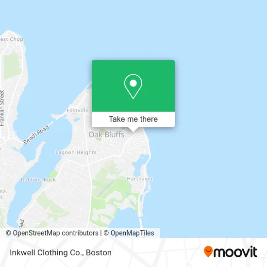
See Inkwell Clothing Co., Boston, on the map
Public Transit to Inkwell Clothing Co. in Boston
Wondering how to get to Inkwell Clothing Co. in Boston? Moovit helps you find the best way to get to Inkwell Clothing Co. with step-by-step directions from the nearest public transit station.
Moovit provides free maps and live directions to help you navigate through your city. View schedules, routes, timetables, and find out how long does it take to get to Inkwell Clothing Co. in real time.
Looking for the nearest stop or station to Inkwell Clothing Co.? Check out this list of stops closest to your destination: Niantic Park; Oak Bluffs Library; Ocean Park; Oak Bluffs.
Bus: 7, 9, 13.Ferry: SEASTREAK, WATER SHUTTLE.
Want to see if there’s another route that gets you there at an earlier time? Moovit helps you find alternative routes or times. Get directions from and directions to Inkwell Clothing Co. easily from the Moovit App or Website.
We make riding to Inkwell Clothing Co. easy, which is why over 1.7 million users, including users in Boston, trust Moovit as the best app for public transit. You don’t need to download an individual bus app or train app, Moovit is your all-in-one transit app that helps you find the best bus time or train time available.
For information on prices of bus and ferry, costs and ride fares to Inkwell Clothing Co., please check the Moovit app.
Use the app to navigate to popular places including to the airport, hospital, stadium, grocery store, mall, coffee shop, school, college, and university.
Inkwell Clothing Co. Address: 47 Circuit Ave street in Boston
Get around Boston by public transit!
Traveling around Boston has never been so easy. See step by step directions as you travel to any attraction, street or major public transit station. View bus and train schedules, arrival times, service alerts and detailed routes on a map, so you know exactly how to get to anywhere in Boston.
When traveling to any destination around Boston use Moovit's Live Directions with Get Off Notifications to know exactly where and how far to walk, how long to wait for your line, and how many stops are left. Moovit will alert you when it's time to get off — no need to constantly re-check whether yours is the next stop.
Wondering how to use public transit in Boston or how to pay for public transit in Boston? Moovit public transit app can help you navigate your way with public transit easily, and at minimum cost. It includes public transit fees, ticket prices, and costs. Looking for a map of Boston public transit lines? Moovit public transit app shows all public transit maps in Boston with all Bus, Train, Subway and Ferry routes and stops on an interactive map.
Boston has 4 transit type(s), including: Bus, Train, Subway and Ferry, operated by several transit agencies, including MBTA, Southeastern Regional Transit Authority, MetroWest Regional Transit Authority, Rhode Island Public Transit Authority, WRTA, Lowell Regional Transit Authority, Merrimack Valley Transit, Montachusett Regional Transit Authority, Cape Cod Regional Transit Authority, Brockton Area Transit Authority, Martha's Vineyard Transit Authority, the WAVE - Nantucket Regional Transit Authority, GATRA, Cape Ann Transportation Authority and Massport