Directions to Inmotion (Boston) with public transportation
The following transit lines have routes that pass near Inmotion
 Bus: 93, 89/93, LOWER MYSTIC LINK.
- Train: NEWBURYPORT/ROCKPORT.
- Subway: GREEN LINE D, ORANGE LINE.
- Ferry: CHARLESTOWN FERRY.
How to get to Inmotion by bus?
Click on the bus route to see step by step directions with maps, line arrival times and updated time schedules.
From The Monument, Boston
85 minFrom Walmart, Saugus
85 minFrom Lemuel Shattuck Hospital, Boston
119 minFrom Boston Children's Hospital, Boston
77 minFrom Hotel Commonwealth, Boston
77 minFrom Walmart, Lynn
95 minFrom GE Aviation, Lynn
95 minFrom Brighton, Boston
93 minFrom Mount Auburn Hospital, Cambridge
62 minFrom Boston University Goldman School of Dental Medicine, Boston
61 min
How to get to Inmotion by train?
Click on the train route to see step by step directions with maps, line arrival times and updated time schedules.
How to get to Inmotion by subway?
Click on the subway route to see step by step directions with maps, line arrival times and updated time schedules.
Bus stops near Inmotion in Boston
Ferry station near Inmotion in Boston
- Charlestown Navy Yard, 20 min walk,VIEW
Bus lines to Inmotion in Boston
What are the closest stations to Inmotion?
The closest stations to Inmotion are:
- First Ave @ Ninth St is 205 yards away, 3 min walk.
- Bunker Hill St @ Vine St is 395 yards away, 5 min walk.
- 83 Medford (Tufts/Medford) is 813 yards away, 10 min walk.
- Charlestown Navy Yard is 1694 yards away, 20 min walk.
Which bus line stops near Inmotion?
93 (Downtown Via Navy Yard)
Which train line stops near Inmotion?
NEWBURYPORT/ROCKPORT (#120 | North Station)
Which subway lines stop near Inmotion?
These subway lines stop near Inmotion: GREEN LINE D, ORANGE LINE.
What’s the nearest bus station to Inmotion in Boston?
The nearest bus station to Inmotion in Boston is First Ave @ Ninth St. It’s a 3 min walk away.
What’s the nearest ferry station to Inmotion in Boston?
The nearest ferry station to Inmotion in Boston is Charlestown Navy Yard. It’s a 20 min walk away.
What time is the first bus to Inmotion in Boston?
The 89/93 is the first bus that goes to Inmotion in Boston. It stops nearby at 4:50 AM.
What time is the last bus to Inmotion in Boston?
The 93 is the last bus that goes to Inmotion in Boston. It stops nearby at 1:44 AM.
What time is the first ferry to Inmotion in Boston?
The CHARLESTOWN FERRY is the first ferry that goes to Inmotion in Boston. It stops nearby at 6:40 AM.
What time is the last ferry to Inmotion in Boston?
The CHARLESTOWN FERRY is the last ferry that goes to Inmotion in Boston. It stops nearby at 8:15 PM.
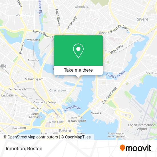
See Inmotion, Boston, on the map
Public Transit to Inmotion in Boston
Wondering how to get to Inmotion in Boston? Moovit helps you find the best way to get to Inmotion with step-by-step directions from the nearest public transit station.
Moovit provides free maps and live directions to help you navigate through your city. View schedules, routes, timetables, and find out how long does it take to get to Inmotion in real time.
Looking for the nearest stop or station to Inmotion? Check out this list of stops closest to your destination: First Ave @ Ninth St; Bunker Hill St @ Vine St; 83 Medford (Tufts/Medford); Charlestown Navy Yard.
Bus: 93, 89/93, LOWER MYSTIC LINK.Train: NEWBURYPORT/ROCKPORT.Subway: GREEN LINE D, ORANGE LINE.Ferry: CHARLESTOWN FERRY.
Want to see if there’s another route that gets you there at an earlier time? Moovit helps you find alternative routes or times. Get directions from and directions to Inmotion easily from the Moovit App or Website.
We make riding to Inmotion easy, which is why over 1.7 million users, including users in Boston, trust Moovit as the best app for public transit. You don’t need to download an individual bus app or train app, Moovit is your all-in-one transit app that helps you find the best bus time or train time available.
For information on prices of bus, subway and train, costs and ride fares to Inmotion, please check the Moovit app.
Use the app to navigate to popular places including to the airport, hospital, stadium, grocery store, mall, coffee shop, school, college, and university.
Inmotion Address: Terminal B, by Gate B5 street in Boston
- Downeast Cider House,
- Super Duck Tours,
- Boston Harbor Cruises/Autoport,
- 300 1st Avenue,
- Spaulding Rehabilitation Hospital,
- Blue Bikes - Spaulding Rehabilitation Hospital - Charlestown Navy Yard,
- 1st Ave,
- Peabody Property,
- Abm Janitorial Services,
- Solt Lab,
- Harborview at the Navy Yard,
- 149 13th Street,
- The Cooperative Of Charlesnewtown,
- Pier 10,
- Ciampa Maria Elisa,
- Partners HealthCare / MGH - Charlestown Navy Yard (CNY),
- MGH at the Navy Yard,
- MGH Cny Parking Garage,
- ATM,
- Prestige Limo Line
Places Near Inmotion (Boston)
- Boston Common, Boston,
- Seaport District, Boston,
- Isabella Stewart Gardner Museum, Boston,
- Boston Children's Hospital, Boston,
- Massachusetts General Hospital, Boston,
- North End, Boston,
- Wilbur Theatre, Boston,
- Cheers, Boston,
- Faneuil Hall, Boston,
- Boston Convention & Exhibition Center, Boston,
- Wang Theater, Boston,
- Td Garden, Boston,
- Prudential Center, Boston,
- Boston Medical Center, Boston,
- Mgm Music Hall, Boston,
- Castle Island, Boston,
- Museum Of Science, Boston,
- Quincy Market, Boston,
- Leader Bank Pavilion (Leader Bank Pavillion), Boston,
- House Of Blues, Boston
How to get to popular places in Boston with public transit
Get around Boston by public transit!
Traveling around Boston has never been so easy. See step by step directions as you travel to any attraction, street or major public transit station. View bus and train schedules, arrival times, service alerts and detailed routes on a map, so you know exactly how to get to anywhere in Boston.
When traveling to any destination around Boston use Moovit's Live Directions with Get Off Notifications to know exactly where and how far to walk, how long to wait for your line, and how many stops are left. Moovit will alert you when it's time to get off — no need to constantly re-check whether yours is the next stop.
Wondering how to use public transit in Boston or how to pay for public transit in Boston? Moovit public transit app can help you navigate your way with public transit easily, and at minimum cost. It includes public transit fees, ticket prices, and costs. Looking for a map of Boston public transit lines? Moovit public transit app shows all public transit maps in Boston with all Bus, Train, Subway and Ferry routes and stops on an interactive map.
Boston has 4 transit type(s), including: Bus, Train, Subway and Ferry, operated by several transit agencies, including MBTA, Southeastern Regional Transit Authority, MetroWest Regional Transit Authority, Rhode Island Public Transit Authority, WRTA, Lowell Regional Transit Authority, Merrimack Valley Transit, Montachusett Regional Transit Authority, Cape Cod Regional Transit Authority, Brockton Area Transit Authority, Martha's Vineyard Transit Authority, the WAVE - Nantucket Regional Transit Authority, GATRA, Cape Ann Transportation Authority and Massport