Directions to Inside And Out (Newton) with public transportation
The following transit lines have routes that pass near Inside And Out
 Bus: 52, 59.
- Train: FRAMINGHAM/WORCESTER.
- Subway: GREEN LINE D.
How to get to Inside And Out by bus?
Click on the bus route to see step by step directions with maps, line arrival times and updated time schedules.
From Bentley University, Waltham
47 minFrom Emmanuel College, Boston
78 minFrom Boston Landing Station, Boston
50 minFrom Davis Sq, Somerville
81 minFrom Allston, Boston
50 minFrom Huntington Theatre Company, Boston
54 minFrom Sommerville Theatre, Somerville
81 minFrom Brandy Melville, Boston
55 minFrom Huntington Theatre, Boston
54 minFrom Samuel Adams Brewery, Boston
89 min
How to get to Inside And Out by train?
Click on the train route to see step by step directions with maps, line arrival times and updated time schedules.
How to get to Inside And Out by subway?
Click on the subway route to see step by step directions with maps, line arrival times and updated time schedules.
From Emmanuel College, Boston
48 minFrom Boston Landing Station, Boston
64 minFrom Davis Sq, Somerville
75 minFrom Allston, Boston
51 minFrom Huntington Theatre Company, Boston
56 minFrom Sommerville Theatre, Somerville
74 minFrom Brandy Melville, Boston
46 minFrom Huntington Theatre, Boston
56 minFrom Samuel Adams Brewery, Boston
74 min
Subway station near Inside And Out in Newton
- Newton Centre, 8 min walk,VIEW
Bus stop near Inside And Out in Newton
- Walnut St @ Beacon St, 8 min walk,VIEW
Train station near Inside And Out in Newton
- Newtonville, 38 min walk,VIEW
Bus lines to Inside And Out in Newton
- 59, Needham Junction Via Needham St,VIEW
What are the closest stations to Inside And Out?
The closest stations to Inside And Out are:
- Newton Centre is 572 yards away, 8 min walk.
- Walnut St @ Beacon St is 682 yards away, 8 min walk.
- Newtonville is 3178 yards away, 38 min walk.
Which bus lines stop near Inside And Out?
These bus lines stop near Inside And Out: 52, 59.
Which train line stops near Inside And Out?
FRAMINGHAM/WORCESTER (#521 | Worcester)
Which subway line stops near Inside And Out?
GREEN LINE D (Riverside)
What’s the nearest subway station to Inside And Out in Newton?
The nearest subway station to Inside And Out in Newton is Newton Centre. It’s a 8 min walk away.
What’s the nearest bus station to Inside And Out in Newton?
The nearest bus station to Inside And Out in Newton is Walnut St @ Beacon St. It’s a 8 min walk away.
What time is the first subway to Inside And Out in Newton?
The GREEN LINE D is the first subway that goes to Inside And Out in Newton. It stops nearby at 4:48 AM.
What time is the last subway to Inside And Out in Newton?
The GREEN LINE D is the last subway that goes to Inside And Out in Newton. It stops nearby at 2:44 AM.
What time is the first train to Inside And Out in Newton?
The FRAMINGHAM/WORCESTER is the first train that goes to Inside And Out in Newton. It stops nearby at 5:25 AM.
What time is the last train to Inside And Out in Newton?
The FRAMINGHAM/WORCESTER is the last train that goes to Inside And Out in Newton. It stops nearby at 12:17 AM.
What time is the first bus to Inside And Out in Newton?
The 59 is the first bus that goes to Inside And Out in Newton. It stops nearby at 6:14 AM.
What time is the last bus to Inside And Out in Newton?
The 59 is the last bus that goes to Inside And Out in Newton. It stops nearby at 8:10 PM.
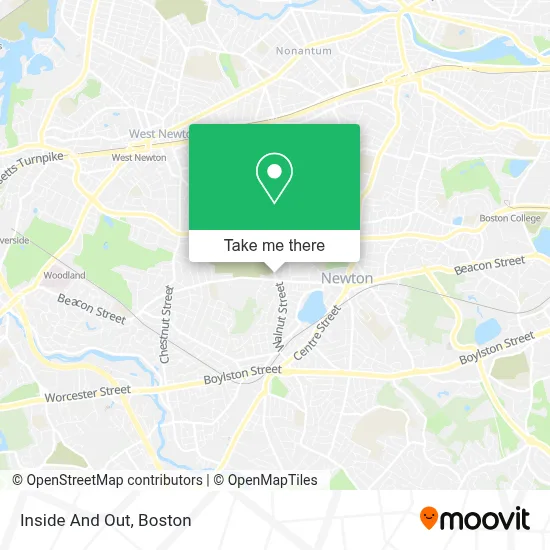
See Inside And Out, Newton, on the map
Public Transit to Inside And Out in Newton
Wondering how to get to Inside And Out in Newton? Moovit helps you find the best way to get to Inside And Out with step-by-step directions from the nearest public transit station.
Moovit provides free maps and live directions to help you navigate through your city. View schedules, routes, timetables, and find out how long does it take to get to Inside And Out in real time.
Looking for the nearest stop or station to Inside And Out? Check out this list of stops closest to your destination: Newton Centre; Walnut St @ Beacon St; Newtonville.
Bus: 52, 59.Train: FRAMINGHAM/WORCESTER.Subway: GREEN LINE D.
Want to see if there’s another route that gets you there at an earlier time? Moovit helps you find alternative routes or times. Get directions from and directions to Inside And Out easily from the Moovit App or Website.
We make riding to Inside And Out easy, which is why over 1.7 million users, including users in Newton, trust Moovit as the best app for public transit. You don’t need to download an individual bus app or train app, Moovit is your all-in-one transit app that helps you find the best bus time or train time available.
For information on prices of bus, subway and train, costs and ride fares to Inside And Out, please check the Moovit app.
Use the app to navigate to popular places including to the airport, hospital, stadium, grocery store, mall, coffee shop, school, college, and university.
Inside And Out Address: 878 Walnut St street in Newton
- Always Affective Available Emergency Locks,
- Centre Endodontics,
- Whole Foods Market,
- Amazon Counter at Whole Foods Market,
- Hannah Levy,
- Great Toning,
- Newton Cemetery,
- Nfi Ma North Crossing,
- May Consulting,
- Annette Furst Dr,
- Tetra,
- 1-800-Got-Junk? Boston West,
- Winnick Rabbi,
- Newton Free Library,
- Kaarndt MD,
- Experienced Plumbing Service,
- Dream Out Loud Productions,
- Crafts for A Cause Inc.,
- Abbot Mill Energy,
- Newton Center Air Conditioning Service 24 7
Places Near Inside And Out (Newton)
- Seaport District, Boston,
- Boston Common, Boston,
- Castle Island, Boston,
- Leader Bank Pavilion (Leader Bank Pavillion), Boston,
- Wilbur Theatre, Boston,
- Cheers, Boston,
- Isabella Stewart Gardner Museum, Boston,
- Td Garden, Boston,
- Boston Medical Center, Boston,
- North End, Boston,
- Massachusetts General Hospital, Boston,
- Prudential Center, Boston,
- Quincy Market, Boston,
- Mgm Music Hall, Boston,
- Museum Of Science, Boston,
- Boston Convention & Exhibition Center, Boston,
- Faneuil Hall, Boston,
- Boston Children's Hospital, Boston,
- House Of Blues, Boston,
- Wang Theater, Boston
How to get to popular places in Boston with public transit
Get around Newton by public transit!
Traveling around Newton has never been so easy. See step by step directions as you travel to any attraction, street or major public transit station. View bus and train schedules, arrival times, service alerts and detailed routes on a map, so you know exactly how to get to anywhere in Newton.
When traveling to any destination around Newton use Moovit's Live Directions with Get Off Notifications to know exactly where and how far to walk, how long to wait for your line, and how many stops are left. Moovit will alert you when it's time to get off — no need to constantly re-check whether yours is the next stop.
Wondering how to use public transit in Newton or how to pay for public transit in Newton? Moovit public transit app can help you navigate your way with public transit easily, and at minimum cost. It includes public transit fees, ticket prices, and costs. Looking for a map of Newton public transit lines? Moovit public transit app shows all public transit maps in Newton with all Bus, Train, Subway and Ferry routes and stops on an interactive map.
Boston has 4 transit type(s), including: Bus, Train, Subway and Ferry, operated by several transit agencies, including MBTA, Southeastern Regional Transit Authority, MetroWest Regional Transit Authority, Rhode Island Public Transit Authority, WRTA, Lowell Regional Transit Authority, Merrimack Valley Transit, Montachusett Regional Transit Authority, Cape Cod Regional Transit Authority, Brockton Area Transit Authority, Martha's Vineyard Transit Authority, the WAVE - Nantucket Regional Transit Authority, GATRA, Cape Ann Transportation Authority and Massport