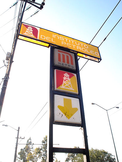
Directions to Instituto del Petróleo (Tultitlán) with public transportation
The following transit lines have routes that pass near Instituto del Petróleo
How to get to Instituto del Petróleo by bus?
Click on the bus route to see step by step directions with maps, line arrival times and updated time schedules.
How to get to Instituto del Petróleo by train?
Click on the train route to see step by step directions with maps, line arrival times and updated time schedules.
How to get to Instituto del Petróleo by metro?
Click on the metro route to see step by step directions with maps, line arrival times and updated time schedules.
Bus stops near Instituto del Petróleo in Tultitlán
- Instituto del Petróleo, 2 min walk,
- Frente A Metro Instituto del Petróleo, 2 min walk,
- Poniente 134, 2 min walk,
- Eje Central Lázaro Cárdenas - Ricarte, 2 min walk,
- Eje Central Lázaro Cárdenas - Pte. 134, 6 min walk,
- Eje Central Lázaro Cardenas - Eje 4 Norte Av. Fortuna, 6 min walk,
Metro stations near Instituto del Petróleo in Tultitlán
- Politécnico, 11 min walk,
- Vallejo, 31 min walk,
Bus lines to Instituto del Petróleo in Tultitlán
- L1, Autobuses del Norte - Autobuses del Sur,
- LÍNEA 1, Nochebús: Autobuses del Norte - Autobuses del Sur,
- RUTA 1, La Raza - Acueducto de Guadalupe,
- RUTA 1, Oficinas Pemex por Coyoacán-Metro Coyoacán-Paseo acoxpa,
- RUTA 3, Metro Normal - Instituto del Petróleo,
- RUTA AB 04, Pantitlán - Pescadores,
- RUTA 88, Metro Revolución - U.H. Acueducto de Guadalupe,
- RUTA 88, La Raza - Reclusorio,
- RUTA 106, Metro Normal - Metro Instituto del Petróleo,
- 145, ,
- 324, ,
- 23, Joaquin Pardave/ José Rolon,
- 27-A, C. C. Metro Hidalgo/Alameda Central - Valerio Trujano/Av. Hidalgo,
- 103, La Raza,
- Z1, 2.7 La Raza-Cantil,
- 144, Santiaguito,
- 146, C.U.,
- RUTA 1, La Raza,
- 15A, Av. Ceylan - Av. Central,
What are the closest stations to Instituto del Petróleo?
The closest stations to Instituto del Petróleo are:
- Instituto del Petróleo is 68 meters away, 2 min walk.
- Frente A Metro Instituto del Petróleo is 89 meters away, 2 min walk.
- Poniente 134 is 89 meters away, 2 min walk.
- Eje Central Lázaro Cárdenas - Ricarte is 91 meters away, 2 min walk.
- Eje Central Lázaro Cárdenas - Pte. 134 is 359 meters away, 6 min walk.
- Eje Central Lázaro Cardenas - Eje 4 Norte Av. Fortuna is 381 meters away, 6 min walk.
- Politécnico is 857 meters away, 11 min walk.
- Vallejo is 2389 meters away, 31 min walk.
Which bus lines stop near Instituto del Petróleo?
These bus lines stop near Instituto del Petróleo: 248, 6, RUTA 1, RUTA 88, Z1.
Which train line stops near Instituto del Petróleo?
BUENAVISTA - CUAUTITLÁN
Which metro lines stop near Instituto del Petróleo?
These metro lines stop near Instituto del Petróleo: 5, 6.
What’s the nearest metro station to Instituto del Petróleo in Tultitlán?
The nearest metro station to Instituto del Petróleo in Tultitlán is Politécnico. It’s a 11 min walk away.
What’s the nearest bus stop to Instituto del Petróleo in Tultitlán?
The nearest bus stops to Instituto del Petróleo in Tultitlán are Instituto del Petróleo, Frente A Metro Instituto del Petróleo, Poniente 134 and Eje Central Lázaro Cárdenas - Ricarte. The closest one is a 2 min walk away.
What time is the first metro to Instituto del Petróleo in Tultitlán?
The 5 is the first metro that goes to Instituto del Petróleo in Tultitlán. It stops nearby at 5:00 AM.
What time is the last metro to Instituto del Petróleo in Tultitlán?
The 5 is the last metro that goes to Instituto del Petróleo in Tultitlán. It stops nearby at 12:30 AM.
What time is the first bus to Instituto del Petróleo in Tultitlán?
The LÍNEA 1 is the first bus that goes to Instituto del Petróleo in Tultitlán. It stops nearby at 3:03 AM.
What time is the last bus to Instituto del Petróleo in Tultitlán?
The LÍNEA 1 is the last bus that goes to Instituto del Petróleo in Tultitlán. It stops nearby at 2:47 AM.
See Instituto del Petróleo, Tultitlán, on the map
Public Transit to Instituto del Petróleo in Tultitlán
Wondering how to get to Instituto del Petróleo in Tultitlán, México? Moovit helps you find the best way to get to Instituto del Petróleo with step-by-step directions from the nearest public transit station.
Moovit provides free maps and live directions to help you navigate through your city. View schedules, routes, timetables, and find out how long does it take to get to Instituto del Petróleo in real time.
Looking for the nearest stop or station to Instituto del Petróleo? Check out this list of stops closest to your destination: Instituto del Petróleo; Frente A Metro Instituto del Petróleo; Poniente 134; Eje Central Lázaro Cárdenas - Ricarte; Eje Central Lázaro Cárdenas - Pte. 134; Eje Central Lázaro Cardenas - Eje 4 Norte Av. Fortuna; Politécnico; Vallejo.
Bus: 248, 6, RUTA 1, RUTA 88, Z1, L1, LÍNEA 1, RUTA 3, 23, 27-A, 103, 144, 146.Train: BUENAVISTA - CUAUTITLÁN.Metro: 5, 6.
Want to see if there’s another route that gets you there at an earlier time? Moovit helps you find alternative routes or times. Get directions from and directions to Instituto del Petróleo easily from the Moovit App or Website.
We make riding to Instituto del Petróleo easy, which is why over 1.5 million users, including users in Tultitlán, trust Moovit as the best app for public transit. You don’t need to download an individual bus app or train app, Moovit is your all-in-one transit app that helps you find the best bus time or train time available.
For information on prices of bus, metro and train, costs and ride fares to Instituto del Petróleo, please check the Moovit app.
Use the app to navigate to popular places including to the airport, hospital, stadium, grocery store, mall, coffee shop, school, college, and university.
Instituto del Petróleo Address: Avenida Lázaro Cárdenas street in Tultitlán
Attractions near Instituto del Petróleo
How to get to popular places in Ciudad de Mexico with public transit
Get around Tultitlán by public transit!
Traveling around Tultitlán has never been so easy. See step by step directions as you travel to any attraction, street or major public transit station. View bus and train schedules, arrival times, service alerts and detailed routes on a map, so you know exactly how to get to anywhere in Tultitlán.
When traveling to any destination around Tultitlán use Moovit's Live Directions with Get Off Notifications to know exactly where and how far to walk, how long to wait for your line, and how many stops are left. Moovit will alert you when it's time to get off — no need to constantly re-check whether yours is the next stop.
Wondering how to use public transit in Tultitlán or how to pay for public transit in Tultitlán? Moovit public transit app can help you navigate your way with public transit easily, and at minimum cost. It includes public transit fees, ticket prices, and costs. Looking for a map of Tultitlán public transit lines? Moovit public transit app shows all public transit maps in Tultitlán with all bus, metro or train routes and stops on an interactive map.
Tultitlán has 3 transit type(s), including: bus, metro or train, operated by several transit agencies, including STC (Metro CDMX), Metrobús, RTP, Trolebús elevado, Trolebús, Tren El Insurgente, Tren Ligero, Corredores Concesionados, Ferrocarriles Suburbanos, Mexibus, Mexicable, Cablebús, Puma Bus, Peseros and Autobuses / Combis