How to get to Insyte Flo Intelligent Automation by bus?
Click on the bus route to see step by step directions with maps, line arrival times and updated time schedules.
From Brooklyn Center Transit Station, Brooklyn Center
46 minFrom Restaurant Depot, Brooklyn Center
53 minFrom Farmer's Markets, Minneapolis
33 minFrom Starling, Edina
44 minFrom University of Northwestern St Paul, Arden Hills
74 minFrom Bandana Square, St. Paul
40 minFrom Target St Paul Midway, St. Paul
34 minFrom Afton Alps, Golden Valley
30 minFrom Mabs Recovery Center, Minneapolis
46 minFrom Concordia University, St. Paul
48 min
Bus stops near Insyte Flo Intelligent Automation in Minneapolis
Light Rail stations near Insyte Flo Intelligent Automation in Minneapolis
- Warehouse/Hennepin Avewarehouse/Hennepin Avenue, 44 min walk,VIEW
Bus lines to Insyte Flo Intelligent Automation in Minneapolis
- 22, Brklyn Ctr Tc / N Lyndale / Via Penn Av,VIEW
- 755, Ltd Stop / Downtown / Gold Vall Rd,VIEW
- 764, Express / Winnetka / Starlite Ctr,VIEW
- 784, Trip 1 / Maple Grove / Transit Sta,VIEW
- 465, Burnsville-Minneapolis-U of M,VIEW
- 475, Apple Valley-Cedar Grove-Mpls/U of M,VIEW
- 490, Prior Lake-Shakopee-Minneapolis,VIEW
- 470, Eagan Transit Station,VIEW
- 472, Rosemount Transit Station,VIEW
- METRO ORANGE LINE, Orange Burnsville,VIEW
- 17, Mtka Blvd / 24st-Uptown / Downtown,VIEW
- 18, Downtown,VIEW
- 467, Express / Downtown Minneapolis,VIEW
- 156, Express / 56st-Xerxes,VIEW
- 600, Express / Southdale / Goldtri / Swsta / Ecrk,VIEW
- 645, Ltd Stop / Wayzata,VIEW
- 460, Burnsville-Minneapolis,VIEW
- 477, Lakeville/Apple Valley-Mpls,VIEW
- 493, Shakopee-Minneapolis,VIEW
What are the closest stations to Insyte Flo Intelligent Automation?
The closest stations to Insyte Flo Intelligent Automation are:
- 4th Ave S & 4th St S is 180 yards away, 3 min walk.
- 4th St S & 2nd Ave / 3rd Ave S is 185 yards away, 3 min walk.
- 4th St S at 2nd Ave is 202 yards away, 3 min walk.
- 4 Av S at 5 St NW Corner is 330 yards away, 5 min walk.
- Gateway Ramp Layover is 381 yards away, 5 min walk.
- Gateway Ramp & Platform is 397 yards away, 6 min walk.
- Gateway Ramp is 455 yards away, 6 min walk.
- Warehouse/Hennepin Avewarehouse/Hennepin Avenue is 3699 yards away, 44 min walk.
Which bus lines stop near Insyte Flo Intelligent Automation?
These bus lines stop near Insyte Flo Intelligent Automation: 22, 3, 5, 645, 94, METRO ORANGE LINE.
Which light rail line stops near Insyte Flo Intelligent Automation?
METRO GREEN LINE (Mpls-Target Field)
What’s the nearest bus station to Insyte Flo Intelligent Automation in Minneapolis?
The nearest bus stations to Insyte Flo Intelligent Automation in Minneapolis are 4th Ave S & 4th St S, 4th St S & 2nd Ave / 3rd Ave S and 4th St S at 2nd Ave. The closest one is a 3 min walk away.
What time is the first light rail to Insyte Flo Intelligent Automation in Minneapolis?
The METRO BLUE LINE is the first light rail that goes to Insyte Flo Intelligent Automation in Minneapolis. It stops nearby at 4:24 AM.
What time is the last light rail to Insyte Flo Intelligent Automation in Minneapolis?
The METRO BLUE LINE is the last light rail that goes to Insyte Flo Intelligent Automation in Minneapolis. It stops nearby at 12:48 AM.
What time is the first bus to Insyte Flo Intelligent Automation in Minneapolis?
The 18 is the first bus that goes to Insyte Flo Intelligent Automation in Minneapolis. It stops nearby at 4:07 AM.
What time is the last bus to Insyte Flo Intelligent Automation in Minneapolis?
The 22 is the last bus that goes to Insyte Flo Intelligent Automation in Minneapolis. It stops nearby at 1:14 AM.
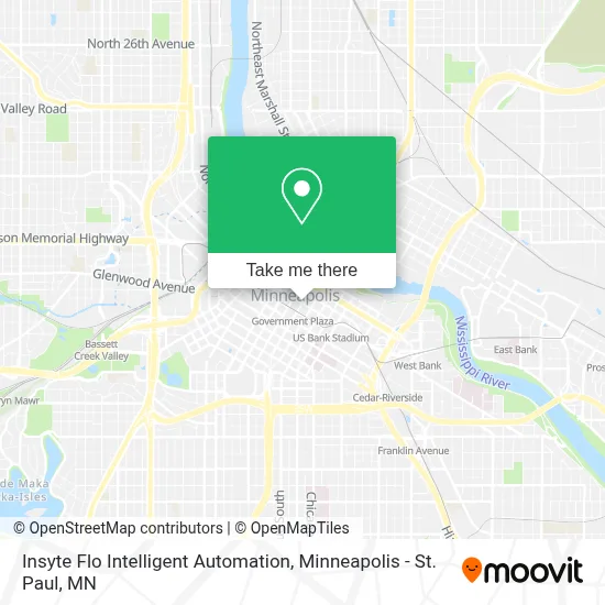
See Insyte Flo Intelligent Automation, Minneapolis, on the map
Public Transit to Insyte Flo Intelligent Automation in Minneapolis
Wondering how to get to Insyte Flo Intelligent Automation in Minneapolis? Moovit helps you find the best way to get to Insyte Flo Intelligent Automation with step-by-step directions from the nearest public transit station.
Moovit provides free maps and live directions to help you navigate through your city. View schedules, routes, timetables, and find out how long does it take to get to Insyte Flo Intelligent Automation in real time.
Looking for the nearest stop or station to Insyte Flo Intelligent Automation? Check out this list of stops closest to your destination: 4th Ave S & 4th St S; 4th St S & 2nd Ave / 3rd Ave S; 4th St S at 2nd Ave; 4 Av S at 5 St NW Corner; Gateway Ramp Layover; Gateway Ramp & Platform; Gateway Ramp; Warehouse/Hennepin Avewarehouse/Hennepin Avenue.
Bus: 22, 3, 5, 645, 94, METRO ORANGE LINE, 755, 764, 784, 465, 475, 490, 470, 472, 17, 18, 467, 156, 600.Light Rail: METRO GREEN LINE.
Want to see if there’s another route that gets you there at an earlier time? Moovit helps you find alternative routes or times. Get directions from and directions to Insyte Flo Intelligent Automation easily from the Moovit App or Website.
We make riding to Insyte Flo Intelligent Automation easy, which is why over 1.7 million users, including users in Minneapolis, trust Moovit as the best app for public transit. You don’t need to download an individual bus app or train app, Moovit is your all-in-one transit app that helps you find the best bus time or train time available.
For information on prices of bus and light rail, costs and ride fares to Insyte Flo Intelligent Automation, please check the Moovit app.
Use the app to navigate to popular places including to the airport, hospital, stadium, grocery store, mall, coffee shop, school, college, and university.
Insyte Flo Intelligent Automation Address: 400 4th St S street in Minneapolis
- Chain of Lakes,
- Hennepin County Sheriff's Office,
- Social Security,
- Bar Zia,
- United States Courthouse And Federal Building,
- Courthouse Municipal Ramp,
- Gateway Parking Ramp,
- Government Center Plaza,
- Sexworld,
- Ryan Pacyga Criminal Defense,
- Classic Cookie Co.,
- Cortland Mill District,
- Washington Av S at 3 Av S / 4 Av S S Corner,
- Eato,
- Minneapolis Government Center DVS, Aka DMV,
- Maple Grove, City of,
- Charley's Coffee Shop,
- Jr Thai Food And Such,
- Emery, Autograph Collection,
- State Of Minnesota Board Of Public Defense
Places Near Insyte Flo Intelligent Automation (Minneapolis)
- Minneapolis Institute of Art, Minneapolis,
- Grand Casino Hinckley,MN, Minneapolis,
- St. Paul College, St. Paul,
- Bishop Henry Whipple Federal Building,
- Minneapolis Sculpture Garden, Minneapolis,
- Orpheum Theatre (Minneapolis, Minnesota), Minneapolis,
- 3m Arena at Mariucci, Minneapolis,
- Mystic lake casino bus, Minneapolis,
- Mpls. Convention Center, Minneapolis,
- Abbott Northwestern Piper Building, Minneapolis,
- Target Center, Minneapolis,
- Minnesota State Capitol, St. Paul,
- Minnehaha Falls, Minneapolis,
- Huntington Bank Stadium, Minneapolis,
- Surly Brewing Co., Minneapolis,
- Target Field, Minneapolis,
- Harriet Island Regional Park, St. Paul,
- Treasure Island Resort & Casino, St. Paul,
- Northrop Auditorium, Minneapolis,
- Xcel Energy Center, St. Paul
How to get to popular places in Minneapolis - St. Paul, MN with public transit
Get around Minneapolis by public transit!
Traveling around Minneapolis has never been so easy. See step by step directions as you travel to any attraction, street or major public transit station. View bus and train schedules, arrival times, service alerts and detailed routes on a map, so you know exactly how to get to anywhere in Minneapolis.
When traveling to any destination around Minneapolis use Moovit's Live Directions with Get Off Notifications to know exactly where and how far to walk, how long to wait for your line, and how many stops are left. Moovit will alert you when it's time to get off — no need to constantly re-check whether yours is the next stop.
Wondering how to use public transit in Minneapolis or how to pay for public transit in Minneapolis? Moovit public transit app can help you navigate your way with public transit easily, and at minimum cost. It includes public transit fees, ticket prices, and costs. Looking for a map of Minneapolis public transit lines? Moovit public transit app shows all public transit maps in Minneapolis with all Bus, Train and Light Rail routes and stops on an interactive map.
Minneapolis - St. Paul, MN has 3 transit type(s), including: Bus, Train and Light Rail, operated by several transit agencies, including Metro Transit , Metro Transit, MVTA, Plymouth Metrolink, SouthWest Transit, Maple Grove, University of Minnesota, Airport (MAC), Amtrak, Mankato Transit System, SMART, FlixBus-us and Greyhound-us