Directions to Intan Refill (Kota Bandung) with public transportation
The following transit lines have routes that pass near Intan Refill
 Bus: 20, 34, CIMAHI-LEUWIPANJANG VIA TAGOG, DAMRI 6A, LW.PANJANG-PADALARANG.
- Train: B, C.
How to get to Intan Refill by bus?
Click on the bus route to see step by step directions with maps, line arrival times and updated time schedules.
From Pusat Pengobatan Terapi Listrik Kang Asep, Kota Bandung
69 minFrom Jl.parakansaat gg.jamhari no.45 rt.02 rw.23 antapani, Bandung
69 minFrom Braga city, Cimahi
53 minFrom Graha Manggala Siliwangi, Kota Bandung
35 minFrom Jatiwangi - Majalengka, Kota Bandung
53 minFrom Pantai Santolo, Kota Bandung
62 minFrom Gegerkalong Hilir, Kota Bandung
39 minFrom Telkom University, Bandung
48 minFrom Jalan Ciwastra Bandung, Bandung
53 minFrom Dago-Bandung, Cimahi
36 min
How to get to Intan Refill by train?
Click on the train route to see step by step directions with maps, line arrival times and updated time schedules.
Bus stops near Intan Refill in Kota Bandung
Train station near Intan Refill in Kota Bandung
- Stasiun Bandung (Lokal), 31 min walk,VIEW
Bus lines to Intan Refill in Kota Bandung
- 21, Sederhana,VIEW
- 34, Caringin,VIEW
- MAHMUD-TEGALEGA, Mahmud,VIEW
- 20, Bumi Asri,VIEW
- 27, Derwati,VIEW
- 17, Dago - Pasar Induk Caringin,VIEW
- CIMAHI-LEUWIPANJANG VIA TAGOG, Cimahi - Tagog - Leuwipanjang,VIEW
- LW.PANJANG-PADALARANG, Leuwipanjang - Cimahi - Padalarang,VIEW
- TMB F2, Summarecon - Cibeureum (Feeder),VIEW
- TMB K1, Cibiru - Cibeureum,VIEW
- TMP 1D, Leuwipanjang - RSUD Otto Iskandar Dinata,VIEW
- DAMRI 6A, Elang,VIEW
- BS 04, Cibiru,VIEW
- 04, Elang,VIEW
What are the closest stations to Intan Refill?
The closest stations to Intan Refill are:
- Masjid Jami Al Istiqomah is 505 meters away, 7 min walk.
- Jalan Holis 209 is 712 meters away, 10 min walk.
- Jalan Raya Cijerah 218 is 732 meters away, 10 min walk.
- Sumber Sari Junction is 950 meters away, 13 min walk.
- Sumbersari is 970 meters away, 13 min walk.
- Ypp Teknik (Holis) is 1588 meters away, 21 min walk.
- Pertigaan Jalan Holis is 1659 meters away, 22 min walk.
- Stasiun Bandung (Lokal) is 2400 meters away, 31 min walk.
Which bus lines stop near Intan Refill?
These bus lines stop near Intan Refill: 20, 34, CIMAHI-LEUWIPANJANG VIA TAGOG, DAMRI 6A, LW.PANJANG-PADALARANG.
Which train line stops near Intan Refill?
B (Padalarang—Cicalengka)
What’s the nearest bus station to Intan Refill in Kota Bandung?
The nearest bus station to Intan Refill in Kota Bandung is Masjid Jami Al Istiqomah. It’s a 7 min walk away.
What time is the first train to Intan Refill in Kota Bandung?
The B is the first train that goes to Intan Refill in Kota Bandung. It stops nearby at 5:05 AM.
What time is the last train to Intan Refill in Kota Bandung?
The B is the last train that goes to Intan Refill in Kota Bandung. It stops nearby at 12:57 AM.
What time is the first bus to Intan Refill in Kota Bandung?
The 20 is the first bus that goes to Intan Refill in Kota Bandung. It stops nearby at 4:05 AM.
What time is the last bus to Intan Refill in Kota Bandung?
The LW.PANJANG-PADALARANG is the last bus that goes to Intan Refill in Kota Bandung. It stops nearby at 12:36 AM.
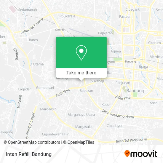
See Intan Refill, Kota Bandung, on the map
Public Transit to Intan Refill in Kota Bandung
Wondering how to get to Intan Refill in Kota Bandung? Moovit helps you find the best way to get to Intan Refill with step-by-step directions from the nearest public transit station.
Moovit provides free maps and live directions to help you navigate through your city. View schedules, routes, timetables, and find out how long does it take to get to Intan Refill in real time.
Looking for the nearest stop or station to Intan Refill? Check out this list of stops closest to your destination: Masjid Jami Al Istiqomah; Jalan Holis 209; Jalan Raya Cijerah 218; Sumber Sari Junction; Sumbersari; Ypp Teknik (Holis); Pertigaan Jalan Holis; Stasiun Bandung (Lokal).
Bus: 20, 34, CIMAHI-LEUWIPANJANG VIA TAGOG, DAMRI 6A, LW.PANJANG-PADALARANG, 21, MAHMUD-TEGALEGA, 27, 17, TMB F2, TMB K1.Train: B, C.
Want to see if there’s another route that gets you there at an earlier time? Moovit helps you find alternative routes or times. Get directions from and directions to Intan Refill easily from the Moovit App or Website.
We make riding to Intan Refill easy, which is why over 1.5 million users, including users in Kota Bandung, trust Moovit as the best app for public transit. You don’t need to download an individual bus app or train app, Moovit is your all-in-one transit app that helps you find the best bus time or train time available.
For information on prices of bus and train, costs and ride fares to Intan Refill, please check the Moovit app.
Use the app to navigate to popular places including to the airport, hospital, stadium, grocery store, mall, coffee shop, school, college, and university.
Intan Refill Address: Jalan Cijerah Bandung Kota 40212 street in Kota Bandung
- Parahyangan Ac,
- Daus Variasi Motor,
- Pangkalan Lpg 3 Kg Ita Juwita Ningrum,
- PT. Kaldu Sari Nabati Indonesia,
- Ganesha Operation,
- Comfort Laundry,
- CV Cipta Sandang,
- Holis/Bojong,
- Xcc BP Maman,
- Produsen Syal Rajut,
- Yayan,
- Dreamcore It Solution,
- Nagamas 88 Telecom Holis,
- PT Setia Sapta,
- Apotek Restu Ibu,
- Nature Nata Jelly Motif,
- Pegadaian,
- PT Bintang Harapan Makmur,
- Apotek Nurkholis Farma,
- Wahana Logistik
Places Near Intan Refill (Kota Bandung)
- Jl.L.L.R.E.Martadinata no.47,Bandung Regency, Bandung,
- Subang, Kota Bandung,
- Stadion Gelora Bandung Lautan Api (GBLA), Kota Bandung,
- Bus Damri Dipati Ukur-Jatinangor, Bandung,
- YYY, Kota Bandung,
- Summarecon Mall Bandung, Kota Bandung,
- Rumah Sakit Hasan Sadikin, Kota Bandung,
- Warung bokep, Bandung,
- RSUP Dr. Hasan Sadikin (RSHS), Kota Bandung,
- 23 Paskal Shopping Mall, Kota Bandung,
- Taman Hutan Raya (TAHURA), Kota Bandung,
- Batujajar, Bandung,
- Rs Hasan Sadikin, Kota Bandung,
- Trans Studio Mall (TSM), Kota Bandung,
- Cililin, Kab. Bandung Barat, Bandung,
- bus damri “Dago - Leuwi panjang”, Kota Bandung,
- Pasteur, Kota Bandung,
- Braga, Kota Bandung,
- Pantai Santolo - Pameungpeuk Garut, Bandung,
- Universitas Pendidikan Indonesia (UPI), Kota Bandung
How to get to popular places in Bandung with public transit
Get around Kota Bandung by public transit!
Traveling around Kota Bandung has never been so easy. See step by step directions as you travel to any attraction, street or major public transit station. View bus and train schedules, arrival times, service alerts and detailed routes on a map, so you know exactly how to get to anywhere in Kota Bandung.
When traveling to any destination around Kota Bandung use Moovit's Live Directions with Get Off Notifications to know exactly where and how far to walk, how long to wait for your line, and how many stops are left. Moovit will alert you when it's time to get off — no need to constantly re-check whether yours is the next stop.
Wondering how to use public transit in Kota Bandung or how to pay for public transit in Kota Bandung? Moovit public transit app can help you navigate your way with public transit easily, and at minimum cost. It includes public transit fees, ticket prices, and costs. Looking for a map of Kota Bandung public transit lines? Moovit public transit app shows all public transit maps in Kota Bandung with all Bus and Train routes and stops on an interactive map.
Bandung has 2 transit type(s), including: Bus and Train, operated by several transit agencies, including Trans Metro Bandung, Trans Metro Pasundan - Teman Bus, Angkutan Antarkota Dalam Provinsi, DAMRI, KAI Commuter, Angkutan Kota Bandung, Angkutan Kabupaten Bandung, Kobanter Baru, Bus Wisata DISHUB Kota Bandung, Bus Sekolah DISHUB Kota Bandung and Dinas Perhubungan Provinsi Jawa Barat