Directions to Intelligent Manufacturing Software (Boston) with public transportation
The following transit lines have routes that pass near Intelligent Manufacturing Software
 Bus: 1, 15.
- Train: DOWNEASTER, HAVERHILL.
How to get to Intelligent Manufacturing Software by bus?
Click on the bus route to see step by step directions with maps, line arrival times and updated time schedules.
From Andover, MA, Andover
97 minFrom Lawrence, Massachusetts, Lawrence
53 minFrom Lawrence, MA, Lawrence
55 minFrom Phillips Academy Andover, Andover
103 minFrom Rockingham Mall Salem New Hampshire, Lawrence
55 minFrom Amesbury, MA, Amesbury
82 minFrom Northern Essex Community College, Haverhill
60 minFrom Methuen, Methuen Town
71 min
Bus stop near Intelligent Manufacturing Software in Boston
- Reasearch Dr & Creek Brook Dr, 15 min walk,VIEW
Train stations near Intelligent Manufacturing Software in Boston
- Haverhill, 50 min walk,VIEW
Bus lines to Intelligent Manufacturing Software in Boston
- 15, Haverhill Commons,VIEW
What are the closest stations to Intelligent Manufacturing Software?
The closest stations to Intelligent Manufacturing Software are:
- Reasearch Dr & Creek Brook Dr is 1295 yards away, 15 min walk.
- Haverhill is 4245 yards away, 50 min walk.
Which bus lines stop near Intelligent Manufacturing Software?
These bus lines stop near Intelligent Manufacturing Software: 1, 15.
What’s the nearest bus station to Intelligent Manufacturing Software in Boston?
The nearest bus station to Intelligent Manufacturing Software in Boston is Reasearch Dr & Creek Brook Dr. It’s a 15 min walk away.
What time is the first train to Intelligent Manufacturing Software in Boston?
The HAVERHILL is the first train that goes to Intelligent Manufacturing Software in Boston. It stops nearby at 5:27 AM.
What time is the last train to Intelligent Manufacturing Software in Boston?
The HAVERHILL is the last train that goes to Intelligent Manufacturing Software in Boston. It stops nearby at 12:53 AM.
What time is the first bus to Intelligent Manufacturing Software in Boston?
The 15 is the first bus that goes to Intelligent Manufacturing Software in Boston. It stops nearby at 5:53 AM.
What time is the last bus to Intelligent Manufacturing Software in Boston?
The 15 is the last bus that goes to Intelligent Manufacturing Software in Boston. It stops nearby at 6:58 PM.
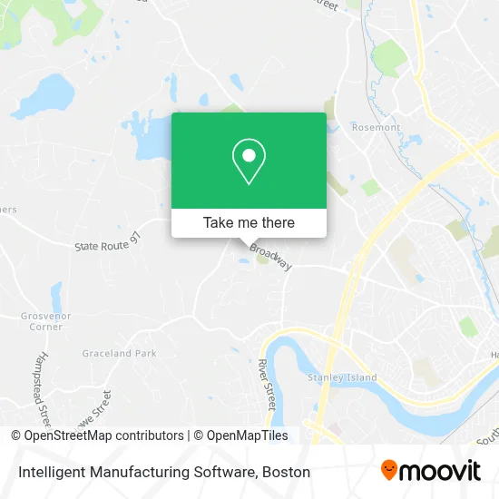
See Intelligent Manufacturing Software, Boston, on the map
Public Transit to Intelligent Manufacturing Software in Boston
Wondering how to get to Intelligent Manufacturing Software in Boston? Moovit helps you find the best way to get to Intelligent Manufacturing Software with step-by-step directions from the nearest public transit station.
Moovit provides free maps and live directions to help you navigate through your city. View schedules, routes, timetables, and find out how long does it take to get to Intelligent Manufacturing Software in real time.
Looking for the nearest stop or station to Intelligent Manufacturing Software? Check out this list of stops closest to your destination: Reasearch Dr & Creek Brook Dr; Haverhill.
Bus: 1, 15.Train: DOWNEASTER, HAVERHILL.
Want to see if there’s another route that gets you there at an earlier time? Moovit helps you find alternative routes or times. Get directions from and directions to Intelligent Manufacturing Software easily from the Moovit App or Website.
We make riding to Intelligent Manufacturing Software easy, which is why over 1.7 million users, including users in Boston, trust Moovit as the best app for public transit. You don’t need to download an individual bus app or train app, Moovit is your all-in-one transit app that helps you find the best bus time or train time available.
For information on prices of bus and train, costs and ride fares to Intelligent Manufacturing Software, please check the Moovit app.
Use the app to navigate to popular places including to the airport, hospital, stadium, grocery store, mall, coffee shop, school, college, and university.
Intelligent Manufacturing Software Address: 800 Broadway street in Boston
- All Glass,
- JM Digital Graphics,
- Bunker Building & Remodeling LLC,
- Solid Slice Pizzeria and Pub,
- ATM,
- Brewer's Market,
- One Stop,
- Body Works,
- Nikol Olivieri - Hairstylist,
- Salon Nikol & Spa, Elite Laser Center,
- Dunkin',
- Hans Kissle Salads,
- Cathi Sherar Realtor,
- Locksmith Day And Night,
- Hard Body Meals,
- Functional Nutrition Rd,
- Advantage Health Massage,
- Mark Lique, DC,
- Maple Wellness Center,
- Sol Shine Bronzing Salon
Places Near Intelligent Manufacturing Software (Boston)
- Isabella Stewart Gardner Museum, Boston,
- North End, Boston,
- Mgm Music Hall, Boston,
- Leader Bank Pavilion (Leader Bank Pavillion), Boston,
- Quincy Market, Boston,
- Massachusetts General Hospital, Boston,
- Boston Convention & Exhibition Center, Boston,
- Castle Island, Boston,
- Museum Of Science, Boston,
- Td Garden, Boston,
- Faneuil Hall, Boston,
- House Of Blues, Boston,
- Boston Children's Hospital, Boston,
- Wang Theater, Boston,
- Cheers, Boston,
- Wilbur Theatre, Boston,
- Boston Medical Center, Boston,
- Boston Common, Boston,
- Seaport District, Boston,
- Prudential Center, Boston
How to get to popular places in Boston with public transit
Get around Boston by public transit!
Traveling around Boston has never been so easy. See step by step directions as you travel to any attraction, street or major public transit station. View bus and train schedules, arrival times, service alerts and detailed routes on a map, so you know exactly how to get to anywhere in Boston.
When traveling to any destination around Boston use Moovit's Live Directions with Get Off Notifications to know exactly where and how far to walk, how long to wait for your line, and how many stops are left. Moovit will alert you when it's time to get off — no need to constantly re-check whether yours is the next stop.
Wondering how to use public transit in Boston or how to pay for public transit in Boston? Moovit public transit app can help you navigate your way with public transit easily, and at minimum cost. It includes public transit fees, ticket prices, and costs. Looking for a map of Boston public transit lines? Moovit public transit app shows all public transit maps in Boston with all Bus, Train, Subway and Ferry routes and stops on an interactive map.
Boston has 4 transit type(s), including: Bus, Train, Subway and Ferry, operated by several transit agencies, including MBTA, Southeastern Regional Transit Authority, MetroWest Regional Transit Authority, Rhode Island Public Transit Authority, WRTA, Lowell Regional Transit Authority, Merrimack Valley Transit, Montachusett Regional Transit Authority, Cape Cod Regional Transit Authority, Brockton Area Transit Authority, Martha's Vineyard Transit Authority, the WAVE - Nantucket Regional Transit Authority, GATRA, Cape Ann Transportation Authority and Massport