Directions to Inter Ortopedi (Bahçelievler) with public transportation
The following transit lines have routes that pass near Inter Ortopedi
 Bus: 31, 31E, 73, 76D, 89K.
- Metro: M1A.
- Train: B1.
- Dolmus & Minibus: BAKIRKÖY-ŞIRINEVLER-FATIH MAH, KULELI-HALKALI-ORTA MAHALLE-KAYAŞEHIR-BAŞAKŞEHIR ÇAM VE SAKURA HASTANESI, KULELI-KSS-ŞAHINTEPE, A31, A31.
How to get to Inter Ortopedi by bus?
Click on the bus route to see step by step directions with maps, line arrival times and updated time schedules.
From Burdur 58. piyade Er Eğitim Alayı, Zeytinburnu
33 minFrom Halic Altin Boynuz, Beyoğlu
67 minFrom Halkalı, Küçükçekmece
50 minFrom Küçükçekmece Ağız ve Diş Sağlığı Hastanesi, Küçükçekmece
40 minFrom Zeyrekhane, Fatih
51 minFrom Avrasya Hastanesi Gaziosmanpaşa, Gaziosmanpasa
68 minFrom Haseki Eğitim ve Araştırma Hastanesi, Fatih
42 minFrom İstanbul İl Nüfus Müdürlüğü, Fatih
68 minFrom Eminönü/Fatih, Fatih
64 minFrom Tersane İstanbul, Beyoğlu
66 min
How to get to Inter Ortopedi by train?
Click on the train route to see step by step directions with maps, line arrival times and updated time schedules.
How to get to Inter Ortopedi by metro?
Click on the metro route to see step by step directions with maps, line arrival times and updated time schedules.
From Burdur 58. piyade Er Eğitim Alayı, Zeytinburnu
38 minFrom Halic Altin Boynuz, Beyoğlu
72 minFrom Halkalı, Küçükçekmece
71 minFrom Zeyrekhane, Fatih
66 minFrom Avrasya Hastanesi Gaziosmanpaşa, Gaziosmanpasa
86 minFrom Haseki Eğitim ve Araştırma Hastanesi, Fatih
53 minFrom İstanbul İl Nüfus Müdürlüğü, Fatih
70 minFrom Eminönü/Fatih, Fatih
65 minFrom Tersane İstanbul, Beyoğlu
72 min
Dolmus & Minibus stations near Inter Ortopedi in Bahçelievler
Bus stops near Inter Ortopedi in Bahçelievler
Bus lines to Inter Ortopedi in Bahçelievler
- 55Y, Sadabad Osmanlı Arşivi-Yenibosna Metro,VIEW
- HT10, Batışehir - Yenibosna Metro,VIEW
- HT11, Giyimkent - Kuyumcukent,VIEW
- HT13, Yeni Mahalle Metro - Zeytinburnu,VIEW
- 31, Kuyumcukent - Yenikapı,VIEW
- 31E, Kuyumcukent - Eminönü,VIEW
- 36CY, Cebeci - Yenibosna Metro,VIEW
- E-57, Esenkent Bahçeşehir - Bakırköy,VIEW
- 73, Yenibosna Metro- Taksim,VIEW
- 73B, Florya - Bakırköy,VIEW
- 73F, Florya - Taksim,VIEW
- 76, Beylikdüzü - Bakırköy,VIEW
- 76D, Bahçeşehir / Esenkent - Taksim,VIEW
- 76V, Kiptaş Vaditepe - Bakırköy,VIEW
- 78ZB, Fenertepe Peron/Başakşehir - Zeytinburnu,VIEW
- 79B, Kayaşehir - Bakırköy,VIEW
- 79G, Kayaşehir - Zeytinburnu,VIEW
- 82, Kuyumcukent - Eminönü,VIEW
- 89, K.S.S. Hastanesi/Atakent-Aksaray,VIEW
- 89A, K.S.S. Hastanesi - Zeytinburnu,VIEW
What are the closest stations to Inter Ortopedi?
The closest stations to Inter Ortopedi are:
- Zümrüt Sokak is 43 meters away, 1 min walk.
- Kamu Sağliği - Şirinevler Yönü is 90 meters away, 2 min walk.
- Fetih Caddesi - Soğanli Yönü is 117 meters away, 2 min walk.
- Fetih Caddesi-2 is 246 meters away, 4 min walk.
- Fetih Caddesi is 276 meters away, 4 min walk.
- Ataköy Geçit - Avcilar Yönü is 285 meters away, 4 min walk.
- Çocuk Sitesi - Şirinevler Yönü is 742 meters away, 10 min walk.
Which bus lines stop near Inter Ortopedi?
These bus lines stop near Inter Ortopedi: 31, 31E, 73, 76D, 89K, 97, 98, MK97.
Which metro line stops near Inter Ortopedi?
M1A (Yenikapı→Atatürk Havalimanı)
Which train line stops near Inter Ortopedi?
B1 (Halkalı)
Which Dolmus & Minibus lines stop near Inter Ortopedi?
These Dolmus & Minibus lines stop near Inter Ortopedi: BAKIRKÖY-ŞIRINEVLER-FATIH MAH, KULELI-HALKALI-ORTA MAHALLE-KAYAŞEHIR-BAŞAKŞEHIR ÇAM VE SAKURA HASTANESI, KULELI-KSS-ŞAHINTEPE.
What’s the nearest bus station to Inter Ortopedi in Bahçelievler?
The nearest bus station to Inter Ortopedi in Bahçelievler is Kamu Sağliği - Şirinevler Yönü. It’s a 2 min walk away.
What’s the nearest Dolmus & Minibus station to Inter Ortopedi in Bahçelievler?
The nearest Dolmus & Minibus station to Inter Ortopedi in Bahçelievler is Zümrüt Sokak. It’s a 1 min walk away.
What time is the first bus to Inter Ortopedi in Bahçelievler?
The HVL - 4 is the first bus that goes to Inter Ortopedi in Bahçelievler. It stops nearby at 3:03 AM.
What time is the last bus to Inter Ortopedi in Bahçelievler?
The HVL - 4 is the last bus that goes to Inter Ortopedi in Bahçelievler. It stops nearby at 3:12 AM.
What time is the first Dolmus & Minibus to Inter Ortopedi in Bahçelievler?
The TAKSIM - ŞIRINEVLER - YENIBOSNA is the first Dolmus & Minibus that goes to Inter Ortopedi in Bahçelievler. It stops nearby at 3:00 AM.
What time is the last Dolmus & Minibus to Inter Ortopedi in Bahçelievler?
The TAKSIM - ŞIRINEVLER - YENIBOSNA is the last Dolmus & Minibus that goes to Inter Ortopedi in Bahçelievler. It stops nearby at 3:09 AM.
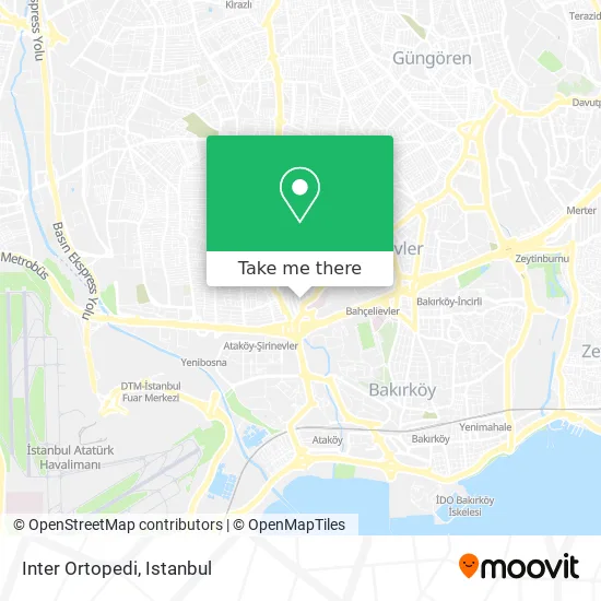
See Inter Ortopedi, Bahçelievler, on the map
Public Transit to Inter Ortopedi in Bahçelievler
Wondering how to get to Inter Ortopedi in Bahçelievler? Moovit helps you find the best way to get to Inter Ortopedi with step-by-step directions from the nearest public transit station.
Moovit provides free maps and live directions to help you navigate through your city. View schedules, routes, timetables, and find out how long does it take to get to Inter Ortopedi in real time.
Looking for the nearest stop or station to Inter Ortopedi? Check out this list of stops closest to your destination: Zümrüt Sokak; Kamu Sağliği - Şirinevler Yönü; Fetih Caddesi - Soğanli Yönü; Fetih Caddesi-2; Fetih Caddesi; Ataköy Geçit - Avcilar Yönü; Çocuk Sitesi - Şirinevler Yönü.
Bus: 31, 31E, 73, 76D, 89K, 97, 98, MK97, 55Y, HT10, HT11, HT13, TAKSIM - ŞIRINEVLER - YENIBOSNA.Metro: M1A.Train: B1.Dolmus & Minibus: BAKIRKÖY-ŞIRINEVLER-FATIH MAH, KULELI-HALKALI-ORTA MAHALLE-KAYAŞEHIR-BAŞAKŞEHIR ÇAM VE SAKURA HASTANESI, KULELI-KSS-ŞAHINTEPE, A31, A31, A31, A31, A31, A03, MK97, 98E, A02.
Want to see if there’s another route that gets you there at an earlier time? Moovit helps you find alternative routes or times. Get directions from and directions to Inter Ortopedi easily from the Moovit App or Website.
We make riding to Inter Ortopedi easy, which is why over 1.5 million users, including users in Bahçelievler, trust Moovit as the best app for public transit. You don’t need to download an individual bus app or train app, Moovit is your all-in-one transit app that helps you find the best bus time or train time available.
For information on prices of bus, metro, Dolmus & Minibus, train and tram, costs and ride fares to Inter Ortopedi, please check the Moovit app.
Use the app to navigate to popular places including to the airport, hospital, stadium, grocery store, mall, coffee shop, school, college, and university.
Inter Ortopedi Address: Sultan Selim Caddesi, 6 34180 Siyavuşpaşa, İstanbul street in Bahçelievler
- Cem Sultan Şok,
- Gardenya Eczanesi,
- siyavuşpaşa uefa kupası gs,
- Şirinevler,
- Ok Apt,
- IPS GROUP SAN.VE TİC.LTD.ŞTİ,
- Barutoglu Apt,
- Cem Sultan Sokak, 18a,
- Opoden Ortez Protez ve,
- Paşam Studio Garage,
- İstanbul Oto Plaka - App Plaka & Pleksi Plakalık,
- #AppCity App Plaka Plexi Plakalık,
- Balkar Saatcılık,
- Egzoz Market (Kumandalı Egzoz),
- Nitek Optik,
- Istanbul Aydin University Central Library,
- Bahçelievler Philips Servis,
- Jant Lastik Body Kit Modifikasyon Merkezi,
- Nazar Oto,
- Oto Far Merkezi
Places Near Inter Ortopedi (Bahçelievler)
- Hilltown AVM, Maltepe,
- Gebze Koop Durağı, Gebze,
- Mehmet Emin Tokadî Hz. Türbesi, Fatih,
- Bakırköy Sosyete Pazarı, Bakirköy,
- 41 Burda AVM, Kocaeli Merkezi,
- İstanbul,
- İstinye Park, Sariyer,
- Gebze-Harem Minibüs Hattı, Gebze,
- Mall Of İstanbul, Basaksehir,
- Karaköy Genelevi, Karaköy, Beyoğlu,
- VİALAND AVM, Eyüp,
- Beylikdüzü - 4 Nolu Minibüs Hattı, Beylikduzu,
- 2 Nolu Minibüss, Beylikduzu,
- Topkule Kışlası 47.Komando Tugay Komutanlığı, Esenler,
- METROPOL IsTaNBuL, Ataşehir,
- Hz. Yuşa Tepesi, Beykoz,
- 212 AVM, Bagcilar,
- Şehit Prof. Dr. İlhan Varank Eğitim Ve Araştırma Hastanesi, Sancaktepe,
- Başakşehir Çam Ve Sakura Şehir Hastanesi, Basaksehir,
- Tersane İstanbul, Beyoğlu
How to get to popular places in Istanbul with public transit
Get around Bahçelievler by public transit!
Traveling around Bahçelievler has never been so easy. See step by step directions as you travel to any attraction, street or major public transit station. View bus and train schedules, arrival times, service alerts and detailed routes on a map, so you know exactly how to get to anywhere in Bahçelievler.
When traveling to any destination around Bahçelievler use Moovit's Live Directions with Get Off Notifications to know exactly where and how far to walk, how long to wait for your line, and how many stops are left. Moovit will alert you when it's time to get off — no need to constantly re-check whether yours is the next stop.
Wondering how to use public transit in Bahçelievler or how to pay for public transit in Bahçelievler? Moovit public transit app can help you navigate your way with public transit easily, and at minimum cost. It includes public transit fees, ticket prices, and costs. Looking for a map of Bahçelievler public transit lines? Moovit public transit app shows all public transit maps in Bahçelievler with all Bus, Train, Metro, Tram, Ferry, Metrobus and Dolmus & Minibus routes and stops on an interactive map.
Istanbul has 7 transit type(s), including: Bus, Train, Metro, Tram, Ferry, Metrobus and Dolmus & Minibus, operated by several transit agencies, including Marmaray, Metro İstanbul, Metrobüs, UAB, İETT, İETT ÇIFT KATLI HATLAR, İETT BÖLGESEL HATLAR, TCDD, Şehir Hatları, Dentur Avrasya, Beyden, Turyol, Mavi Marmara, Havaist and Prenstur
