How to get to Intermède by bus?
Click on the bus route to see step by step directions with maps, line arrival times and updated time schedules.
From Circuit Alain Prost, Le Mans
78 minFrom Piscine Les Atlantides, Le Mans
64 minFrom ZAC DU CORMIER, Mulsanne
74 minFrom Viandes Despi, Allonnes
50 minFrom ZAC des Hunaudières, Le Mans
77 minFrom MMA Espace P, Le Mans
50 minFrom Jardiland, Ruaudin
82 minFrom Usine Yoplait Le Mans, Le Mans
46 minFrom Barre De Péage D'Auvours, Changé
85 min
Bus stops near Intermède in Le Mans
Bus lines to Intermède in Le Mans
What are the closest stations to Intermède?
The closest stations to Intermède are:
- Gallière is 198 meters away, 3 min walk.
- Léard is 465 meters away, 6 min walk.
- Thomas Edison is 567 meters away, 8 min walk.
- Collège La Madeleine is 586 meters away, 8 min walk.
- Zone Industrielle Nord is 858 meters away, 12 min walk.
- Ste-Catherine is 1078 meters away, 14 min walk.
- Lafayette is 3002 meters away, 39 min walk.
Which bus lines stop near Intermède?
These bus lines stop near Intermède: 14, 17, 20.
What’s the nearest bus station to Intermède in Le Mans?
The nearest bus station to Intermède in Le Mans is Gallière. It’s a 3 min walk away.
What time is the first light rail to Intermède in Le Mans?
The T1 is the first light rail that goes to Intermède in Le Mans. It stops nearby at 5:24 AM.
What time is the last light rail to Intermède in Le Mans?
The T1 is the last light rail that goes to Intermède in Le Mans. It stops nearby at 1:03 AM.
What time is the first bus to Intermède in Le Mans?
The 17 is the first bus that goes to Intermède in Le Mans. It stops nearby at 6:30 AM.
What time is the last bus to Intermède in Le Mans?
The 7 is the last bus that goes to Intermède in Le Mans. It stops nearby at 10:25 PM.
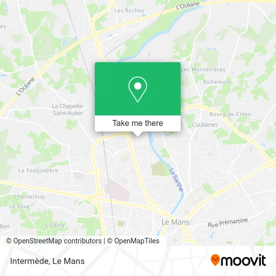
See Intermède, Le Mans, on the map
Public Transit to Intermède in Le Mans
Wondering how to get to Intermède in Le Mans? Moovit helps you find the best way to get to Intermède with step-by-step directions from the nearest public transit station.
Moovit provides free maps and live directions to help you navigate through your city. View schedules, routes, timetables, and find out how long does it take to get to Intermède in real time.
Looking for the nearest stop or station to Intermède? Check out this list of stops closest to your destination: Gallière; Léard; Thomas Edison; Collège La Madeleine; Zone Industrielle Nord; Ste-Catherine; Lafayette.
Bus: 14, 17, 20, 7, 102, 11, 28, 162, 163.
Want to see if there’s another route that gets you there at an earlier time? Moovit helps you find alternative routes or times. Get directions from and directions to Intermède easily from the Moovit App or Website.
We make riding to Intermède easy, which is why over 1.5 million users, including users in Le Mans, trust Moovit as the best app for public transit. You don’t need to download an individual bus app or train app, Moovit is your all-in-one transit app that helps you find the best bus time or train time available.
For information on prices of bus and light rail, costs and ride fares to Intermède, please check the Moovit app.
Use the app to navigate to popular places including to the airport, hospital, stadium, grocery store, mall, coffee shop, school, college, and university.
Intermède Address: Avenue Georges Duhamel 72000 Le Mans street in Le Mans
- Takko Fashion,
- Beauregard Auto,
- Guy,
- Centre Commercial Beauregard,
- Agapanthe,
- IZIVIA Express,
- Centrakor,
- Amazon Locker-Ildut,
- Resto Abi,
- Amazon Locker-Venerable,
- Avenue Rhin et Danube,
- Boutique Gusto Café,
- Babou le Mans,
- Garczynski Traploir Energie,
- lidl,
- Station de recharge pour véhicules électriques,
- Sevdec,
- Cultura,
- E.Leclerc Drive,
- ZA Le Parc Manceau
Places Near Intermède (Le Mans)
- Pôle Santé Sud-Elsan, Le Mans,
- Coulaines, Coulaines,
- Université, Le Mans,
- Circuit des 24 Heures du Mans, Le Mans,
- Centre Hospitalier Du Mans, Le Mans,
- Avenue Bollée, Le Mans,
- Auchan le Mans, La Chapelle-Saint-Aubin,
- Clinique Du Pré, Le Mans,
- Family Village, Ruaudin,
- Place des Jacobins (le Mans), Le Mans,
- E.Leclerc, Le Mans,
- La Chapelle-Saint-Aubin, La Chapelle-Saint-Aubin,
- Clinique Pôle Santé Sud, Le Mans,
- Hôpital, Le Mans,
- Gare SNCF du Mans, Le Mans,
- Saint-Saturnin, Saint-Saturnin,
- Camp du 2e RIMa, Champagné,
- Maison D'Arrêt Le Mans - Les Croisettes, Coulaines,
- Parc Des Expositions, Le Mans,
- Changé, Changé
How to get to popular places in Le Mans with public transit
Get around Le Mans by public transit!
Traveling around Le Mans has never been so easy. See step by step directions as you travel to any attraction, street or major public transit station. View bus and train schedules, arrival times, service alerts and detailed routes on a map, so you know exactly how to get to anywhere in Le Mans.
When traveling to any destination around Le Mans use Moovit's Live Directions with Get Off Notifications to know exactly where and how far to walk, how long to wait for your line, and how many stops are left. Moovit will alert you when it's time to get off — no need to constantly re-check whether yours is the next stop.
Wondering how to use public transit in Le Mans or how to pay for public transit in Le Mans? Moovit public transit app can help you navigate your way with public transit easily, and at minimum cost. It includes public transit fees, ticket prices, and costs. Looking for a map of Le Mans public transit lines? Moovit public transit app shows all public transit maps in Le Mans with all Bus and Light Rail routes and stops on an interactive map.
Le Mans has 2 transit type(s), including: Bus and Light Rail, operated by several transit agencies, including SETRAM