Directions to International Auto Works (Boston) with public transportation
The following transit lines have routes that pass near International Auto Works
 Bus: 11, NCS, 10, MWES.
- Train: FRAMINGHAM/WORCESTER.
How to get to International Auto Works by bus?
Click on the bus route to see step by step directions with maps, line arrival times and updated time schedules.
From Lasell College, Newton
105 minFrom I-95 / Route 128 & Route 16 Interchange (Exit 21), Newton
87 minFrom Framingham, MA, Framingham
49 minFrom Newton Wellesley Hospital Green Building, Newton
91 minFrom Bose Corp, Framingham
87 minFrom Babson College, Wellesley
82 minFrom Newton-Wellesley Hospital, Newton
91 minFrom Boston Marriott Newton, Newton
114 min
How to get to International Auto Works by train?
Click on the train route to see step by step directions with maps, line arrival times and updated time schedules.
Bus stops near International Auto Works in Boston
Train station near International Auto Works in Boston
- West Natick, 50 min walk,VIEW
Bus lines to International Auto Works in Boston
What are the closest stations to International Auto Works?
The closest stations to International Auto Works are:
- Natick Common is 133 yards away, 2 min walk.
- Natick Center Mbta is 170 yards away, 3 min walk.
- West Natick is 4243 yards away, 50 min walk.
Which bus lines stop near International Auto Works?
These bus lines stop near International Auto Works: 11, NCS.
Which train line stops near International Auto Works?
FRAMINGHAM/WORCESTER (#521 | Worcester)
What’s the nearest bus station to International Auto Works in Boston?
The nearest bus station to International Auto Works in Boston is Natick Common. It’s a 2 min walk away.
What time is the first train to International Auto Works in Boston?
The FRAMINGHAM/WORCESTER is the first train that goes to International Auto Works in Boston. It stops nearby at 4:59 AM.
What time is the last train to International Auto Works in Boston?
The FRAMINGHAM/WORCESTER is the last train that goes to International Auto Works in Boston. It stops nearby at 12:41 AM.
What time is the first bus to International Auto Works in Boston?
The NCS is the first bus that goes to International Auto Works in Boston. It stops nearby at 6:50 AM.
What time is the last bus to International Auto Works in Boston?
The 11 is the last bus that goes to International Auto Works in Boston. It stops nearby at 8:15 PM.
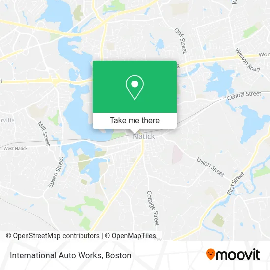
See International Auto Works, Boston, on the map
Public Transit to International Auto Works in Boston
Wondering how to get to International Auto Works in Boston? Moovit helps you find the best way to get to International Auto Works with step-by-step directions from the nearest public transit station.
Moovit provides free maps and live directions to help you navigate through your city. View schedules, routes, timetables, and find out how long does it take to get to International Auto Works in real time.
Looking for the nearest stop or station to International Auto Works? Check out this list of stops closest to your destination: Natick Common; Natick Center Mbta; West Natick.
Bus: 11, NCS, 10, MWES.Train: FRAMINGHAM/WORCESTER.
Want to see if there’s another route that gets you there at an earlier time? Moovit helps you find alternative routes or times. Get directions from and directions to International Auto Works easily from the Moovit App or Website.
We make riding to International Auto Works easy, which is why over 1.7 million users, including users in Boston, trust Moovit as the best app for public transit. You don’t need to download an individual bus app or train app, Moovit is your all-in-one transit app that helps you find the best bus time or train time available.
For information on prices of bus and train, costs and ride fares to International Auto Works, please check the Moovit app.
Use the app to navigate to popular places including to the airport, hospital, stadium, grocery store, mall, coffee shop, school, college, and university.
International Auto Works Address: 9 Middlesex Ave street in Boston
- Kimura BJJ Natick,
- Alibaba Locksmith,
- David B. Zirlen Law Offices,
- Culligan Water Conditioning of Cape Cod, Ma,
- Kell's Beer Company and Tap Room,
- Sound & Spirit,
- Kate Rose Photography,
- Heads Up Hair Salon of Natick,
- Bradford Brew House,
- European Violin Studio,
- William Raveis Real Estate - Natick, Ma,
- Sasa's Tree Care and Landscaping,
- Chitika,
- Estate Realty,
- Horne & Johnson Architects,
- Nexus Property 1000,
- Ofm Enterprises,
- Natick Democratic Town Comm,
- Ryan Connors,
- Natick Center
Places Near International Auto Works (Boston)
- Castle Island, Boston,
- Isabella Stewart Gardner Museum, Boston,
- Td Garden, Boston,
- Wilbur Theatre, Boston,
- Boston Common, Boston,
- Wang Theater, Boston,
- Faneuil Hall, Boston,
- Museum Of Science, Boston,
- Seaport District, Boston,
- Massachusetts General Hospital, Boston,
- Boston Convention & Exhibition Center, Boston,
- Boston Medical Center, Boston,
- Prudential Center, Boston,
- Leader Bank Pavilion (Leader Bank Pavillion), Boston,
- Quincy Market, Boston,
- North End, Boston,
- House Of Blues, Boston,
- Mgm Music Hall, Boston,
- Cheers, Boston,
- Boston Children's Hospital, Boston
How to get to popular places in Boston with public transit
Get around Boston by public transit!
Traveling around Boston has never been so easy. See step by step directions as you travel to any attraction, street or major public transit station. View bus and train schedules, arrival times, service alerts and detailed routes on a map, so you know exactly how to get to anywhere in Boston.
When traveling to any destination around Boston use Moovit's Live Directions with Get Off Notifications to know exactly where and how far to walk, how long to wait for your line, and how many stops are left. Moovit will alert you when it's time to get off — no need to constantly re-check whether yours is the next stop.
Wondering how to use public transit in Boston or how to pay for public transit in Boston? Moovit public transit app can help you navigate your way with public transit easily, and at minimum cost. It includes public transit fees, ticket prices, and costs. Looking for a map of Boston public transit lines? Moovit public transit app shows all public transit maps in Boston with all Bus, Train, Subway and Ferry routes and stops on an interactive map.
Boston has 4 transit type(s), including: Bus, Train, Subway and Ferry, operated by several transit agencies, including MBTA, Southeastern Regional Transit Authority, MetroWest Regional Transit Authority, Rhode Island Public Transit Authority, WRTA, Lowell Regional Transit Authority, Merrimack Valley Transit, Montachusett Regional Transit Authority, Cape Cod Regional Transit Authority, Brockton Area Transit Authority, Martha's Vineyard Transit Authority, the WAVE - Nantucket Regional Transit Authority, GATRA, Cape Ann Transportation Authority and Massport