How to get to Intoxalock by bus?
Click on the bus route to see step by step directions with maps, line arrival times and updated time schedules.
From Lawrence, Massachusetts, Lawrence
42 minFrom Rockingham Mall Salem New Hampshire, Lawrence
43 minFrom Phillips Academy Andover, Andover
91 minFrom Parque de las ardillas, Lawrence
40 minFrom Andover, MA, Andover
85 minFrom Lawrence, MA, Lawrence
43 minFrom Methuen, Methuen Town
59 minFrom QRD, Methuen Town
58 min
How to get to Intoxalock by train?
Click on the train route to see step by step directions with maps, line arrival times and updated time schedules.
Bus stops near Intoxalock in Haverhill
Train stations near Intoxalock in Haverhill
- Haverhill, 40 min walk,VIEW
Bus lines to Intoxalock in Haverhill
- 17, Salisbury Beach,VIEW
- 11, Pond Street - Cvs,VIEW
- 13, Stateline Plaza (T.J. Maxx),VIEW
- 18, Rivers Edge Plaza,VIEW
- 14, Washington Square Transit Center,VIEW
- 15, Haverhill Commons,VIEW
- 16, Westgate Plaza,VIEW
- 1, Washington Square Transit Center,VIEW
- HAVERHILL LINE SHUTTLE, Haverhill - Andover,VIEW
- HAVERHILL LINE SHUTTLE, Haverhill - Reading (Express),VIEW
- HAVERHILL LINE SHUTTLE, Haverhill - Reading (Local),VIEW
- HAVERHILL LINE SHUTTLE, Haverhill - Bradford,VIEW
- HAVERHILL LINE SHUTTLE, Haverhill - Malden Center,VIEW
- HAVERHILL LINE SHUTTLE, Haverhill - North Station,VIEW
What are the closest stations to Intoxalock?
The closest stations to Intoxalock are:
- Emerson St & Merrimack St is 27 yards away, 1 min walk.
- Washington Square is 94 yards away, 2 min walk.
- 191 Merrimack Street - Bank Of America is 100 yards away, 2 min walk.
- Elliot Place is 101 yards away, 2 min walk.
- Washington Square Transit Center is 147 yards away, 3 min walk.
- Haverhill is 1039 yards away, 13 min walk.
Which bus lines stop near Intoxalock?
These bus lines stop near Intoxalock: 1, 11, 14.
Which train line stops near Intoxalock?
HAVERHILL (#223 | Haverhill)
What’s the nearest bus station to Intoxalock in Haverhill?
The nearest bus station to Intoxalock in Haverhill is Emerson St & Merrimack St. It’s a 1 min walk away.
What time is the first train to Intoxalock in Haverhill?
The HAVERHILL is the first train that goes to Intoxalock in Haverhill. It stops nearby at 5:27 AM.
What time is the last train to Intoxalock in Haverhill?
The HAVERHILL is the last train that goes to Intoxalock in Haverhill. It stops nearby at 12:53 AM.
What time is the first bus to Intoxalock in Haverhill?
The 1 is the first bus that goes to Intoxalock in Haverhill. It stops nearby at 5:00 AM.
What time is the last bus to Intoxalock in Haverhill?
The 1 is the last bus that goes to Intoxalock in Haverhill. It stops nearby at 9:45 PM.
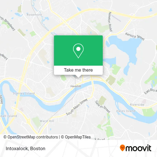
See Intoxalock, Haverhill, on the map
Public Transit to Intoxalock in Haverhill
Wondering how to get to Intoxalock in Haverhill? Moovit helps you find the best way to get to Intoxalock with step-by-step directions from the nearest public transit station.
Moovit provides free maps and live directions to help you navigate through your city. View schedules, routes, timetables, and find out how long does it take to get to Intoxalock in real time.
Looking for the nearest stop or station to Intoxalock? Check out this list of stops closest to your destination: Emerson St & Merrimack St; Washington Square; 191 Merrimack Street - Bank Of America; Elliot Place; Washington Square Transit Center; Haverhill.
Bus: 1, 11, 14, 17, 13, 18.Train: HAVERHILL, DOWNEASTER.
Want to see if there’s another route that gets you there at an earlier time? Moovit helps you find alternative routes or times. Get directions from and directions to Intoxalock easily from the Moovit App or Website.
We make riding to Intoxalock easy, which is why over 1.7 million users, including users in Haverhill, trust Moovit as the best app for public transit. You don’t need to download an individual bus app or train app, Moovit is your all-in-one transit app that helps you find the best bus time or train time available.
For information on prices of bus and train, costs and ride fares to Intoxalock, please check the Moovit app.
Use the app to navigate to popular places including to the airport, hospital, stadium, grocery store, mall, coffee shop, school, college, and university.
Intoxalock Address: 42 Locust St street in Haverhill
- Insulation,
- Craft Dog Deli,
- Liquor Warehouse,
- Forghany Law PC,
- Halstead Haverhill,
- Pedro's,
- Creatorpult Design,
- Identogo,
- New England Health Transportation,
- US Eco Products,
- Greater Haverhill Foundation,
- PP*the Cogitation Zone,
- Veranda Outdoors Wholesale,
- A Saben Lynne Attorney,
- Laz Parking,
- Andover Family Craftsmen,
- Joseph's Trattoria Bakery Cafe,
- Wingate Condo Assoc,
- JMH Consulting,
- Chinburg Builders
Places Near Intoxalock (Haverhill)
- Boston Medical Center, Boston,
- Prudential Center, Boston,
- House Of Blues, Boston,
- Quincy Market, Boston,
- Boston Common, Boston,
- Museum Of Science, Boston,
- Isabella Stewart Gardner Museum, Boston,
- Seaport District, Boston,
- Leader Bank Pavilion (Leader Bank Pavillion), Boston,
- Castle Island, Boston,
- North End, Boston,
- Boston Children's Hospital, Boston,
- Boston Convention & Exhibition Center, Boston,
- Massachusetts General Hospital, Boston,
- Wilbur Theatre, Boston,
- Faneuil Hall, Boston,
- Cheers, Boston,
- Mgm Music Hall, Boston,
- Wang Theater, Boston,
- Td Garden, Boston
How to get to popular places in Boston with public transit
Get around Haverhill by public transit!
Traveling around Haverhill has never been so easy. See step by step directions as you travel to any attraction, street or major public transit station. View bus and train schedules, arrival times, service alerts and detailed routes on a map, so you know exactly how to get to anywhere in Haverhill.
When traveling to any destination around Haverhill use Moovit's Live Directions with Get Off Notifications to know exactly where and how far to walk, how long to wait for your line, and how many stops are left. Moovit will alert you when it's time to get off — no need to constantly re-check whether yours is the next stop.
Wondering how to use public transit in Haverhill or how to pay for public transit in Haverhill? Moovit public transit app can help you navigate your way with public transit easily, and at minimum cost. It includes public transit fees, ticket prices, and costs. Looking for a map of Haverhill public transit lines? Moovit public transit app shows all public transit maps in Haverhill with all Bus, Train, Subway and Ferry routes and stops on an interactive map.
Boston has 4 transit type(s), including: Bus, Train, Subway and Ferry, operated by several transit agencies, including MBTA, Southeastern Regional Transit Authority, MetroWest Regional Transit Authority, Rhode Island Public Transit Authority, WRTA, Lowell Regional Transit Authority, Merrimack Valley Transit, Montachusett Regional Transit Authority, Cape Cod Regional Transit Authority, Brockton Area Transit Authority, Martha's Vineyard Transit Authority, the WAVE - Nantucket Regional Transit Authority, GATRA, Cape Ann Transportation Authority and Massport