How to get to Inventor Academy by bus?
Click on the bus route to see step by step directions with maps, line arrival times and updated time schedules.
From Takeda, Lexington
131 minFrom Reading, MA, Reading
176 minFrom Wilmington, MA, Wilmington
100 minFrom Arlington, MA, Arlington
66 minFrom AWACS (Bldg 1612), Hanscom Afb
136 minFrom MIT Lincoln Laboratory, Lexington
125 minFrom Middlesex Superior Court, Woburn
91 minFrom Winchester, MA, Winchester
76 min
Bus stops near Inventor Academy in Boston
What are the closest stations to Inventor Academy?
The closest stations to Inventor Academy are:
- 28-30 Crosby Dr is 223 yards away, 4 min walk.
- Middlesex Tpk & Plank St is 1008 yards away, 13 min walk.
Which bus lines stop near Inventor Academy?
These bus lines stop near Inventor Academy: 13, 14, 354.
What’s the nearest bus station to Inventor Academy in Boston?
The nearest bus station to Inventor Academy in Boston is 28-30 Crosby Dr. It’s a 4 min walk away.
What time is the first bus to Inventor Academy in Boston?
The 14 is the first bus that goes to Inventor Academy in Boston. It stops nearby at 6:34 AM.
What time is the last bus to Inventor Academy in Boston?
The 14 is the last bus that goes to Inventor Academy in Boston. It stops nearby at 7:17 PM.
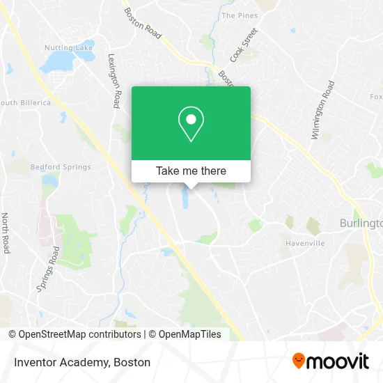
See Inventor Academy, Boston, on the map
Public Transit to Inventor Academy in Boston
Wondering how to get to Inventor Academy in Boston? Moovit helps you find the best way to get to Inventor Academy with step-by-step directions from the nearest public transit station.
Moovit provides free maps and live directions to help you navigate through your city. View schedules, routes, timetables, and find out how long does it take to get to Inventor Academy in real time.
Looking for the nearest stop or station to Inventor Academy? Check out this list of stops closest to your destination: 28-30 Crosby Dr; Middlesex Tpk & Plank St.
Bus: 13, 14, 354, 351.
Want to see if there’s another route that gets you there at an earlier time? Moovit helps you find alternative routes or times. Get directions from and directions to Inventor Academy easily from the Moovit App or Website.
We make riding to Inventor Academy easy, which is why over 1.7 million users, including users in Boston, trust Moovit as the best app for public transit. You don’t need to download an individual bus app or train app, Moovit is your all-in-one transit app that helps you find the best bus time or train time available.
For information on prices of bus and train, costs and ride fares to Inventor Academy, please check the Moovit app.
Use the app to navigate to popular places including to the airport, hospital, stadium, grocery store, mall, coffee shop, school, college, and university.
Inventor Academy Address: 54 Middlesex Tpke street in Boston
- Construction Recruiters of New England,
- Projectnet,
- Combo Advanced Classes,
- Rinn Transportation,
- Hampton Inn Boston Bedford Burlington Billerica,
- Satang Infinity Restaurant,
- DoubleTree by Hilton Boston - Bedford Glen,
- Affordable TV Repair,
- Casenet,
- Brady and Company,P.C,
- Astea International,
- Innovative Applied Solutions,
- Innoera,
- Emd Serono Research Center,
- Emd Serono,
- Conformis,
- Meals on Wheels,
- Gym,
- Supplyworks,
- Kaleido Biosciences
Places Near Inventor Academy (Boston)
- House Of Blues, Boston,
- Boston Children's Hospital, Boston,
- Leader Bank Pavilion (Leader Bank Pavillion), Boston,
- Prudential Center, Boston,
- North End, Boston,
- Boston Common, Boston,
- Quincy Market, Boston,
- Faneuil Hall, Boston,
- Isabella Stewart Gardner Museum, Boston,
- Wang Theater, Boston,
- Mgm Music Hall, Boston,
- Wilbur Theatre, Boston,
- Cheers, Boston,
- Castle Island, Boston,
- Museum Of Science, Boston,
- Boston Medical Center, Boston,
- Seaport District, Boston,
- Boston Convention & Exhibition Center, Boston,
- Massachusetts General Hospital, Boston,
- Td Garden, Boston
How to get to popular places in Boston with public transit
Get around Boston by public transit!
Traveling around Boston has never been so easy. See step by step directions as you travel to any attraction, street or major public transit station. View bus and train schedules, arrival times, service alerts and detailed routes on a map, so you know exactly how to get to anywhere in Boston.
When traveling to any destination around Boston use Moovit's Live Directions with Get Off Notifications to know exactly where and how far to walk, how long to wait for your line, and how many stops are left. Moovit will alert you when it's time to get off — no need to constantly re-check whether yours is the next stop.
Wondering how to use public transit in Boston or how to pay for public transit in Boston? Moovit public transit app can help you navigate your way with public transit easily, and at minimum cost. It includes public transit fees, ticket prices, and costs. Looking for a map of Boston public transit lines? Moovit public transit app shows all public transit maps in Boston with all Bus, Train, Subway and Ferry routes and stops on an interactive map.
Boston has 4 transit type(s), including: Bus, Train, Subway and Ferry, operated by several transit agencies, including MBTA, Southeastern Regional Transit Authority, MetroWest Regional Transit Authority, Rhode Island Public Transit Authority, WRTA, Lowell Regional Transit Authority, Merrimack Valley Transit, Montachusett Regional Transit Authority, Cape Cod Regional Transit Authority, Brockton Area Transit Authority, Martha's Vineyard Transit Authority, the WAVE - Nantucket Regional Transit Authority, GATRA, Cape Ann Transportation Authority and Massport