How to get to Invision Distinctive Eyewear by bus?
Click on the bus route to see step by step directions with maps, line arrival times and updated time schedules.
From Uptown Transit Center, Minneapolis
49 minFrom New Hope, Minnesota, New Hope
59 minFrom Economic Masonry, Minneapolis
59 minFrom Jordan, Minneapolis
59 minFrom I-394 and Hwy 100, Golden Valley
27 minFrom I-394 & Xenia/Park Place, St. Louis Park
21 minFrom Allina Health Cancer Institute - Piper Breast Center - Plymouth, Plymouth
36 minFrom Uptown, Minneapolis
53 minFrom Target, Crystal
76 minFrom 50th & France Downtown Edina, Edina
72 min
Bus stops near Invision Distinctive Eyewear in Minnetonka
Bus lines to Invision Distinctive Eyewear in Minnetonka
What are the closest stations to Invision Distinctive Eyewear?
The closest stations to Invision Distinctive Eyewear are:
- Wayzata Blvd & County Rd 73 is 77 yards away, 2 min walk.
- Hopkins Xroad - Co 73 & Wayzata Blvd N is 305 yards away, 4 min walk.
- Fairfield Rd & Co Rd 73 (Hopkins Xroad) is 429 yards away, 6 min walk.
- Co Rd 73 P&R & A Bay is 764 yards away, 10 min walk.
Which bus lines stop near Invision Distinctive Eyewear?
These bus lines stop near Invision Distinctive Eyewear: 615, 645, 774.
What’s the nearest bus station to Invision Distinctive Eyewear in Minnetonka?
The nearest bus station to Invision Distinctive Eyewear in Minnetonka is Wayzata Blvd & County Rd 73. It’s a 2 min walk away.
What time is the first bus to Invision Distinctive Eyewear in Minnetonka?
The 645 is the first bus that goes to Invision Distinctive Eyewear in Minnetonka. It stops nearby at 5:21 AM.
What time is the last bus to Invision Distinctive Eyewear in Minnetonka?
The 645 is the last bus that goes to Invision Distinctive Eyewear in Minnetonka. It stops nearby at 9:41 PM.
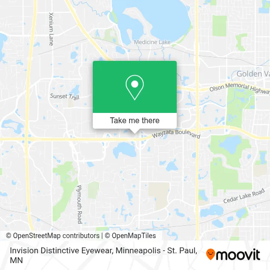
See Invision Distinctive Eyewear, Minnetonka, on the map
Public Transit to Invision Distinctive Eyewear in Minnetonka
Wondering how to get to Invision Distinctive Eyewear in Minnetonka? Moovit helps you find the best way to get to Invision Distinctive Eyewear with step-by-step directions from the nearest public transit station.
Moovit provides free maps and live directions to help you navigate through your city. View schedules, routes, timetables, and find out how long does it take to get to Invision Distinctive Eyewear in real time.
Looking for the nearest stop or station to Invision Distinctive Eyewear? Check out this list of stops closest to your destination: Wayzata Blvd & County Rd 73; Hopkins Xroad - Co 73 & Wayzata Blvd N; Fairfield Rd & Co Rd 73 (Hopkins Xroad); Co Rd 73 P&R & A Bay.
Bus: 615, 645, 774, 777, 795, 673.
Want to see if there’s another route that gets you there at an earlier time? Moovit helps you find alternative routes or times. Get directions from and directions to Invision Distinctive Eyewear easily from the Moovit App or Website.
We make riding to Invision Distinctive Eyewear easy, which is why over 1.7 million users, including users in Minnetonka, trust Moovit as the best app for public transit. You don’t need to download an individual bus app or train app, Moovit is your all-in-one transit app that helps you find the best bus time or train time available.
For information on prices of bus, costs and ride fares to Invision Distinctive Eyewear, please check the Moovit app.
Use the app to navigate to popular places including to the airport, hospital, stadium, grocery store, mall, coffee shop, school, college, and university.
Invision Distinctive Eyewear Address: 11300 Wayzata Blvd street in Minnetonka
- County Road 73 & Wayzata Boulevard,
- I-394 and Hopkins Crossroad,
- Ridgedale Mall & East Entrance,
- Metro Transit Park & Ride,
- Piprude Financial,
- Jordan Parks, Liberty Mutual Insurance Agent,
- Mary Pieri & Amp Prime Mortgage,
- Co Rd 73 (Hopkins Crossroad) & Fairfield Rd,
- Oakknoll Preschool,
- Inner Wellness Counseling & Psychotherapy,
- Kismet Inn,
- Envision Capital,
- Gilda's Club Twin Cities,
- Sher Thing Construction,
- Back To Balance Natural Healing Center,
- La Quinta Inn,
- Listing Courtesy of Edina Realty Inc,
- Pete Thoresen,
- Perspective 6 Group,
- Ridgedale - Sears Auto Center
Places Near Invision Distinctive Eyewear (Minnetonka)
- Treasure Island Resort & Casino, St. Paul,
- Target Field, Minneapolis,
- St. Paul College, St. Paul,
- Mystic lake casino bus, Minneapolis,
- Orpheum Theatre (Minneapolis, Minnesota), Minneapolis,
- Grand Casino Hinckley,MN, Minneapolis,
- Harriet Island Regional Park, St. Paul,
- Bishop Henry Whipple Federal Building,
- Mpls. Convention Center, Minneapolis,
- 3m Arena at Mariucci, Minneapolis,
- Minnehaha Falls, Minneapolis,
- Minneapolis Institute of Art, Minneapolis,
- Abbott Northwestern Piper Building, Minneapolis,
- Minneapolis Sculpture Garden, Minneapolis,
- Northrop Auditorium, Minneapolis,
- Xcel Energy Center, St. Paul,
- Minnesota State Capitol, St. Paul,
- Huntington Bank Stadium, Minneapolis,
- Target Center, Minneapolis,
- Surly Brewing Co., Minneapolis
How to get to popular places in Minneapolis - St. Paul, MN with public transit
Get around Minnetonka by public transit!
Traveling around Minnetonka has never been so easy. See step by step directions as you travel to any attraction, street or major public transit station. View bus and train schedules, arrival times, service alerts and detailed routes on a map, so you know exactly how to get to anywhere in Minnetonka.
When traveling to any destination around Minnetonka use Moovit's Live Directions with Get Off Notifications to know exactly where and how far to walk, how long to wait for your line, and how many stops are left. Moovit will alert you when it's time to get off — no need to constantly re-check whether yours is the next stop.
Wondering how to use public transit in Minnetonka or how to pay for public transit in Minnetonka? Moovit public transit app can help you navigate your way with public transit easily, and at minimum cost. It includes public transit fees, ticket prices, and costs. Looking for a map of Minnetonka public transit lines? Moovit public transit app shows all public transit maps in Minnetonka with all Bus, Train and Light Rail routes and stops on an interactive map.
Minneapolis - St. Paul, MN has 3 transit type(s), including: Bus, Train and Light Rail, operated by several transit agencies, including Metro Transit , Metro Transit, MVTA, Plymouth Metrolink, SouthWest Transit, Maple Grove, University of Minnesota, Airport (MAC), Amtrak, Mankato Transit System, SMART, FlixBus-us and Greyhound-us