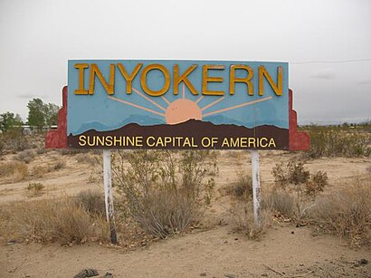
See Inyokern on the map
Directions to Inyokern with public transportation
The following transit lines have routes that pass near Inyokern
 Bus:
Bus:
How to get to Inyokern by bus?
Click on the bus route to see step by step directions with maps, line arrival times and updated time schedules.
Bus stations near Inyokern
- Transit Center / 3rd Street (771460),3 min walk,
- Inyokern Transfer Hub,3 min walk,
Bus lines to Inyokern
- 227,Cerro Coso Community College (2740476),
- 230,Wal-Mart/China Lake Blvd. (780704),
- L4,Ridgecrest,
What are the closest stations to Inyokern?
The closest stations to Inyokern are:
- Transit Center / 3rd Street (771460) is 209 yards away, 3 min walk.
- Inyokern Transfer Hub is 209 yards away, 3 min walk.
Which bus line stops near Inyokern?
L4
What’s the nearest bus stop to Inyokern?
The nearest bus stops to Inyokern are Transit Center / 3rd Street (771460) and Inyokern Transfer Hub. The closest one is a 3 min walk away.
What time is the first bus to Inyokern?
The L4 is the first bus that goes to Inyokern. It stops nearby at 7:05 AM.
What time is the last bus to Inyokern?
The L4 is the last bus that goes to Inyokern. It stops nearby at 3:42 PM.
How much is the bus fare to Inyokern?
The bus fare to Inyokern costs about $2.50.
See Inyokern on the map
Public Transportation to Inyokern
Wondering how to get to Inyokern, United States? Moovit helps you find the best way to get to Inyokern with step-by-step directions from the nearest public transit station.
Moovit provides free maps and live directions to help you navigate through your city. View schedules, routes, timetables, and find out how long does it take to get to Inyokern in real time.
Looking for the nearest stop or station to Inyokern? Check out this list of stops closest to your destination: Transit Center / 3rd Street (771460); Inyokern Transfer Hub.
Bus:
Want to see if there’s another route that gets you there at an earlier time? Moovit helps you find alternative routes or times. Get directions from and directions to Inyokern easily from the Moovit App or Website.
We make riding to Inyokern easy, which is why over 1.5 million users, including users in Bakersfield, CA, trust Moovit as the best app for public transit. You don’t need to download an individual bus app or train app, Moovit is your all-in-one transit app that helps you find the best bus time or train time available.
For information on prices of bus, costs and ride fares to Inyokern, please check the Moovit app.
Use the app to navigate to popular places including to the airport, hospital, stadium, grocery store, mall, coffee shop, school, college, and university.
Location: Bakersfield, CA
Popular routes to Inyokern
Popular routes from Inyokern
Attractions near Inyokern
Holiday Boutique,Las Cabañas,Holmes Pauline,Coin Cloud DCM,Inyokern,Inyokern, California,City of Inyorken,Inyokern Truck Bay,TEXACO,Sierra Breeze Sun & Swim Club,Desert Environmental & Equipment Company,Bertrand's High Desert Mobile Home & RV Park,Skinner Masonry,Sierra Group,Sierra Oil,U-Haulbuttermilk Acres,Owens Peak Medical Clinic,Ridgecrest Area Association,Tybrin,Tease SalonHow to get to popular attractions in Bakersfield, CA with public transit
BMO Harris Bank,Built Right Home Inspection,ChargePoint,Judy's Cleaning SE,Magnolia Payday Loans - Bakersfield,Student Housing East - Csub,Pacific Automotive,T & U Roofing, Ridgecrest,Kids Empire,Richard and Karri Christensen Realtor Bakersfield,Maggi Rojas, CMT, Ridgecrest,Entrance CA-99 S,Trust Services of Kern,Forever 21,PEP Boys,Quick Fuel,Intoxalock Ignition Interlock, Greenacres,Robles Shopping, Ridgecrest,Lou's Lessons - Guitar, Electric Bass, and Ukulele Lessons,Vigil DesignsGet around Bakersfield, CA by public transit!
Traveling around Bakersfield, CA has never been so easy. See step by step directions as you travel to any attraction, street or major public transit station. View bus and train schedules, arrival times, service alerts and detailed routes on a map, so you know exactly how to get to anywhere in Bakersfield, CA.
When traveling to any destination around Bakersfield, CA use Moovit's Live Directions with Get Off Notifications to know exactly where and how far to walk, how long to wait for your line, and how many stops are left. Moovit will alert you when it's time to get off — no need to constantly re-check whether yours is the next stop.
Wondering how to use public transit in Bakersfield, CA or how to pay for public transit in Bakersfield, CA? Moovit public transit app can help you navigate your way with public transit easily, and at minimum cost. It includes public transit fees, ticket prices, and costs. Looking for a map of Bakersfield, CA public transit lines? Moovit public transit app shows all public transit maps in Bakersfield, CA with all bus routes and stops on an interactive map.
Bakersfield, CA has 1 transit type(s), including: bus, operated by several transit agencies, including Golden Empire Transit District, Kern Transit, Delano Area Rapid Transit, Arvin Transit, Ridgerunner, Taft - Maricopa Area Transit, Amtrak, Greyhound-us, FlixBus-us and Megabus