Directions to Ironwood Piercing (Medford) with public transportation
The following transit lines have routes that pass near Ironwood Piercing
 Bus: 100, 108, 110, 134, 85.
- Subway: ORANGE LINE, GREEN LINE B, GREEN LINE C, GREEN LINE E.
How to get to Ironwood Piercing by bus?
Click on the bus route to see step by step directions with maps, line arrival times and updated time schedules.
From DCR Hatch Memorial Shell, Boston
81 minFrom FOUR POINTS BY SHERATON Boston Newton, Newton
88 minFrom Homewood Suites by Hilton Boston Brookline-Longwood Medical, Brookline
98 minFrom Samuel Adams Brewery, Boston
109 minFrom Harvard, Boston
58 minFrom East Boston, Boston
45 minFrom Jamaica Pond, Boston
93 minFrom Sam Adams Boston Brewery Tour, Boston
109 minFrom Woburn, MA, Woburn
46 minFrom Maverick Station, Boston
58 min
How to get to Ironwood Piercing by subway?
Click on the subway route to see step by step directions with maps, line arrival times and updated time schedules.
From DCR Hatch Memorial Shell, Boston
41 minFrom Homewood Suites by Hilton Boston Brookline-Longwood Medical, Brookline
56 minFrom Samuel Adams Brewery, Boston
40 minFrom Harvard, Boston
48 minFrom East Boston, Boston
30 minFrom Jamaica Pond, Boston
50 minFrom Sam Adams Boston Brewery Tour, Boston
40 minFrom Maverick Station, Boston
30 min
Bus stops near Ironwood Piercing in Medford
Subway stations near Ironwood Piercing in Medford
Bus lines to Ironwood Piercing in Medford
- 100, Elm St,VIEW
- 108, Wellington,VIEW
- 134, North Woburn Via Veterans Senior Center,VIEW
- 97, Wellington - Malden,VIEW
- 99, Wellington - Woodland Rd,VIEW
- 106, Wellington - Lebanon Loop,VIEW
- 110, Wellington - Wonderland,VIEW
- 112, Wood Island via Market Basket & Admiral's Hill - Wellington via Admiral's Hill & Market Basket,VIEW
- ORANGE LINE SHUTTLE, North Station - Oak Grove (Local),VIEW
- ORANGE LINE SHUTTLE, North Station - Wellington (Express),VIEW
- ORANGE LINE SHUTTLE, North Station - Wellington (Local),VIEW
What are the closest stations to Ironwood Piercing?
The closest stations to Ironwood Piercing are:
- Fellsway @ Middlesex Ave - Wellington Circle is 470 yards away, 6 min walk.
- Wellington is 536 yards away, 7 min walk.
- Magoun Station is 3180 yards away, 38 min walk.
Which bus lines stop near Ironwood Piercing?
These bus lines stop near Ironwood Piercing: 100, 108, 110, 134, 85.
Which subway line stops near Ironwood Piercing?
ORANGE LINE (Oak Grove)
What’s the nearest subway station to Ironwood Piercing in Medford?
The nearest subway station to Ironwood Piercing in Medford is Wellington. It’s a 27 min walk away.
What’s the nearest bus station to Ironwood Piercing in Medford?
The nearest bus station to Ironwood Piercing in Medford is Fellsway @ Middlesex Ave - Wellington Circle. It’s a 6 min walk away.
What time is the first subway to Ironwood Piercing in Medford?
The GREEN LINE E is the first subway that goes to Ironwood Piercing in Medford. It stops nearby at 4:51 AM.
What time is the last subway to Ironwood Piercing in Medford?
The GREEN LINE E is the last subway that goes to Ironwood Piercing in Medford. It stops nearby at 2:38 AM.
What time is the first bus to Ironwood Piercing in Medford?
The 110 is the first bus that goes to Ironwood Piercing in Medford. It stops nearby at 4:50 AM.
What time is the last bus to Ironwood Piercing in Medford?
The 110 is the last bus that goes to Ironwood Piercing in Medford. It stops nearby at 2:09 AM.
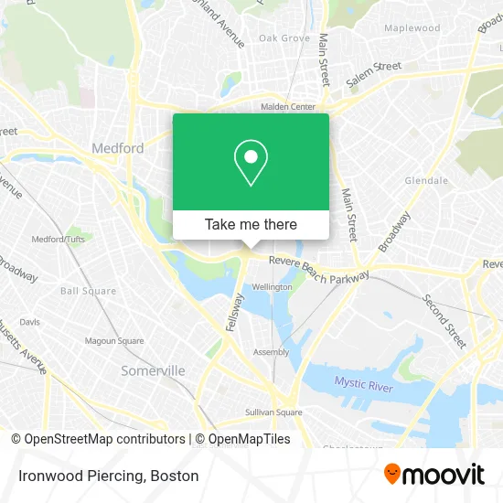
See Ironwood Piercing, Medford, on the map
Public Transit to Ironwood Piercing in Medford
Wondering how to get to Ironwood Piercing in Medford? Moovit helps you find the best way to get to Ironwood Piercing with step-by-step directions from the nearest public transit station.
Moovit provides free maps and live directions to help you navigate through your city. View schedules, routes, timetables, and find out how long does it take to get to Ironwood Piercing in real time.
Looking for the nearest stop or station to Ironwood Piercing? Check out this list of stops closest to your destination: Fellsway @ Middlesex Ave - Wellington Circle; Wellington; Magoun Station.
Bus: 100, 108, 110, 134, 85, 97, 99, 106, 112.Subway: ORANGE LINE, GREEN LINE B, GREEN LINE C, GREEN LINE E.
Want to see if there’s another route that gets you there at an earlier time? Moovit helps you find alternative routes or times. Get directions from and directions to Ironwood Piercing easily from the Moovit App or Website.
We make riding to Ironwood Piercing easy, which is why over 1.7 million users, including users in Medford, trust Moovit as the best app for public transit. You don’t need to download an individual bus app or train app, Moovit is your all-in-one transit app that helps you find the best bus time or train time available.
For information on prices of subway and bus, costs and ride fares to Ironwood Piercing, please check the Moovit app.
Use the app to navigate to popular places including to the airport, hospital, stadium, grocery store, mall, coffee shop, school, college, and university.
Ironwood Piercing Address: 567 Fellsway street in Medford
- Kappy's Liquors (Kappys Fine Wine Medfo),
- Brancato Barber,
- Mystic Valley Pkwy & Revere Beach Pkwy,
- STARBUCKS,
- Arborpoint & Station Landing ,
- Done Right Carpet Cleaning,
- COLD STONE CREAMERY,
- Stretchmed,
- Mystic Wellington,
- Boston Market,
- Hult International Business School,
- Dave's Hot Chicken,
- Massachusetts State Police A-4 Medford,
- Coach Carpet Cleaning,
- Longcross,
- Stretchlab,
- EVgo,
- Life Time Fitness,
- Mystic Valley Pkwy,
- Station Landing Parking Garage
Places Near Ironwood Piercing (Medford)
- North End, Boston,
- Boston Medical Center, Boston,
- Wilbur Theatre, Boston,
- Leader Bank Pavilion (Leader Bank Pavillion), Boston,
- Isabella Stewart Gardner Museum, Boston,
- Cheers, Boston,
- Mgm Music Hall, Boston,
- Prudential Center, Boston,
- Massachusetts General Hospital, Boston,
- Td Garden, Boston,
- Wang Theater, Boston,
- Castle Island, Boston,
- Boston Children's Hospital, Boston,
- Quincy Market, Boston,
- Faneuil Hall, Boston,
- House Of Blues, Boston,
- Boston Convention & Exhibition Center, Boston,
- Museum Of Science, Boston,
- Boston Common, Boston,
- Seaport District, Boston
How to get to popular places in Boston with public transit
Get around Medford by public transit!
Traveling around Medford has never been so easy. See step by step directions as you travel to any attraction, street or major public transit station. View bus and train schedules, arrival times, service alerts and detailed routes on a map, so you know exactly how to get to anywhere in Medford.
When traveling to any destination around Medford use Moovit's Live Directions with Get Off Notifications to know exactly where and how far to walk, how long to wait for your line, and how many stops are left. Moovit will alert you when it's time to get off — no need to constantly re-check whether yours is the next stop.
Wondering how to use public transit in Medford or how to pay for public transit in Medford? Moovit public transit app can help you navigate your way with public transit easily, and at minimum cost. It includes public transit fees, ticket prices, and costs. Looking for a map of Medford public transit lines? Moovit public transit app shows all public transit maps in Medford with all Bus, Train, Subway and Ferry routes and stops on an interactive map.
Boston has 4 transit type(s), including: Bus, Train, Subway and Ferry, operated by several transit agencies, including MBTA, Southeastern Regional Transit Authority, MetroWest Regional Transit Authority, Rhode Island Public Transit Authority, WRTA, Lowell Regional Transit Authority, Merrimack Valley Transit, Montachusett Regional Transit Authority, Cape Cod Regional Transit Authority, Brockton Area Transit Authority, Martha's Vineyard Transit Authority, the WAVE - Nantucket Regional Transit Authority, GATRA, Cape Ann Transportation Authority and Massport