Directions to Isabel Sweet Photography (Boston) with public transportation
The following transit lines have routes that pass near Isabel Sweet Photography
 Bus: 1, 504, BB, 55, 57.
- Train: FRAMINGHAM/WORCESTER, NORTHEAST REGIONAL.
- Subway: GREEN LINE B, GREEN LINE C, GREEN LINE E, ORANGE LINE, GREEN LINE D.
How to get to Isabel Sweet Photography by bus?
Click on the bus route to see step by step directions with maps, line arrival times and updated time schedules.
From Qea, Quincy
104 minFrom Costco Wholesale, Everett
80 minFrom Six Flags New England, Newton
45 minFrom Lower Mills, Boston
72 minFrom Uscis Biometrics Office, Revere
66 minFrom Beth Israel Deaconess Hospital-Milton, Milton
89 minFrom Milton, MA, Milton
99 minFrom Target, Everett
79 minFrom Rino's Place, Boston
44 minFrom East Boston, Boston
36 min
How to get to Isabel Sweet Photography by train?
Click on the train route to see step by step directions with maps, line arrival times and updated time schedules.
How to get to Isabel Sweet Photography by subway?
Click on the subway route to see step by step directions with maps, line arrival times and updated time schedules.
From Qea, Quincy
45 minFrom Costco Wholesale, Everett
47 minFrom Rino's Place, Boston
34 minFrom Lower Mills, Boston
56 minFrom Uscis Biometrics Office, Revere
49 minFrom Beth Israel Deaconess Hospital-Milton, Milton
78 minFrom Milton, MA, Milton
80 minFrom Target, Everett
44 minFrom East Boston, Boston
26 min
Bus stops near Isabel Sweet Photography in Boston
Subway stations near Isabel Sweet Photography in Boston
Bus lines to Isabel Sweet Photography in Boston
What are the closest stations to Isabel Sweet Photography?
The closest stations to Isabel Sweet Photography are:
- Belvidere St @ Huntington Ave is 121 yards away, 2 min walk.
- Announcement #3 - Airport To Back Bay is 152 yards away, 2 min walk.
- Hynes T Station (To Crc) is 238 yards away, 3 min walk.
- Massachusetts Ave @ Newbury St is 255 yards away, 3 min walk.
- Prudential is 469 yards away, 6 min walk.
- Hynes Convention Center is 775 yards away, 10 min walk.
- Massachusetts Ave. is 1512 yards away, 18 min walk.
Which bus lines stop near Isabel Sweet Photography?
These bus lines stop near Isabel Sweet Photography: 1, 504, BB.
Which train lines stop near Isabel Sweet Photography?
These train lines stop near Isabel Sweet Photography: FRAMINGHAM/WORCESTER, NORTHEAST REGIONAL.
Which subway lines stop near Isabel Sweet Photography?
These subway lines stop near Isabel Sweet Photography: GREEN LINE B, GREEN LINE C, GREEN LINE E, ORANGE LINE.
What’s the nearest subway station to Isabel Sweet Photography in Boston?
The nearest subway station to Isabel Sweet Photography in Boston is Prudential. It’s a 6 min walk away.
What’s the nearest bus station to Isabel Sweet Photography in Boston?
The nearest bus stations to Isabel Sweet Photography in Boston are Belvidere St @ Huntington Ave and Announcement #3 - Airport To Back Bay. The closest one is a 2 min walk away.
What time is the first subway to Isabel Sweet Photography in Boston?
The GREEN LINE D is the first subway that goes to Isabel Sweet Photography in Boston. It stops nearby at 5:03 AM.
What time is the last subway to Isabel Sweet Photography in Boston?
The GREEN LINE D is the last subway that goes to Isabel Sweet Photography in Boston. It stops nearby at 2:15 AM.
What time is the first bus to Isabel Sweet Photography in Boston?
The 1 is the first bus that goes to Isabel Sweet Photography in Boston. It stops nearby at 4:47 AM.
What time is the last bus to Isabel Sweet Photography in Boston?
The 1 is the last bus that goes to Isabel Sweet Photography in Boston. It stops nearby at 2:34 AM.
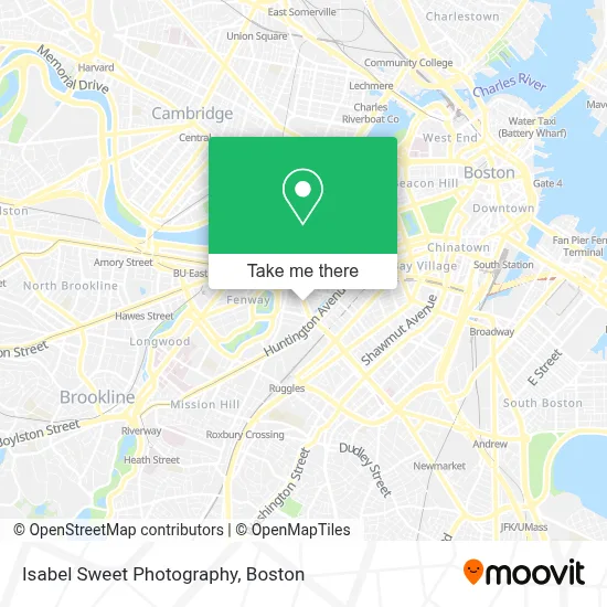
See Isabel Sweet Photography, Boston, on the map
Public Transit to Isabel Sweet Photography in Boston
Wondering how to get to Isabel Sweet Photography in Boston? Moovit helps you find the best way to get to Isabel Sweet Photography with step-by-step directions from the nearest public transit station.
Moovit provides free maps and live directions to help you navigate through your city. View schedules, routes, timetables, and find out how long does it take to get to Isabel Sweet Photography in real time.
Looking for the nearest stop or station to Isabel Sweet Photography? Check out this list of stops closest to your destination: Belvidere St @ Huntington Ave; Announcement #3 - Airport To Back Bay; Hynes T Station (To Crc); Massachusetts Ave @ Newbury St; Prudential; Hynes Convention Center; Massachusetts Ave..
Bus: 1, 504, BB, 55, 57, 1 BU (CHARLES RIVER-MEDICAL CAMPUS).Train: FRAMINGHAM/WORCESTER, NORTHEAST REGIONAL.Subway: GREEN LINE B, GREEN LINE C, GREEN LINE E, ORANGE LINE, GREEN LINE D.
Want to see if there’s another route that gets you there at an earlier time? Moovit helps you find alternative routes or times. Get directions from and directions to Isabel Sweet Photography easily from the Moovit App or Website.
We make riding to Isabel Sweet Photography easy, which is why over 1.7 million users, including users in Boston, trust Moovit as the best app for public transit. You don’t need to download an individual bus app or train app, Moovit is your all-in-one transit app that helps you find the best bus time or train time available.
For information on prices of subway, bus and train, costs and ride fares to Isabel Sweet Photography, please check the Moovit app.
Use the app to navigate to popular places including to the airport, hospital, stadium, grocery store, mall, coffee shop, school, college, and university.
Isabel Sweet Photography Address: 207 Massachusetts Ave street in Boston
- Alankara Records,
- Guerilla Opera,
- Saigon Fusion,
- Bel Canto Academy of Music,
- Tech Bros,
- Urban Leash,
- The Mapparium,
- Mapparium,
- Mary Baker Eddy Library,
- Bodega,
- New Edgerly Rd & Public Alley 904,
- The Mother Church,
- Citizens Bank,
- Mothers Rest Playground,
- Blend Entertainment,
- Perkins Restaurant Solutions,
- Imove Moving/Labor,
- Boston Best Rate Movers,
- Business,
- Christian Science Plaza
Places Near Isabel Sweet Photography (Boston)
- Wang Theater, Boston,
- Museum Of Science, Boston,
- Massachusetts General Hospital, Boston,
- Isabella Stewart Gardner Museum, Boston,
- Seaport District, Boston,
- Boston Common, Boston,
- Wilbur Theatre, Boston,
- Boston Medical Center, Boston,
- Td Garden, Boston,
- House Of Blues, Boston,
- Boston Convention & Exhibition Center, Boston,
- Leader Bank Pavilion (Leader Bank Pavillion), Boston,
- North End, Boston,
- Castle Island, Boston,
- Cheers, Boston,
- Prudential Center, Boston,
- Mgm Music Hall, Boston,
- Faneuil Hall, Boston,
- Quincy Market, Boston,
- Boston Children's Hospital, Boston
How to get to popular places in Boston with public transit
Get around Boston by public transit!
Traveling around Boston has never been so easy. See step by step directions as you travel to any attraction, street or major public transit station. View bus and train schedules, arrival times, service alerts and detailed routes on a map, so you know exactly how to get to anywhere in Boston.
When traveling to any destination around Boston use Moovit's Live Directions with Get Off Notifications to know exactly where and how far to walk, how long to wait for your line, and how many stops are left. Moovit will alert you when it's time to get off — no need to constantly re-check whether yours is the next stop.
Wondering how to use public transit in Boston or how to pay for public transit in Boston? Moovit public transit app can help you navigate your way with public transit easily, and at minimum cost. It includes public transit fees, ticket prices, and costs. Looking for a map of Boston public transit lines? Moovit public transit app shows all public transit maps in Boston with all Bus, Train, Subway and Ferry routes and stops on an interactive map.
Boston has 4 transit type(s), including: Bus, Train, Subway and Ferry, operated by several transit agencies, including MBTA, Southeastern Regional Transit Authority, MetroWest Regional Transit Authority, Rhode Island Public Transit Authority, WRTA, Lowell Regional Transit Authority, Merrimack Valley Transit, Montachusett Regional Transit Authority, Cape Cod Regional Transit Authority, Brockton Area Transit Authority, Martha's Vineyard Transit Authority, the WAVE - Nantucket Regional Transit Authority, GATRA, Cape Ann Transportation Authority and Massport