See Islamic Foundation North, Green Oaks, on the map
Directions to Islamic Foundation North (Green Oaks) with public transportation
The following transit lines have routes that pass near Islamic Foundation North
 Bus:
Bus: - Train:
Train stations near Islamic Foundation North in Green Oaks
- Libertyville,67 min walk,
Bus stations near Islamic Foundation North in Green Oaks
- 3900 Fountain Square Pl & Fountain Square Pl,120 min walk,
Bus lines to Islamic Foundation North in Green Oaks
- 568,Sheridan Rd & Washington St,
What are the closest stations to Islamic Foundation North?
The closest stations to Islamic Foundation North are:
- Libertyville is 5733 yards away, 67 min walk.
- 3900 Fountain Square Pl & Fountain Square Pl is 10350 yards away, 120 min walk.
Which bus lines stop near Islamic Foundation North?
These bus lines stop near Islamic Foundation North: 572, 574.
Which train line stops near Islamic Foundation North?
MD-N
See Islamic Foundation North, Green Oaks, on the map
Public Transit to Islamic Foundation North in Green Oaks
Wondering how to get to Islamic Foundation North in Green Oaks, United States? Moovit helps you find the best way to get to Islamic Foundation North with step-by-step directions from the nearest public transit station.
Moovit provides free maps and live directions to help you navigate through your city. View schedules, routes, timetables, and find out how long does it take to get to Islamic Foundation North in real time.
Looking for the nearest stop or station to Islamic Foundation North? Check out this list of stops closest to your destination: Libertyville; 3900 Fountain Square Pl & Fountain Square Pl.
Bus:Train:
Want to see if there’s another route that gets you there at an earlier time? Moovit helps you find alternative routes or times. Get directions from and directions to Islamic Foundation North easily from the Moovit App or Website.
We make riding to Islamic Foundation North easy, which is why over 1.5 million users, including users in Green Oaks, trust Moovit as the best app for public transit. You don’t need to download an individual bus app or train app, Moovit is your all-in-one transit app that helps you find the best bus time or train time available.
For information on prices of bus and train, costs and ride fares to Islamic Foundation North, please check the Moovit app.
Use the app to navigate to popular places including to the airport, hospital, stadium, grocery store, mall, coffee shop, school, college, and university.
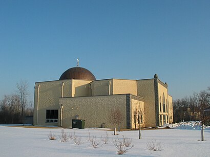
Islamic Foundation North Address: 1751 O'Plaine Rd street in Green Oaks
Attractions near Islamic Foundation North
Shedden Sales Co,Markus Electric Inc,1,Afterschool Club,Martin Biedermann,Top Deck Builders, Incorporated.,Schiever & Schiever,Belmont Dr,St Demetrios Greek Orthodox Church,Parsons Nutrition,Grove School (historical),Quartermaster,Yellow Card Photos Co,1863 N Saint Marys Rd,Ascension Cemetery & Mausoleum,11329 King Drive,Scomac Contruction,Fisher Healthcare,1,1675 N St Marys RdHow to get to popular attractions in Green Oaks with public transit
The Original Pancake House, Chicago,Target, South Elgin,Lockport, IL, Lockport,Hotel Arista, Naperville,Elgin O'Hare Expressway, Itasca,Chicago Marriott Southwest at Burr Ridge, Burr Ridge,Joliet Junior College, Joliet,Maggiano's Little Italy, Schaumburg,Museum Of Science And Industry, Chicago,Intersection of Algonquin Road & Illinois Route 53, Rolling Meadows,Advocate Condell Medical Center, Libertyville,Naperville Riverwalk, Naperville,Metra - Glenview, Glenview,NICTD's South Shore - Hammond Station, Hammond,Elmhurst Center for Health, Elmhurst,Chicago Marriott Naperville, Naperville,Metra - Kenosha,Baxter Healthcare,1350 North Lake Shore Drive Apartments, Chicago,United Center, ChicagoGet around Green Oaks by public transit!
Traveling around Green Oaks has never been so easy. See step by step directions as you travel to any attraction, street or major public transit station. View bus and train schedules, arrival times, service alerts and detailed routes on a map, so you know exactly how to get to anywhere in Green Oaks.
When traveling to any destination around Green Oaks use Moovit's Live Directions with Get Off Notifications to know exactly where and how far to walk, how long to wait for your line, and how many stops are left. Moovit will alert you when it's time to get off — no need to constantly re-check whether yours is the next stop.
Wondering how to use public transit in Green Oaks or how to pay for public transit in Green Oaks? Moovit public transit app can help you navigate your way with public transit easily, and at minimum cost. It includes public transit fees, ticket prices, and costs. Looking for a map of Green Oaks public transit lines? Moovit public transit app shows all public transit maps in Green Oaks with all bus or train routes and stops on an interactive map.
Green Oaks has 2 transit type(s), including: bus or train, operated by several transit agencies, including CTA 'L', Metra, Northern Indiana Commuter Transportation District, CTA, PACE, O'Hare International Airport Shuttle Bus, Gary Public Transit, Amtrak, River Valley Metro, Valpo Transit, DeKalb Public Transit, FlixBus-us, Greyhound-us, Van Galder (Coach USA) and Wisconsin Coach Lines