See Island Trees High School, Levittown, Ny, on the map
Directions to Island Trees High School (Levittown, Ny) with public transportation
The following transit lines have routes that pass near Island Trees High School
 Bus:
Bus: - Train:
How to get to Island Trees High School by bus?
Click on the bus route to see step by step directions with maps, line arrival times and updated time schedules.
How to get to Island Trees High School by train?
Click on the train route to see step by step directions with maps, line arrival times and updated time schedules.
Bus stations near Island Trees High School in Levittown, Ny
- Hempstead Tpke + Randall Dr,20 min walk,
- Hicksville Rd + Courtney La,34 min walk,
Train stations near Island Trees High School in Levittown, Ny
- Bethpage,40 min walk,
Bus lines to Island Trees High School in Levittown, Ny
- N70,Farmingdale St Coll,
- N80,Sunrise Mall,
What are the closest stations to Island Trees High School?
The closest stations to Island Trees High School are:
- Hempstead Tpke + Randall Dr is 1530 yards away, 20 min walk.
- Hicksville Rd + Courtney La is 2684 yards away, 34 min walk.
- Bethpage is 3202 yards away, 40 min walk.
Which bus line stops near Island Trees High School?
N72
Which train line stops near Island Trees High School?
PORT JEFFERSON
See Island Trees High School, Levittown, Ny, on the map
Public Transit to Island Trees High School in Levittown, Ny
Wondering how to get to Island Trees High School in Levittown, Ny, United States? Moovit helps you find the best way to get to Island Trees High School with step-by-step directions from the nearest public transit station.
Moovit provides free maps and live directions to help you navigate through your city. View schedules, routes, timetables, and find out how long does it take to get to Island Trees High School in real time.
Looking for the nearest stop or station to Island Trees High School? Check out this list of stops closest to your destination: Hempstead Tpke + Randall Dr; Hicksville Rd + Courtney La; Bethpage.
Bus:Train:
Want to see if there’s another route that gets you there at an earlier time? Moovit helps you find alternative routes or times. Get directions from and directions to Island Trees High School easily from the Moovit App or Website.
We make riding to Island Trees High School easy, which is why over 1.5 million users, including users in Levittown, Ny, trust Moovit as the best app for public transit. You don’t need to download an individual bus app or train app, Moovit is your all-in-one transit app that helps you find the best bus time or train time available.
For information on prices of bus, train and subway, costs and ride fares to Island Trees High School, please check the Moovit app.
Use the app to navigate to popular places including to the airport, hospital, stadium, grocery store, mall, coffee shop, school, college, and university.
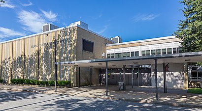
Island Trees High School Address: Byron Place street in Levittown, Ny
Attractions near Island Trees High School
3960 Byron Pl,4 Elm Pl,134 Elm Place,De Oliveira Development,Soccer Shots,CRP Inc,77 Elm Pl,Gimme Some Sugar,99 Elm Pl,58 Longfellow Avenue,Brydan Daries Inc,Online Construction,3800 Duke Ct,Frank Maryann,Yorkshire Village,Family Residences,American Telephone Company,Shoe Outlet,ATM,Pizza Hut ExpressHow to get to popular attractions in Levittown, Ny with public transit
Rattle N Hum, Manhattan,Bubba Gump Shrimp Co., Manhattan,Rubirosa Ristorante, Manhattan,Dos Toros Taquería, Manhattan,Ferrara Bakery, Manhattan,I-80 (Interstate 80), Paterson, Nj,Central Park SummerStage, Manhattan,Brass Monkey, Manhattan,Wingate by Wyndham Manhattan Midtown, Manhattan,The Dutch, Manhattan,New Jersey, Nutley, Nj,Beauty & Essex, Manhattan,Veselka, Manhattan,Norwalk, CT, Norwalk, Ct,Upper West Side, Manhattan,Atlantic City, NJ, Atlantic City, Nj,Hill Country Chicken, Manhattan,Spring Lounge, Manhattan,Dinosaur Bar-B-Que, Manhattan,The Stanton Social, ManhattanGet around Levittown, Ny by public transit!
Traveling around Levittown, Ny has never been so easy. See step by step directions as you travel to any attraction, street or major public transit station. View bus and train schedules, arrival times, service alerts and detailed routes on a map, so you know exactly how to get to anywhere in Levittown, Ny.
When traveling to any destination around Levittown, Ny use Moovit's Live Directions with Get Off Notifications to know exactly where and how far to walk, how long to wait for your line, and how many stops are left. Moovit will alert you when it's time to get off — no need to constantly re-check whether yours is the next stop.
Wondering how to use public transit in Levittown, Ny or how to pay for public transit in Levittown, Ny? Moovit public transit app can help you navigate your way with public transit easily, and at minimum cost. It includes public transit fees, ticket prices, and costs. Looking for a map of Levittown, Ny public transit lines? Moovit public transit app shows all public transit maps in Levittown, Ny with all bus, train or subway routes and stops on an interactive map.
Levittown, Ny has 3 transit type(s), including: bus, train or subway, operated by several transit agencies, including MTA Subway, Metro-North Railroad, LIRR, PATH, Shore Line East, MTA Bus Company, MTA New York City Transit - Express routes, MTA Bus, NJ Transit, NYC Ferry, NICE bus, Bee-Line Bus, NJ Transit Rail, NJ Transit Rail and Norwalk Transit District