How to get to Isocover by bus?
Click on the bus route to see step by step directions with maps, line arrival times and updated time schedules.
From Boulevard de Magenta, Paris
67 minFrom Hopital Lariboisière, Paris
53 minFrom Hôpital Port Royal, Paris
50 minFrom 27 Rue du Faubourg Saint-Jacques, Paris
49 minFrom Pavillon d'Armenonville, Paris
30 minFrom Boulevard de Magenta, Paris
63 minFrom Station F, Paris
61 minFrom 185 Rue Raymond Losserand, Paris
41 minFrom La Comedie Saint Martin, Paris
65 minFrom Rue du Chateau des Rentiers, Paris
51 min
How to get to Isocover by train?
Click on the train route to see step by step directions with maps, line arrival times and updated time schedules.
How to get to Isocover by metro?
Click on the metro route to see step by step directions with maps, line arrival times and updated time schedules.
From Boulevard de Magenta, Paris
48 minFrom Hopital Lariboisière, Paris
56 minFrom Hôpital Port Royal, Paris
44 minFrom 27 Rue du Faubourg Saint-Jacques, Paris
45 minFrom Pavillon d'Armenonville, Paris
58 minFrom Boulevard de Magenta, Paris
44 minFrom Station F, Paris
49 minFrom 185 Rue Raymond Losserand, Paris
60 minFrom La Comedie Saint Martin, Paris
44 minFrom Rue du Chateau des Rentiers, Paris
53 min
Bus stops near Isocover in Boulogne-Billancourt
Metro stations near Isocover in Boulogne-Billancourt
Bus lines to Isocover in Boulogne-Billancourt
What are the closest stations to Isocover?
The closest stations to Isocover are:
- Silly - Gallieni is 110 meters away, 2 min walk.
- Square Des Frères Farman is 123 meters away, 2 min walk.
- Ancienne Mairie is 233 meters away, 3 min walk.
- Rue de Silly is 264 meters away, 4 min walk.
- Boulogne Jean Jaurès is 265 meters away, 4 min walk.
- Rhin Et Danube is 375 meters away, 5 min walk.
- Pont de Sèvres is 674 meters away, 9 min walk.
Which train lines stop near Isocover?
These train lines stop near Isocover: L, U.
Which metro line stops near Isocover?
10 (Gare D'Austerlitz)
Which bus lines stop near Isocover?
These bus lines stop near Isocover: 126, 175, 52, 72.
What’s the nearest metro station to Isocover in Boulogne-Billancourt?
The nearest metro station to Isocover in Boulogne-Billancourt is Boulogne Jean Jaurès. It’s a 4 min walk away.
What’s the nearest bus station to Isocover in Boulogne-Billancourt?
The nearest bus stations to Isocover in Boulogne-Billancourt are Silly - Gallieni and Square Des Frères Farman. The closest one is a 2 min walk away.
What time is the first metro to Isocover in Boulogne-Billancourt?
The 9 is the first metro that goes to Isocover in Boulogne-Billancourt. It stops nearby at 5:30 AM.
What time is the last metro to Isocover in Boulogne-Billancourt?
The 9 is the last metro that goes to Isocover in Boulogne-Billancourt. It stops nearby at 1:15 AM.
What time is the first bus to Isocover in Boulogne-Billancourt?
The 175 is the first bus that goes to Isocover in Boulogne-Billancourt. It stops nearby at 6:50 AM.
What time is the last bus to Isocover in Boulogne-Billancourt?
The 72 is the last bus that goes to Isocover in Boulogne-Billancourt. It stops nearby at 1:28 AM.
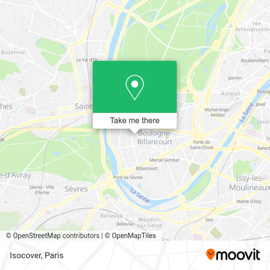
See Isocover, Boulogne-Billancourt, on the map
Public Transit to Isocover in Boulogne-Billancourt
Wondering how to get to Isocover in Boulogne-Billancourt? Moovit helps you find the best way to get to Isocover with step-by-step directions from the nearest public transit station.
Moovit provides free maps and live directions to help you navigate through your city. View schedules, routes, timetables, and find out how long does it take to get to Isocover in real time.
Looking for the nearest stop or station to Isocover? Check out this list of stops closest to your destination: Silly - Gallieni; Square Des Frères Farman; Ancienne Mairie; Rue de Silly; Boulogne Jean Jaurès; Rhin Et Danube; Pont de Sèvres.
Train: L, U.Metro: 10, 9.Bus: 126, 175, 52, 72, 260, 389, SUBB N.
Want to see if there’s another route that gets you there at an earlier time? Moovit helps you find alternative routes or times. Get directions from and directions to Isocover easily from the Moovit App or Website.
We make riding to Isocover easy, which is why over 1.5 million users, including users in Boulogne-Billancourt, trust Moovit as the best app for public transit. You don’t need to download an individual bus app or train app, Moovit is your all-in-one transit app that helps you find the best bus time or train time available.
For information on prices of metro, bus and train, costs and ride fares to Isocover, please check the Moovit app.
Use the app to navigate to popular places including to the airport, hospital, stadium, grocery store, mall, coffee shop, school, college, and university.
Isocover Address: 83 Avenue André Morizet 92100 Boulogne-Billancourt street in Boulogne-Billancourt
- C.G.I,
- Editions Progress,
- Cenapex,
- Levy Group International,
- Telatel Permanence Téléphonique,
- Foyer des Jeunes Travailleurs - Résidence Sociale Afjb,
- Dr. Alexandre Pascale,
- Mano,
- Osmozium,
- Cap Data Consulting,
- Bdr Prothèse,
- Groupe Symposia Informatique,
- Glob'Eau Productions,
- Futuramedia,
- Activ Zone Group,
- Corpimmo,
- Poleo,
- Dynames Tech,
- Artcode/360,
- Dr. Robine Olivier
Places Near Isocover (Boulogne-Billancourt)
- Marché Saint-Pierre, Paris,
- Hôpital Necker, Paris,
- Gare Routière Flixbus, Paris,
- Fondation Louis Vuitton, Paris,
- Hôpital Beaujon, Clichy,
- Galeries Lafayette, Paris,
- Créteil Soleil, Creteil,
- Hopital Foch, Suresnes,
- Galeries Lafayette Haussmann, Paris,
- Théâtre Mogador, Paris,
- Hôpital Cochin, Paris,
- Hôpital Pitié Salpêtrière, Paris,
- Hôpital Saint-Joseph, Paris,
- Beaugrenelle, Paris,
- Hôpital de la Pitié-Salpêtrière, Paris,
- Hôpital Henri Mondor, Creteil,
- 29 Rue Manin, Paris,
- Hopital Lariboisière, Paris,
- Atelier Des Lumieres, Paris,
- Centre Hospitalier des 15/20, Paris
How to get to popular places in Paris with public transit
Get around Boulogne-Billancourt by public transit!
Traveling around Boulogne-Billancourt has never been so easy. See step by step directions as you travel to any attraction, street or major public transit station. View bus and train schedules, arrival times, service alerts and detailed routes on a map, so you know exactly how to get to anywhere in Boulogne-Billancourt.
When traveling to any destination around Boulogne-Billancourt use Moovit's Live Directions with Get Off Notifications to know exactly where and how far to walk, how long to wait for your line, and how many stops are left. Moovit will alert you when it's time to get off — no need to constantly re-check whether yours is the next stop.
Wondering how to use public transit in Boulogne-Billancourt or how to pay for public transit in Boulogne-Billancourt? Moovit public transit app can help you navigate your way with public transit easily, and at minimum cost. It includes public transit fees, ticket prices, and costs. Looking for a map of Boulogne-Billancourt public transit lines? Moovit public transit app shows all public transit maps in Boulogne-Billancourt with all Bus, Train, Metro, Light Rail, RER, Funicular and Gondola routes and stops on an interactive map.
Paris has 7 transit type(s), including: Bus, Train, Metro, Light Rail, RER, Funicular and Gondola, operated by several transit agencies, including RATP, RER, RER Bus de remplacement, Train, Train Bus de remplacement, Tramway Bus de remplacement, TER, ADP, Magical Shuttle, Argenteuil - Boucles de Seine, Autocars Dominique, Bièvre, Brie et 2 Morin, Le Bus - C.C. du Clermontois and Cœur d’Essonne