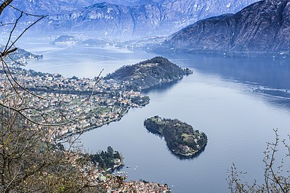
Directions to Isola Comacina (Sala Comacina) with public transportation
The following transit lines have routes that pass near Isola Comacina
How to get to Isola Comacina by bus?
Click on the bus route to see step by step directions with maps, line arrival times and updated time schedules.
How to get to Isola Comacina by ferry?
Click on the ferry route to see step by step directions with maps, line arrival times and updated time schedules.
Bus stations near Isola Comacina in Sala Comacina
- Sala Comacina - San Rocco, 9 min walk,
Ferry stations near Isola Comacina in Sala Comacina
- Lenno, 40 min walk,
Cable Car stations near Isola Comacina in Sala Comacina
- Argegno, 55 min walk,
Bus lines to Isola Comacina in Sala Comacina
- C10, Magistri Cumacini,
What are the closest stations to Isola Comacina?
The closest stations to Isola Comacina are:
- Sala Comacina - San Rocco is 348 meters away, 9 min walk.
- Lenno is 2775 meters away, 40 min walk.
- Argegno is 4025 meters away, 55 min walk.
Which bus line stops near Isola Comacina?
C10
Which ferry line stops near Isola Comacina?
⛴
What’s the nearest bus stop to Isola Comacina in Sala Comacina?
The nearest bus stop to Isola Comacina in Sala Comacina is Sala Comacina - San Rocco. It’s a 9 min walk away.
What time is the first bus to Isola Comacina in Sala Comacina?
The C10 is the first bus that goes to Isola Comacina in Sala Comacina. It stops nearby at 6:54 AM.
What time is the last bus to Isola Comacina in Sala Comacina?
The C10 is the last bus that goes to Isola Comacina in Sala Comacina. It stops nearby at 11:22 PM.
What time is the first ferry to Isola Comacina in Sala Comacina?
The ⛴ is the first ferry that goes to Isola Comacina in Sala Comacina. It stops nearby at 8:25 AM.
What time is the last ferry to Isola Comacina in Sala Comacina?
The ⛴ is the last ferry that goes to Isola Comacina in Sala Comacina. It stops nearby at 7:22 PM.
What time is the first cable car to Isola Comacina in Sala Comacina?
The FUN is the first cable car that goes to Isola Comacina in Sala Comacina. It stops nearby at 10:00 AM.
What time is the last cable car to Isola Comacina in Sala Comacina?
The FUN is the last cable car that goes to Isola Comacina in Sala Comacina. It stops nearby at 6:06 PM.
See Isola Comacina, Sala Comacina, on the map
Public Transit to Isola Comacina in Sala Comacina
Wondering how to get to Isola Comacina in Sala Comacina, Italy? Moovit helps you find the best way to get to Isola Comacina with step-by-step directions from the nearest public transit station.
Moovit provides free maps and live directions to help you navigate through your city. View schedules, routes, timetables, and find out how long does it take to get to Isola Comacina in real time.
Looking for the nearest stop or station to Isola Comacina? Check out this list of stops closest to your destination: Sala Comacina - San Rocco; Lenno; Argegno.
Bus: C10.Cable Car: FUN.Ferry: ⛴.
Want to see if there’s another route that gets you there at an earlier time? Moovit helps you find alternative routes or times. Get directions from and directions to Isola Comacina easily from the Moovit App or Website.
We make riding to Isola Comacina easy, which is why over 1.5 million users, including users in Sala Comacina, trust Moovit as the best app for public transit. You don’t need to download an individual bus app or train app, Moovit is your all-in-one transit app that helps you find the best bus time or train time available.
For information on prices of bus, train and ferry, costs and ride fares to Isola Comacina, please check the Moovit app.
Use the app to navigate to popular places including to the airport, hospital, stadium, grocery store, mall, coffee shop, school, college, and university.
Location: Sala Comacina, Milan and Lombardy
Attractions near Isola Comacina
Isola Comacina,Parco Walter Mai,Locanda La Tirlindana,Casa Isola,Piazza 25 Aprile / Via Felice Prestinari,Boat Service Lake Como di Marco Morganti & C.,Consorzio Motoscafi Lario,Maxs Bar,Ivk516,Casa Luisella by Lovecomo,Banca Popolare di Sondrio Società Cooperativa per Azioni,Cimino,Macelleria Salumi Formaggi Polleria,Chiesa di San Giacomo a Spurano,Villa Bonfiglio,Torre del Soccorso Detta del Barbarossa,Villa Molli,Bellosi Auto di Bellosi Venceslao & C.,Greenway del Lago di Como,Anglican Church of AscensionHow to get to popular attractions in Sala Comacina with public transit
Istituto Clinico Villa Aprica, Como,Piazza Novelli, Milano,Mediolanum Forum, Assago,Via Saponaro, Milano,Ospedale Civile di Legnano, Legnano,Via Crocefisso 5, Milano,Via Manfredo Fanti 6, Milano,Via Giuseppe Impastato, San Donato Milanese,Padiglione Monteggia, Milano,C.C. Orio Center, Orio Al Serio,City Life, Milano,Via Meda, Milano,Via Filippo Turati 40, Milano,Fermata Romolo M2, Milano,VILLAPIZZONE, Milano,Via Alfonso Capecelatro 66, Milano,Casa Milan (Museo Mondo Milan), Milano,Via Giulio Natta 226, Milano,Clinica Pederzoli, Peschiera Del Garda,Ospedale Fatebenefratelli Accettazione, MilanoGet around Milan and Lombardy by public transit!
Traveling around Milan and Lombardy has never been so easy. See step by step directions as you travel to any attraction, street or major public transit station. View bus and train schedules, arrival times, service alerts and detailed routes on a map, so you know exactly how to get to anywhere in Milan and Lombardy.
When traveling to any destination around Milan and Lombardy use Moovit's Live Directions with Get Off Notifications to know exactly where and how far to walk, how long to wait for your line, and how many stops are left. Moovit will alert you when it's time to get off — no need to constantly re-check whether yours is the next stop.
Wondering how to use public transit in Milan and Lombardy or how to pay for public transit in Milan and Lombardy? Moovit public transit app can help you navigate your way with public transit easily, and at minimum cost. It includes public transit fees, ticket prices, and costs. Looking for a map of Milan and Lombardy public transit lines? Moovit public transit app shows all public transit maps in Milan and Lombardy with all Bus, Train, Metro, Light Rail, Ferry, Cable Car, Funicular and Gondola routes and stops on an interactive map.
Milan and Lombardy has 8 transit type(s), including: Bus, Train, Metro, Light Rail, Ferry, Cable Car, Funicular and Gondola, operated by several transit agencies, including ATM, Trenord, Trenitalia, NET, Movibus, ASF Autolinee, Autostradale S.r.l., Terravision, AirPullman, TEB, ATB, AVT, Brescia Mobilità, Autoguidovie S.p.A., Star Mobility