Directions to Israel Ride (Newton) with public transportation
The following transit lines have routes that pass near Israel Ride
 Bus: 52, GREEN LINE D SHUTTLE, GREEN LINE D SHUTTLE, GREEN LINE D SHUTTLE, GREEN LINE D SHUTTLE.
- Train: FRAMINGHAM/WORCESTER.
- Subway: GREEN LINE D.
How to get to Israel Ride by bus?
Click on the bus route to see step by step directions with maps, line arrival times and updated time schedules.
From Biogen, Cambridge
64 minFrom Fogo De Chão, Boston
36 minFrom Lolita Cocina & Tequila Bar, Boston
37 minFrom The Salty Pig, Boston
38 minFrom Showa Boston Institute, Boston
74 minFrom Market Basket, Somerville
78 minFrom Residence Inn by Marriott Boston Downtown/South End, Boston
73 minFrom Sam Adams Boston Brewery Tour, Boston
77 minFrom Harvard University, Cambridge
45 minFrom Boston Medical Center, Boston
68 min
How to get to Israel Ride by train?
Click on the train route to see step by step directions with maps, line arrival times and updated time schedules.
How to get to Israel Ride by subway?
Click on the subway route to see step by step directions with maps, line arrival times and updated time schedules.
From Biogen, Cambridge
59 minFrom Fogo De Chão, Boston
37 minFrom Lolita Cocina & Tequila Bar, Boston
36 minFrom The Salty Pig, Boston
41 minFrom Market Basket, Somerville
73 minFrom Residence Inn by Marriott Boston Downtown/South End, Boston
59 minFrom Sam Adams Boston Brewery Tour, Boston
62 minFrom Harvard University, Cambridge
59 minFrom Boston Medical Center, Boston
59 min
Bus stops near Israel Ride in Newton
Subway station near Israel Ride in Newton
- Eliot, 4 min walk,VIEW
Train station near Israel Ride in Newton
- Newtonville, 28 min walk,VIEW
Bus lines to Israel Ride in Newton
- 52, Dedham Mall,VIEW
- GREEN LINE D SHUTTLE, Newton Highlands - Kenmore,VIEW
- GREEN LINE D SHUTTLE, Newton Highlands - Fenway,VIEW
- GREEN LINE D SHUTTLE, Riverside - Brookline Village,VIEW
- GREEN LINE D SHUTTLE, Riverside - Brookline Hills,VIEW
- GREEN LINE D SHUTTLE, Riverside - Reservoir,VIEW
- GREEN LINE D SHUTTLE, Newton Highlands - Kenmore via Saint Mary's Street,VIEW
- GREEN LINE D SHUTTLE, Riverside - Kenmore,VIEW
- GREEN LINE D SHUTTLE, Newton Highlands - Brookline Hills,VIEW
- GREEN LINE D SHUTTLE, Riverside - Fenway,VIEW
- GREEN LINE D SHUTTLE, Riverside - Kenmore via Saint Mary's Street,VIEW
- GREEN LINE D SHUTTLE, Newton Highlands - Reservoir,VIEW
- GREEN LINE D SHUTTLE, Riverside - Kenmore (Shuttle),VIEW
What are the closest stations to Israel Ride?
The closest stations to Israel Ride are:
- Centre St @ Beacon St is 49 yards away, 1 min walk.
- Eliot is 339 yards away, 4 min walk.
- Newton Centre - Langley Rd @ Braeland Ave is 386 yards away, 5 min walk.
- Newtonville is 2327 yards away, 28 min walk.
Which bus line stops near Israel Ride?
52 (Charles River Loop)
Which train line stops near Israel Ride?
FRAMINGHAM/WORCESTER (#521 | Worcester)
Which subway line stops near Israel Ride?
GREEN LINE D (Riverside)
What’s the nearest subway station to Israel Ride in Newton?
The nearest subway station to Israel Ride in Newton is Eliot. It’s a 4 min walk away.
What’s the nearest train station to Israel Ride in Newton?
The nearest train station to Israel Ride in Newton is Newtonville. It’s a 28 min walk away.
What’s the nearest bus station to Israel Ride in Newton?
The nearest bus station to Israel Ride in Newton is Centre St @ Beacon St. It’s a 1 min walk away.
What time is the first subway to Israel Ride in Newton?
The GREEN LINE D is the first subway that goes to Israel Ride in Newton. It stops nearby at 4:50 AM.
What time is the last subway to Israel Ride in Newton?
The GREEN LINE D is the last subway that goes to Israel Ride in Newton. It stops nearby at 2:41 AM.
What time is the first train to Israel Ride in Newton?
The FRAMINGHAM/WORCESTER is the first train that goes to Israel Ride in Newton. It stops nearby at 5:25 AM.
What time is the last train to Israel Ride in Newton?
The FRAMINGHAM/WORCESTER is the last train that goes to Israel Ride in Newton. It stops nearby at 12:17 AM.
What time is the first bus to Israel Ride in Newton?
The 52 is the first bus that goes to Israel Ride in Newton. It stops nearby at 6:42 AM.
What time is the last bus to Israel Ride in Newton?
The 52 is the last bus that goes to Israel Ride in Newton. It stops nearby at 7:02 PM.
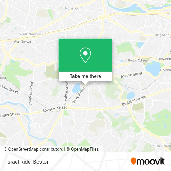
See Israel Ride, Newton, on the map
Public Transit to Israel Ride in Newton
Wondering how to get to Israel Ride in Newton? Moovit helps you find the best way to get to Israel Ride with step-by-step directions from the nearest public transit station.
Moovit provides free maps and live directions to help you navigate through your city. View schedules, routes, timetables, and find out how long does it take to get to Israel Ride in real time.
Looking for the nearest stop or station to Israel Ride? Check out this list of stops closest to your destination: Centre St @ Beacon St; Eliot; Newton Centre - Langley Rd @ Braeland Ave; Newtonville.
Bus: 52, GREEN LINE D SHUTTLE, GREEN LINE D SHUTTLE, GREEN LINE D SHUTTLE, GREEN LINE D SHUTTLE, GREEN LINE D SHUTTLE.Train: FRAMINGHAM/WORCESTER.Subway: GREEN LINE D.
Want to see if there’s another route that gets you there at an earlier time? Moovit helps you find alternative routes or times. Get directions from and directions to Israel Ride easily from the Moovit App or Website.
We make riding to Israel Ride easy, which is why over 1.7 million users, including users in Newton, trust Moovit as the best app for public transit. You don’t need to download an individual bus app or train app, Moovit is your all-in-one transit app that helps you find the best bus time or train time available.
For information on prices of bus, subway and train, costs and ride fares to Israel Ride, please check the Moovit app.
Use the app to navigate to popular places including to the airport, hospital, stadium, grocery store, mall, coffee shop, school, college, and university.
Israel Ride Address: 1320 Centre St street in Newton
- The Law Office,
- Citizens Justice Association,
- Par Eighty,
- Cheetah Medical,
- Arava Institute for Environmental,
- Peace.Love.Food Nutrition Counseling,
- Hadassah Northern New England,
- Nitkin William,
- Emergency Locksmith Available 24 7,
- Golden Law Center,
- FedEx,
- ADT 24 7 Alarm & Security,
- International Benefits,
- Avalon Admission,
- The Law Firm of Victoria C. Spetter,
- Fleet Homes - KW Chestnut Hill,
- Fortis Insurance,
- Kathryn Sallis Realtor,
- Chris Kostopoulos, Realtor,
- Trinity Catholic MacKenzie Center
Places Near Israel Ride (Newton)
- House Of Blues, Boston,
- Prudential Center, Boston,
- Wang Theater, Boston,
- Boston Convention & Exhibition Center, Boston,
- Wilbur Theatre, Boston,
- Boston Children's Hospital, Boston,
- North End, Boston,
- Boston Medical Center, Boston,
- Boston Common, Boston,
- Museum Of Science, Boston,
- Td Garden, Boston,
- Mgm Music Hall, Boston,
- Massachusetts General Hospital, Boston,
- Faneuil Hall, Boston,
- Seaport District, Boston,
- Quincy Market, Boston,
- Isabella Stewart Gardner Museum, Boston,
- Cheers, Boston,
- Leader Bank Pavilion (Leader Bank Pavillion), Boston,
- Castle Island, Boston
How to get to popular places in Boston with public transit
Get around Newton by public transit!
Traveling around Newton has never been so easy. See step by step directions as you travel to any attraction, street or major public transit station. View bus and train schedules, arrival times, service alerts and detailed routes on a map, so you know exactly how to get to anywhere in Newton.
When traveling to any destination around Newton use Moovit's Live Directions with Get Off Notifications to know exactly where and how far to walk, how long to wait for your line, and how many stops are left. Moovit will alert you when it's time to get off — no need to constantly re-check whether yours is the next stop.
Wondering how to use public transit in Newton or how to pay for public transit in Newton? Moovit public transit app can help you navigate your way with public transit easily, and at minimum cost. It includes public transit fees, ticket prices, and costs. Looking for a map of Newton public transit lines? Moovit public transit app shows all public transit maps in Newton with all Bus, Train, Subway and Ferry routes and stops on an interactive map.
Boston has 4 transit type(s), including: Bus, Train, Subway and Ferry, operated by several transit agencies, including MBTA, Southeastern Regional Transit Authority, MetroWest Regional Transit Authority, Rhode Island Public Transit Authority, WRTA, Lowell Regional Transit Authority, Merrimack Valley Transit, Montachusett Regional Transit Authority, Cape Cod Regional Transit Authority, Brockton Area Transit Authority, Martha's Vineyard Transit Authority, the WAVE - Nantucket Regional Transit Authority, GATRA, Cape Ann Transportation Authority and Massport