Directions to Issokson Deborah (Wellesley) with public transportation
The following transit lines have routes that pass near Issokson Deborah
 Bus: 01, MBRS.
- Train: FRAMINGHAM/WORCESTER.
- Subway: GREEN LINE D.
How to get to Issokson Deborah by bus?
Click on the bus route to see step by step directions with maps, line arrival times and updated time schedules.
From Brighton, Boston
122 minFrom Mass General Waltham, Waltham
101 minFrom Route 9 East / West Framingham, Framingham
63 minFrom Embassy Suites by Hilton Boston Waltham, Waltham
102 minFrom Dedham District Court, Dedham
141 minFrom VFW Parkway, Boston
118 minFrom West Roxbury, Boston
135 minFrom The Westin Waltham Boston, Waltham
101 minFrom Watertown, MA, Watertown Town
117 minFrom Six Flags New England, Newton
104 min
How to get to Issokson Deborah by train?
Click on the train route to see step by step directions with maps, line arrival times and updated time schedules.
How to get to Issokson Deborah by subway?
Click on the subway route to see step by step directions with maps, line arrival times and updated time schedules.
Train station near Issokson Deborah in Wellesley
- Wellesley Square, 10 min walk,VIEW
Subway station near Issokson Deborah in Wellesley
- Woodland, 23 min walk,VIEW
What are the closest stations to Issokson Deborah?
The closest stations to Issokson Deborah are:
- Wellesley Square is 813 yards away, 10 min walk.
- Woodland is 1865 yards away, 23 min walk.
Which bus lines stop near Issokson Deborah?
These bus lines stop near Issokson Deborah: 01, MBRS.
Which train line stops near Issokson Deborah?
FRAMINGHAM/WORCESTER (#521 | Worcester)
Which subway line stops near Issokson Deborah?
GREEN LINE D (Riverside)
What’s the nearest subway station to Issokson Deborah in Wellesley?
The nearest subway station to Issokson Deborah in Wellesley is Woodland. It’s a 23 min walk away.
What’s the nearest train station to Issokson Deborah in Wellesley?
The nearest train station to Issokson Deborah in Wellesley is Wellesley Square. It’s a 10 min walk away.
What time is the first subway to Issokson Deborah in Wellesley?
The GREEN LINE D is the first subway that goes to Issokson Deborah in Wellesley. It stops nearby at 4:45 AM.
What time is the last subway to Issokson Deborah in Wellesley?
The GREEN LINE D is the last subway that goes to Issokson Deborah in Wellesley. It stops nearby at 2:48 AM.
What time is the first train to Issokson Deborah in Wellesley?
The FRAMINGHAM/WORCESTER is the first train that goes to Issokson Deborah in Wellesley. It stops nearby at 5:09 AM.
What time is the last train to Issokson Deborah in Wellesley?
The FRAMINGHAM/WORCESTER is the last train that goes to Issokson Deborah in Wellesley. It stops nearby at 12:32 AM.
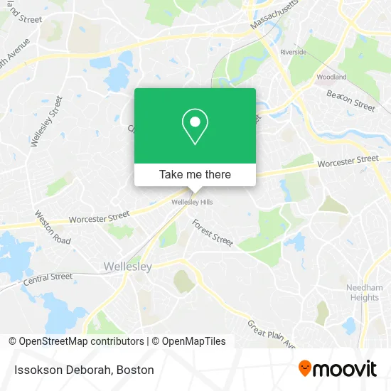
See Issokson Deborah, Wellesley, on the map
Public Transit to Issokson Deborah in Wellesley
Wondering how to get to Issokson Deborah in Wellesley? Moovit helps you find the best way to get to Issokson Deborah with step-by-step directions from the nearest public transit station.
Moovit provides free maps and live directions to help you navigate through your city. View schedules, routes, timetables, and find out how long does it take to get to Issokson Deborah in real time.
Looking for the nearest stop or station to Issokson Deborah? Check out this list of stops closest to your destination: Wellesley Square; Woodland.
Bus: 01, MBRS.Train: FRAMINGHAM/WORCESTER.Subway: GREEN LINE D.
Want to see if there’s another route that gets you there at an earlier time? Moovit helps you find alternative routes or times. Get directions from and directions to Issokson Deborah easily from the Moovit App or Website.
We make riding to Issokson Deborah easy, which is why over 1.7 million users, including users in Wellesley, trust Moovit as the best app for public transit. You don’t need to download an individual bus app or train app, Moovit is your all-in-one transit app that helps you find the best bus time or train time available.
For information on prices of bus, train and subway, costs and ride fares to Issokson Deborah, please check the Moovit app.
Use the app to navigate to popular places including to the airport, hospital, stadium, grocery store, mall, coffee shop, school, college, and university.
Issokson Deborah Address: 332 Washington St street in Wellesley
- Divergence Physical Therapy and Wellness,
- Candy Connection,
- Renaissance Family Medicine Of Wellesley,
- The Dental Studios,
- Art Of Tile & Stone,
- Wellesley Dental Studio,
- Aesthetic + Mind MD,
- Wellesley Oral & Maxillofacial Surgery,
- Ann N Becker MD,
- Christopher Owen DMD,
- Heather Davidson, Md, Faap,
- Breast Surgeon In Boston,
- Boston & Wellesley, Ma Plastic Surgery Practice,
- Tang Stephen V MD,
- Craniosacral and Massage Therapy of Wellesley,
- Plastic Surgery Specialists,
- Liposuction Center of Greater Boston,
- Spielberg Theodore,
- Dr Giti Ghavamzadeh,
- Aspire Med Spa
Places Near Issokson Deborah (Wellesley)
- Boston Medical Center, Boston,
- Boston Children's Hospital, Boston,
- Isabella Stewart Gardner Museum, Boston,
- Cheers, Boston,
- Prudential Center, Boston,
- Mgm Music Hall, Boston,
- Castle Island, Boston,
- North End, Boston,
- House Of Blues, Boston,
- Wang Theater, Boston,
- Quincy Market, Boston,
- Faneuil Hall, Boston,
- Leader Bank Pavilion (Leader Bank Pavillion), Boston,
- Boston Common, Boston,
- Td Garden, Boston,
- Seaport District, Boston,
- Massachusetts General Hospital, Boston,
- Boston Convention & Exhibition Center, Boston,
- Museum Of Science, Boston,
- Wilbur Theatre, Boston
How to get to popular places in Boston with public transit
Get around Wellesley by public transit!
Traveling around Wellesley has never been so easy. See step by step directions as you travel to any attraction, street or major public transit station. View bus and train schedules, arrival times, service alerts and detailed routes on a map, so you know exactly how to get to anywhere in Wellesley.
When traveling to any destination around Wellesley use Moovit's Live Directions with Get Off Notifications to know exactly where and how far to walk, how long to wait for your line, and how many stops are left. Moovit will alert you when it's time to get off — no need to constantly re-check whether yours is the next stop.
Wondering how to use public transit in Wellesley or how to pay for public transit in Wellesley? Moovit public transit app can help you navigate your way with public transit easily, and at minimum cost. It includes public transit fees, ticket prices, and costs. Looking for a map of Wellesley public transit lines? Moovit public transit app shows all public transit maps in Wellesley with all Bus, Train, Subway and Ferry routes and stops on an interactive map.
Boston has 4 transit type(s), including: Bus, Train, Subway and Ferry, operated by several transit agencies, including MBTA, Southeastern Regional Transit Authority, MetroWest Regional Transit Authority, Rhode Island Public Transit Authority, WRTA, Lowell Regional Transit Authority, Merrimack Valley Transit, Montachusett Regional Transit Authority, Cape Cod Regional Transit Authority, Brockton Area Transit Authority, Martha's Vineyard Transit Authority, the WAVE - Nantucket Regional Transit Authority, GATRA, Cape Ann Transportation Authority and Massport