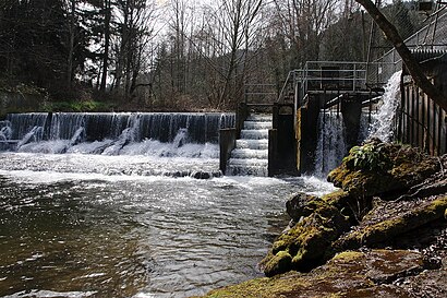
See Issquah Creek, Seattle - Tacoma, WA, on the map
Directions to Issquah Creek (Seattle - Tacoma, WA) with public transportation
The following transit lines have routes that pass near Issquah Creek
 Bus:
Bus:
How to get to Issquah Creek by bus?
Click on the bus route to see step by step directions with maps, line arrival times and updated time schedules.
Bus stations near Issquah Creek in Seattle - Tacoma, WA
- Nw Sammamish Rd & 15th Pl Nw,20 min walk,
Bus lines to Issquah Creek in Seattle - Tacoma, WA
- 271,University District Bellevue,
What are the closest stations to Issquah Creek?
The closest stations to Issquah Creek are:
- Nw Sammamish Rd & 15th Pl Nw is 1592 yards away, 20 min walk.
Which bus lines stop near Issquah Creek?
These bus lines stop near Issquah Creek: 269, 271.
See Issquah Creek, Seattle - Tacoma, WA, on the map
Public Transit to Issquah Creek in Seattle - Tacoma, WA
Wondering how to get to Issquah Creek in Seattle - Tacoma, WA, United States? Moovit helps you find the best way to get to Issquah Creek with step-by-step directions from the nearest public transit station.
Moovit provides free maps and live directions to help you navigate through your city. View schedules, routes, timetables, and find out how long does it take to get to Issquah Creek in real time.
Looking for the nearest stop or station to Issquah Creek? Check out this list of stops closest to your destination: Nw Sammamish Rd & 15th Pl Nw.
Bus:
Want to see if there’s another route that gets you there at an earlier time? Moovit helps you find alternative routes or times. Get directions from and directions to Issquah Creek easily from the Moovit App or Website.
We make riding to Issquah Creek easy, which is why over 1.5 million users, including users in Seattle - Tacoma, WA, trust Moovit as the best app for public transit. You don’t need to download an individual bus app or train app, Moovit is your all-in-one transit app that helps you find the best bus time or train time available.
For information on prices of bus, costs and ride fares to Issquah Creek, please check the Moovit app.
Use the app to navigate to popular places including to the airport, hospital, stadium, grocery store, mall, coffee shop, school, college, and university.
Location: Seattle - Tacoma, WA
Attractions near Issquah Creek
1,S2: Creek Shelter Picnic Area,S2: Creek Shelter,Sunset Beach,2000 Northwest Sammamish Road,Sunset Beach Bathhouse,Sunset Beach Picnic Area,Sunset Beach Parking Lot,Pole Shelter,1,Sammamish Lake State Park,Jensens Cove,Parks & Recreation Department-Maintenance,S1: Kitchen Shelter,Alexander Beach,S1: Kitchen Shelter Picnic Area,S3: Rotunda Shelter,S3: Rotunda Picnic Area,Lake Sammamish State Park,Tibbetts Beach Picnic AreaHow to get to popular attractions in Seattle - Tacoma, WA with public transit
TCC Transit Center, Tacoma,Boeing Field / King County International Airport (BFI), Seattle,Westlake Center, Seattle,The Landing In Renton, Renton,Virginia Mason Hospital, Seattle,The Old Spaghetti Factory, Tacoma,Microsoft Visitor Center, Redmond,Marketplace At Factoria, Bellevue,Walmart Supercenter, Lakewood,Southcenter Mall, Tukwila,Renton Highlands, Renton,Tulalip Casino Resort,I-5,Seattle Japanese Garden, Seattle,Dick's Drive-In, Seattle,Regal Cinemas Everett Mall 16 & RPX, Everett,Costco Wholesale, Tacoma,Everett, WA, Everett,Seattle Premium Outlets,Pike Place Market, SeattleGet around Seattle - Tacoma, WA by public transit!
Traveling around Seattle - Tacoma, WA has never been so easy. See step by step directions as you travel to any attraction, street or major public transit station. View bus and train schedules, arrival times, service alerts and detailed routes on a map, so you know exactly how to get to anywhere in Seattle - Tacoma, WA.
When traveling to any destination around Seattle - Tacoma, WA use Moovit's Live Directions with Get Off Notifications to know exactly where and how far to walk, how long to wait for your line, and how many stops are left. Moovit will alert you when it's time to get off — no need to constantly re-check whether yours is the next stop.
Wondering how to use public transit in Seattle - Tacoma, WA or how to pay for public transit in Seattle - Tacoma, WA? Moovit public transit app can help you navigate your way with public transit easily, and at minimum cost. It includes public transit fees, ticket prices, and costs. Looking for a map of Seattle - Tacoma, WA public transit lines? Moovit public transit app shows all public transit maps in Seattle - Tacoma, WA with all bus routes and stops on an interactive map.
Seattle - Tacoma, WA has 1 transit type(s), including: bus, operated by several transit agencies, including Sound Transit, Seattle Streetcar, Sound Transit, Metro Transit, Metro Transit, Sound Transit, Whatcom Transportation Authority, Mason Transit Authority, Snoqualmie Valley Transportation (SVT), Snoqualmie Valley Transportation, Amtrak, Island Transit, Kitsap Transit, Intercity Transit and Everett Transit