Directions to Itf Services (Boston) with public transportation
The following transit lines have routes that pass near Itf Services
 Bus: 15, 19, 210, 201, 202.
- Train: FAIRMOUNT, KINGSTON, FRANKLIN/FOXBORO, PROVIDENCE/STOUGHTON.
- Subway: RED LINE.
How to get to Itf Services by bus?
Click on the bus route to see step by step directions with maps, line arrival times and updated time schedules.
From Sarma, Somerville
107 minFrom Wentworth Institute Of Technology, Boston
38 minFrom Moderna Therapeutics - Corporate Headquarters, Cambridge
70 minFrom Massport Bus 77 Chelsea Employee Parking, Chelsea
87 minFrom Somerville, MA, Somerville
107 minFrom Yotel Boston, Boston
68 minFrom TownePlace Suites Boston Logan Airport/Chelsea, Chelsea
87 minFrom Constitution Beach, Boston
101 minFrom Quincy Market, Quincy
52 minFrom The Garment District, Cambridge
75 min
How to get to Itf Services by train?
Click on the train route to see step by step directions with maps, line arrival times and updated time schedules.
How to get to Itf Services by subway?
Click on the subway route to see step by step directions with maps, line arrival times and updated time schedules.
From Sarma, Somerville
53 minFrom Wentworth Institute Of Technology, Boston
42 minFrom Moderna Therapeutics - Corporate Headquarters, Cambridge
35 minFrom Massport Bus 77 Chelsea Employee Parking, Chelsea
54 minFrom Somerville, MA, Somerville
50 minFrom Yotel Boston, Boston
32 minFrom TownePlace Suites Boston Logan Airport/Chelsea, Chelsea
53 minFrom Constitution Beach, Boston
50 minFrom Quincy Market, Quincy
29 minFrom The Garment District, Cambridge
35 min
Bus stops near Itf Services in Boston
Subway station near Itf Services in Boston
- Fields Corner, 9 min walk,VIEW
Train station near Itf Services in Boston
- Four Corners/Geneva, 23 min walk,VIEW
Bus lines to Itf Services in Boston
What are the closest stations to Itf Services?
The closest stations to Itf Services are:
- Gibson St @ Adams St is 186 yards away, 3 min walk.
- Dorchester Ave @ Adams St is 335 yards away, 5 min walk.
- Park St Busway @ Dorchester Ave is 386 yards away, 5 min walk.
- Dorchester Ave Opp Charles St is 478 yards away, 6 min walk.
- Dorchester Ave @ Lincoln St - Fields Corner Sta is 605 yards away, 8 min walk.
- Fields Corner is 651 yards away, 8 min walk.
- Four Corners/Geneva is 1904 yards away, 23 min walk.
Which bus lines stop near Itf Services?
These bus lines stop near Itf Services: 15, 19, 210.
Which train lines stop near Itf Services?
These train lines stop near Itf Services: FAIRMOUNT, KINGSTON.
Which subway line stops near Itf Services?
RED LINE (Ashmont/Braintree)
What’s the nearest subway station to Itf Services in Boston?
The nearest subway station to Itf Services in Boston is Fields Corner. It’s a 9 min walk away.
What’s the nearest train station to Itf Services in Boston?
The nearest train station to Itf Services in Boston is Four Corners/Geneva. It’s a 23 min walk away.
What’s the nearest bus station to Itf Services in Boston?
The nearest bus station to Itf Services in Boston is Gibson St @ Adams St. It’s a 3 min walk away.
What time is the first subway to Itf Services in Boston?
The RED LINE is the first subway that goes to Itf Services in Boston. It stops nearby at 5:16 AM.
What time is the last subway to Itf Services in Boston?
The RED LINE is the last subway that goes to Itf Services in Boston. It stops nearby at 2:03 AM.
What time is the first train to Itf Services in Boston?
The FAIRMOUNT is the first train that goes to Itf Services in Boston. It stops nearby at 6:30 AM.
What time is the last train to Itf Services in Boston?
The FAIRMOUNT is the last train that goes to Itf Services in Boston. It stops nearby at 12:00 AM.
What time is the first bus to Itf Services in Boston?
The 15 is the first bus that goes to Itf Services in Boston. It stops nearby at 3:28 AM.
What time is the last bus to Itf Services in Boston?
The 15 is the last bus that goes to Itf Services in Boston. It stops nearby at 1:26 AM.
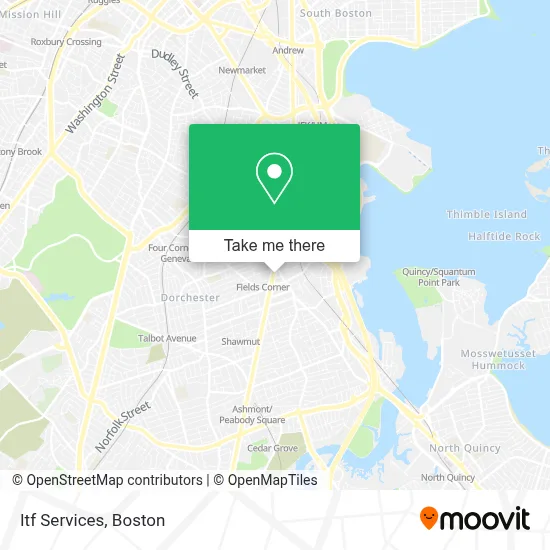
See Itf Services, Boston, on the map
Public Transit to Itf Services in Boston
Wondering how to get to Itf Services in Boston? Moovit helps you find the best way to get to Itf Services with step-by-step directions from the nearest public transit station.
Moovit provides free maps and live directions to help you navigate through your city. View schedules, routes, timetables, and find out how long does it take to get to Itf Services in real time.
Looking for the nearest stop or station to Itf Services? Check out this list of stops closest to your destination: Gibson St @ Adams St; Dorchester Ave @ Adams St; Park St Busway @ Dorchester Ave; Dorchester Ave Opp Charles St; Dorchester Ave @ Lincoln St - Fields Corner Sta; Fields Corner; Four Corners/Geneva.
Bus: 15, 19, 210, 201, 202, 18, RED LINE SHUTTLE.Train: FAIRMOUNT, KINGSTON, FRANKLIN/FOXBORO, PROVIDENCE/STOUGHTON.Subway: RED LINE.
Want to see if there’s another route that gets you there at an earlier time? Moovit helps you find alternative routes or times. Get directions from and directions to Itf Services easily from the Moovit App or Website.
We make riding to Itf Services easy, which is why over 1.7 million users, including users in Boston, trust Moovit as the best app for public transit. You don’t need to download an individual bus app or train app, Moovit is your all-in-one transit app that helps you find the best bus time or train time available.
For information on prices of subway, bus and train, costs and ride fares to Itf Services, please check the Moovit app.
Use the app to navigate to popular places including to the airport, hospital, stadium, grocery store, mall, coffee shop, school, college, and university.
Itf Services Address: 1478 Dorchester Ave street in Boston
- Boston Fish Market,
- King Smoke Shop,
- Habibi Nails and Designs,
- Michael Bryant Photography,
- MBTA-Fields Corner (Fields Corner Station - MBTA - Red Line),
- Boston Gun & Rifle,
- Grand Line Development,
- Blasis Kitchen & Bar,
- Tri Seafood Market,
- Chua Luc Hoa Buddhist Center,
- VI Multi Service and Gift Shop,
- Cộng Đoàn Mẹ La Vang, Dorchester,
- Adams St (adams street dorchester),
- MBTA Fields Corner Station,
- Boston Arts Academy,
- SK Dugbazah Enterprise,
- Santander Bank,
- Santander,
- Eblens - 46,
- Snipes
Places Near Itf Services (Boston)
- House Of Blues, Boston,
- Isabella Stewart Gardner Museum, Boston,
- Boston Common, Boston,
- Seaport District, Boston,
- Museum Of Science, Boston,
- Massachusetts General Hospital, Boston,
- Cheers, Boston,
- North End, Boston,
- Prudential Center, Boston,
- Quincy Market, Boston,
- Boston Convention & Exhibition Center, Boston,
- Boston Children's Hospital, Boston,
- Faneuil Hall, Boston,
- Mgm Music Hall, Boston,
- Td Garden, Boston,
- Leader Bank Pavilion (Leader Bank Pavillion), Boston,
- Wang Theater, Boston,
- Wilbur Theatre, Boston,
- Castle Island, Boston,
- Boston Medical Center, Boston
How to get to popular places in Boston with public transit
Get around Boston by public transit!
Traveling around Boston has never been so easy. See step by step directions as you travel to any attraction, street or major public transit station. View bus and train schedules, arrival times, service alerts and detailed routes on a map, so you know exactly how to get to anywhere in Boston.
When traveling to any destination around Boston use Moovit's Live Directions with Get Off Notifications to know exactly where and how far to walk, how long to wait for your line, and how many stops are left. Moovit will alert you when it's time to get off — no need to constantly re-check whether yours is the next stop.
Wondering how to use public transit in Boston or how to pay for public transit in Boston? Moovit public transit app can help you navigate your way with public transit easily, and at minimum cost. It includes public transit fees, ticket prices, and costs. Looking for a map of Boston public transit lines? Moovit public transit app shows all public transit maps in Boston with all Bus, Train, Subway and Ferry routes and stops on an interactive map.
Boston has 4 transit type(s), including: Bus, Train, Subway and Ferry, operated by several transit agencies, including MBTA, Southeastern Regional Transit Authority, MetroWest Regional Transit Authority, Rhode Island Public Transit Authority, WRTA, Lowell Regional Transit Authority, Merrimack Valley Transit, Montachusett Regional Transit Authority, Cape Cod Regional Transit Authority, Brockton Area Transit Authority, Martha's Vineyard Transit Authority, the WAVE - Nantucket Regional Transit Authority, GATRA, Cape Ann Transportation Authority and Massport