Directions to Itrainbaseball (Newton) with public transportation
The following transit lines have routes that pass near Itrainbaseball
 Bus: 52, 59.
- Train: NEEDHAM.
- Subway: GREEN LINE D.
How to get to Itrainbaseball by bus?
Click on the bus route to see step by step directions with maps, line arrival times and updated time schedules.
From Fenway Park (Fenway Park, Home of the Boston Red Sox), Boston
72 minFrom Boston Latin School, Boston
86 minFrom The Westin Waltham Boston, Waltham
85 minFrom the mall at rockingham park mall, Boston
55 minFrom James P. Kelleher Rose Garden, Boston
68 minFrom The Verb Hotel, Boston
72 minFrom Arnold Arboretum, Boston
81 minFrom Museum of Fine Arts (MFA), Boston
64 minFrom Fenway Park, Boston
68 minFrom Hyatt Regency Cambridge - Overlooking Boston, Cambridge
68 min
How to get to Itrainbaseball by train?
Click on the train route to see step by step directions with maps, line arrival times and updated time schedules.
From Fenway Park (Fenway Park, Home of the Boston Red Sox), Boston
114 minFrom Boston Latin School, Boston
91 minFrom James P. Kelleher Rose Garden, Boston
88 minFrom The Verb Hotel, Boston
114 minFrom Arnold Arboretum, Boston
81 minFrom Museum of Fine Arts (MFA), Boston
85 minFrom Fenway Park, Boston
111 min
How to get to Itrainbaseball by subway?
Click on the subway route to see step by step directions with maps, line arrival times and updated time schedules.
From Fenway Park (Fenway Park, Home of the Boston Red Sox), Boston
56 minFrom Boston Latin School, Boston
55 minFrom the mall at rockingham park mall, Boston
39 minFrom James P. Kelleher Rose Garden, Boston
57 minFrom The Verb Hotel, Boston
53 minFrom Arnold Arboretum, Boston
85 minFrom Museum of Fine Arts (MFA), Boston
65 minFrom Fenway Park, Boston
51 minFrom Hyatt Regency Cambridge - Overlooking Boston, Cambridge
65 min
Bus stop near Itrainbaseball in Newton
- Needham St @ Columbia Ave, 6 min walk,VIEW
Subway station near Itrainbaseball in Newton
- Eliot, 11 min walk,VIEW
Train station near Itrainbaseball in Newton
- Needham Heights, 13 min walk,VIEW
Bus lines to Itrainbaseball in Newton
- 59, Needham Junction Via Needham St,VIEW
What are the closest stations to Itrainbaseball?
The closest stations to Itrainbaseball are:
- Needham St @ Columbia Ave is 428 yards away, 6 min walk.
- Eliot is 863 yards away, 11 min walk.
- Needham Heights is 1063 yards away, 13 min walk.
Which bus lines stop near Itrainbaseball?
These bus lines stop near Itrainbaseball: 52, 59.
Which train line stops near Itrainbaseball?
NEEDHAM (#625 | Needham Heights)
Which subway line stops near Itrainbaseball?
GREEN LINE D (Riverside)
What’s the nearest subway station to Itrainbaseball in Newton?
The nearest subway station to Itrainbaseball in Newton is Eliot. It’s a 11 min walk away.
What’s the nearest train station to Itrainbaseball in Newton?
The nearest train station to Itrainbaseball in Newton is Needham Heights. It’s a 13 min walk away.
What’s the nearest bus station to Itrainbaseball in Newton?
The nearest bus station to Itrainbaseball in Newton is Needham St @ Columbia Ave. It’s a 6 min walk away.
What time is the first subway to Itrainbaseball in Newton?
The GREEN LINE D is the first subway that goes to Itrainbaseball in Newton. It stops nearby at 4:48 AM.
What time is the last subway to Itrainbaseball in Newton?
The GREEN LINE D is the last subway that goes to Itrainbaseball in Newton. It stops nearby at 2:44 AM.
What time is the first train to Itrainbaseball in Newton?
The NEEDHAM is the first train that goes to Itrainbaseball in Newton. It stops nearby at 7:05 AM.
What time is the last train to Itrainbaseball in Newton?
The NEEDHAM is the last train that goes to Itrainbaseball in Newton. It stops nearby at 6:38 PM.
What time is the first bus to Itrainbaseball in Newton?
The 59 is the first bus that goes to Itrainbaseball in Newton. It stops nearby at 6:20 AM.
What time is the last bus to Itrainbaseball in Newton?
The 59 is the last bus that goes to Itrainbaseball in Newton. It stops nearby at 8:05 PM.
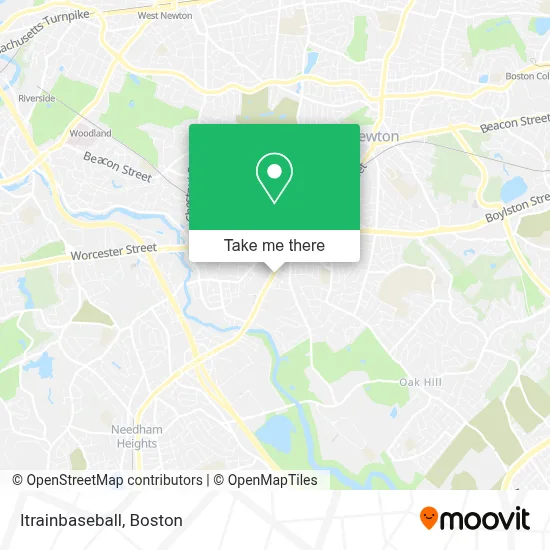
See Itrainbaseball, Newton, on the map
Public Transit to Itrainbaseball in Newton
Wondering how to get to Itrainbaseball in Newton? Moovit helps you find the best way to get to Itrainbaseball with step-by-step directions from the nearest public transit station.
Moovit provides free maps and live directions to help you navigate through your city. View schedules, routes, timetables, and find out how long does it take to get to Itrainbaseball in real time.
Looking for the nearest stop or station to Itrainbaseball? Check out this list of stops closest to your destination: Needham St @ Columbia Ave; Eliot; Needham Heights.
Bus: 52, 59.Train: NEEDHAM.Subway: GREEN LINE D.
Want to see if there’s another route that gets you there at an earlier time? Moovit helps you find alternative routes or times. Get directions from and directions to Itrainbaseball easily from the Moovit App or Website.
We make riding to Itrainbaseball easy, which is why over 1.7 million users, including users in Newton, trust Moovit as the best app for public transit. You don’t need to download an individual bus app or train app, Moovit is your all-in-one transit app that helps you find the best bus time or train time available.
For information on prices of bus, subway and train, costs and ride fares to Itrainbaseball, please check the Moovit app.
Use the app to navigate to popular places including to the airport, hospital, stadium, grocery store, mall, coffee shop, school, college, and university.
Itrainbaseball Address: 110 Stergis Way street in Newton
- Msa Mortgage,
- District 118 Kitchen and Bar,
- Garage Door Experts,
- Fox's,
- DUNKIN',
- 89 Needham St,
- Dave's Hot Chicken,
- The TJX Companies,
- Security Design Consultants,
- Exxon,
- 1 24 Hour Emergency Locksmith,
- The Hampton Collection,
- The New England School of Photography,
- Film & Video Transfer,
- Super Dough Pizza Co LLC,
- China Fair Inc.,
- Mfi Plumbing,
- Mass General Brigham Urgent Care - Newton,
- Skillful Heating & Cooling Repair,
- AAA
Places Near Itrainbaseball (Newton)
- Castle Island, Boston,
- Boston Convention & Exhibition Center, Boston,
- Seaport District, Boston,
- Prudential Center, Boston,
- Wilbur Theatre, Boston,
- Museum Of Science, Boston,
- Mgm Music Hall, Boston,
- Wang Theater, Boston,
- Faneuil Hall, Boston,
- Td Garden, Boston,
- Quincy Market, Boston,
- Massachusetts General Hospital, Boston,
- Boston Medical Center, Boston,
- North End, Boston,
- Leader Bank Pavilion (Leader Bank Pavillion), Boston,
- Cheers, Boston,
- Boston Children's Hospital, Boston,
- House Of Blues, Boston,
- Boston Common, Boston,
- Isabella Stewart Gardner Museum, Boston
How to get to popular places in Boston with public transit
Get around Newton by public transit!
Traveling around Newton has never been so easy. See step by step directions as you travel to any attraction, street or major public transit station. View bus and train schedules, arrival times, service alerts and detailed routes on a map, so you know exactly how to get to anywhere in Newton.
When traveling to any destination around Newton use Moovit's Live Directions with Get Off Notifications to know exactly where and how far to walk, how long to wait for your line, and how many stops are left. Moovit will alert you when it's time to get off — no need to constantly re-check whether yours is the next stop.
Wondering how to use public transit in Newton or how to pay for public transit in Newton? Moovit public transit app can help you navigate your way with public transit easily, and at minimum cost. It includes public transit fees, ticket prices, and costs. Looking for a map of Newton public transit lines? Moovit public transit app shows all public transit maps in Newton with all Bus, Train, Subway and Ferry routes and stops on an interactive map.
Boston has 4 transit type(s), including: Bus, Train, Subway and Ferry, operated by several transit agencies, including MBTA, Southeastern Regional Transit Authority, MetroWest Regional Transit Authority, Rhode Island Public Transit Authority, WRTA, Lowell Regional Transit Authority, Merrimack Valley Transit, Montachusett Regional Transit Authority, Cape Cod Regional Transit Authority, Brockton Area Transit Authority, Martha's Vineyard Transit Authority, the WAVE - Nantucket Regional Transit Authority, GATRA, Cape Ann Transportation Authority and Massport