How to get to JP Morgan Chase Co. by bus?
Click on the bus route to see step by step directions with maps, line arrival times and updated time schedules.
From 103rd Street, Manhattan
99 minFrom MetLife Stadium, East Rutherford
80 minFrom Central Park - Conservatory Garden, Manhattan
97 minFrom Sunnyside, NY, Queens
105 minFrom 2nd Ave (59th st and 2nd ave), Manhattan
75 minFrom Radio City Music Hall, Manhattan
55 minFrom Astoria, NY, Queens
118 minFrom Costco Wholesale, Queens
120 minFrom Pier 88 Manhattan Cruise Terminal, Manhattan
53 min
How to get to JP Morgan Chase Co. by train?
Click on the train route to see step by step directions with maps, line arrival times and updated time schedules.
Bus stops near JP Morgan Chase Co. in Jersey City
Train stations near JP Morgan Chase Co. in Jersey City
Light Rail stations near JP Morgan Chase Co. in Jersey City
- Harsimus Cove Light Rail Station, 11 min walk,VIEW
Bus lines to JP Morgan Chase Co. in Jersey City
- 9, Montgomery St West Side Ave Newport Mall,VIEW
- 16, Journal Square,VIEW
- 86, Newport Mall,VIEW
- 126, Hoboken Via Willow Ave,VIEW
- 85, Hoboken Terminal,VIEW
- 87, Hoboken-Path Via Journal Sq,VIEW
- 63, X Lakewood Express To Union Hill Park Ride,VIEW
- 64, Lakewood Via Freehold Ctr,VIEW
- 68, Old Bridge Via Route 18,VIEW
- 206, Jersey City - Parkway Express,VIEW
What are the closest stations to JP Morgan Chase Co.?
The closest stations to JP Morgan Chase Co. are:
- Washington Blvd at Newport Pkwy is 120 yards away, 2 min walk.
- Observer Hwy at Bloomfield St# is 256 yards away, 4 min walk.
- Newport is 265 yards away, 4 min walk.
- Washington Blvd at Path Station is 299 yards away, 4 min walk.
- Washington Blvd @ Pavonia Station (Northbound) is 299 yards away, 4 min walk.
- Hoboken Terminal is 598 yards away, 8 min walk.
- Harsimus Cove Light Rail Station is 861 yards away, 11 min walk.
Which bus line stops near JP Morgan Chase Co.?
126 (Hoboken-Path)
Which train lines stop near JP Morgan Chase Co.?
These train lines stop near JP Morgan Chase Co.: GRE, YEL.
What’s the nearest light rail station to JP Morgan Chase Co. in Jersey City?
The nearest light rail station to JP Morgan Chase Co. in Jersey City is Harsimus Cove Light Rail Station. It’s a 11 min walk away.
What’s the nearest train station to JP Morgan Chase Co. in Jersey City?
The nearest train station to JP Morgan Chase Co. in Jersey City is Newport. It’s a 4 min walk away.
What’s the nearest bus station to JP Morgan Chase Co. in Jersey City?
The nearest bus station to JP Morgan Chase Co. in Jersey City is Washington Blvd at Newport Pkwy. It’s a 2 min walk away.
What time is the first light rail to JP Morgan Chase Co. in Jersey City?
The HBLR is the first light rail that goes to JP Morgan Chase Co. in Jersey City. It stops nearby at 4:49 AM.
What time is the last light rail to JP Morgan Chase Co. in Jersey City?
The HBLR is the last light rail that goes to JP Morgan Chase Co. in Jersey City. It stops nearby at 2:10 AM.
What time is the first train to JP Morgan Chase Co. in Jersey City?
The ATW is the first train that goes to JP Morgan Chase Co. in Jersey City. It stops nearby at 3:10 AM.
What time is the last train to JP Morgan Chase Co. in Jersey City?
The ATW is the last train that goes to JP Morgan Chase Co. in Jersey City. It stops nearby at 3:10 AM.
What time is the first bus to JP Morgan Chase Co. in Jersey City?
The 87 is the first bus that goes to JP Morgan Chase Co. in Jersey City. It stops nearby at 5:34 AM.
What time is the last bus to JP Morgan Chase Co. in Jersey City?
The 85 is the last bus that goes to JP Morgan Chase Co. in Jersey City. It stops nearby at 1:35 AM.
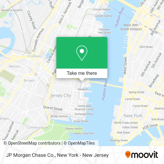
See JP Morgan Chase Co., Jersey City, on the map
Public Transit to JP Morgan Chase Co. in Jersey City
Wondering how to get to JP Morgan Chase Co. in Jersey City? Moovit helps you find the best way to get to JP Morgan Chase Co. with step-by-step directions from the nearest public transit station.
Moovit provides free maps and live directions to help you navigate through your city. View schedules, routes, timetables, and find out how long does it take to get to JP Morgan Chase Co. in real time.
Looking for the nearest stop or station to JP Morgan Chase Co.? Check out this list of stops closest to your destination: Washington Blvd at Newport Pkwy; Observer Hwy at Bloomfield St#; Newport; Washington Blvd at Path Station; Washington Blvd @ Pavonia Station (Northbound); Hoboken Terminal; Harsimus Cove Light Rail Station.
Bus: 126, 9, 16, 86, 85, 87, 63, 64, 68, 206.Train: GRE, YEL, ATW, GB, MCL, MEL, ML, PJL.
Want to see if there’s another route that gets you there at an earlier time? Moovit helps you find alternative routes or times. Get directions from and directions to JP Morgan Chase Co. easily from the Moovit App or Website.
We make riding to JP Morgan Chase Co. easy, which is why over 1.5 million users, including users in Jersey City, trust Moovit as the best app for public transit. You don’t need to download an individual bus app or train app, Moovit is your all-in-one transit app that helps you find the best bus time or train time available.
For information on prices of train, bus, subway and ferry, costs and ride fares to JP Morgan Chase Co., please check the Moovit app.
Use the app to navigate to popular places including to the airport, hospital, stadium, grocery store, mall, coffee shop, school, college, and university.
JP Morgan Chase Co. Address: 575 Washington Blvd street in Jersey City
- Chase Atm,
- Newport Conference Center,
- At&T,
- Aleutian Islands,
- Boca Grande Mexican Cantina,
- The Laugh Tour Comedy Club,
- Dorrian's Red Hand,
- Verisk,
- Newport,
- Verisk Analytics,
- Cargonet,
- Newport North Garage,
- Iso (Insurance Services Office, Inc.),
- Paris Baguette,
- Insurance Data Management Association,
- Boa - Ml Central Parking,
- Kura Revolving Sushi Bar,
- Kipling,
- Atalian Global Services United States,
- Hummus Grill
Places Near JP Morgan Chase Co. (Jersey City)
- Hudson Yards, Manhattan,
- Times Square, Manhattan,
- Bellevue Hospital, Manhattan,
- San Gennaro Feast, Manhattan,
- 3 Stone St, Manhattan,
- 376 Hudson Street, Manhattan,
- Wall Street, Manhattan,
- Pier 83, Manhattan,
- 26 Federal Plaza, Manhattan,
- 911 Memorial, Manhattan,
- Rockefeller Center, Manhattan,
- Katz's Deli, Manhattan,
- qqqq, Manhattan,
- Queens Center Mall, Queens,
- 111 Centre New York City Supreme Court, Manhattan,
- 66 John Street, Manhattan,
- 1 Police Plaza, Manhattan,
- SoHo, Manhattan,
- Mountainside Hospital, Glen Ridge,
- Chinatown, Manhattan
How to get to popular places in New York - New Jersey with public transit
Get around Jersey City by public transit!
Traveling around Jersey City has never been so easy. See step by step directions as you travel to any attraction, street or major public transit station. View bus and train schedules, arrival times, service alerts and detailed routes on a map, so you know exactly how to get to anywhere in Jersey City.
When traveling to any destination around Jersey City use Moovit's Live Directions with Get Off Notifications to know exactly where and how far to walk, how long to wait for your line, and how many stops are left. Moovit will alert you when it's time to get off — no need to constantly re-check whether yours is the next stop.
Wondering how to use public transit in Jersey City or how to pay for public transit in Jersey City? Moovit public transit app can help you navigate your way with public transit easily, and at minimum cost. It includes public transit fees, ticket prices, and costs. Looking for a map of Jersey City public transit lines? Moovit public transit app shows all public transit maps in Jersey City with all Bus, Train, Subway, Light Rail, Ferry and Cable Car routes and stops on an interactive map.
New York - New Jersey has 6 transit type(s), including: Bus, Train, Subway, Light Rail, Ferry and Cable Car, operated by several transit agencies, including MTA Subway, Metro-North Railroad, LIRR, PATH, MTA New York City Transit - Express routes, MTA Bus, NJ Transit, NYC Ferry, NICE bus, Bee-Line Bus, NJ Transit Rail, Norwalk Transit District, Hartford Line, River Valley Transit and HART