Directions to J.Crew (Boston) with public transportation
The following transit lines have routes that pass near J.Crew
 Bus: 1, 10, 39, 450, 504.
- Train: NEEDHAM, FOXBORO EVENT SERVICE, FRAMINGHAM/WORCESTER, FRANKLIN/FOXBORO, ORANGE LINE.
- Subway: GREEN LINE B, GREEN LINE C, GREEN LINE D, GREEN LINE E, ORANGE LINE.
How to get to J.Crew by bus?
Click on the bus route to see step by step directions with maps, line arrival times and updated time schedules.
From Qea, Quincy
100 minFrom Winthrop, Winthrop Town
92 minFrom Arlington, MA, Arlington
90 minFrom Arnold Arboretum, Boston
46 minFrom AC Hotel Boston Cambridge, Cambridge
83 minFrom The Mall At Chestnut Hill, Newton
62 minFrom Milton Academy, Milton
100 minFrom VFW Parkway, Boston
58 minFrom Courtyard by Marriott Boston Logan Airport, Boston
49 minFrom West Roxbury, Boston
60 min
How to get to J.Crew by train?
Click on the train route to see step by step directions with maps, line arrival times and updated time schedules.
How to get to J.Crew by subway?
Click on the subway route to see step by step directions with maps, line arrival times and updated time schedules.
Bus stops near J.Crew in Boston
- Boston, MA - Copley Square (Corner Of Clarendon St. & St. James Ave. In Front Of Trinity Church), 2 min walk,VIEW
- Boylston St @ Clarendon St, 3 min walk,VIEW
- Saint James Ave @ Berkeley St, 3 min walk,VIEW
- Stuart St @ Dartmouth St, 3 min walk,VIEW
- Copley - Opp 575 Boylston St, 4 min walk,VIEW
- Saint James Ave @ Dartmouth St, 5 min walk,VIEW
- Boylston St @ Dartmouth St, 6 min walk,VIEW
- Copley - Boylston St @ Dartmouth St, 7 min walk,VIEW
Train station near J.Crew in Boston
- Back Bay - South End, 10 min walk,VIEW
Subway station near J.Crew in Boston
- Copley, 11 min walk,VIEW
Bus lines to J.Crew in Boston
- ACTON/CONCORD COMMUTER, Acton,VIEW
- 9, Kenmore Via Boston Latin,VIEW
- 10, Arlington Via South Bay Center,VIEW
- 39, Haymarket Via Forest Hills,VIEW
- 55, West Fenway,VIEW
- 57, Haymarket Via Kenmore,VIEW
- GREEN LINE D SHUTTLE, Riverside (Shuttle),VIEW
- ORANGE LINE SHUTTLE, Back Bay Via Copley (Shuttle),VIEW
- 501, Brighton Via Copley (Express),VIEW
- 504, Watertown Via Copley And Newton Corner (Express),VIEW
- BB, Back Bay,VIEW
- ORANGE LINE SHUTTLE, Forest Hills (Shuttle),VIEW
- GREEN LINE B SHUTTLE, Babcock Street - Copley,VIEW
- GREEN LINE B SHUTTLE, Boston University East - Back Bay,VIEW
- GREEN LINE C SHUTTLE, Saint Mary's Street - Back Bay,VIEW
- GREEN LINE D SHUTTLE, Riverside - Copley (Express),VIEW
- GREEN LINE D SHUTTLE, Riverside - Copley via Woodland (Express),VIEW
- GREEN LINE D SHUTTLE, Woodland - Copley via Riverside (Express),VIEW
- GREEN LINE E SHUTTLE, Heath Street - Park Street,VIEW
- GREEN LINE SHUTTLE, Boston University East - Park Street,VIEW
What are the closest stations to J.Crew?
The closest stations to J.Crew are:
- Boston, MA - Copley Square (Corner Of Clarendon St. & St. James Ave. In Front Of Trinity Church) is 97 yards away, 2 min walk.
- Boylston St @ Clarendon St is 174 yards away, 3 min walk.
- Saint James Ave @ Berkeley St is 203 yards away, 3 min walk.
- Stuart St @ Dartmouth St is 223 yards away, 3 min walk.
- Copley - Opp 575 Boylston St is 266 yards away, 4 min walk.
- Saint James Ave @ Dartmouth St is 338 yards away, 5 min walk.
- Boylston St @ Dartmouth St is 482 yards away, 6 min walk.
- Copley - Boylston St @ Dartmouth St is 542 yards away, 7 min walk.
- Back Bay - South End is 780 yards away, 10 min walk.
- Copley is 890 yards away, 11 min walk.
Which bus lines stop near J.Crew?
These bus lines stop near J.Crew: 1, 10, 39, 450, 504.
Which train line stops near J.Crew?
NEEDHAM (#620 | South Station)
Which subway lines stop near J.Crew?
These subway lines stop near J.Crew: GREEN LINE B, GREEN LINE C, GREEN LINE D, GREEN LINE E, ORANGE LINE.
What’s the nearest subway station to J.Crew in Boston?
The nearest subway station to J.Crew in Boston is Copley. It’s a 11 min walk away.
What’s the nearest train station to J.Crew in Boston?
The nearest train station to J.Crew in Boston is Back Bay - South End. It’s a 10 min walk away.
What’s the nearest bus station to J.Crew in Boston?
The nearest bus station to J.Crew in Boston is Boston, MA - Copley Square (Corner Of Clarendon St. & St. James Ave. In Front Of Trinity Church). It’s a 2 min walk away.
What time is the first subway to J.Crew in Boston?
The GREEN LINE D is the first subway that goes to J.Crew in Boston. It stops nearby at 5:05 AM.
What time is the last subway to J.Crew in Boston?
The GREEN LINE E is the last subway that goes to J.Crew in Boston. It stops nearby at 2:16 AM.
What time is the first train to J.Crew in Boston?
The PROVIDENCE/STOUGHTON is the first train that goes to J.Crew in Boston. It stops nearby at 4:25 AM.
What time is the last train to J.Crew in Boston?
The LAKE SHORE LIMITED is the last train that goes to J.Crew in Boston. It stops nearby at 8:26 PM.
What time is the first bus to J.Crew in Boston?
The 57 is the first bus that goes to J.Crew in Boston. It stops nearby at 4:53 AM.
What time is the last bus to J.Crew in Boston?
The 10 is the last bus that goes to J.Crew in Boston. It stops nearby at 1:19 AM.
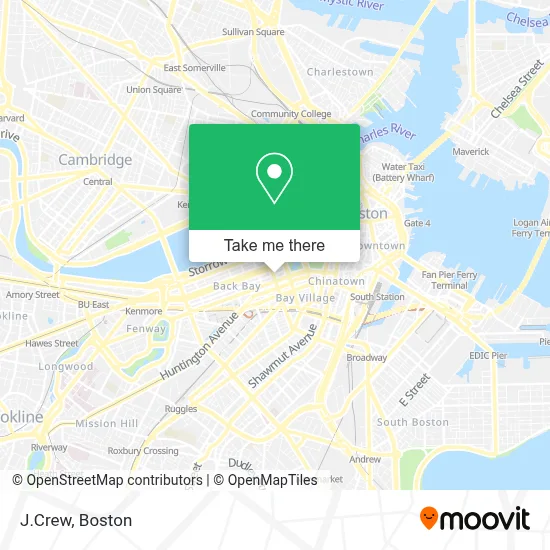
See J.Crew, Boston, on the map
Public Transit to J.Crew in Boston
Wondering how to get to J.Crew in Boston? Moovit helps you find the best way to get to J.Crew with step-by-step directions from the nearest public transit station.
Moovit provides free maps and live directions to help you navigate through your city. View schedules, routes, timetables, and find out how long does it take to get to J.Crew in real time.
Looking for the nearest stop or station to J.Crew? Check out this list of stops closest to your destination: Boston, MA - Copley Square (Corner Of Clarendon St. & St. James Ave. In Front Of Trinity Church); Boylston St @ Clarendon St; Saint James Ave @ Berkeley St; Stuart St @ Dartmouth St; Copley - Opp 575 Boylston St; Saint James Ave @ Dartmouth St; Boylston St @ Dartmouth St; Copley - Boylston St @ Dartmouth St; Back Bay - South End; Copley.
Bus: 1, 10, 39, 450, 504, ACTON/CONCORD COMMUTER, 9, 55, 57, 501, BB.Train: NEEDHAM, FOXBORO EVENT SERVICE, FRAMINGHAM/WORCESTER, FRANKLIN/FOXBORO, ORANGE LINE.Subway: GREEN LINE B, GREEN LINE C, GREEN LINE D, GREEN LINE E, ORANGE LINE.
Want to see if there’s another route that gets you there at an earlier time? Moovit helps you find alternative routes or times. Get directions from and directions to J.Crew easily from the Moovit App or Website.
We make riding to J.Crew easy, which is why over 1.7 million users, including users in Boston, trust Moovit as the best app for public transit. You don’t need to download an individual bus app or train app, Moovit is your all-in-one transit app that helps you find the best bus time or train time available.
For information on prices of bus, subway and train, costs and ride fares to J.Crew, please check the Moovit app.
Use the app to navigate to popular places including to the airport, hospital, stadium, grocery store, mall, coffee shop, school, college, and university.
J.Crew Address: 46 Newbury St street in Boston
- Cartier,
- Van Cleef & Arpels,
- Brilliant Earth,
- Bella Sante Day Spa Med Spa,
- Fiorillo Dental (Fiorillo Cosmetic and General Dentistry),
- MD Boston (Waleed H Ezzat, MD -the Boston Center for Facial Plastics),
- Monte Nido Eating Disorder Center of Boston,
- Edward Jones - Financial Advisor: Andrew B Ball,
- Starbucks,
- Emmanuel Church,
- Women's Lunch Place (The Womans Lunch Place),
- Adams Center-Boston (Adams Center for Aesthetic Surgery),
- New Balance Hubway,
- Sassoon Salon,
- Klavens Law Group,
- Girl Scouts of Eastern Massachusetts,
- Northeast Assisted Fertility Group,
- Boston Bud Club,
- Marc Jacobs,
- Tiffany
Places Near J.Crew (Boston)
- Leader Bank Pavilion (Leader Bank Pavillion), Boston,
- Seaport District, Boston,
- Boston Convention & Exhibition Center, Boston,
- Boston Common, Boston,
- Td Garden, Boston,
- Cheers, Boston,
- Quincy Market, Boston,
- North End, Boston,
- Faneuil Hall, Boston,
- Isabella Stewart Gardner Museum, Boston,
- Wang Theater, Boston,
- Museum Of Science, Boston,
- Mgm Music Hall, Boston,
- Boston Children's Hospital, Boston,
- Boston Medical Center, Boston,
- Castle Island, Boston,
- Prudential Center, Boston,
- Wilbur Theatre, Boston,
- Massachusetts General Hospital, Boston,
- House Of Blues, Boston
How to get to popular places in Boston with public transit
Get around Boston by public transit!
Traveling around Boston has never been so easy. See step by step directions as you travel to any attraction, street or major public transit station. View bus and train schedules, arrival times, service alerts and detailed routes on a map, so you know exactly how to get to anywhere in Boston.
When traveling to any destination around Boston use Moovit's Live Directions with Get Off Notifications to know exactly where and how far to walk, how long to wait for your line, and how many stops are left. Moovit will alert you when it's time to get off — no need to constantly re-check whether yours is the next stop.
Wondering how to use public transit in Boston or how to pay for public transit in Boston? Moovit public transit app can help you navigate your way with public transit easily, and at minimum cost. It includes public transit fees, ticket prices, and costs. Looking for a map of Boston public transit lines? Moovit public transit app shows all public transit maps in Boston with all Bus, Train, Subway and Ferry routes and stops on an interactive map.
Boston has 4 transit type(s), including: Bus, Train, Subway and Ferry, operated by several transit agencies, including MBTA, Southeastern Regional Transit Authority, MetroWest Regional Transit Authority, Rhode Island Public Transit Authority, WRTA, Lowell Regional Transit Authority, Merrimack Valley Transit, Montachusett Regional Transit Authority, Cape Cod Regional Transit Authority, Brockton Area Transit Authority, Martha's Vineyard Transit Authority, the WAVE - Nantucket Regional Transit Authority, GATRA, Cape Ann Transportation Authority and Massport